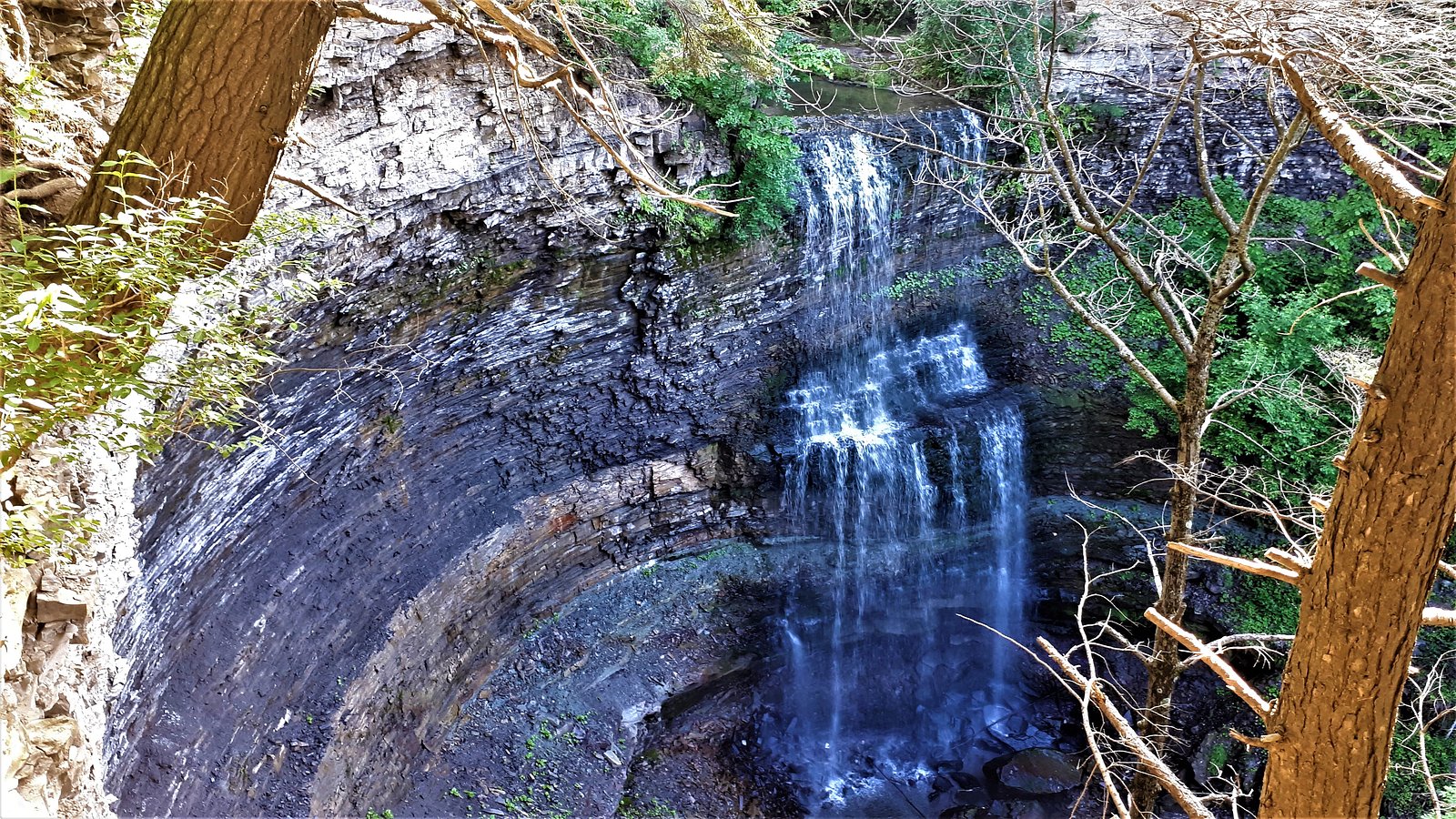
Buttermilk Falls
Ontario • 23 m
By Armen Suny · Last verified Jun 2026
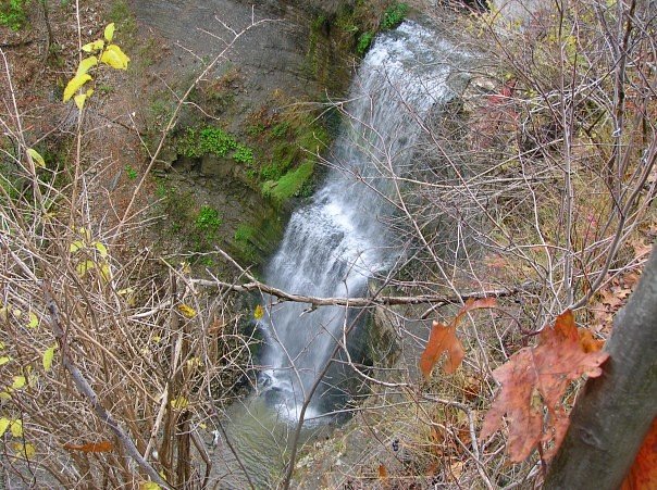
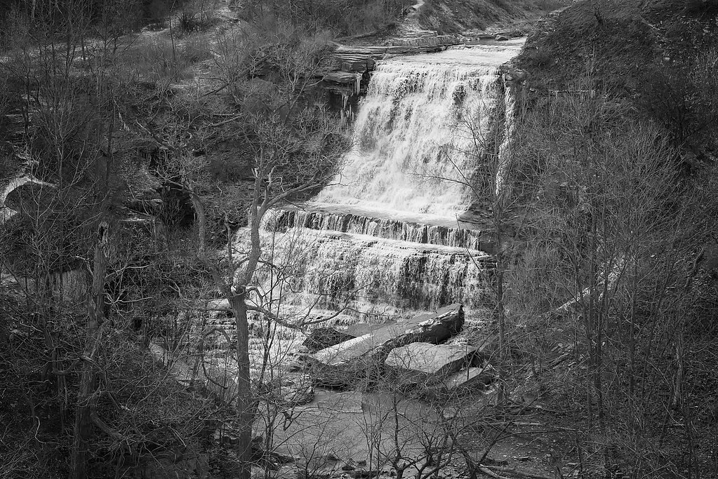

Photo Credits (3)
Difficulty
Easy
Trail Length
3.7 km
Trail Type
Out And Back
Elevation Gain
74 m
About Buttermilk Falls
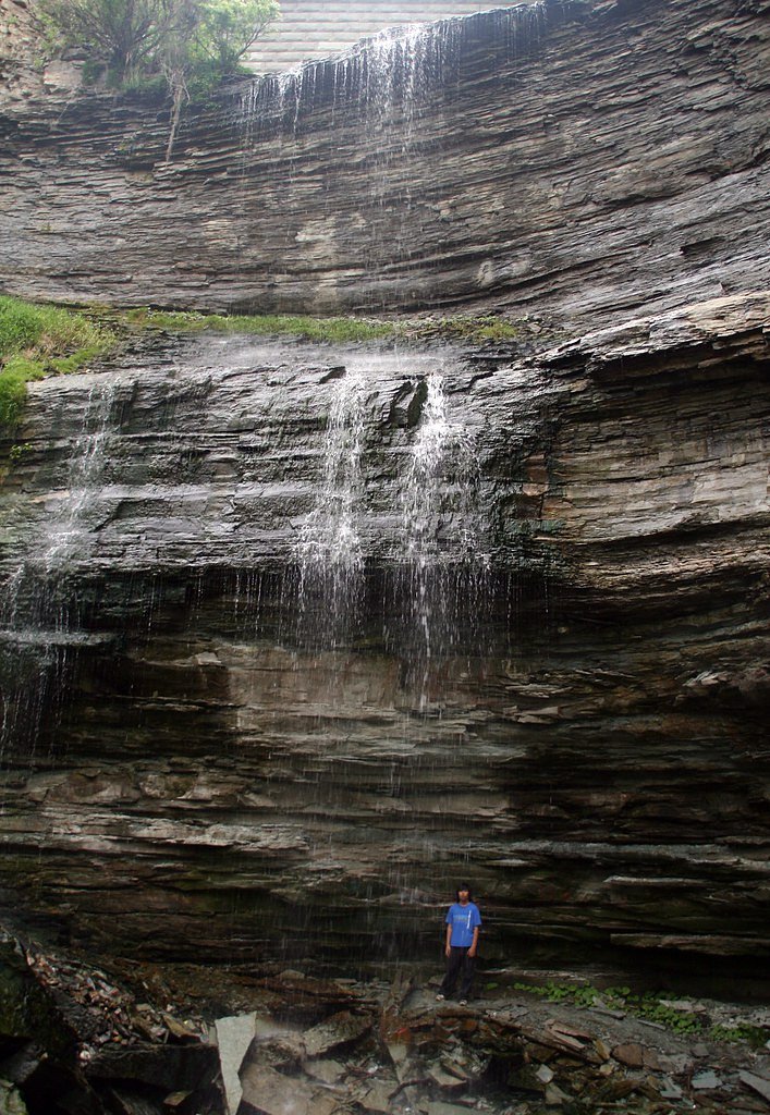
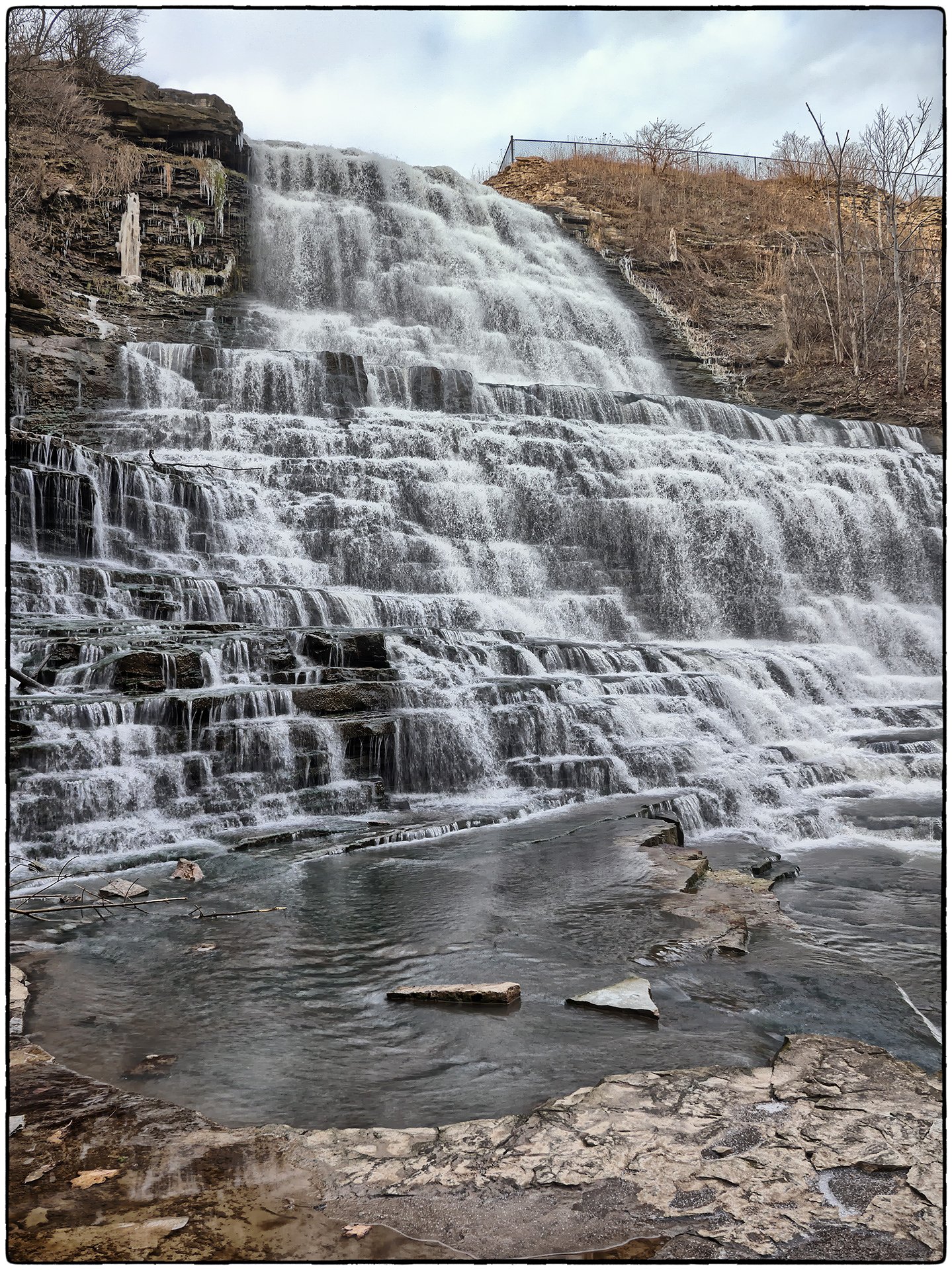
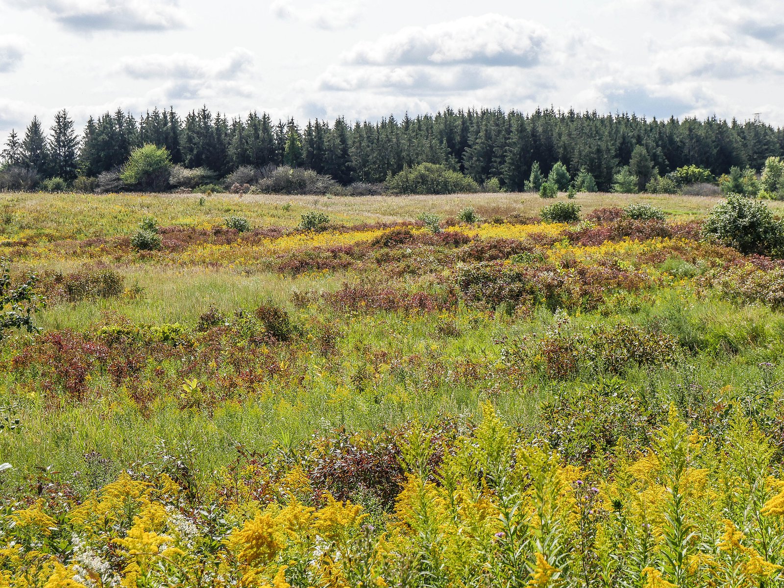
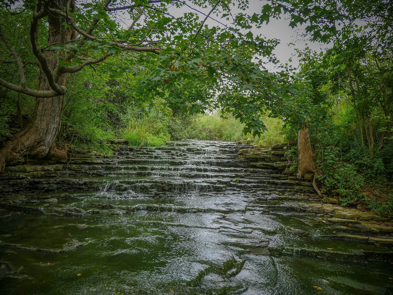
Buttermilk Falls is one of more than 100 waterfalls tucked into the Niagara Escarpment around Hamilton, Ontario, where the Bruce Trail threads through dramatic cliffs, cascades, and mixed forest. The escarpment itself is internationally recognized, designated a UNESCO Biosphere Reserve, and provides the limestone and shale ledges that create scenic drops like this one. The result is a compact, photo-worthy cascade that feels wild despite being close to the city. The falls plunges about 75 feet and is commonly visited as a short day hike. Most visitors reach it via a roughly 2.3-mile out-and-back route with about 242 feet of elevation gain, an easy outing suited to families and casual hikers. While there’s no large visitor center, the trail offers classic Escarpment scenery and pleasant viewpoints above and below the drop, making Buttermilk Falls a rewarding stop on any waterfall loop through Hamilton.
The Setting
Buttermilk Falls sits at 187 metres in the foothills of Ontario. The falls drop 23 metres.
Height: 75 feet
Nearby Falls Worth Visiting
Felker's Falls (22 m) lies 2.4 kilometres to the east. Also nearby: Albion Falls (19 m, 0.5 km) and Baby Albion Falls (8 m, 0.6 km).
Trail & Hike Details
The Approach
The easy 3.7-km out-and-back trail gains 74 metres of elevation on the way to the falls.
Trail Description
The approach is generally a short out-and-back on a natural surface trail through mixed hardwoods. Trails to Hamilton-area falls commonly include exposed roots, rocks, and short stair sections; expect uneven footing and possibly short rock scrambles to reach better viewpoints. There may be a primary viewing area above or below the drop but no developed boardwalk or visitor center at many smaller falls.
What to Expect
The falls drop 23 metres.
Accessibility
The trail is not wheelchair accessible. Uneven terrain and elevation changes require steady footing.
Frequently Asked Questions
🐶 Are Dogs Allowed at Buttermilk Falls?
❌ Dogs are not allowed
Are There Any Fees or Permits Required?
🆖 No fees required
🏊 Is There Swimming at Buttermilk Falls?
❌ Swimming is not allowed
When to Visit
Late spring (after snowmelt and spring rains) for the fullest flows; fall for foliage and cooler temperatures. Early morning or weekday visits reduce crowding.
Seasonal Access
The best time to visit is Spring, Summer, Fall, and Winter. Check with the managing park or local authority for current conditions.
Safety Information
Hazards commonly associated with escarpment waterfalls include slippery rock and muddy trails, steep and unstable banks, potential for falling, fast water after rains, cold water temperatures, and limited or variable cell service. Wear appropriate footwear, supervise children closely, keep a safe distance from edges, and avoid climbing on wet rocks near the falls. Check weather and recent visitor reports for trail conditions.
Current Water Conditions
0.2 m³/s
Current discharge — how much water is flowing
About average for this time of year
Based on 40 years of record
11.27 m
Water depth at gauge
7-Day Discharge Trend
What does this mean for your visit?
Flow is about average for this time of year.
About This Gauge
7-Day Flow Outlook
Based on the WSC gauge REDHILL CREEK AT HAMILTON (5 km away).
Today
Moderate
0.2 m³/s
8/10Tomorrow
Moderate
0.2 m³/s
6/10Tue
Moderate
0.2 m³/s
6/10Wed
Moderate
0.2 m³/s
6/10Thu
Moderate
0.2 m³/s
8/10Fri
Moderate
0.2 m³/s
6/10Sat
Moderate
0.2 m³/s
6/10Best window: Today — moderate flow, mainly sunny (trip score 8/10).
Best time of year: this gauge typically runs highest from mid February to early May, peaking in April.
How we calculate this
This is a transparent outlook, not a precise forecast. We take the waterfall's current flow strength (how it ranks against its historical normal for today, from the nearest WSC stream gauge), carry that ranking forward along the gauge's seasonal curve, and nudge it for forecast rain. Confidence is highest for the next day or two and falls further out. Always check official conditions and your own judgment before visiting — high flows can be dangerous.
Know when to go.
Get a free email alert when waterfalls near Hamilton hit peak flow. We only send when conditions are worth the trip — no weekly newsletters, no spam.
Weather Forecast
Location & Access
Getting There
Coordinates: 43.2053, -79.8196. The site is located just outside Hamilton and can be reached by local roads from Hamilton or nearby towns (Youngstown, Niagara University). Use the provided coordinates in a GPS or mapping app to locate the trailhead or nearest roadside parking. Expect a short walk from the parking area to the viewpoint; exact access roads and trailhead names vary by map source.
Get Directions on Google MapsParking
Limited parking is typical, small roadside pullouts or a small gravel lot may be available near the trailhead. Parking capacity is likely limited and may fill on weekends. Park legally and avoid blocking private driveways or gates.
Elevation
187 metres above sea level
Coordinates
43.205314° N, -79.819615° W
Visitor Tips & Gear
• Use the provided coordinates in your mapping app and verify current access before you go. • Wear sturdy, closed-toe shoes with good traction, surfaces are often wet and slippery. • Stay behind safety railings (if present) and keep a safe distance from cliff edges. • Parking can be limited; arrive early on weekends or consider visiting on weekdays. • Bring layers in cooler months; fall and spring can be muddy. • Leave no trace: pack out trash and avoid disturbing vegetation or wildlife. • Check local conservation authority or municipal websites for closures or advisories.
As an Amazon Associate, we earn from qualifying purchases.
This easy 3.7 km hike is straightforward — comfortable trail shoes and plenty of water should do. Icy conditions are common in winter — traction cleats are a smart addition.

Columbia Watertight II Rain Jacket
Packs into its own pocket, seam-sealed, and keeps you dry from spray and surprise rain.

Polarized Sunglasses (Knockaround)
Cuts glare off the water so you actually see the falls — and your photos turn out better too.

Earth Pak Waterproof Dry Bag
Keeps your phone and gear dry when waterfall mist soaks everything else.

Waterproof Phone Pouch (AiRunTech)
Cheap insurance — take photos right next to the falls without killing your phone.

Kahtoola MICROspikes
Cult-favorite traction cleats that grip ice and wet rock — essential for winter waterfall hikes.

JOBY GorillaPod Starter Kit
Wraps around railings and rocks for long-exposure waterfall shots — no flat surface needed.
Where to Stay
Browse vacation cabins and private rentals nearby
Unique outdoor stays — tents, yurts, and treehouses
Rent a campervan or RV for your waterfall road trip
Some links are affiliate links. We may earn a commission at no extra cost to you.
Nearby Campground
Lost Forest Park & Camping Resort
20.1 km away
Additional Information
Nearby Attractions
Hamilton and the Niagara Escarpment host many waterfalls and natural areas. Nearby notable sites (check distances and access separately) include other escarpment falls around Hamilton, conservation areas, and parks in the Niagara Peninsula and Hamilton region. The Royal Botanical Gardens and several well-known cascades and lookouts are also in the broader area.
Wildlife
Typical southern Ontario woodland species may be present: songbirds, woodpeckers, grey squirrels, raccoons, white-tailed deer, and small mammals. Be mindful of ticks, especially in spring and summer. Do not approach or feed wildlife.
Cities near Buttermilk Falls
Nearby Waterfalls

Other waterfalls named Buttermilk Falls
22 other waterfalls share this name across Canada.
-
01
Apalachin
165 ftCurrent flow 29 ft³/s -
02
Claverack-Red Mills
165 ftCurrent flow 87 ft³/s -
03
Cohoes
165 ftCurrent flow 833 ft³/s -
04
East Worcester
165 ftCurrent flow 3 ft³/s -
05
Fultonville
165 ftCurrent flow 640 ft³/s -
06
Gloversville
165 ftCurrent flow 640 ft³/s -
07
Greenwood Lake
165 ftCurrent flow 39 ft³/s -
08
Highland Falls
Current flow 8 ft³/s -
09
Hudson Falls
165 ftCurrent flow 39 ft³/s -
10
Keeseville
165 ftCurrent flow 79 ft³/s -
11
Linwood
165 ft -
12
Palenville
165 ftCurrent flow 0 ft³/s -
13
Speculator
165 ftCurrent flow 289 ft³/s -
14
Wampsville
165 ftCurrent flow 23 ft³/s
Writing about Buttermilk Falls? Embed this waterfall on your site for free.