Photo Credits (5)
Difficulty
Moderate
Trail Length
2.4 miles
Trail Type
Out And Back
Elevation Gain
350 ft
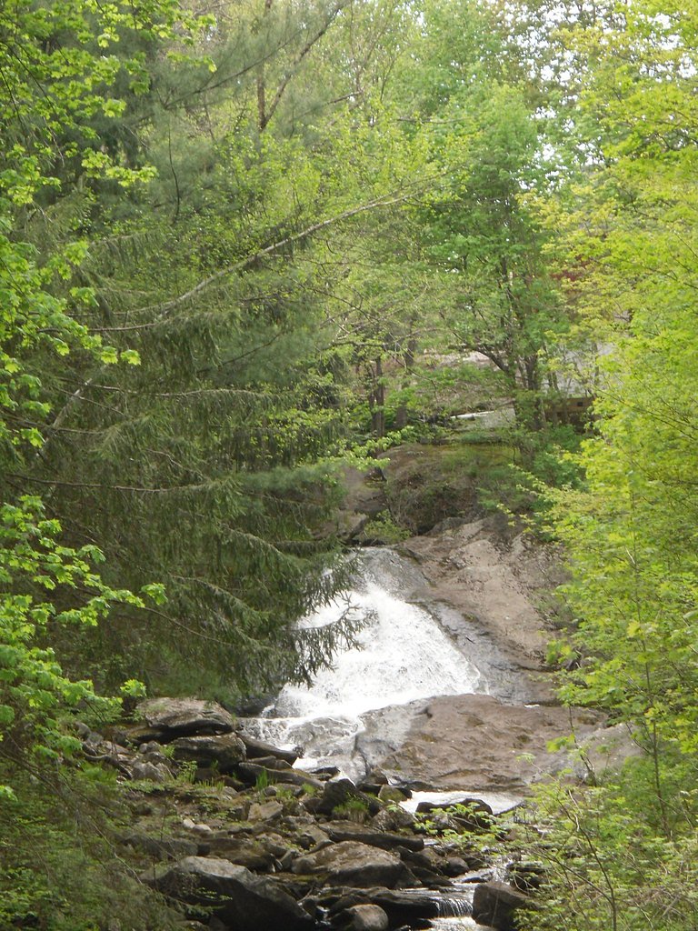
About Buttermilk Falls
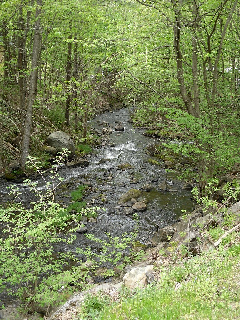
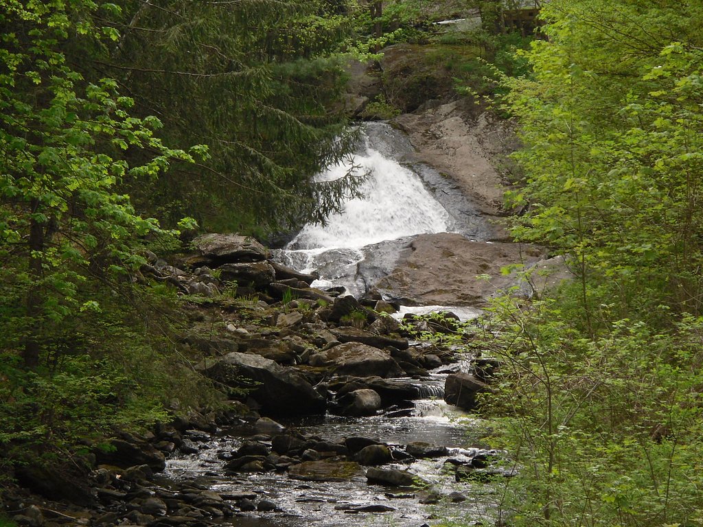
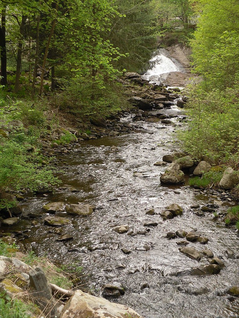
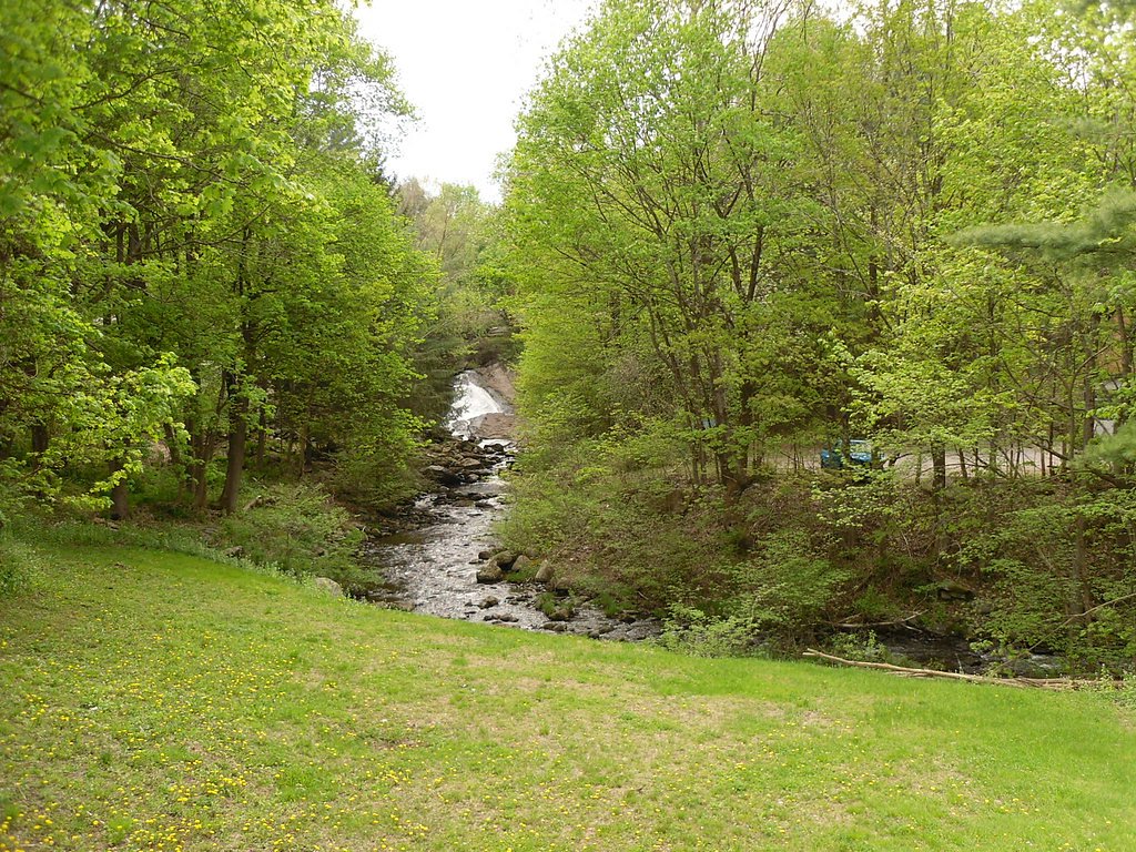
Buttermilk Falls in Connecticut is a picturesque waterfall located in the White Memorial Conservation Center in Litchfield. It is a small but charming cascade surrounded by lush forest, making it a popular spot for nature enthusiasts and photographers.
The Setting
Buttermilk Falls sits at 696 feet within Buttermilk Falls, fed by the Naugatuck River, in the foothills of Connecticut.
Trail & Hike Details
The Approach
The moderate 2.4-mile out-and-back trail gains 350 feet of elevation on the way to the falls.
Trail Description
The trail to Buttermilk Falls is a short and easy walk through a wooded area. It is well-marked and suitable for most visitors, including families with children. The trail leads directly to the base of the falls, offering a close-up view of the cascading water.
What to Expect
Dogs are welcome.
Accessibility
The trail is not wheelchair accessible. Uneven terrain and elevation changes require steady footing.
Frequently Asked Questions
🐶 Are Dogs Allowed at Buttermilk Falls?
✅ Dogs are allowed
Are There Any Fees or Permits Required?
🆖 No fees required
🏊 Is There Swimming at Buttermilk Falls?
❌ Swimming is not allowed
When to Visit
Spring and early summer are the best times to visit, as the water flow is typically strongest during these seasons.
Seasonal Access
The best time to visit is Spring, Summer, and Fall. Winter access may be limited.
Safety Information
The trail may be slippery after rain, so caution is advised. Stay on marked trails to avoid damaging the environment or getting lost.
Current Water Conditions
35 ft³/s
Current discharge — how much water is flowing
About average for this time of year
Based on 65 years of record
1.79 ft
Water depth at gauge
7-Day Discharge Trend
What does this mean for your visit?
Flow is about average for this time of year.
About This Gauge
7-Day Flow Outlook
Based on the USGS gauge NAUGATUCK RIVER AT THOMASTON, CT (6 km away).
Today
Barely Flowing
35 cfs
5/10Tomorrow
Barely Flowing
30 cfs
5/10Wed
Barely Flowing
34 cfs
5/10Thu
Barely Flowing
32 cfs
5/10Fri
Barely Flowing
30 cfs
5/10Sat
Barely Flowing
30 cfs
3/10Sun
Low
32 cfs
3/10Best window: Today — barely flowing flow, sunny (trip score 5/10).
Best time of year: this gauge typically runs highest from early March to early May, peaking in April.
How we calculate this
This is a transparent outlook, not a precise forecast. We take the waterfall's current flow strength (how it ranks against its historical normal for today, from the nearest USGS stream gauge), carry that ranking forward along the gauge's seasonal curve, and nudge it for forecast rain. Confidence is highest for the next day or two and falls further out. Always check official conditions and your own judgment before visiting — high flows can be dangerous.
Know when to go.
Get a free email alert when waterfalls near Terryville hit peak flow. We only send when conditions are worth the trip — no weekly newsletters, no spam.
Weather Forecast
Location & Access
Getting There
Buttermilk Falls is located in the White Memorial Conservation Center in Litchfield, Connecticut. The falls can be accessed via a short trail starting from the designated parking area.
Get Directions on Google MapsParking
There is a small parking area near the trailhead, but availability may be limited during peak times.
Elevation
696 feet above sea level
Coordinates
41.644152° N, -73.005517° W
Land Management
Managed by NGO
Visitor Tips & Gear
Visit early in the day to avoid crowds, especially on weekends. Wear sturdy shoes as the trail may be muddy or slippery after rain. Bring a camera to capture the scenic views.
As an Amazon Associate, we earn from qualifying purchases.
With 2.4 miles and 350 ft of elevation gain, sturdy boots and trekking poles will help on this moderate trail. Sun exposure on the trail makes good sun protection a must in summer.

Polarized Sunglasses (Knockaround)
Cuts glare off the water so you actually see the falls — and your photos turn out better too.

Columbia Watertight II Rain Jacket
Packs into its own pocket, seam-sealed, and keeps you dry from spray and surprise rain.

Earth Pak Waterproof Dry Bag
Keeps your phone and gear dry when waterfall mist soaks everything else.

Waterproof Phone Pouch (AiRunTech)
Cheap insurance — take photos right next to the falls without killing your phone.

Timberland Euro Sprint Mid Waterproof
Trusted waterproof boot with premium leather and grippy rubber sole — reliable on rocky, wet trails.

TrailBuddy Trekking Poles
Lightweight aluminum, cork grips, and flip-locks that actually hold — a best-seller for good reason.
Where to Stay

Courtyard Waterbury Downtown

Holiday Inn Cheshire - Southington by IHG

The Kent Collection - The Firefly Inn

Homewood Suites by Hilton Hartford / Southington CT
Browse vacation cabins and private rentals nearby
Unique outdoor stays — tents, yurts, and treehouses
Rent a campervan or RV for your waterfall road trip
Some links are affiliate links. We may earn a commission at no extra cost to you.
Nearby Campground
NORTHFIELD BROOK LAKE GROUP SHELTERS
5.4 miles away · 2 sites
Overview Northfield Brook Lake Group Shelters are located along a small scenic lake in the Naugatuck Valley of west-central Connecticut. Naugatuck Valley boasts picturesque small towns, rolling hills and industry and where public recreation is valued. On warm summer evenings, people gather at the park to enjoy hiking, picnicking and other outdoor activities. Recreation The recreation area provides two picnic shelters that can be reserved for group events in spring, summer and early fall, though g
Book on Recreation.govAdditional Information
Nearby Attractions
The White Memorial Conservation Center offers additional hiking trails, a nature museum, and opportunities for birdwatching. The town of Litchfield also has charming shops and restaurants.
Wildlife
The area is home to various bird species, deer, and small mammals. Visitors may also encounter frogs and other amphibians near the water.
Cities near Buttermilk Falls
Other waterfalls named Buttermilk Falls
22 other waterfalls share this name across the U.S.
-
01
Apalachin
165 ftCurrent flow 40 ft³/s -
02
Claverack-Red Mills
165 ftCurrent flow 209 ft³/s -
03
Cohoes
165 ftCurrent flow 1,440 ft³/s -
04
East Worcester
165 ftCurrent flow 8 ft³/s -
05
Fultonville
165 ft -
06
Gloversville
165 ft -
07
Greenwood Lake
165 ftCurrent flow 108 ft³/s -
08
Highland Falls
Current flow 27 ft³/s -
09
Hudson Falls
165 ftCurrent flow 32 ft³/s -
10
Keeseville
165 ftCurrent flow 110 ft³/s -
11
Linwood
165 ftCurrent flow 26 ft³/s -
12
Palenville
165 ftCurrent flow 1 ft³/s -
13
Speculator
165 ftCurrent flow 247 ft³/s -
14
Wampsville
165 ftCurrent flow 29 ft³/s
Writing about Buttermilk Falls? Embed this waterfall on your site for free.