Buttermilk Falls
New York • 165 ft
By Armen Suny · Last verified Mar 2026
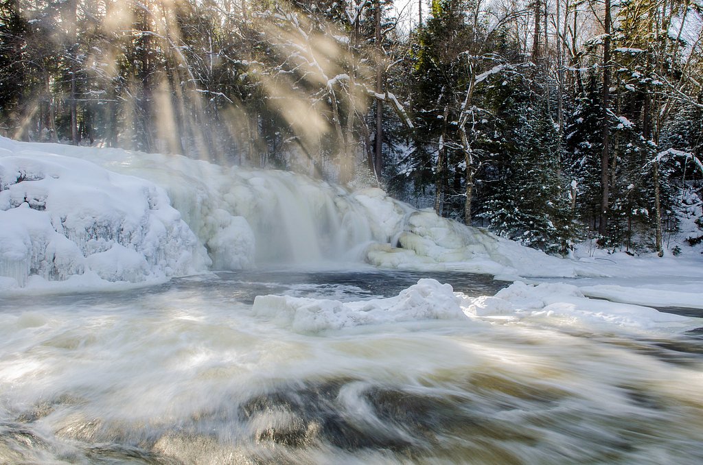
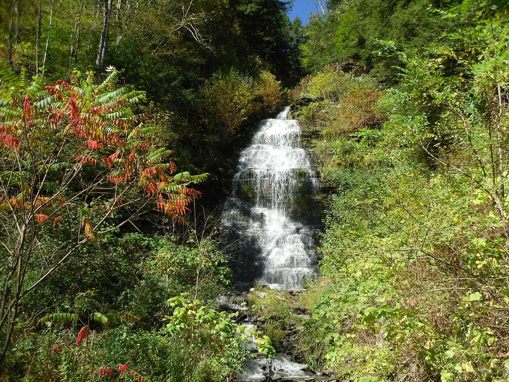

Photo Credits (5)
Difficulty
Moderate
Trail Length
1.5 miles
Trail Type
Out And Back
Elevation Gain
500 ft
About Buttermilk Falls
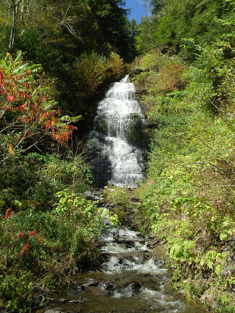
Buttermilk Falls is a striking 165-foot cascade that tumbles over a series of rocky steps and ledges, producing lively flows in spring and after heavy rain. The falls present a photogenic sequence of drops and pools that reward a short hike with big scenery; Wikipedia notes that “Buttermilk Falls” is a name used for several different waterfalls in New York, so be sure you’re looking at the Sargent Ponds Wild Forest location when planning a visit. The falls sit within the Sargent Ponds Wild Forest (designation: SCA) and are managed by SDC, giving the area a managed-wild character that balances access with conservation. The most common approach follows the Gorge Trail and offers a close-up encounter with the creek and multiple small cascades; for a longer outing hikers often combine the Gorge route with the Rim Trail to make a loop.
The Setting
Buttermilk Falls sits at 1,654 feet within Sargent Ponds Wild Forest, fed by the Indian River, in the hills of New York. At 165 feet, it is among the taller waterfalls in New York.
Height: 165 feet
Trail & Hike Details
The Approach
The moderate 1.5-mile out-and-back trail gains 500 feet of elevation on the way to the falls.
Trail Description
Trail type: out-and-back; length: 1.5 miles; elevation gain: ~500 ft; difficulty: moderate. The Gorge Trail follows Buttermilk Creek and leads directly past the main 165-foot fall and several smaller cascades. Expect stone steps and some steep sections along the route—short, rocky pitches and stair-like stonework are the primary features of the tread. The Rim Trail can be used to form a loop for those wanting a longer hike. No USFS trail number is provided for this route.
What to Expect
The falls plunge 165 feet. Swimming is permitted. Dogs are welcome.
Accessibility
The trail is not wheelchair accessible. Uneven terrain and elevation changes require steady footing.
Frequently Asked Questions
🐶 Are Dogs Allowed at Buttermilk Falls?
✅ Dogs are allowed
Are There Any Fees or Permits Required?
🤑 Fee: $9.00
🏊 Is There Swimming at Buttermilk Falls?
✅ Swimming is allowed
When to Visit
Spring and early summer are ideal for visiting, as the water flow is typically strongest during these seasons. Fall offers beautiful foliage, while winter provides unique ice formations.
Seasonal Access
The best time to visit is Spring, Summer, and Fall. Winter access may be limited.
Safety Information
The trail can be slippery, especially after rain. Stay on marked trails and avoid climbing on rocks near the falls. Swimming is only permitted in designated areas when lifeguards are present.
Current Water Conditions
Based on a USGS gauge 15.4 miles away
260 ft³/s
Current discharge — how much water is flowing
About average for this time of year
Based on 112 years of record
2.20 ft
Water depth at gauge
7-Day Discharge Trend
What does this mean for your visit?
Flow is about average for this time of year.
About This Gauge
This gauge is on a regional waterway. Conditions at the falls may differ, especially after local rain.
7-Day Flow Outlook
Based on the USGS gauge INDIAN RIVER NEAR INDIAN LAKE NY (25 km away).
Today
Moderate
260 cfs
6/10Tomorrow
Moderate
284 cfs
8/10Tue
Moderate
319 cfs
4/10Wed
Moderate
302 cfs
6/10Thu
Moderate
287 cfs
6/10Fri
Moderate
316 cfs
6/10Sat
Moderate
323 cfs
6/10Best window: Tomorrow — moderate flow, mostly sunny (trip score 8/10).
Best time of year: this gauge typically runs highest from late December to mid March, peaking in February.
How we calculate this
This is a transparent outlook, not a precise forecast. We take the waterfall's current flow strength (how it ranks against its historical normal for today, from the nearest USGS stream gauge), carry that ranking forward along the gauge's seasonal curve, and nudge it for forecast rain. Confidence is highest for the next day or two and falls further out. Always check official conditions and your own judgment before visiting — high flows can be dangerous.
Know when to go.
Get a free email alert when waterfalls near Speculator hit peak flow. We only send when conditions are worth the trip — no weekly newsletters, no spam.
Weather Forecast
Location & Access
Getting There
Buttermilk Falls is located in Buttermilk Falls State Park, just south of Ithaca, New York. The main entrance is off Route 13, and the falls are easily accessible from the parking area.
Get Directions on Google MapsParking
There is a designated parking area near the base of the falls within the state park. Parking may require a fee during peak seasons.
Elevation
1,654 feet above sea level
Coordinates
43.914784° N, -74.484052° W
Land Management
Managed by SDC
Visitor Tips & Gear
Arrive early during peak seasons to secure parking. Wear sturdy footwear, as the trail can be slippery, especially near the falls. Bring water and be prepared for some steep sections on the trail.
As an Amazon Associate, we earn from qualifying purchases.
With 1.5 miles and 500 ft of elevation gain, sturdy boots and trekking poles will help on this moderate trail. Sun exposure on the trail makes good sun protection a must in summer.

Polarized Sunglasses (Knockaround)
Cuts glare off the water so you actually see the falls — and your photos turn out better too.

Columbia Watertight II Rain Jacket
Packs into its own pocket, seam-sealed, and keeps you dry from spray and surprise rain.

Earth Pak Waterproof Dry Bag
Keeps your phone and gear dry when waterfall mist soaks everything else.

Waterproof Phone Pouch (AiRunTech)
Cheap insurance — take photos right next to the falls without killing your phone.

Timberland Euro Sprint Mid Waterproof
Trusted waterproof boot with premium leather and grippy rubber sole — reliable on rocky, wet trails.

TrailBuddy Trekking Poles
Lightweight aluminum, cork grips, and flip-locks that actually hold — a best-seller for good reason.
Where to Stay

Sandy Point Motel

The Alpine Lodge

The Long View Lodge

The Lazy Bear Cabin
Browse vacation cabins and private rentals nearby
Unique outdoor stays — tents, yurts, and treehouses
Rent a campervan or RV for your waterfall road trip
Some links are affiliate links. We may earn a commission at no extra cost to you.
Additional Information
Nearby Attractions
Other nearby attractions include Taughannock Falls State Park, Robert H. Treman State Park, and the Finger Lakes wineries.
Wildlife
The area is home to various bird species, deer, and small mammals. Visitors may also see fish in the creek.
Cities near Buttermilk Falls
Other waterfalls named Buttermilk Falls
22 other waterfalls share this name across the U.S.
-
01
Apalachin
165 ft -
02
Claverack-Red Mills
165 ftCurrent flow 105 ft³/s -
03
Cohoes
165 ftCurrent flow 1,720 ft³/s -
04
East Worcester
165 ftCurrent flow 17 ft³/s -
05
Fultonville
165 ftCurrent flow 1,280 ft³/s -
06
Gloversville
165 ftCurrent flow 1,280 ft³/s -
07
Greenwood Lake
165 ftCurrent flow 20 ft³/s -
08
Highland Falls
Current flow 1 ft³/s -
09
Hudson Falls
165 ftCurrent flow 54 ft³/s -
10
Keeseville
165 ft -
11
Linwood
165 ftCurrent flow 103 ft³/s -
12
Palenville
165 ftCurrent flow 1 ft³/s -
13
Wampsville
165 ftCurrent flow 47 ft³/s
Writing about Buttermilk Falls? Embed this waterfall on your site for free.