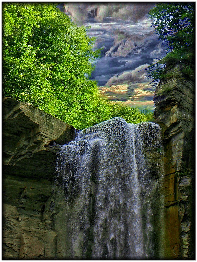
Buttermilk Falls
New York • 165 ft
By Armen Suny · Last verified May 2026
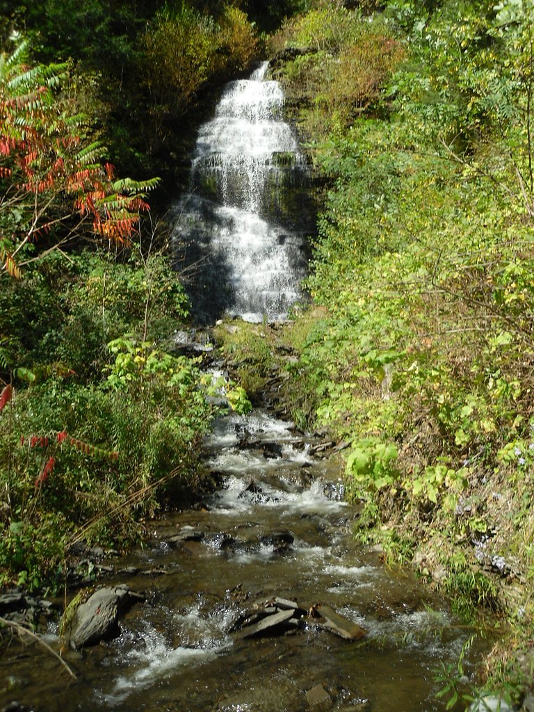
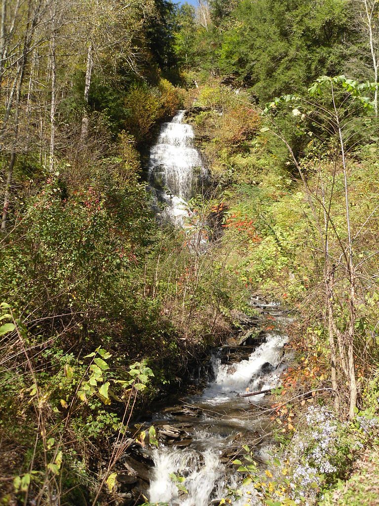
Photo Credits (3)
Difficulty
Moderate
Trail Length
1.5 miles
Trail Type
Out And Back
Elevation Gain
500 ft
About Buttermilk Falls
Tucked into Buttermilk Falls State Park just outside Ithaca, New York, Buttermilk Falls tumbles down a series of rocky steps for a total drop of about 165 feet. The cascade threads through a narrow, tree-lined gorge and is particularly dramatic after heavy rains or spring snowmelt, when the tiers foam and spill over the ledges into pools below. Visitors typically access the falls via the Gorge Trail; the out-and-back hike is roughly 1.5 miles round trip with about 500 feet of elevation gain and is generally rated moderate. The path winds past stone steps, bridges, and multiple overlooks that offer intimate viewpoints of the cascade, but be prepared for steep, sometimes slippery sections. Note that “Buttermilk Falls” is a common name for waterfalls in the region, and this is the well-known cascade located within Buttermilk Falls State Park.
The Setting
Buttermilk Falls sits at 886 feet along the Ramapo River, in the foothills of New York. At 165 feet, it is among the taller waterfalls in New York.
Height: 165 feet
Trail & Hike Details
The Approach
The moderate 1.5-mile out and back trail gains 500 feet of elevation on the way to the falls.
Trail Description
Gorge Trail (out-and-back) — distance: ~1.5 miles round trip, elevation gain: ~500 ft, difficulty: moderate. Surface and features: a mix of carved stone steps, packed dirt, exposed rock and wooden bridges with constructed viewpoints along the gorge. Grade/class: trail includes short, steep pitches and stairway sections through the ravine; overall class is a moderate day-hike with uneven footing. Conditions: sections can be slick after rain or during spring melt, so use caution on stairs, rock ledges and bridges.
What to Expect
The falls plunge 165 feet. Swimming is permitted. Dogs are welcome.
Accessibility
The trail is not wheelchair accessible. Uneven terrain and elevation changes require steady footing.
Frequently Asked Questions
🐶 Are Dogs Allowed at Buttermilk Falls?
✅ Dogs are allowed
Are There Any Fees or Permits Required?
🤑 Fee: $9.00
🏊 Is There Swimming at Buttermilk Falls?
✅ Swimming is allowed
When to Visit
Spring and early summer are ideal for visiting, as the waterfall flow is strongest due to snowmelt and rainfall. Fall offers beautiful foliage, while winter provides unique ice formations.
Seasonal Access
The best time to visit is Spring, Summer, and Fall. Winter access may be limited.
Safety Information
The trail can be slippery, especially after rain. Stay on marked trails and avoid climbing on rocks near the falls. Swimming is only permitted in designated areas when lifeguards are present.
Current Water Conditions
76 ft³/s
Current discharge — how much water is flowing
Higher than usual for this time of year
Based on 47 years of record
2.11 ft
Water depth at gauge
7-Day Discharge Trend
What does this mean for your visit?
The water is flowing higher than usual for this time of year.
About This Gauge
This gauge is on a nearby waterway and may not reflect exact conditions at the falls.
7-Day Flow Outlook
Based on the USGS gauge RAMAPO RIVER AT RAMAPO NY (16 km away).
Today
Barely Flowing
76 cfs
5/10Tomorrow
Barely Flowing
76 cfs
5/10Wed
Barely Flowing
81 cfs
5/10Thu
Barely Flowing
81 cfs
5/10Fri
Barely Flowing
74 cfs
5/10Sat
Low
88 cfs
4/10Sun
Low
101 cfs
3/10Best window: Today — barely flowing flow, sunny (trip score 5/10).
Best time of year: this gauge typically runs highest from late February to early May, peaking in April.
How we calculate this
This is a transparent outlook, not a precise forecast. We take the waterfall's current flow strength (how it ranks against its historical normal for today, from the nearest USGS stream gauge), carry that ranking forward along the gauge's seasonal curve, and nudge it for forecast rain. Confidence is highest for the next day or two and falls further out. Always check official conditions and your own judgment before visiting — high flows can be dangerous.
Know when to go.
Get a free email alert when waterfalls near Greenwood Lake hit peak flow. We only send when conditions are worth the trip — no weekly newsletters, no spam.
Weather Forecast
Location & Access
Getting There
Buttermilk Falls is located in Buttermilk Falls State Park, approximately 2 miles south of downtown Ithaca, New York. The main entrance is off Route 13, and the falls are easily accessible from the parking area.
Get Directions on Google MapsParking
There is a designated parking area near the base of the falls, which is typically sufficient for visitors. Parking fees may apply during peak seasons.
Hours
Elevation
886 feet above sea level
Coordinates
41.220094° N, -74.334874° W
Visitor Tips & Gear
Wear sturdy footwear, as the trail can be uneven and slippery. Arrive early during peak seasons to secure parking. Bring water and snacks, and be prepared for steep sections of the trail.
As an Amazon Associate, we earn from qualifying purchases.
With 1.5 miles and 500 ft of elevation gain, sturdy boots and trekking poles will help on this moderate trail. Sun exposure on the trail makes good sun protection a must in summer.

Polarized Sunglasses (Knockaround)
Cuts glare off the water so you actually see the falls — and your photos turn out better too.

Columbia Watertight II Rain Jacket
Packs into its own pocket, seam-sealed, and keeps you dry from spray and surprise rain.

Earth Pak Waterproof Dry Bag
Keeps your phone and gear dry when waterfall mist soaks everything else.

Waterproof Phone Pouch (AiRunTech)
Cheap insurance — take photos right next to the falls without killing your phone.

Timberland Euro Sprint Mid Waterproof
Trusted waterproof boot with premium leather and grippy rubber sole — reliable on rocky, wet trails.

TrailBuddy Trekking Poles
Lightweight aluminum, cork grips, and flip-locks that actually hold — a best-seller for good reason.
Where to Stay

Cottage at Millpond Falls - A Romantic Escape

1 Hour Drive from MetLife Stadium, World Cup Base, Lakeview Villa with Private Hot Tub, Firepit & Spacious Decks with Breathtaking Cliff Views

Cromwell Manor Inn

13-Acre Private Estate, Private Lake, Private Golf Range, Private Forest & Hiking Trails
Browse vacation cabins and private rentals nearby
Unique outdoor stays — tents, yurts, and treehouses
Rent a campervan or RV for your waterfall road trip
Some links are affiliate links. We may earn a commission at no extra cost to you.
Additional Information
Nearby Attractions
Other nearby attractions include Taughannock Falls State Park, Robert H. Treman State Park, and the Finger Lakes Wine Trail.
Wildlife
The park is home to various wildlife, including birds, deer, and small mammals. Visitors may also spot fish in the streams.
Cities near Buttermilk Falls
Other waterfalls named Buttermilk Falls
22 other waterfalls share this name across the U.S.
-
01
Apalachin
165 ftCurrent flow 38 ft³/s -
02
Claverack-Red Mills
165 ftCurrent flow 260 ft³/s -
03
Cohoes
165 ftCurrent flow 1,190 ft³/s -
04
East Worcester
165 ftCurrent flow 9 ft³/s -
05
Fultonville
165 ftCurrent flow 1,530 ft³/s -
06
Gloversville
165 ftCurrent flow 1,530 ft³/s -
07
Highland Falls
Current flow 32 ft³/s -
08
Hudson Falls
165 ft -
09
Keeseville
165 ftCurrent flow 94 ft³/s -
10
Linwood
165 ft -
11
Palenville
165 ftCurrent flow 1 ft³/s -
12
Speculator
165 ftCurrent flow 22 ft³/s -
13
Wampsville
165 ftCurrent flow 29 ft³/s
Writing about Buttermilk Falls? Embed this waterfall on your site for free.