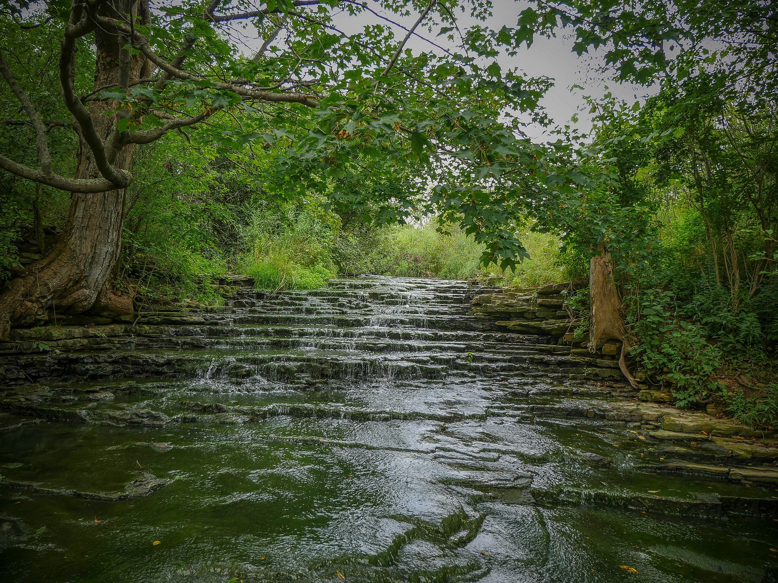
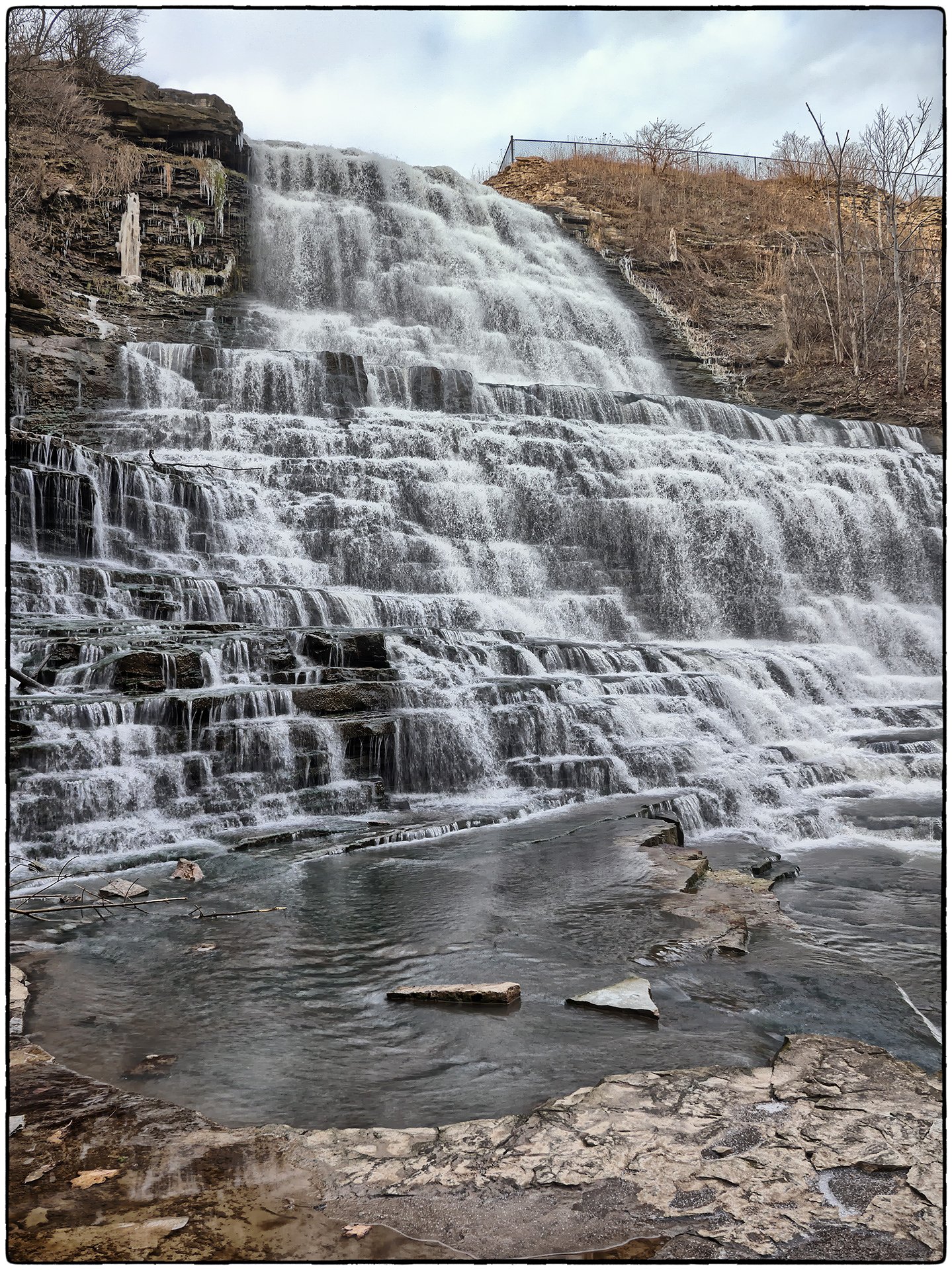
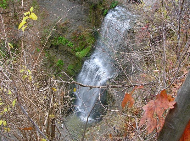
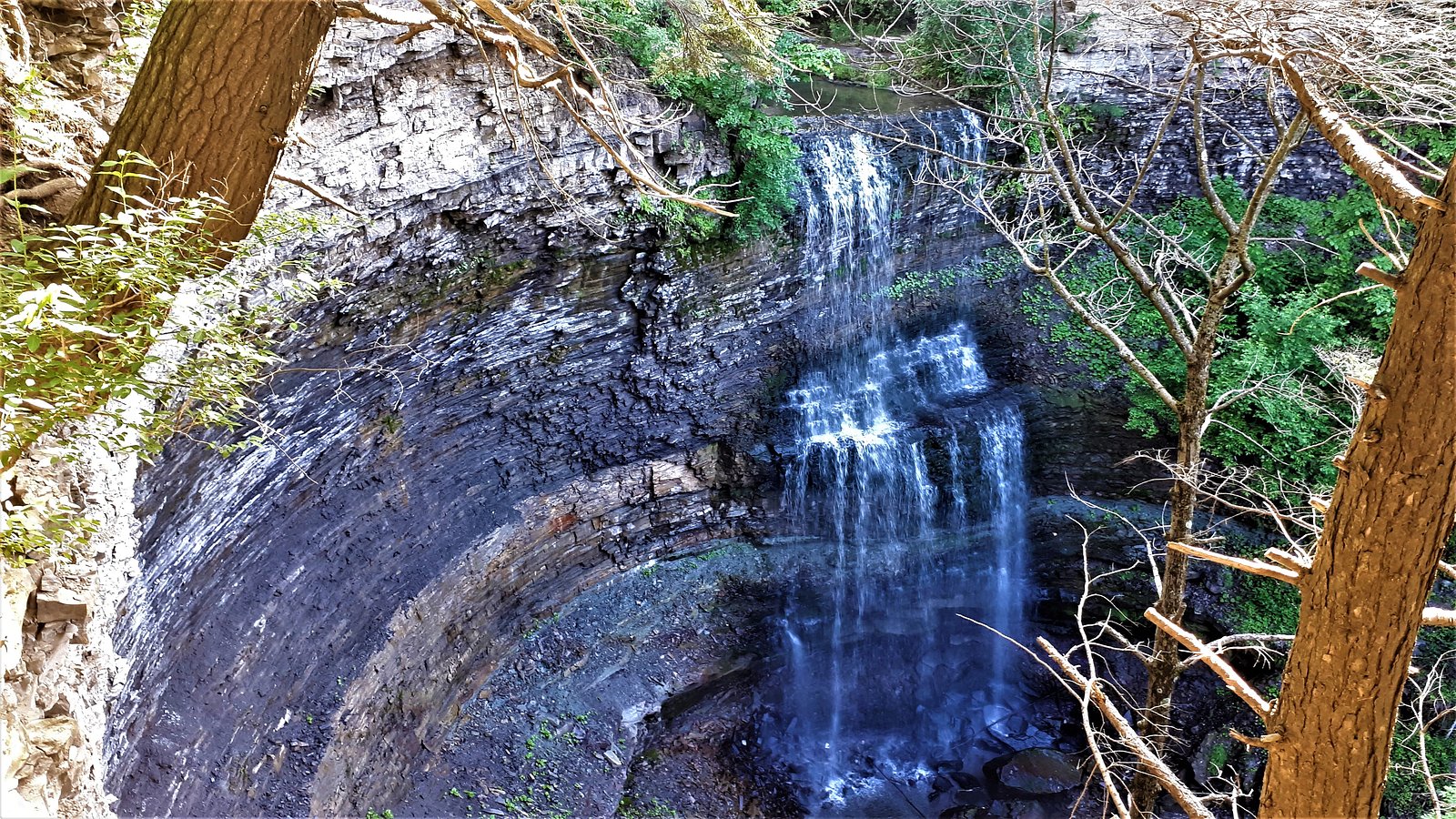
Hannon Cascade
Ontario • 2 m
By Armen Suny · Last verified Jun 2026
Photo Credits (3)
Difficulty
Drive Up
Trail Length
0.2 km
Trail Type
Out And Back
About Hannon Cascade
Hannon Cascade is a small, scenic cascade on a tributary near Hamilton, Ontario. The feature is best described as a modest series of drops over bedrock and mossy ledges rather than a single high vertical plunge. Flow and appearance vary seasonally, highest in spring and after heavy rain, lower in dry late summer. The site is relatively close to urban areas but feels wooded and natural at the immediate approach. Exact historical or geological details are limited and may vary by source.
The Setting
Hannon Cascade sits at 198 metres in the foothills of Ontario. The falls drop 2 metres.
Why This Waterfall Exists
Hannon Cascade flows over layered sedimentary rock laid down about 419-444 million years ago. Over time, the stream has worn through these layers at different rates, creating a 6-foot drop that forms the waterfall.
Nearby Falls Worth Visiting
Buttermilk Falls (23 m) lies 2.1 kilometres to the northeast. Also nearby: Felker's Falls (22 m, 3.7 km) and Albion Falls (19 m, 1.6 km).
Trail & Hike Details
The Approach
No hiking required. Hannon Cascade is accessible by vehicle with a roadside viewing area.
Trail Description
The approach to Hannon Cascade is generally a short walk over natural surface trails, expect compact dirt, roots, and occasional rocks. Trails in the immediate vicinity may be narrow and can become muddy after rain. The final approach to the water often requires scrambling a short, possibly steep section over rocks to get the best views; there may not be formal viewing platforms or railings. Signage and trail maintenance can vary; plan for an informal trail experience.
What to Expect
The falls drop a gentle 2 metres over layered sedimentary rock.
Accessibility
This waterfall is viewable from a vehicle-accessible area. No hiking is required.
Frequently Asked Questions
🐶 Are Dogs Allowed at Hannon Cascade?
❌ Dogs are not allowed
Are There Any Fees or Permits Required?
🆖 No fees required
🏊 Is There Swimming at Hannon Cascade?
❌ Swimming is not allowed
When to Visit
Late winter to late spring (after snowmelt and spring rains) for highest flows and best photos. Early morning on weekdays reduces crowds and gives better lighting. Fall provides attractive foliage colors; summer flows may be reduced during dry periods. Winter can produce ice formations but is also more hazardous.
Seasonal Access
The best time to visit is Spring, Summer, Fall, and Winter. Check with the managing park or local authority for current conditions.
Safety Information
Primary hazards include slippery and unstable rock near the cascade, steep or unmarked drop-offs, sudden high water after heavy rain, and icy conditions in winter. Do not climb on ledges or enter fast-moving water. Wear appropriate footwear, supervise children closely, and avoid visiting alone in remote conditions. Check weather and recent visitor reports for trail conditions before you go.
Current Water Conditions
0.2 m³/s
Current discharge — how much water is flowing
About average for this time of year
Based on 40 years of record
11.27 m
Water depth at gauge
7-Day Discharge Trend
What does this mean for your visit?
Flow is about average for this time of year.
About This Gauge
7-Day Flow Outlook
Based on the WSC gauge REDHILL CREEK AT HAMILTON (7 km away).
Today
Moderate
0.2 m³/s
8/10Tomorrow
Moderate
0.2 m³/s
6/10Tue
Moderate
0.2 m³/s
6/10Wed
Moderate
0.2 m³/s
6/10Thu
Moderate
0.2 m³/s
8/10Fri
Moderate
0.2 m³/s
6/10Sat
Moderate
0.2 m³/s
6/10Best window: Today — moderate flow, mainly sunny (trip score 8/10).
Best time of year: this gauge typically runs highest from mid February to early May, peaking in April.
How we calculate this
This is a transparent outlook, not a precise forecast. We take the waterfall's current flow strength (how it ranks against its historical normal for today, from the nearest WSC stream gauge), carry that ranking forward along the gauge's seasonal curve, and nudge it for forecast rain. Confidence is highest for the next day or two and falls further out. Always check official conditions and your own judgment before visiting — high flows can be dangerous.
Know when to go.
Get a free email alert when waterfalls near Hamilton hit peak flow. We only send when conditions are worth the trip — no weekly newsletters, no spam.
Weather Forecast
Location & Access
Getting There
Coordinates: 43.1874, -79.8297. The site lies just outside the core of Hamilton (approx. 4.5 miles from downtown Hamilton), and is roughly 36 miles from Niagara University and Youngstown. Access is typically from local roads or a short spur/trail off a nearby parking area or roadside pullout; exact public access points can vary, so check local maps and signage. Some approaches may pass near private property, follow posted signs and stay on designated trails.
Get Directions on Google MapsParking
Parking is likely limited to a small roadside pullout or a nearby small lot. Expect informal parking; spaces may be few and can fill on weekends. If you cannot find official parking, do not block driveways or the roadway. Specific lot names and capacities are not confirmed here.
Elevation
198 metres above sea level
Coordinates
43.187409° N, -79.829706° W
Visitor Tips & Gear
• Wear sturdy, grippy footwear, rocks and mud can be slippery. • Stay on marked trails and behind any posted barriers; fall hazards exist near edges. • Respect private property and posted signs; some approaches may cross sensitive or privately owned land. • Leave no trace: pack out trash and avoid disturbing vegetation or streambeds. • Cell reception may be variable, bring a map or download offline maps if needed. • If visiting in winter, expect ice and icy trails; microspikes or traction devices are recommended.
Where to Stay
Browse vacation cabins and private rentals nearby
Unique outdoor stays — tents, yurts, and treehouses
Rent a campervan or RV for your waterfall road trip
Some links are affiliate links. We may earn a commission at no extra cost to you.
Nearby Campground
Lost Forest Park & Camping Resort
21.8 km away
Additional Information
Nearby Attractions
Hamilton region is known for many waterfalls and conservation areas. Nearby notable falls and attractions (general region) include Webster's Falls, Tews Falls, Albion Falls, and various conservation area trails, verify exact distances and access separately.
Wildlife
Expect typical southern Ontario woodland fauna: songbirds, squirrels, raccoons, white-tailed deer, and small mammals. Ticks can be present in warmer months; take appropriate precautions. Aquatic life may include small fish and invertebrates.
Cities near Hannon Cascade
Nearby Waterfalls


Writing about Hannon Cascade? Embed this waterfall on your site for free.