Billy Monkley Cascade
Ontario • 3 m
By Armen Suny · Last verified Jun 2026
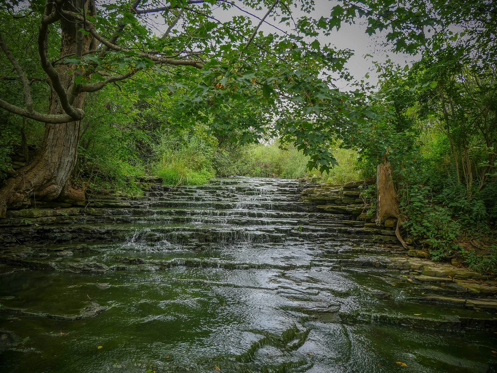
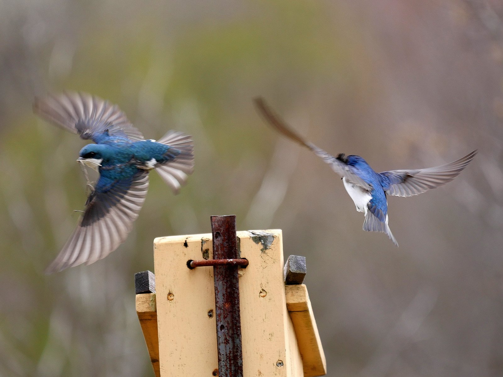

Photo Credits (5)
Difficulty
Easy
Trail Length
3.7 km
Trail Type
Loop
Elevation Gain
25 m
About Billy Monkley Cascade
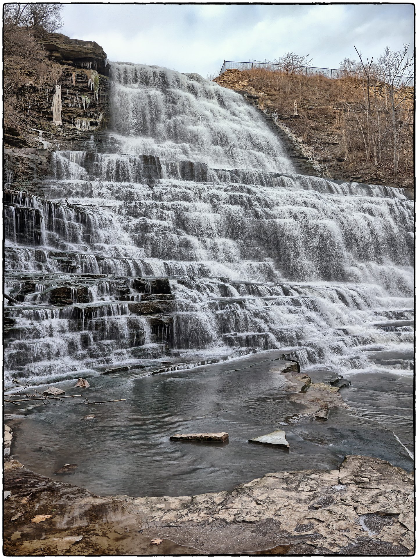
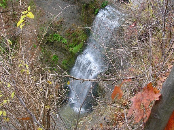
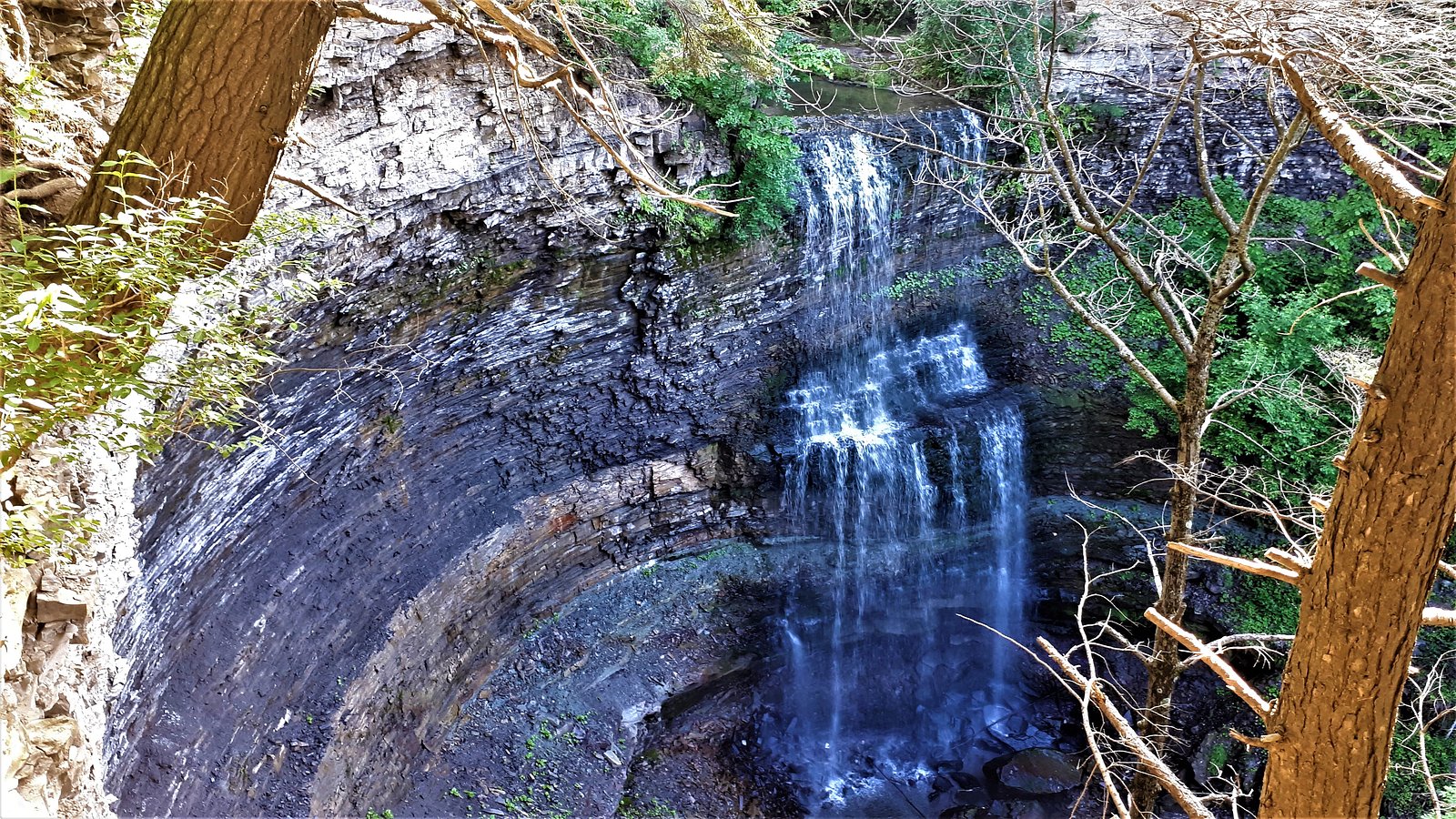
Billy Monkley Cascade is a small, locally known cascade located near the southern edge of the Niagara Escarpment in the Niagara/Hamilton region of Ontario (coordinates 43.1905, -79.8293). It appears as a modest multi-step drop on a small tributary or creek and is primarily of interest to local hikers and photographers. Specific published information about official naming, precise measured height, or maintained infrastructure at the site is limited; the description below reflects typical conditions for small cascades in this part of Ontario and is conservative where definitive sources are not available.
The Setting
Billy Monkley Cascade sits at 190 metres within Mount Albion, in the foothills of Ontario. The falls drop 3 metres.
Why This Waterfall Exists
Billy Monkley Cascade flows over layered sedimentary rock laid down about 419-444 million years ago. Over time, the stream has worn through these layers at different rates, creating a 9-foot drop that forms the waterfall.
Nearby Falls Worth Visiting
Buttermilk Falls (23 m) lies 1.8 kilometres to the northeast. Also nearby: Felker's Falls (22 m, 3.5 km) and Albion Falls (19 m, 1.3 km).
Trail & Hike Details
The Approach
The easy 3.7-km loop trail gains 25 metres of elevation on the way to the falls.
Trail Description
Published trail descriptions for Billy Monkley Cascade are limited. Expect a short, potentially unmarked path from a roadside pullout down to the creek, with uneven footing, roots and rocks, and possibly a short scramble to reach the water's edge. Trails in this area can be narrow and may be eroded in places. There may be informal social trails rather than a maintained, signed route.
What to Expect
The falls drop a gentle 3 metres over layered sedimentary rock.
Accessibility
The trail is not wheelchair accessible. Uneven terrain and elevation changes require steady footing.
Frequently Asked Questions
🐶 Are Dogs Allowed at Billy Monkley Cascade?
❌ Dogs are not allowed
Are There Any Fees or Permits Required?
🆖 No fees required
🏊 Is There Swimming at Billy Monkley Cascade?
❌ Swimming is not allowed
When to Visit
Spring (snowmelt and seasonal rains) typically provides the best flow for photos. Early morning or late afternoon light is ideal for photography and fewer visitors. Avoid peak freeze-thaw conditions in winter unless you have appropriate traction equipment and experience with icy terrain.
Seasonal Access
The best time to visit is Spring, Summer, Fall, and Winter. Check with the managing park or local authority for current conditions.
Safety Information
WARNING: Conditions can be hazardous. Common hazards include slippery rocks and wet surfaces, unstable or eroded banks, sudden high-water after rain, cold water and hypothermia risk, ice in winter, and limited cell coverage. Do not climb on wet or frozen rock faces. Keep a safe distance from the edge of cliffs and drop-offs, supervise children closely, and avoid entering the water unless you are certain it is safe. If unsure about conditions, postpone the visit and consult recent trip reports or local authorities.
Current Water Conditions
0.2 m³/s
Current discharge — how much water is flowing
About average for this time of year
Based on 40 years of record
11.27 m
Water depth at gauge
7-Day Discharge Trend
What does this mean for your visit?
Flow is about average for this time of year.
About This Gauge
7-Day Flow Outlook
Based on the WSC gauge REDHILL CREEK AT HAMILTON (7 km away).
Today
Moderate
0.2 m³/s
6/10Tomorrow
Moderate
0.2 m³/s
6/10Tue
Moderate
0.2 m³/s
6/10Wed
Moderate
0.2 m³/s
6/10Thu
Moderate
0.2 m³/s
8/10Fri
Moderate
0.2 m³/s
6/10Sat
Moderate
0.2 m³/s
6/10Best window: Thu — moderate flow, cloudy (trip score 8/10).
Best time of year: this gauge typically runs highest from mid February to early May, peaking in April.
How we calculate this
This is a transparent outlook, not a precise forecast. We take the waterfall's current flow strength (how it ranks against its historical normal for today, from the nearest WSC stream gauge), carry that ranking forward along the gauge's seasonal curve, and nudge it for forecast rain. Confidence is highest for the next day or two and falls further out. Always check official conditions and your own judgment before visiting — high flows can be dangerous.
Know when to go.
Get a free email alert when waterfalls near Hamilton hit peak flow. We only send when conditions are worth the trip — no weekly newsletters, no spam.
Weather Forecast
Location & Access
Getting There
Drive to the general coordinates (43.1905, -79.8293). The site is roughly 4–5 miles southeast of central Hamilton and is also within driving distance of Youngstown and Niagara University (roughly 36 miles). Expect to follow local roads and possibly unpaved access or short forest service lanes near the escarpment; exact directions are not provided by a single authoritative trail listing. Use a reliable map app and the coordinates to plan the final approach. If arriving from Hamilton, head toward the southern escarpment region and look for small creek crossings or pullouts near forested parcels.
Get Directions on Google MapsParking
There may be no formal parking lot. Parking is likely roadside or in a small informal pullout near the trail access; park legally and avoid blocking private driveways or gates. If you find a marked conservation-area lot nearby, use the designated lot. Availability and legality of parking are not confirmed.
Elevation
190 metres above sea level
Coordinates
43.190475° N, -79.829296° W
Land Management
Managed by Hamilton Conservation Authority
Visitor Tips & Gear
• Use the provided coordinates and a current map app to plan access; parking may be informal. • Wear sturdy, waterproof footwear with good traction; rocks are slippery, especially when wet or icy. • Treat the site as wild, no guardrails or formal viewing platforms should be assumed. • Respect private property: if a gate or 'no trespassing' sign is present, do not enter. • Check recent local trip reports (hiking forums, AllTrails, local conservation authority pages) for up-to-date access notes and hazards. • Leave no trace: pack out all trash and avoid disturbing vegetation or stream banks.
As an Amazon Associate, we earn from qualifying purchases.
This easy 3.7 km hike is straightforward — comfortable trail shoes and plenty of water should do. Icy conditions are common in winter — traction cleats are a smart addition.

Columbia Watertight II Rain Jacket
Packs into its own pocket, seam-sealed, and keeps you dry from spray and surprise rain.

Polarized Sunglasses (Knockaround)
Cuts glare off the water so you actually see the falls — and your photos turn out better too.

Earth Pak Waterproof Dry Bag
Keeps your phone and gear dry when waterfall mist soaks everything else.

Waterproof Phone Pouch (AiRunTech)
Cheap insurance — take photos right next to the falls without killing your phone.

Kahtoola MICROspikes
Cult-favorite traction cleats that grip ice and wet rock — essential for winter waterfall hikes.

JOBY GorillaPod Starter Kit
Wraps around railings and rocks for long-exposure waterfall shots — no flat surface needed.
Where to Stay
Browse vacation cabins and private rentals nearby
Unique outdoor stays — tents, yurts, and treehouses
Rent a campervan or RV for your waterfall road trip
Some links are affiliate links. We may earn a commission at no extra cost to you.
Nearby Campground
Lost Forest Park & Camping Resort
21.5 km away
Additional Information
Nearby Attractions
Hamilton's well-known network of waterfalls and escarpment trails is relatively nearby (e.g., many popular falls and parks around Hamilton and the Niagara Escarpment), as are Niagara Gorge attractions to the east. Exact distances and access points vary; consult local park and conservation authority resources for established sites.
Wildlife
Typical Southern Ontario wildlife may be present: songbirds, waterfowl near open water, white-tailed deer, raccoons, small mammals, and occasionally snakes. Ticks and biting insects can be present in warmer months.
Cities near Billy Monkley Cascade
Nearby Waterfalls


Writing about Billy Monkley Cascade? Embed this waterfall on your site for free.