Buttermilk Falls
Ontario • 18 m
By Armen Suny · Last verified Jun 2026
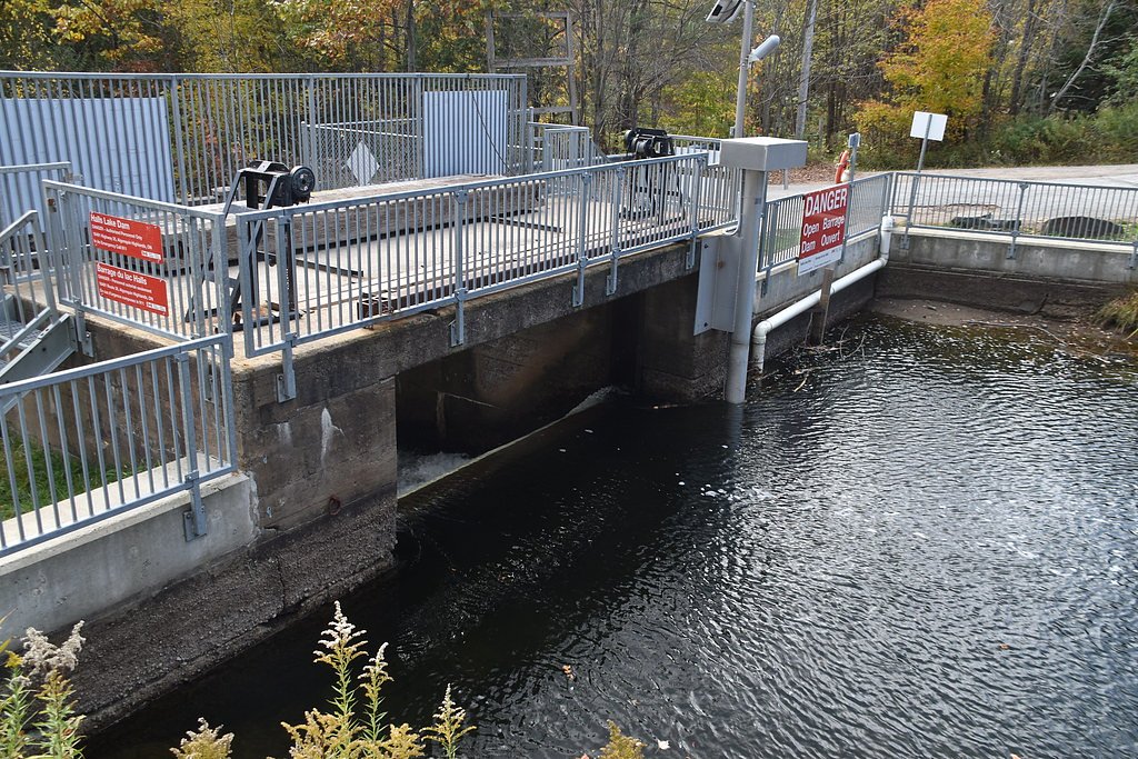
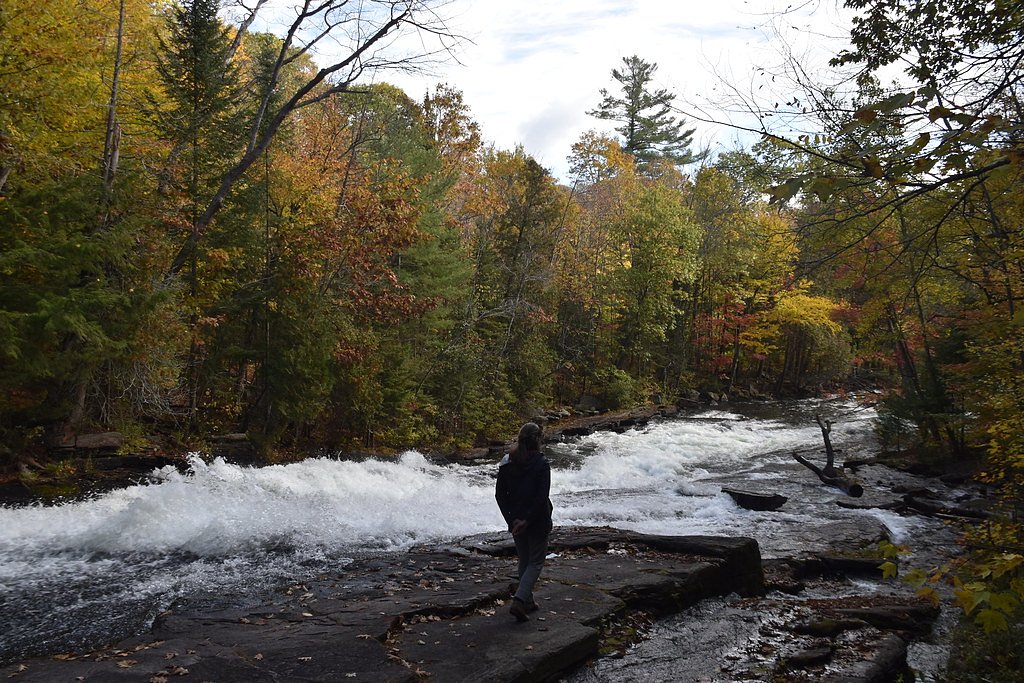
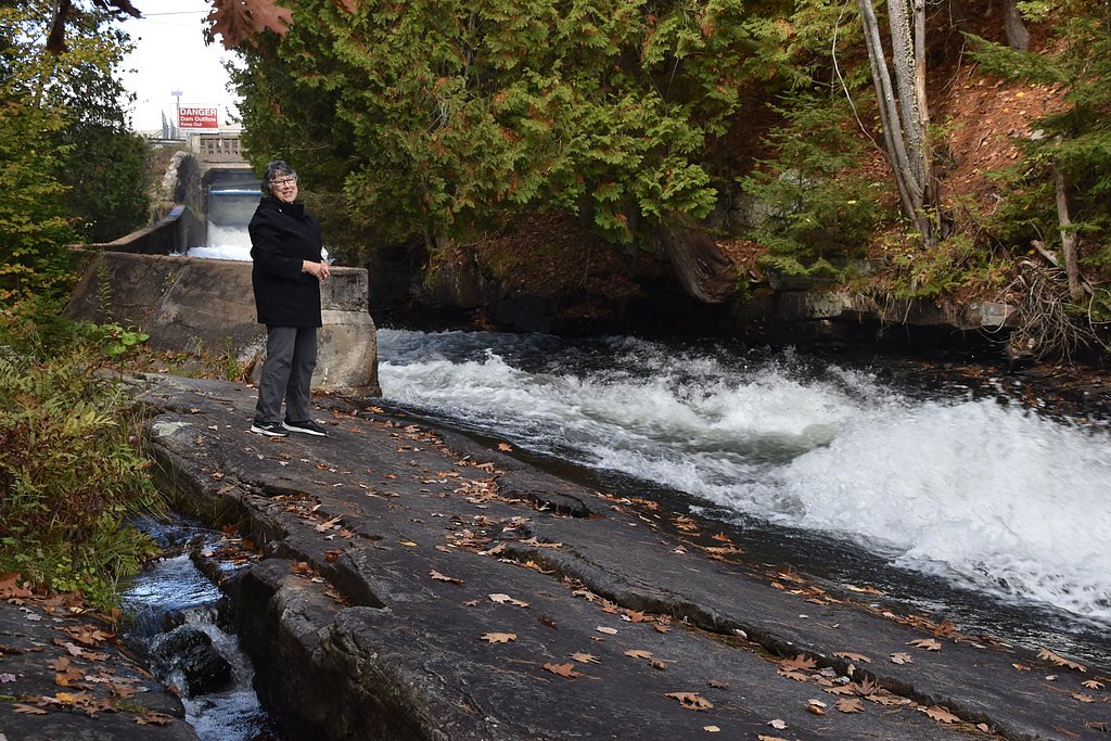
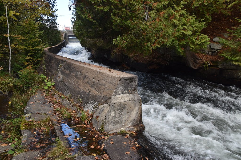
Photo Credits (5)
Difficulty
Easy
Trail Length
1.4 km
Trail Type
Out And Back
Elevation Gain
6 m
About Buttermilk Falls
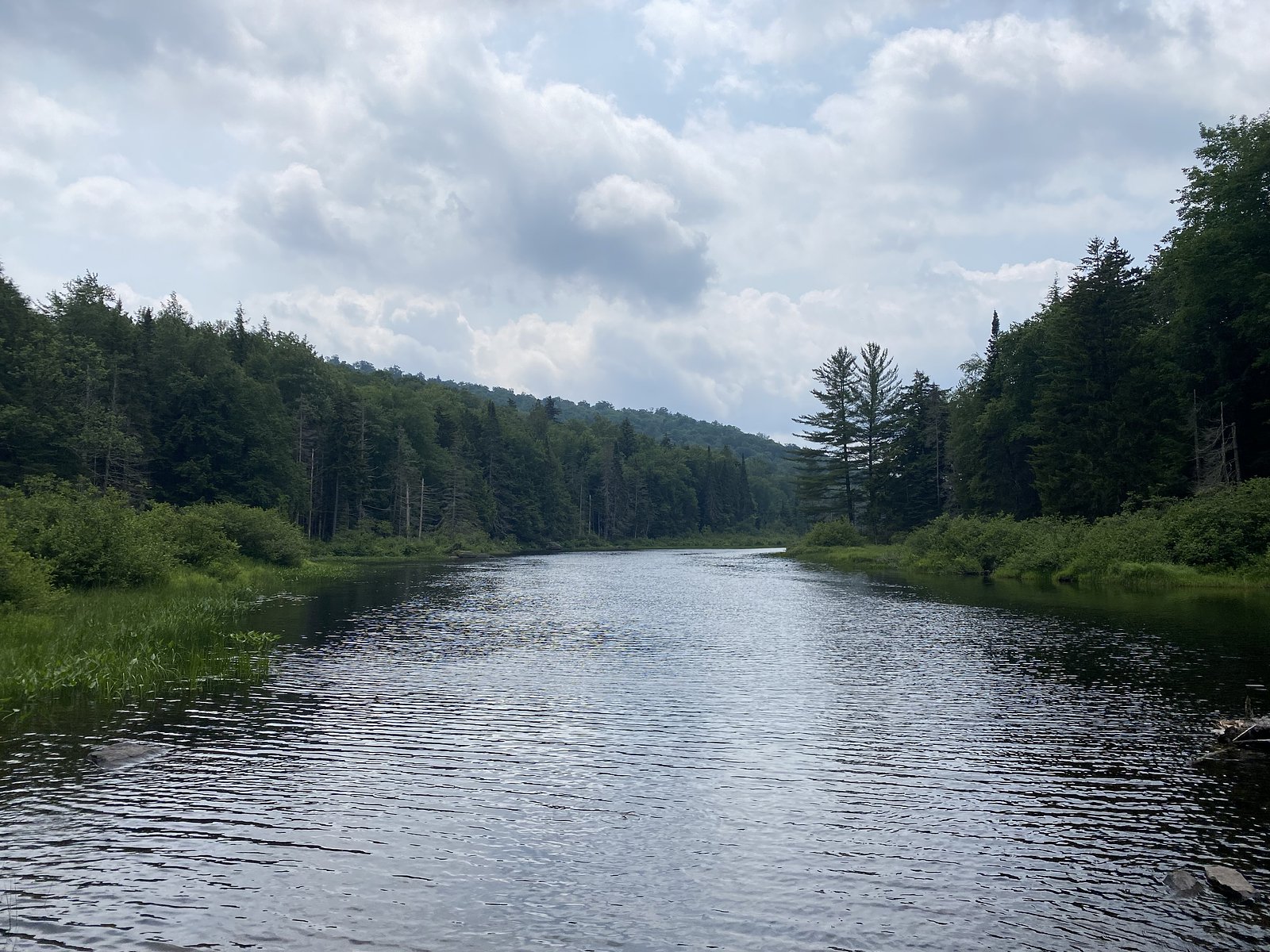
Buttermilk Falls (coords: 45.0947, -78.745) is a small cascade-style waterfall in central Ontario. It is best known as a scenic roadside/near-road waterfall in a mixed forest and lake-dotted landscape typical of the Muskoka/Parry Sound region. Flow and appearance can vary seasonally, highest flows are typically in spring runoff and after heavy rain. There are few formal facilities at the site and visitor information online is limited; visitors should plan for minimal infrastructure and exercise caution near the edge and on wet rock.
The Setting
Buttermilk Falls sits at 324 metres in the foothills of Ontario. The falls drop 18 metres.
Why This Waterfall Exists
Buttermilk Falls flows over hard crystalline rock, primarily gneiss, laid down over 1.0-1.6 billion years ago. These resistant rocks form a durable ledge that water cannot easily wear away, creating a 59-foot drop where softer material downstream has already eroded.
Trail & Hike Details
The Approach
The easy 1.4-km out-and-back trail gains 6 metres of elevation on the way to the falls.
Trail Description
Publicly available trail details are limited. Access from the nearest parking/pull-off to the falls may be a short, potentially steep or uneven walk over roots and rocks. Surfaces can be muddy and slippery, and there may be short scrambles or informal paths near the water. If you require a developed boardwalk, paved access, or long maintained trail, this site may not provide those features. If you plan a visit, expect minimal maintained trail infrastructure and bring appropriate footwear.
What to Expect
The falls drop 18 metres over hard crystalline rock.
Accessibility
The trail is short and relatively flat, but the surface may be uneven. Contact the managing agency for accessibility details.
Frequently Asked Questions
🐶 Are Dogs Allowed at Buttermilk Falls?
❌ Dogs are not allowed
Are There Any Fees or Permits Required?
🆖 No fees required
🏊 Is There Swimming at Buttermilk Falls?
❌ Swimming is not allowed
When to Visit
Spring (snowmelt and rain) for highest flows and dramatic water; late spring through early fall for milder weather and easier hiking. Early fall can offer attractive foliage. Winter visits are possible but can be hazardous due to ice, snow, and unstable banks, only attempt in winter with appropriate experience and equipment.
Seasonal Access
The best time to visit is Spring, Summer, Fall, and Winter. Check with the managing park or local authority for current conditions.
Safety Information
Hazards to be aware of: • Slippery, wet rocks and algae, high risk of falls and injury. • Unmarked or unstable edges and drop-offs near the falls. • Cold, fast-moving water and submerged hazards, never assume safe swimming. • Sudden changes in water flow after rain or upstream releases. • Winter ice can be brittle and conceal hazards; ice-related incidents are common near waterfalls. • Limited or no emergency services or cell coverage in some spots, carry a map, inform someone of your plans, and consider a personal locator/beacon if venturing off-grid. Always exercise caution, supervise children closely, and stay a safe distance from the water's edge.
Current Water Conditions
Based on a Water Survey of Canada gauge 26.5 km away
1.7 m³/s
Current discharge — how much water is flowing
About average for this time of year
Based on 19 years of record
8.82 m
Water depth at gauge
7-Day Discharge Trend
What does this mean for your visit?
Flow is about average for this time of year.
About This Gauge
This gauge is on a regional waterway. Conditions at the falls may differ, especially after local rain.
7-Day Flow Outlook
Based on the WSC gauge BLACK RIVER NEAR VANKOUGHNET (26 km away).
Today
Moderate
1.7 m³/s
6/10Tomorrow
Moderate
1.7 m³/s
6/10Tue
Moderate
1.8 m³/s
6/10Wed
Moderate
1.8 m³/s
6/10Thu
Moderate
1.8 m³/s
8/10Fri
Moderate
1.8 m³/s
6/10Sat
Moderate
1.6 m³/s
8/10Best window: Thu — moderate flow, cloudy (trip score 8/10).
Best time of year: this gauge typically runs highest from mid March to mid May, peaking in April.
How we calculate this
This is a transparent outlook, not a precise forecast. We take the waterfall's current flow strength (how it ranks against its historical normal for today, from the nearest WSC stream gauge), carry that ranking forward along the gauge's seasonal curve, and nudge it for forecast rain. Confidence is highest for the next day or two and falls further out. Always check official conditions and your own judgment before visiting — high flows can be dangerous.
Know when to go.
Get a free email alert when waterfalls near Orillia hit peak flow. We only send when conditions are worth the trip — no weekly newsletters, no spam.
Weather Forecast
Location & Access
Getting There
Coordinates: 45.0947, -78.745. The site is located in central Ontario, roughly 52.6 miles from Orillia and about 75.2 miles from Barrie by road travel (distances provided are approximate). Use the coordinates with a GPS or mapping app to locate the exact parking/turnoff. Local access is typically via secondary roads; detailed turn-by-turn directions and road names are not confirmed here, so check a current map or local resources before travel.
Get Directions on Google MapsParking
Parking may be limited and may consist of a small roadside pull-off or an informal lot. Expect little to no official parking infrastructure or signage. Do not block driveways or private roads; if no safe legal parking is available, do not stop.
Elevation
324 metres above sea level
Coordinates
45.094730° N, -78.745006° W
Visitor Tips & Gear
• Use the provided GPS coordinates and a current map; local road names and pull-offs may not be well signed. • Wear sturdy, non-slip footwear; rocks and trails near the falls are often wet and slippery. • Leave no trace: pack out all garbage and avoid disturbing vegetation or wildlife. • Watch small children closely; there are likely unguarded edges and fast water. • Check recent trip reports or local conservation authority/municipal notices for access changes, seasonal hazards, or private property restrictions before visiting. • If you see posted rules on site (dogs leashed, no swimming, private property, etc.), follow them.
As an Amazon Associate, we earn from qualifying purchases.
For this easy 1.4 km trail, lightweight trail shoes and a water bottle are usually sufficient. Icy conditions are common in winter — traction cleats are a smart addition.

Columbia Watertight II Rain Jacket
Packs into its own pocket, seam-sealed, and keeps you dry from spray and surprise rain.

Polarized Sunglasses (Knockaround)
Cuts glare off the water so you actually see the falls — and your photos turn out better too.

Earth Pak Waterproof Dry Bag
Keeps your phone and gear dry when waterfall mist soaks everything else.

Waterproof Phone Pouch (AiRunTech)
Cheap insurance — take photos right next to the falls without killing your phone.

Kahtoola MICROspikes
Cult-favorite traction cleats that grip ice and wet rock — essential for winter waterfall hikes.

JOBY GorillaPod Starter Kit
Wraps around railings and rocks for long-exposure waterfall shots — no flat surface needed.
Where to Stay
Browse vacation cabins and private rentals nearby
Unique outdoor stays — tents, yurts, and treehouses
Rent a campervan or RV for your waterfall road trip
Some links are affiliate links. We may earn a commission at no extra cost to you.
Nearby Campground
Kinark Outdoor Centre
8.2 km away
Additional Information
Nearby Attractions
Nearest larger communities: Orillia (~52.6 miles) and Barrie (~75.2 miles). The region has many lakes, provincial and regional parks, and hiking opportunities; check local tourism resources for nearby parks and trails. Specific nearby named attractions to this exact coordinate are not confirmed here.
Wildlife
Expect typical central Ontario wildlife: songbirds, small mammals (squirrels, hares), white-tailed deer, and insects. Black bears and moose may be present in parts of the broader region, exercise standard wildlife precautions. Ticks can be active in warmer months; use insect repellent and check for ticks after hikes.
Cities near Buttermilk Falls
Other waterfalls named Buttermilk Falls
22 other waterfalls share this name across Canada.
-
01
Apalachin
165 ft -
02
Claverack-Red Mills
165 ft -
03
Cohoes
165 ft -
04
East Worcester
165 ftCurrent flow 4 ft³/s -
05
Fultonville
165 ft -
06
Gloversville
165 ft -
07
Greenwood Lake
165 ftCurrent flow 57 ft³/s -
08
Highland Falls
Current flow 24 ft³/s -
09
Hudson Falls
165 ftCurrent flow 40 ft³/s -
10
Keeseville
165 ftCurrent flow 72 ft³/s -
11
Linwood
165 ftCurrent flow 699 ft³/s -
12
Palenville
165 ft -
13
Speculator
165 ft -
14
Wampsville
165 ftCurrent flow 31 ft³/s
Writing about Buttermilk Falls? Embed this waterfall on your site for free.