
Buttermilk Falls
By Armen Suny · Last verified Mar 2026
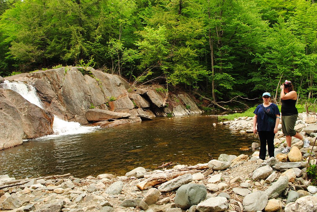
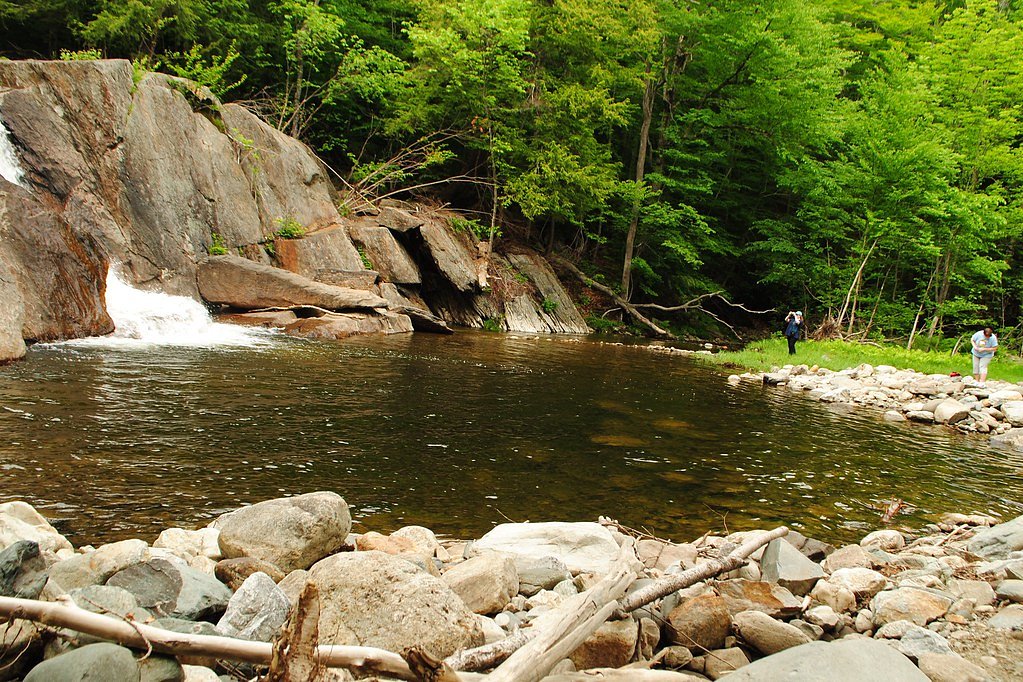
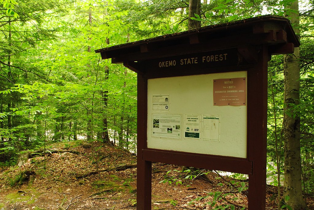
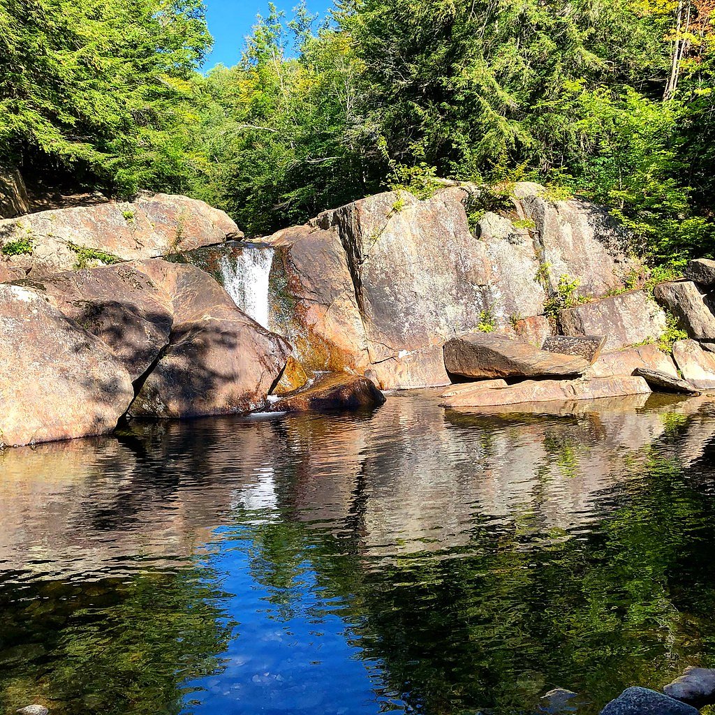
Photo Credits (5)
Difficulty
Moderate
Trail Length
2.4 miles
Trail Type
Out And Back
Elevation Gain
350 ft
About Buttermilk Falls
Nestled within Okemo State Forest’s CONE land unit, Buttermilk Falls is a charming series of cascades in Vermont that draws hikers for its photogenic tiers and forested setting. The falls are part of a broader set of similarly named sites (as noted on Wikipedia), but this location’s combination of flowing water, verdant hardwoods, and accessible approach makes it a distinct outing for day hikers and photographers alike. The parcel is owned by SPR and managed under the OTHS unit, so visitors should treat the area with the quiet respect of a managed forest landscape. The falls themselves unfold over multiple drops with clear pools at their bases, offering pleasant vantage points from well-worn viewpoints. While the scene is suitably tranquil for a short escape into nature, the trail approach rewards a modest effort and provides a satisfying half-day loop for most active visitors — bring sturdy shoes and a camera for the best views.
The Setting
Buttermilk Falls sits at 1,198 feet within Okemo State Forest, fed by the Black River, in the foothills of Vermont.
Trail & Hike Details
The Approach
The moderate 2.4-mile out-and-back trail gains 350 feet of elevation on the way to the falls.
Trail Description
The trail to Buttermilk Falls is an out-and-back route of roughly 2.4 miles round trip with about 350 feet of elevation gain and is rated moderate. The path is generally well-marked and suitable for most hikers, with mostly level walking broken by some uneven sections and short steeper pitches as you near the cascades. Expect a straightforward route that leads directly to viewpoints above and beside the falls; there is no USFS trail number provided for this site.
What to Expect
Swimming is permitted. Dogs are welcome.
Accessibility
The trail is not wheelchair accessible. Uneven terrain and elevation changes require steady footing.
Frequently Asked Questions
🐶 Are Dogs Allowed at Buttermilk Falls?
✅ Dogs are allowed
Are There Any Fees or Permits Required?
🆖 No fees required
🏊 Is There Swimming at Buttermilk Falls?
✅ Swimming is allowed
When to Visit
Spring and early summer are ideal for visiting, as the water flow is strongest during these seasons. Fall offers stunning foliage, while summer provides opportunities for wading in the pools.
Seasonal Access
The best time to visit is Spring, Summer, and Fall. Winter access may be limited.
Safety Information
Rocks near the falls can be slippery, so exercise caution. Avoid visiting during heavy rain or after storms, as water levels may rise rapidly.
Current Water Conditions
380 ft³/s
Current discharge — how much water is flowing
Much higher than usual for this time of year
Based on 68 years of record
3.01 ft
Water depth at gauge
7-Day Discharge Trend
What does this mean for your visit?
The water is flowing much higher than usual, expect an impressive display.
About This Gauge
This gauge is on a nearby waterway and may not reflect exact conditions at the falls.
7-Day Flow Outlook
Based on the USGS gauge BLACK RIVER AT NORTH SPRINGFIELD, VT (21 km away).
Today
Moderate
380 cfs
8/10Tomorrow
Moderate
380 cfs
8/10Tue
Moderate
424 cfs
6/10Wed
Moderate
460 cfs
6/10Thu
Moderate
437 cfs
6/10Fri
Moderate
432 cfs
6/10Sat
Moderate
386 cfs
6/10Best window: Today — moderate flow, mostly sunny (trip score 8/10).
Best time of year: this gauge typically runs highest from mid March to late May, peaking in April.
How we calculate this
This is a transparent outlook, not a precise forecast. We take the waterfall's current flow strength (how it ranks against its historical normal for today, from the nearest USGS stream gauge), carry that ranking forward along the gauge's seasonal curve, and nudge it for forecast rain. Confidence is highest for the next day or two and falls further out. Always check official conditions and your own judgment before visiting — high flows can be dangerous.
Know when to go.
Get a free email alert when waterfalls near Proctorsville hit peak flow. We only send when conditions are worth the trip — no weekly newsletters, no spam.
Weather Forecast
Location & Access
Getting There
Buttermilk Falls is located near Ludlow, Vermont, off Buttermilk Falls Road. It is easily accessible by car, and the trailhead is a short drive from the town center.
Get Directions on Google MapsParking
There is a small parking area near the trailhead, but it can fill up quickly during peak seasons.
Elevation
1,198 feet above sea level
Coordinates
43.436460° N, -72.727875° W
Land Management
Managed by OTHS
Visitor Tips & Gear
Arrive early during weekends or peak seasons to secure parking. Wear sturdy shoes as the area near the falls can be slippery. Bring a camera to capture the beautiful scenery.
As an Amazon Associate, we earn from qualifying purchases.
With 2.4 miles and 350 ft of elevation gain, sturdy boots and trekking poles will help on this moderate trail. Sun exposure on the trail makes good sun protection a must in summer.

Polarized Sunglasses (Knockaround)
Cuts glare off the water so you actually see the falls — and your photos turn out better too.

Columbia Watertight II Rain Jacket
Packs into its own pocket, seam-sealed, and keeps you dry from spray and surprise rain.

Earth Pak Waterproof Dry Bag
Keeps your phone and gear dry when waterfall mist soaks everything else.

Waterproof Phone Pouch (AiRunTech)
Cheap insurance — take photos right next to the falls without killing your phone.

Timberland Euro Sprint Mid Waterproof
Trusted waterproof boot with premium leather and grippy rubber sole — reliable on rocky, wet trails.

TrailBuddy Trekking Poles
Lightweight aluminum, cork grips, and flip-locks that actually hold — a best-seller for good reason.
Where to Stay

Winterplace G205

Jackson Gore Village, A Vail Resorts Property

Manchester View

Seesaw's Lodge
Browse vacation cabins and private rentals nearby
Unique outdoor stays — tents, yurts, and treehouses
Rent a campervan or RV for your waterfall road trip
Some links are affiliate links. We may earn a commission at no extra cost to you.
Nearby Campground
Stoughton Pond Rec Area
12 miles away · 1 sites
Overview Stoughton Pond Recreation Area is a day use area located to the north of North Springfield Lake. Stoughton Pond is located off State Route 106 on Stoughton Pond Road in Perkinsville, Vermont. Recreation Stoughton Pond Recreation Area offers plenty of activities for visitors of all ages. Many people enjoy canoeing, kayaking, boating and fishing. The state of Vermont Department of Fish and Game annually stock the pond with rainbow trout, and the pond also offers excellent bass fishing. A b
Book on Recreation.govNearby Hot Springs
Hot springs near Proctorsville, Vermont
Looking for a soak after your hike? Explore more hot springs near Proctorsville, Vermont on SoakingSprings.
Explore Vermont springsAdditional Information
Nearby Attractions
Okemo Mountain Resort, Ludlow town center, and Echo Lake State Park are nearby attractions worth visiting.
Wildlife
The area is home to various bird species, small mammals, and occasional deer sightings.
Cities near Buttermilk Falls
Nearby Waterfalls
Other waterfalls named Buttermilk Falls
22 other waterfalls share this name across the U.S.
-
01
Apalachin
165 ftCurrent flow 81 ft³/s -
02
Claverack-Red Mills
165 ftCurrent flow 143 ft³/s -
03
Cohoes
165 ftCurrent flow 2,800 ft³/s -
04
East Worcester
165 ftCurrent flow 25 ft³/s -
05
Fultonville
165 ftCurrent flow 1,950 ft³/s -
06
Gloversville
165 ftCurrent flow 1,950 ft³/s -
07
Greenwood Lake
165 ftCurrent flow 66 ft³/s -
08
Highland Falls
Current flow 3 ft³/s -
09
Hudson Falls
165 ftCurrent flow 45 ft³/s -
10
Keeseville
165 ftCurrent flow 241 ft³/s -
11
Linwood
165 ftCurrent flow 81 ft³/s -
12
Palenville
165 ftCurrent flow 1 ft³/s -
13
Speculator
165 ftCurrent flow 263 ft³/s -
14
Wampsville
165 ftCurrent flow 43 ft³/s
Writing about Buttermilk Falls? Embed this waterfall on your site for free.