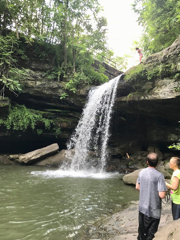
Buttermilk Falls
Pennsylvania • 45 ft
By Armen Suny · Last verified Mar 2026
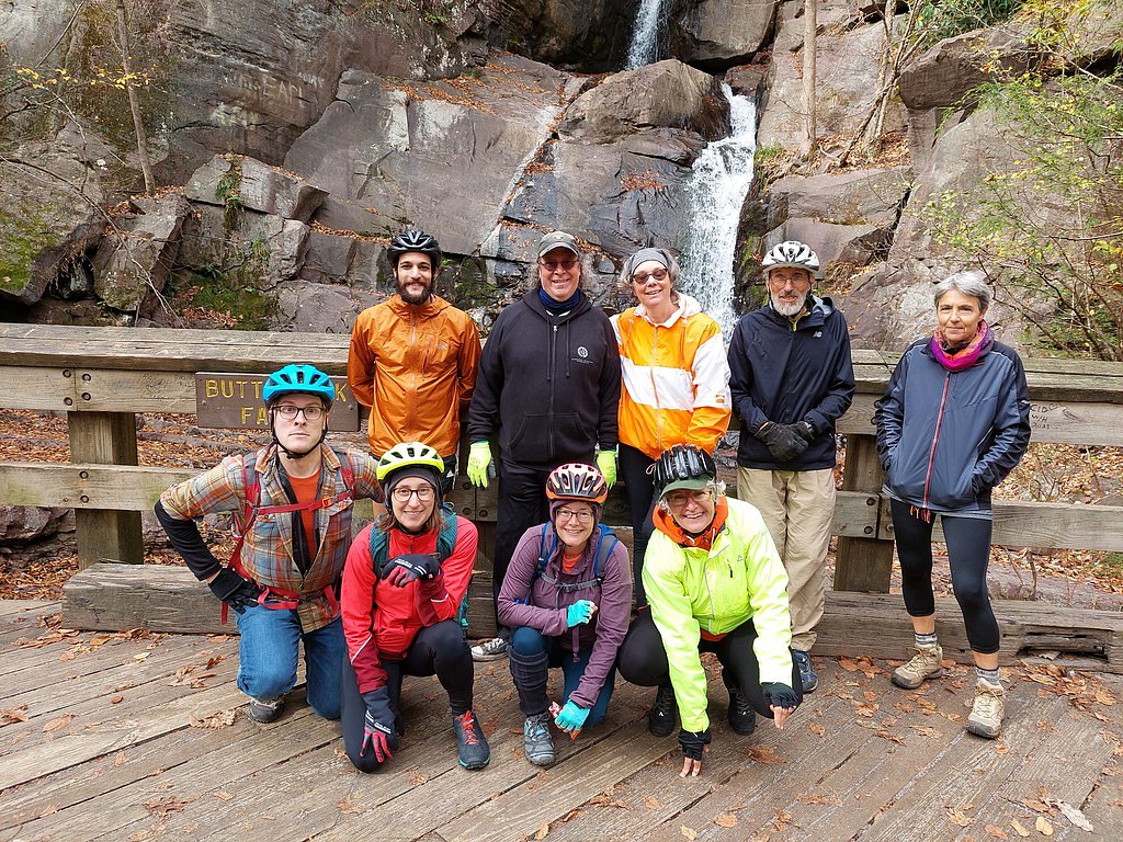
Photo Credits (5)
Difficulty
Moderate
Trail Length
2.4 miles
Trail Type
Out And Back
Elevation Gain
350 ft
About Buttermilk Falls
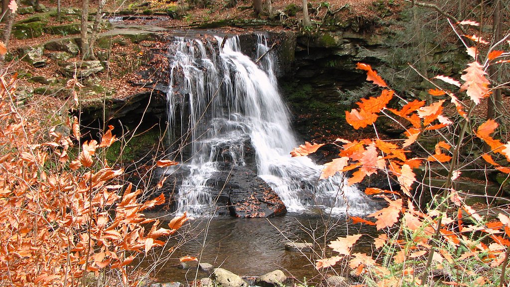
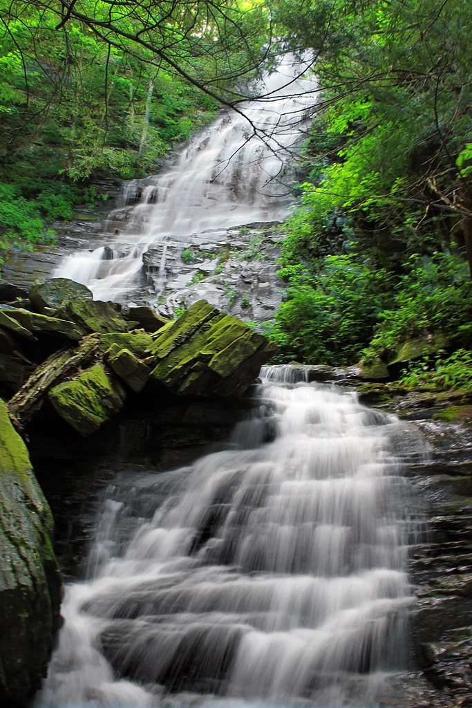
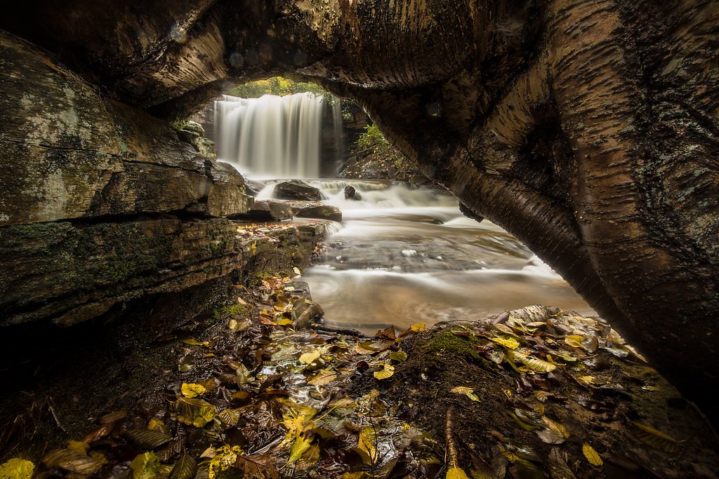
Buttermilk Falls in Pennsylvania tumbles roughly 45 feet over a rocky ledge into a tranquil pool, framed by mixed hardwoods and mossy outcrops. Though “Buttermilk Falls” is a name shared by multiple cascades across the country (as noted on Wikipedia), this particular site is prized locally for its photogenic plunge and approachable setting, making it a popular stop for nature lovers and photographers. You reach the falls via a compact but rewarding out-and-back hike — the trail is 2.4 miles round trip with about 350 feet of elevation gain and is typically rated moderate. The route is well maintained and includes a short staircase and a sturdy viewing platform that brings you close to the water, so plan on a couple of hours for a relaxed visit and plenty of time to enjoy the scenery.
The Setting
Buttermilk Falls sits at 1,476 feet along the Towanda Creek, in the foothills of Pennsylvania. The falls drop 45 feet.
Height: 45 feet
Trail & Hike Details
The Approach
The moderate 2.4-mile out-and-back trail gains 350 feet of elevation on the way to the falls.
Trail Description
Out-and-back trail, 2.4 miles round trip with approximately 350 feet of elevation gain; rated moderate. The route is well maintained and includes a short staircase and a viewing platform for close-up views of the 45-foot cascade. Expect steady uphill sections on the return; the trail’s condition and features make it suitable for hikers comfortable with moderate grades and short stairways.
What to Expect
The falls drop 45 feet. Dogs are welcome.
Accessibility
The trail is not wheelchair accessible. Uneven terrain and elevation changes require steady footing.
Frequently Asked Questions
🐶 Are Dogs Allowed at Buttermilk Falls?
✅ Dogs are allowed
Are There Any Fees or Permits Required?
🆖 No fees required
🏊 Is There Swimming at Buttermilk Falls?
❌ Swimming is not allowed
When to Visit
Spring and early summer are ideal for visiting, as the waterfall flow is strongest after rainfall or snowmelt.
Seasonal Access
The best time to visit is Spring, Summer, and Fall. Winter access may be limited.
Safety Information
The trail and viewing platform can be slippery, especially after rain. Exercise caution near the waterfall and stay on designated paths.
Current Water Conditions
26 ft³/s
Current discharge — how much water is flowing
About average for this time of year
Based on 15 years of record
3.04 ft
Water depth at gauge
7-Day Discharge Trend
What does this mean for your visit?
Flow is about average for this time of year.
About This Gauge
This gauge is on a nearby waterway and may not reflect exact conditions at the falls.
7-Day Flow Outlook
Based on the USGS gauge Towanda Creek near Franklindale, PA (23 km away).
Today
Moderate
26 cfs
8/10Tomorrow
Moderate
21 cfs
8/10Wed
Moderate
18 cfs
8/10Thu
Moderate
21 cfs
8/10Fri
Moderate
19 cfs
8/10Sat
Moderate
20 cfs
4/10Sun
Moderate
20 cfs
6/10Best window: Today — moderate flow, sunny (trip score 8/10).
Best time of year: this gauge typically runs highest from late March to late April, peaking in March.
How we calculate this
This is a transparent outlook, not a precise forecast. We take the waterfall's current flow strength (how it ranks against its historical normal for today, from the nearest USGS stream gauge), carry that ranking forward along the gauge's seasonal curve, and nudge it for forecast rain. Confidence is highest for the next day or two and falls further out. Always check official conditions and your own judgment before visiting — high flows can be dangerous.
Know when to go.
Get a free email alert when waterfalls near Forksville hit peak flow. We only send when conditions are worth the trip — no weekly newsletters, no spam.
Weather Forecast
Location & Access
Getting There
Buttermilk Falls is located near New Florence, Pennsylvania, in Indiana County. It is accessible via Buttermilk Falls Road, with clear signage leading to the parking area.
Get Directions on Google MapsParking
There is a small parking lot available near the trailhead, which can accommodate several vehicles.
Elevation
1,476 feet above sea level
Coordinates
41.536524° N, -76.745967° W
Visitor Tips & Gear
Visit early in the day to avoid crowds, especially during weekends. Wear sturdy shoes as the trail may be slippery near the waterfall. Bring a camera to capture the scenic views.
As an Amazon Associate, we earn from qualifying purchases.
With 2.4 miles and 350 ft of elevation gain, sturdy boots and trekking poles will help on this moderate trail. Sun exposure on the trail makes good sun protection a must in summer.

Polarized Sunglasses (Knockaround)
Cuts glare off the water so you actually see the falls — and your photos turn out better too.

Columbia Watertight II Rain Jacket
Packs into its own pocket, seam-sealed, and keeps you dry from spray and surprise rain.

Earth Pak Waterproof Dry Bag
Keeps your phone and gear dry when waterfall mist soaks everything else.

Waterproof Phone Pouch (AiRunTech)
Cheap insurance — take photos right next to the falls without killing your phone.

Timberland Euro Sprint Mid Waterproof
Trusted waterproof boot with premium leather and grippy rubber sole — reliable on rocky, wet trails.

TrailBuddy Trekking Poles
Lightweight aluminum, cork grips, and flip-locks that actually hold — a best-seller for good reason.
Where to Stay

Quality Inn & Suites Mansfield

SHERWOOD MOTEL

Crystal Springs Inn and Suites

Quality Inn & Suites Towanda
Browse vacation cabins and private rentals nearby
Unique outdoor stays — tents, yurts, and treehouses
Rent a campervan or RV for your waterfall road trip
Some links are affiliate links. We may earn a commission at no extra cost to you.
Additional Information
Nearby Attractions
Nearby attractions include Yellow Creek State Park and the Ghost Town Trail for additional hiking and outdoor activities.
Wildlife
The area is home to various bird species, deer, and small mammals. Keep an eye out for wildlife along the trail.
Cities near Buttermilk Falls
Nearby Waterfalls

Other waterfalls named Buttermilk Falls
22 other waterfalls share this name across the U.S.
-
01
Apalachin
165 ftCurrent flow 38 ft³/s -
02
Claverack-Red Mills
165 ftCurrent flow 257 ft³/s -
03
Cohoes
165 ftCurrent flow 1,930 ft³/s -
04
East Worcester
165 ftCurrent flow 9 ft³/s -
05
Fultonville
165 ft -
06
Gloversville
165 ft -
07
Greenwood Lake
165 ftCurrent flow 132 ft³/s -
08
Highland Falls
Current flow 32 ft³/s -
09
Hudson Falls
165 ftCurrent flow 36 ft³/s -
10
Keeseville
165 ftCurrent flow 94 ft³/s -
11
Linwood
165 ftCurrent flow 28 ft³/s -
12
Palenville
165 ftCurrent flow 1 ft³/s -
13
Speculator
165 ft -
14
Wampsville
165 ftCurrent flow 29 ft³/s
Writing about Buttermilk Falls? Embed this waterfall on your site for free.