Buttermilk Falls
New York • 549 ft
By Armen Suny · Last verified Sep 2026
LiDAR & 3D terrain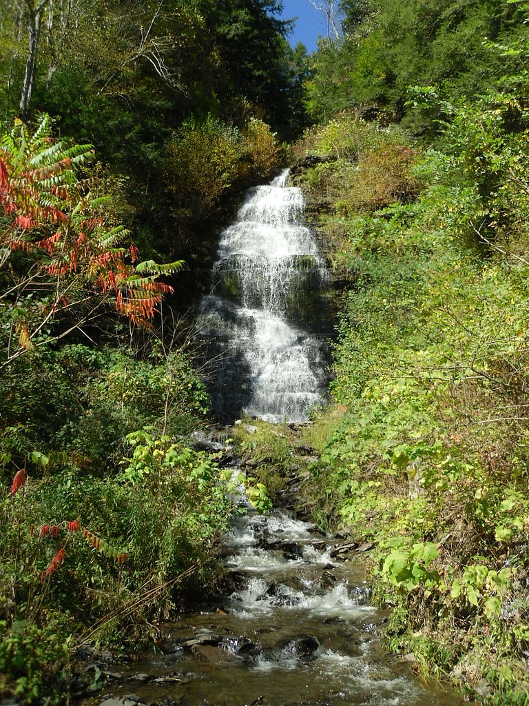
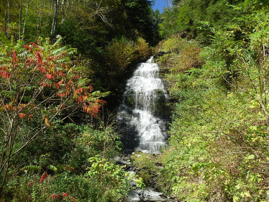
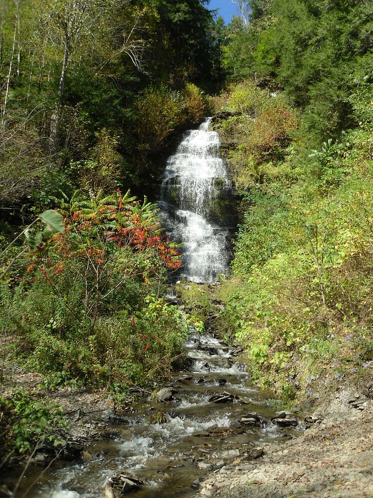
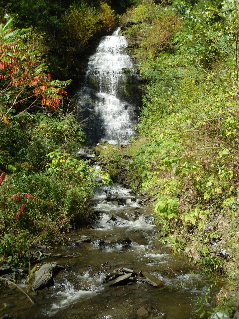
Photo Credits (5)
Difficulty
Moderate
Trail Length
1.5 miles
Trail Type
Out And Back
Elevation Gain
500 ft
About Buttermilk Falls
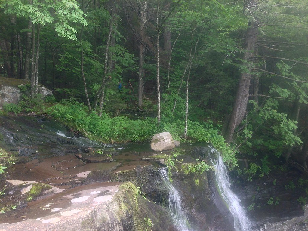
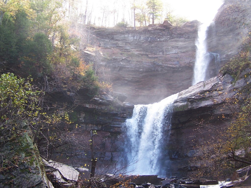
Buttermilk Falls is a long chain of nine drops totaling about 549 feet as Buttermilk Creek plunges down Buttermilk Ravine into Kaaterskill Clove in Greene County's Kaaterskill Wild Forest. The Long Path crosses the brink of the upper drop 4.8 miles from either the Harding Road trailhead in Palenville or the Steenburg Road trailhead off Platte Clove Road; the ravine below is extremely steep and unsafe to descend without technical gear.
The Setting
Buttermilk Falls sits at 2,064 feet within Kaaterskill Wild Forest, fed by the Myrtle Brook, in the hills of New York. At 549 feet, it is among the taller waterfalls in New York.
Height: 549 feet
Nearby Falls Worth Visiting
Kaaterskill Falls (260 ft) lies 1.3 miles to the northeast.
Trail & Hike Details
The Approach
The moderate 1.5-mile out-and-back trail gains 500 feet of elevation on the way to the falls.
Trail Description
The primary access is an out-and-back trail about 1.5 miles round trip with roughly 500 feet of elevation gain; difficulty is rated moderate. The route follows the cascading creek and provides multiple viewpoints of the main 165-foot drop and smaller cascades. Trail surface is a mix of natural tread, exposed bedrock and stone steps; expect some steep sections and short flights of stairs that make the grade feel steeper in places. Overall the trail is moderately challenging but well-defined, suitable for hikers comfortable on uneven, rocky terrain.
What to Expect
The falls plunge a dramatic 549 feet. Swimming is permitted. Dogs are welcome.
Accessibility
The trail is not wheelchair accessible. Uneven terrain and elevation changes require steady footing.
Frequently Asked Questions
🐶 Are Dogs Allowed at Buttermilk Falls?
✅ Dogs are allowed
Are There Any Fees or Permits Required?
🤑 Fee: $9.00
🏊 Is There Swimming at Buttermilk Falls?
✅ Swimming is allowed
When to Visit
Spring and early summer are the best times to visit when the water flow is at its peak. Fall is also a great time to enjoy the colorful foliage.
Seasonal Access
The best time to visit is Spring, Summer, and Fall. Winter access may be limited.
Safety Information
The trail can be slippery, especially after rain. Stay on marked trails and avoid climbing on rocks near the falls. Swimming is only allowed in designated areas when lifeguards are present.
Current Water Conditions
14 ft³/s
Current discharge — how much water is flowing
Much higher than usual for this time of year
Based on 9 years of record
4.68 ft
Water depth at gauge
7-Day Discharge Trend
What does this mean for your visit?
The water is flowing much higher than usual, expect an impressive display.
About This Gauge
This gauge is on a nearby waterway and may not reflect exact conditions at the falls.
7-Day Flow Outlook
Based on the USGS gauge MYRTLE BROOK AT STATE HWY 214 AT EDGEWOOD NY (14 km away).
Today
Roaring
15 cfs
6/10Tomorrow
Strong
13 cfs
10/10Thu
Strong
12 cfs
10/10Fri
Roaring
12 cfs
6/10Sat
Roaring
12 cfs
6/10Sun
Roaring
12 cfs
6/10Mon
Roaring
21 cfs
6/10Best window: Tomorrow — strong flow, mostly sunny (trip score 10/10).
Best time of year: this gauge typically runs highest from late March to mid May, peaking in April.
How we calculate this
This is a transparent outlook, not a precise forecast. We take the waterfall's current flow strength (how it ranks against its historical normal for today, from the nearest USGS stream gauge), carry that ranking forward along the gauge's seasonal curve, and nudge it for forecast rain. Confidence is highest for the next day or two and falls further out. Always check official conditions and your own judgment before visiting — high flows can be dangerous.
Know when to go.
Get a free email alert when waterfalls near Palenville hit peak flow. We only send when conditions are worth the trip — no weekly newsletters, no spam.
Weather Forecast
The Terrain, Seen by LiDAR
Aircraft-mounted lasers measured this ground to within inches. Trees and buildings are digitally stripped away, leaving the bare shape of the land the water has carved.
The ground through the falls loses about 264 feet in steep steps rather than one leap. The full 549 feet the falls are listed at is spread over a longer run than this window: along the whole mile-long profile the ground drops about 934 feet. The ground at the falls is roughly 2,154 feet above sea level.
The whole reach is steep: about 104 feet of descent in the 500 feet above the falls and another 207 feet in the 500 feet below. The falls face northeast and stay mostly shaded, with soft, even light all day.
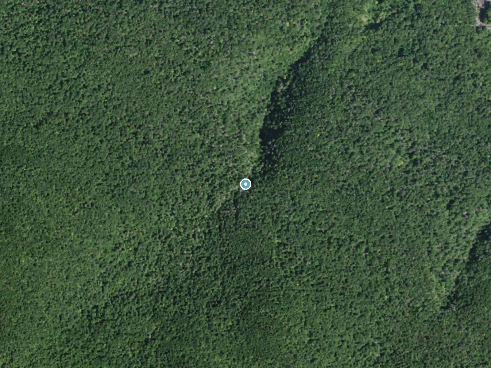
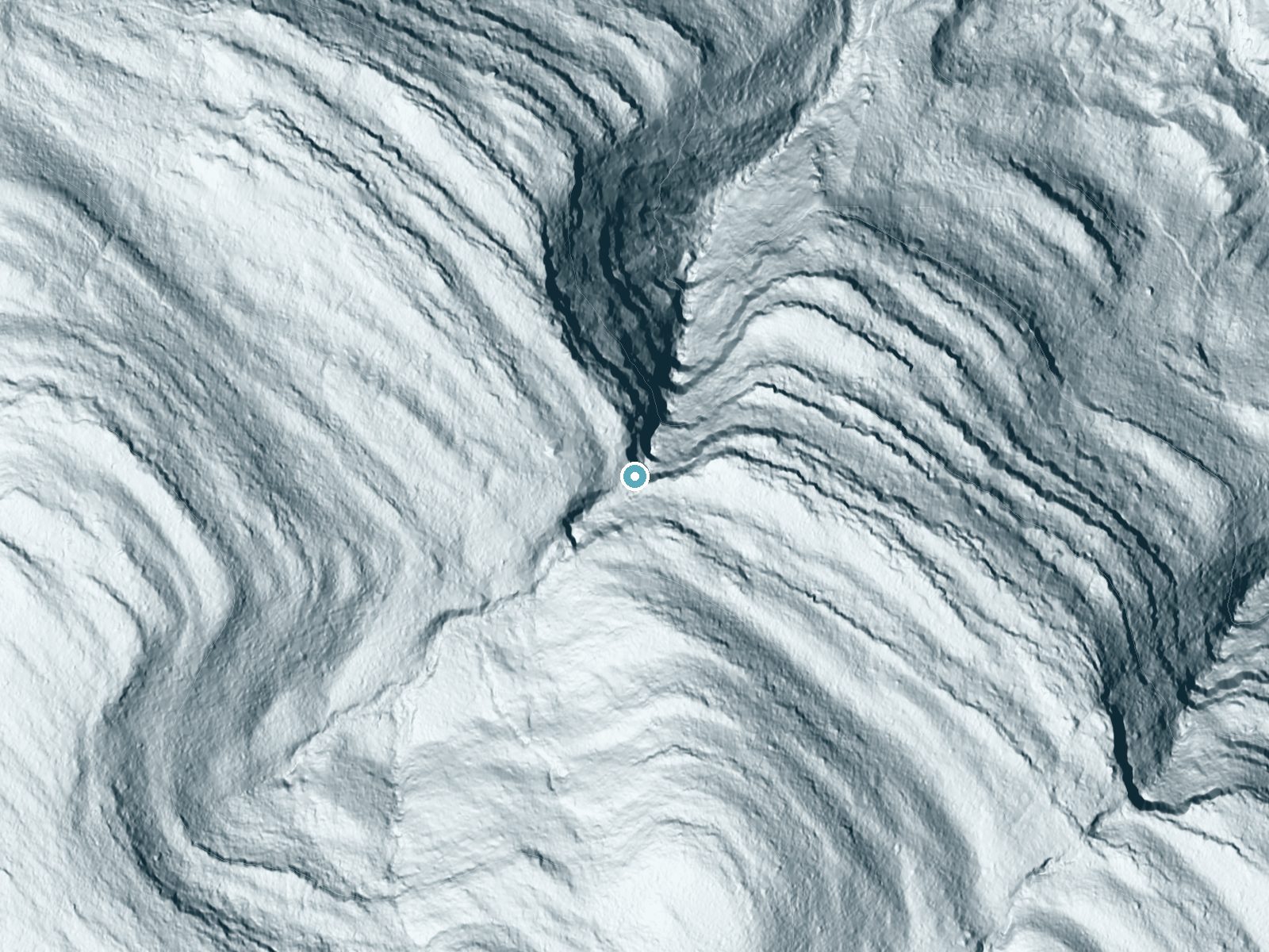
Drag to compare. The dot marks the waterfall. The frame is about a mile across.
- Ground elevation
- 2,154 feet
- Measured by 1-meter lidar
- Drop at the falls
- About 264 feet
- Change in ground height within ~250 feet of the falls
- Faces
- Northeast
- Mostly shaded, so the light stays soft and even all day.
A slice through the lidar ground surface, from above the falls to downstream (heading northeast).
Elevation data: USGS 3D Elevation Program. Aerial imagery: USGS The National Map. Public domain.
Location & Access
Getting There
Buttermilk Falls is located in Buttermilk Falls State Park, just south of Ithaca, New York. The main entrance is off Route 13, and the falls are a short walk from the parking area.
Get Directions on Google MapsParking
There is a designated parking area near the entrance of Buttermilk Falls State Park. Parking is typically available, but it can fill up during peak seasons.
Elevation
2,064 feet above sea level
Coordinates
42.175367° N, -74.071804° W
Land Management
Managed by SDC
Visitor Tips & Gear
Arrive early during peak seasons to secure parking. Wear sturdy footwear as the trail can be uneven and slippery. Bring water and a camera to capture the stunning views.
As an Amazon Associate, we earn from qualifying purchases.
With 1.5 miles and 500 ft of elevation gain, sturdy boots and trekking poles will help on this moderate trail. Sun exposure on the trail makes good sun protection a must in summer.

Polarized Sunglasses (Knockaround)
Cuts glare off the water so you actually see the falls — and your photos turn out better too.

Columbia Watertight II Rain Jacket
Packs into its own pocket, seam-sealed, and keeps you dry from spray and surprise rain.

Earth Pak Waterproof Dry Bag
Keeps your phone and gear dry when waterfall mist soaks everything else.

Waterproof Phone Pouch (AiRunTech)
Cheap insurance — take photos right next to the falls without killing your phone.

Timberland Euro Sprint Mid Waterproof
Trusted waterproof boot with premium leather and grippy rubber sole — reliable on rocky, wet trails.

TrailBuddy Trekking Poles
Lightweight aluminum, cork grips, and flip-locks that actually hold — a best-seller for good reason.
Where to Stay

The Willow, Catskill

The Innwoods - One Bedroom Apartment
Matterhorns Hunter Lodge

Ski In Ski Out Cabin on Hunter Mtn Seasonal Pool Access w Panoramic Views Hike Swim Fish Relax
Browse vacation cabins and private rentals nearby
Unique outdoor stays — tents, yurts, and treehouses
Rent a campervan or RV for your waterfall road trip
Some links are affiliate links. We may earn a commission at no extra cost to you.
Nearby Hot Springs
Hot springs near Kingston, New York

Lebanon Spring
Lebanon Spring discharges at 72°F at 663 feet elevation in Columbia County, flowing 24 degrees above ambient air temperature ju...
Sand Spring
Sand Spring surfaces at 75°F in Williamstown, Massachusetts — one of the few thermal features in New England. At just 670 feet ...
Looking for a soak after your hike? Explore more hot springs near Kingston, New York on SoakingSprings.
Explore New York springsAdditional Information
Nearby Attractions
Other nearby attractions include Taughannock Falls State Park, Robert H. Treman State Park, and the town of Ithaca with its shops and restaurants.
Wildlife
The area is home to various birds, deer, and small mammals. Visitors may also see fish in the creek.
Cities near Buttermilk Falls
Nearby Waterfalls
Other waterfalls named Buttermilk Falls
22 other waterfalls share this name across the U.S.
-
01
Apalachin
50 ftCurrent flow 76 ft³/s -
02
Claverack-Red Mills
45 ftCurrent flow 156 ft³/s -
03
Cohoes
15 ft -
04
East Worcester
104 ftCurrent flow 13 ft³/s -
05
Fultonville
30 ftCurrent flow 1,590 ft³/s -
06
Gloversville
77 ftCurrent flow 1,590 ft³/s -
07
Greenwood Lake
40 ftCurrent flow 123 ft³/s -
08
Highland Falls
100 ftCurrent flow 44 ft³/s -
09
Hudson Falls
60 ftCurrent flow 39 ft³/s -
10
Keeseville
128 ftCurrent flow 51 ft³/s -
11
Linwood
70 ftCurrent flow 22 ft³/s -
12
Speculator
25 ft -
13
Wampsville
30 ftCurrent flow 17 ft³/s
Writing about Buttermilk Falls? Embed this waterfall on your site for free.