Buttermilk Falls
New York • 165 ft
By Armen Suny · Last verified Mar 2026
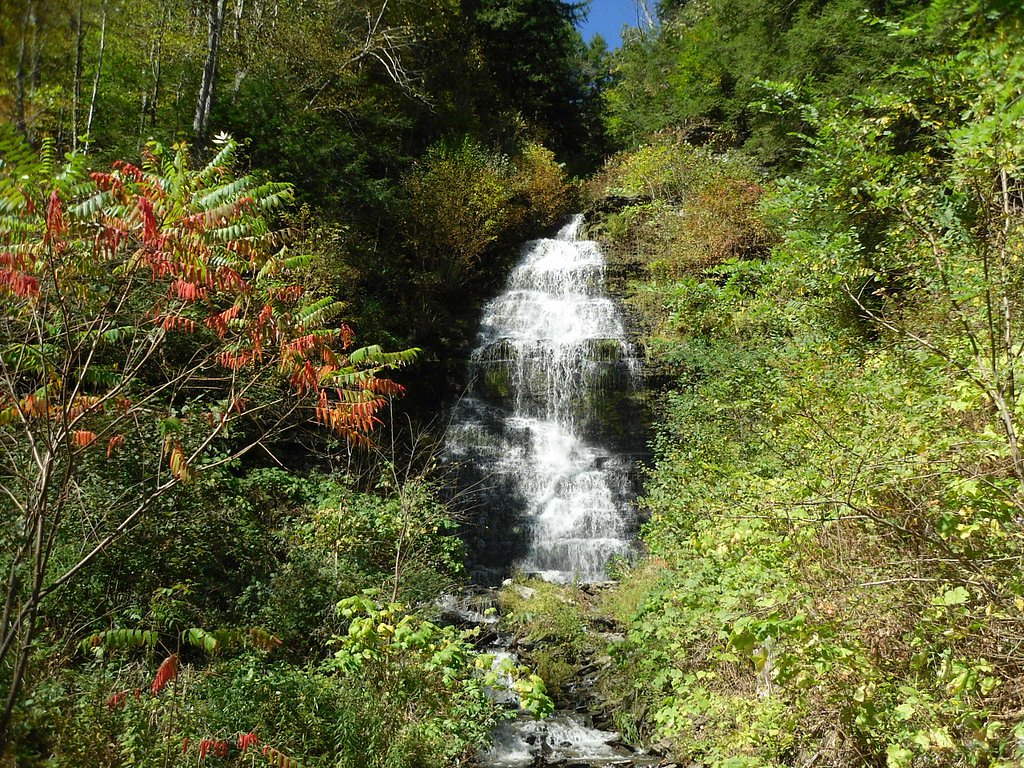
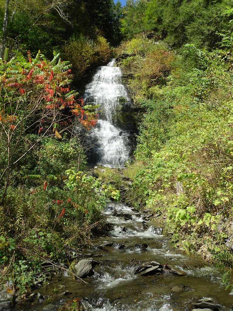
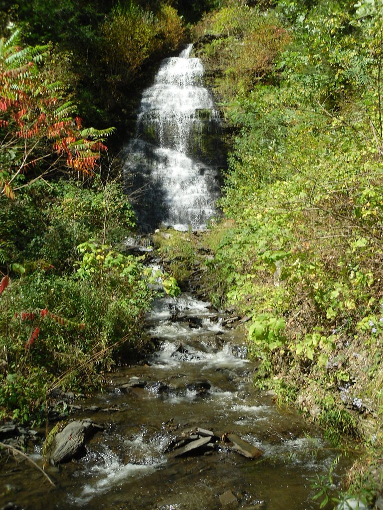
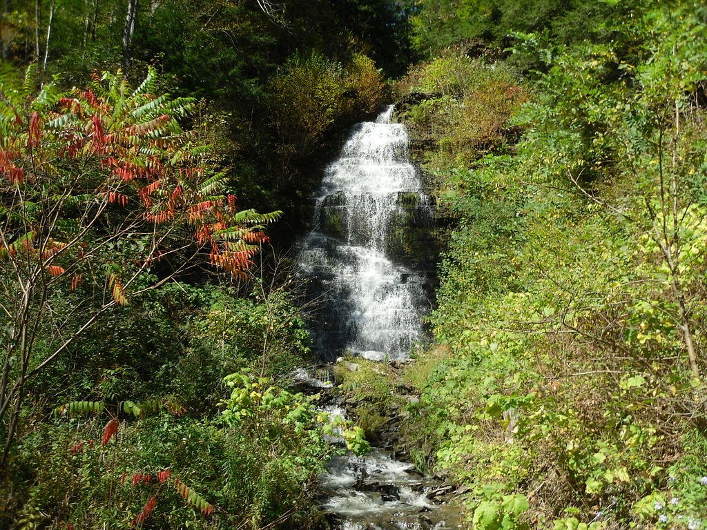

Photo Credits (5)
Difficulty
Moderate
Trail Length
1.5 miles
Trail Type
Out And Back
Elevation Gain
500 ft
About Buttermilk Falls
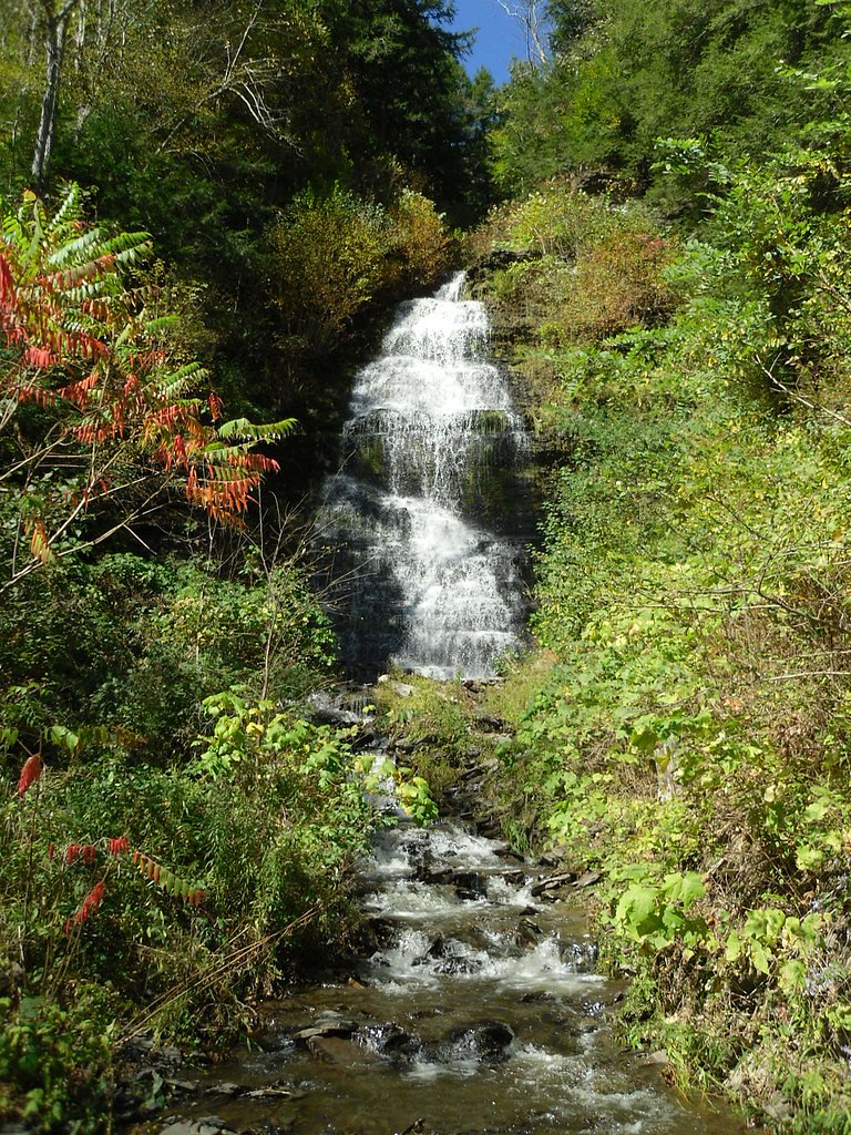
Buttermilk Falls plunges a dramatic 165 feet through a series of rocky steps and pools, creating one of the most photographed cascades in the Ithaca area. The falls are especially striking after heavy rain or spring snowmelt, when the gorge fills and the layered bedrock channels water into thundering tiers. Note that “Buttermilk Falls” is a common name for waterfalls across the U.S.; this particular ribbon of water sits just outside Ithaca and is known for its steep, sculpted rock formations. The falls lie within Buttermilk Falls State Park, making them an easy day destination for hikers and families. The popular Gorge Trail traces the cascading creek upstream, passing multiple smaller cascades and offering a series of close-up viewing spots. With a mix of stone steps and natural tread, the setting feels intimate and wild while remaining accessible for most moderately fit visitors.
The Setting
Buttermilk Falls sits at 20 feet along the Mohawk River, in the coastal lowlands of New York. At 165 feet, it is among the taller waterfalls in New York.
Height: 165 feet
Trail & Hike Details
The Approach
The moderate 1.5-mile out-and-back trail gains 500 feet of elevation on the way to the falls.
Trail Description
Gorge Trail (the primary route to the falls) is an out-and-back route of about 1.5 miles round trip with roughly 500 feet of elevation gain and a moderate difficulty rating. The path follows the stream upstream, switching between natural dirt tread and built stone steps; several short, steep stretches require careful footing. Expect close-up viewpoints of the main 165-foot fall and additional smaller cascades along the route — a compact, scenic hike that rewards steady climbers.
What to Expect
The falls plunge 165 feet. Swimming is permitted. Dogs are welcome.
Accessibility
The trail is not wheelchair accessible. Uneven terrain and elevation changes require steady footing.
Frequently Asked Questions
🐶 Are Dogs Allowed at Buttermilk Falls?
✅ Dogs are allowed
Are There Any Fees or Permits Required?
🤑 Fee: $9.00
🏊 Is There Swimming at Buttermilk Falls?
✅ Swimming is allowed
When to Visit
Spring and early summer are ideal for visiting, as the waterfall flow is strongest due to snowmelt and rainfall. Fall is also popular for its colorful foliage.
Seasonal Access
The best time to visit is Spring, Summer, and Fall. Winter access may be limited.
Safety Information
The trail can be slippery, especially after rain. Stay on marked trails and avoid climbing on rocks near the falls. Swimming is only permitted in designated areas during lifeguard hours.
Current Water Conditions
1,750 ft³/s
Current discharge — how much water is flowing
About average for this time of year
Based on 100 years of record
8.72 ft
Water depth at gauge
77°F
ComfortablePleasant for swimming
7-Day Discharge Trend
What does this mean for your visit?
Flow is about average for this time of year. The water is a comfortable 77 degrees F, pleasant for swimming. Mineral content is typical.
Water Quality
Conductance
Dissolved minerals in the water
About This Gauge
7-Day Flow Outlook
Based on the USGS gauge MOHAWK RIVER AT COHOES NY (2 km away).
Today
Moderate
1995 cfs
4/10Tomorrow
Moderate
2096 cfs
6/10Thu
Moderate
1892 cfs
8/10Fri
Moderate
1688 cfs
8/10Sat
Moderate
1710 cfs
4/10Sun
Moderate
1988 cfs
6/10Mon
Moderate
1869 cfs
5/10Best window: Thu — moderate flow, sunny (trip score 8/10).
Best time of year: this gauge typically runs highest from early March to mid May, peaking in April.
How we calculate this
This is a transparent outlook, not a precise forecast. We take the waterfall's current flow strength (how it ranks against its historical normal for today, from the nearest USGS stream gauge), carry that ranking forward along the gauge's seasonal curve, and nudge it for forecast rain. Confidence is highest for the next day or two and falls further out. Always check official conditions and your own judgment before visiting — high flows can be dangerous.
Know when to go.
Get a free email alert when waterfalls near Cohoes hit peak flow. We only send when conditions are worth the trip — no weekly newsletters, no spam.
Weather Forecast
Location & Access
Getting There
Buttermilk Falls is located within Buttermilk Falls State Park, approximately 2 miles south of downtown Ithaca, New York. The park entrance is off Route 13, and the falls are easily accessible from the main parking area.
Get Directions on Google MapsParking
There is a designated parking area near the base of the falls within Buttermilk Falls State Park. Parking fees may apply during peak seasons.
Elevation
20 feet above sea level
Coordinates
42.775833° N, -73.687778° W
Visitor Tips & Gear
Arrive early during peak seasons to secure parking. Wear sturdy shoes with good grip, as the trail can be uneven and slippery. Bring water and a camera to capture the stunning scenery.
As an Amazon Associate, we earn from qualifying purchases.
With 1.5 miles and 500 ft of elevation gain, sturdy boots and trekking poles will help on this moderate trail. Sun exposure on the trail makes good sun protection a must in summer.

Polarized Sunglasses (Knockaround)
Cuts glare off the water so you actually see the falls — and your photos turn out better too.

Columbia Watertight II Rain Jacket
Packs into its own pocket, seam-sealed, and keeps you dry from spray and surprise rain.

Earth Pak Waterproof Dry Bag
Keeps your phone and gear dry when waterfall mist soaks everything else.

Waterproof Phone Pouch (AiRunTech)
Cheap insurance — take photos right next to the falls without killing your phone.

Timberland Euro Sprint Mid Waterproof
Trusted waterproof boot with premium leather and grippy rubber sole — reliable on rocky, wet trails.

TrailBuddy Trekking Poles
Lightweight aluminum, cork grips, and flip-locks that actually hold — a best-seller for good reason.
Where to Stay

The Clocktower Hotel Latham - North Albany, an Ascend Collection Hotel

The Century House Latham - North Albany, an Ascend Collection Hotel

Holiday Inn Express & Suites Albany Airport Area - Latham by IHG

Tru By Hilton Albany Airport, Ny
Browse vacation cabins and private rentals nearby
Unique outdoor stays — tents, yurts, and treehouses
Rent a campervan or RV for your waterfall road trip
Some links are affiliate links. We may earn a commission at no extra cost to you.
Nearby Hot Springs
Hot springs near Cohoes, New York
Sand Spring
Sand Spring surfaces at 75°F in Williamstown, Massachusetts — one of the few thermal features in New England. At just 670 feet ...

Lebanon Spring
Lebanon Spring discharges at 72°F at 663 feet elevation in Columbia County, flowing 24 degrees above ambient air temperature ju...
Looking for a soak after your hike? Explore more hot springs near Cohoes, New York on SoakingSprings.
Explore New York springsAdditional Information
Nearby Attractions
Other nearby attractions include Taughannock Falls State Park, Robert H. Treman State Park, and the Finger Lakes Wine Trail.
Wildlife
The park is home to various wildlife, including birds, deer, and small mammals. Visitors may also see fish in the creek.
Cities near Buttermilk Falls
Nearby Waterfalls

Other waterfalls named Buttermilk Falls
22 other waterfalls share this name across the U.S.
-
01
Apalachin
165 ft -
02
Claverack-Red Mills
165 ftCurrent flow 128 ft³/s -
03
East Worcester
165 ftCurrent flow 25 ft³/s -
04
Fultonville
165 ftCurrent flow 2,230 ft³/s -
05
Gloversville
165 ftCurrent flow 2,230 ft³/s -
06
Greenwood Lake
165 ftCurrent flow 50 ft³/s -
07
Highland Falls
Current flow 2 ft³/s -
08
Hudson Falls
165 ftCurrent flow 42 ft³/s -
09
Keeseville
165 ftCurrent flow 201 ft³/s -
10
Linwood
165 ftCurrent flow 92 ft³/s -
11
Palenville
165 ftCurrent flow 0 ft³/s -
12
Speculator
165 ftCurrent flow 260 ft³/s -
13
Wampsville
165 ftCurrent flow 44 ft³/s
Writing about Buttermilk Falls? Embed this waterfall on your site for free.