Photo Credits (5)
Difficulty
Moderate
Trail Length
2.4 miles
Trail Type
Out And Back
Elevation Gain
350 ft
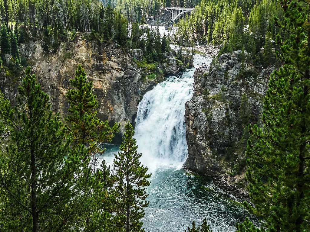
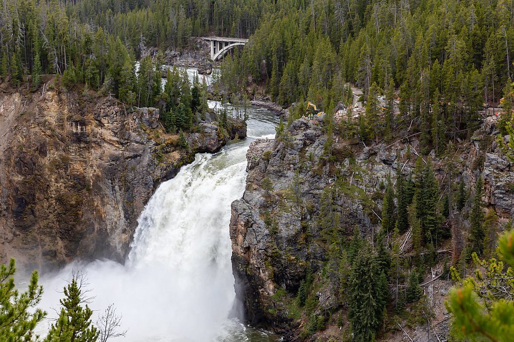
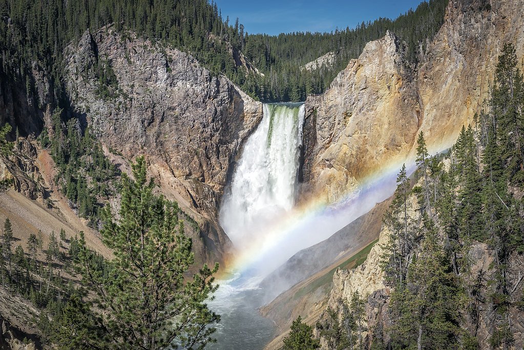
About Upper Falls
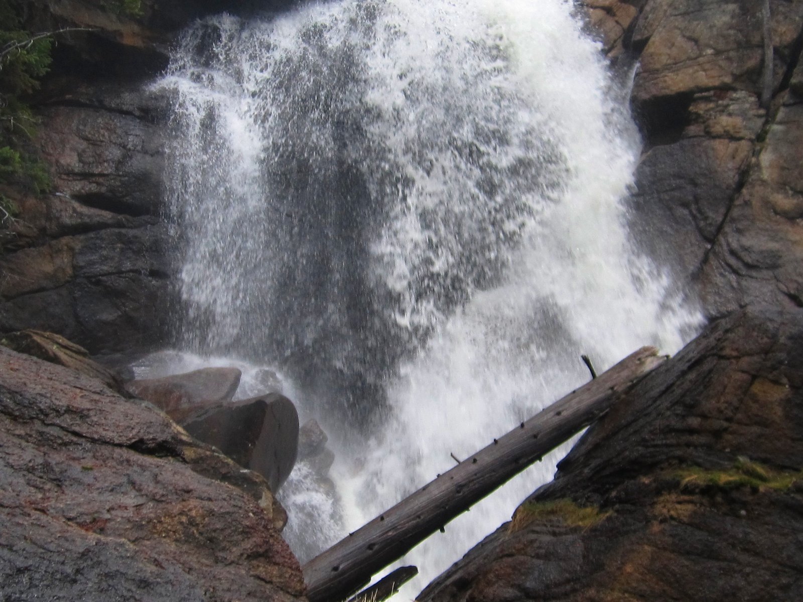
Upper Falls is a 109-foot waterfall located within Teton National Forest in Wyoming and managed by the U.S. Forest Service. The fall’s significant vertical drop makes it a standout feature in this forested landscape, a rewarding destination for hikers who prefer less-developed, scenic cascades. Access to Upper Falls is provided by the U.S. Forest Service’s Big Cow Creek Trail (Trail #4083). The common outing is an approximately 2.4-mile out-and-back with about 350 feet of elevation gain and a moderate difficulty rating; the Forest Service’s GIS records Trail #4083 at 0.77 miles. Visitors should plan for a native-material tread and some Class 3 sections as they approach viewpoints of the falls.
The Setting
Upper Falls sits at 8,753 feet within Teton National Forest, in the high alpine of Wyoming. At 109 feet, it is among the taller waterfalls in Wyoming.
Height: 109 feet
Trail & Hike Details
The Approach
The moderate hike follows Big Cow Creek (#4083), a 2.4-mile out-and-back trail over natural surface. Expect 350 feet of elevation gain. The trail is developed (Class 3).
USFS Trail
BIG COW CREEK #4083
Trail Class
Developed
Surface
USFS Segment
0.77 miTrail Description
Big Cow Creek Trail (USFS Trail #4083) is the route to Upper Falls. The full outing is typically a 2.4-mile out-and-back with ~350 ft of elevation gain and a moderate difficulty rating. According to USFS data the trail segment is recorded as 0.77 GIS miles, the tread is native material, and portions of the approach include Class 3 terrain. Expect uneven, natural surface underfoot and short steeper or rockier sections where careful footing is required.
What to Expect
The falls cascade 109 feet.
Accessibility
The trail is not wheelchair accessible. Uneven terrain and elevation changes require steady footing.
Frequently Asked Questions
🐶 Are Dogs Allowed at Upper Falls?
❌ Dogs are not allowed
Are There Any Fees or Permits Required?
🤑 Fee: $35.00
🏊 Is There Swimming at Upper Falls?
❌ Swimming is not allowed
When to Visit
The best time to visit is during the spring and early summer when the water flow is at its peak due to snowmelt. Fall also offers beautiful foliage, while winter provides a serene, snowy landscape.
Seasonal Access
The best time to visit is Spring, Summer, and Fall. Access roads and trails may close during winter due to snow. Check with Teton National Forest for seasonal road closures.
Safety Information
Stay on designated trails and viewing platforms. The area around the falls can be slippery, especially after rain or snow. Keep a safe distance from the edge of the canyon.
Know when to go.
Get a free email alert when waterfalls near Bondurant hit peak flow. We only send when conditions are worth the trip — no weekly newsletters, no spam.
Weather Forecast
Location & Access
Getting There
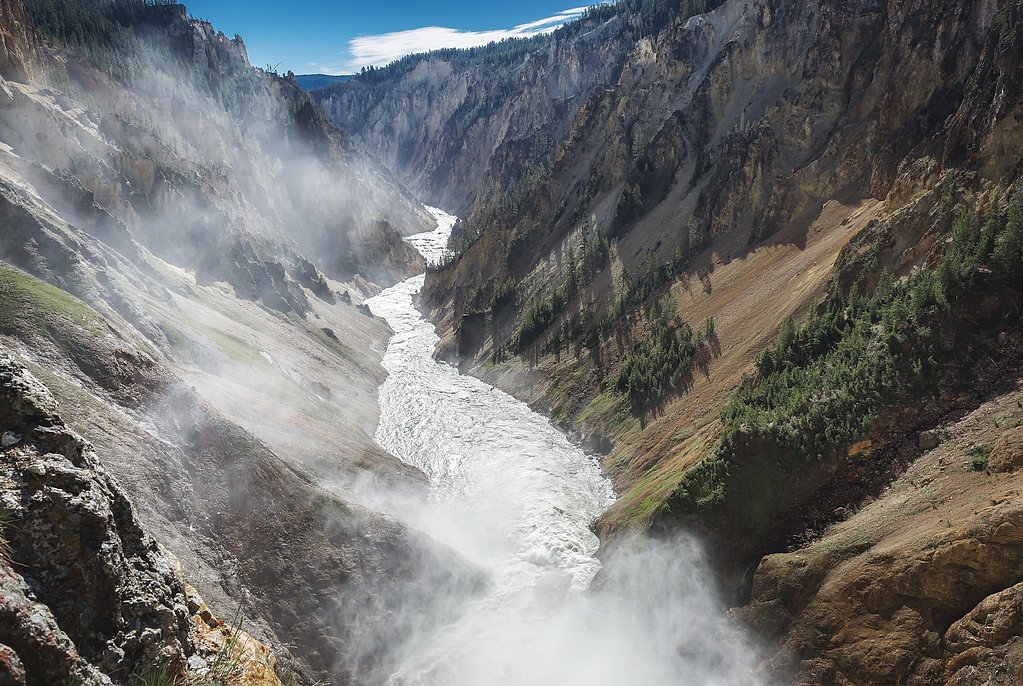
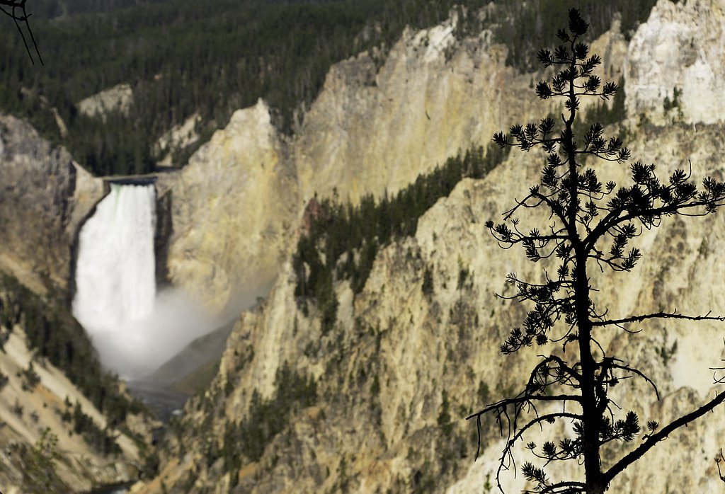
Upper Falls is located in the Canyon area of Yellowstone National Park. It can be accessed via the South Rim Drive or North Rim Drive, with several viewpoints available nearby.
Get Directions on Google MapsParking
Parking is available at designated lots near the South Rim Drive and North Rim Drive. These lots can fill up quickly during peak seasons.
Elevation
8,753 feet above sea level
Coordinates
43.423830° N, -110.253794° W
Land Management
Managed by USFS
Visitor Tips & Gear
Arrive early in the day to avoid crowds, especially during the summer months. Wear sturdy shoes for walking on uneven surfaces, and bring a camera to capture the views.
This trail sits at 8,753 ft — the air is noticeably thinner
High AltitudeSome visitors experience headaches, fatigue, or shortness of breath at this elevation. Take it slow, stay hydrated, and consider supplemental oxygen if you're coming from a lower altitude.
As an Amazon Associate, we earn from qualifying purchases.

Coppertone Sport SPF 50 Sunscreen
UV intensity jumps ~4% per 1,000 ft — at this elevation you can burn in half the time.

Sun Bum SPF 30 Lip Balm (3-Pack)
Lips have almost no natural UV protection and burn fast in thin, dry mountain air.

Liquid I.V. Electrolyte Packets
You lose moisture ~2x faster at elevation — electrolytes help you absorb water efficiently.

ROCKNIGHT Polarized UV400 Sunglasses
High-altitude glare off rock and water is intense — UV400 lenses block 99%+ of UVA/UVB.

Boost Oxygen 10L Canister (2-Pack)
Portable supplemental oxygen for quick relief from headaches and shortness of breath.

Altitude Rx OxyBoost Complex
Antioxidant formula designed to support your body's natural altitude acclimation.
As an Amazon Associate, we earn from qualifying purchases.
With 2.4 miles and 350 ft of elevation gain, sturdy boots and trekking poles will help on this moderate trail. Sun exposure on the trail makes good sun protection a must in summer.

Polarized Sunglasses (Knockaround)
Cuts glare off the water so you actually see the falls — and your photos turn out better too.

Columbia Watertight II Rain Jacket
Packs into its own pocket, seam-sealed, and keeps you dry from spray and surprise rain.

Earth Pak Waterproof Dry Bag
Keeps your phone and gear dry when waterfall mist soaks everything else.

Waterproof Phone Pouch (AiRunTech)
Cheap insurance — take photos right next to the falls without killing your phone.

Timberland Euro Sprint Mid Waterproof
Trusted waterproof boot with premium leather and grippy rubber sole — reliable on rocky, wet trails.

TrailBuddy Trekking Poles
Lightweight aluminum, cork grips, and flip-locks that actually hold — a best-seller for good reason.
Where to Stay

Crooked Creek Guest Ranch

Studio Cabin with Mtn Views by the Green River!

Cozy Cora Studio Cabin w/ Wind River Mtn Views

Abode at Grand Teton Vista
Browse vacation cabins and private rentals nearby
Unique outdoor stays — tents, yurts, and treehouses
Rent a campervan or RV for your waterfall road trip
Some links are affiliate links. We may earn a commission at no extra cost to you.
Nearby Campground
Whiskey Grove Campground
16.7 miles away · 10 sites
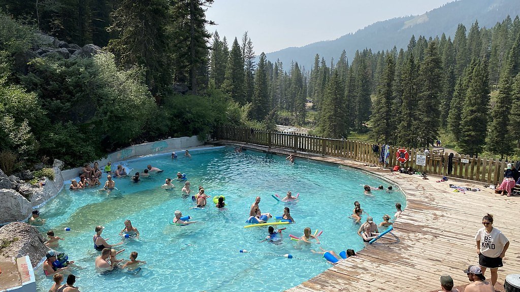
Nearby Hot Springs
Hot springs near Bondurant, Wyoming

Granite Hot Spring
This spring produces 106-degree Fahrenheit water at 7,035 feet elevation on Forest Service land, emerging 750 feet from the roa...
Granite Falls Hot Springs
This Forest Service-maintained spring produces 112-degree Fahrenheit water at 6,882 feet elevation, accessible via 625-foot wal...
Kendall Warm Spring
Kendall Warm Spring emerges at 86 degrees with pH 7.8 and high sulfate content (650 mg/L) at 7,820 feet in Bridger National For...

Kelly Warm Spring
Kelly Warm Spring flows at 81 degrees Fahrenheit just 108 meters from Gros Ventre Road at 6,684 feet elevation in Grand Teton N...

North Buffalo Fork Springs
North Buffalo Fork Springs flows at 113 degrees Fahrenheit—76 degrees above the frigid 36-degree ambient—at 7,420 feet elevatio...

Abercrombie Warm Springs
Abercrombie Warm Springs flows at 81°F within Grand Teton National Park, requiring a 104-meter walk from Warm Springs Road. The...
Looking for a soak after your hike? Explore more hot springs near Bondurant, Wyoming on SoakingSprings.
Explore Wyoming springsAdditional Information
Nearby Attractions
Lower Falls, Artist Point, Grand Canyon of the Yellowstone, Uncle Tom's Trail
Wildlife
Visitors may see bison, elk, and various bird species in the area. Always maintain a safe distance from wildlife.
Cities near Upper Falls
Nearby Waterfalls
Other waterfalls named Upper Falls
27 other waterfalls share this name across the U.S.
Writing about Upper Falls? Embed this waterfall on your site for free.