
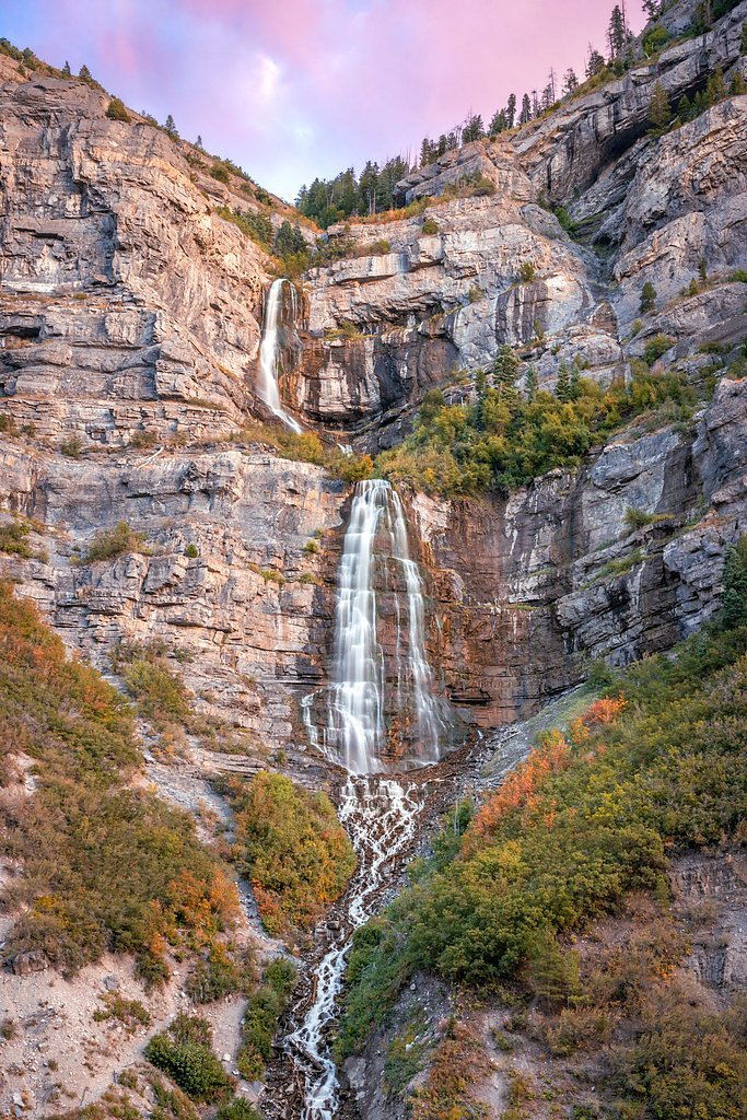
Upper Falls
By Armen Suny · Last verified May 2026
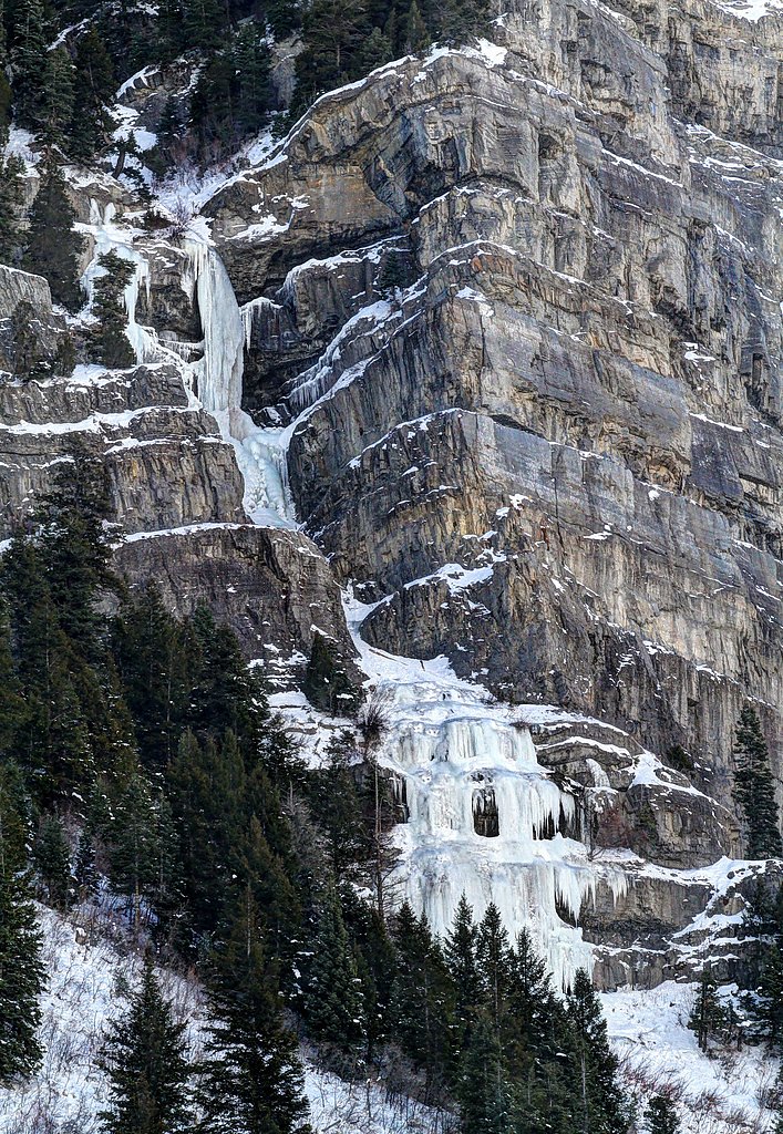
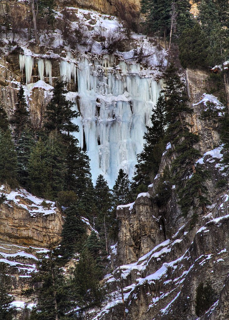
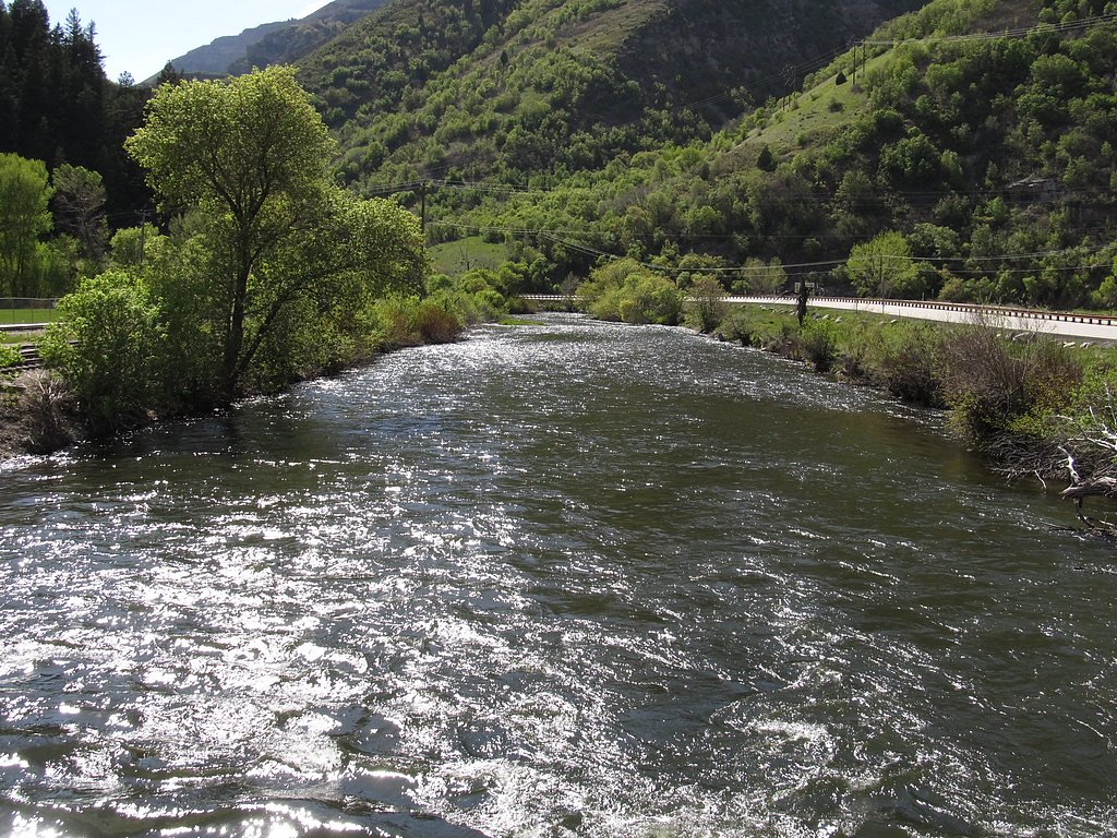
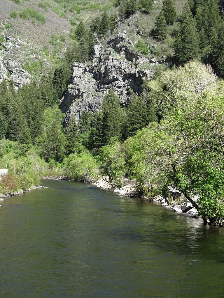
Photo Credits (5)
Difficulty
Moderate
Trail Length
2.4 miles
Trail Type
Out And Back
Elevation Gain
350 ft
About Upper Falls
Upper Falls tumbles through Provo Canyon along the Provo River, offering a compact but rewarding taste of canyon scenery not far from the valley. Surrounded by the lush vegetation of the canyon walls, the falls are a favorite short outing for locals and visitors seeking a scenic payoff without a long backcountry commitment. The setting is peaceful and photogenic, with easy access to the sound and spray of falling water. The approach to Upper Falls follows a 2.4-mile out-and-back route with roughly 350 feet of elevation gain, rated moderate—a manageable hike for anyone with a bit of conditioning. If you’re making a night of it, Theater in the Pines campground sits about 6.74 km away, putting a convenient overnight option within easy reach of this classic Provo Canyon stop.
Nearby Falls Worth Visiting
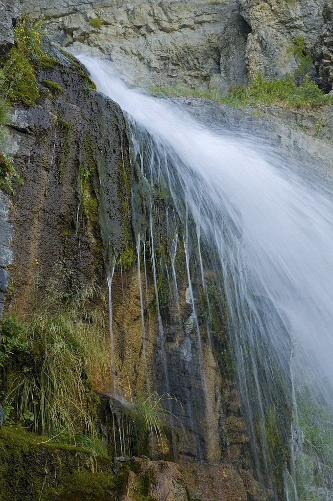
Bridal Veil Falls, the tallest waterfall in Utah at 607 feet, lies 0.7 miles to the southwest. Also nearby: Stewarts Cascades (200 ft, 3.0 mi).
Trail & Hike Details
The Approach
The moderate 2.4-mile out and back trail gains 350 feet of elevation on the way to the falls.
Trail Description
This is a 2.4-mile out-and-back hike along a well-maintained corridor that follows the Provo River to Upper Falls. Expect approximately 350 feet of cumulative elevation gain; the route is rated moderate due to the steady but short climb approaching the falls rather than technical challenges. The path is suitable for most hikers and provides steady river and canyon views; no USFS trail number or specific surface/grade/class data was provided in the source information. Nearby Theater in the Pines campground (≈6.74 km away) offers a camping option for multi-day visitors.
What to Expect
Dogs are welcome.
Accessibility
The trail is not wheelchair accessible. Uneven terrain and elevation changes require steady footing.
Frequently Asked Questions
🐶 Are Dogs Allowed at Upper Falls?
✅ Dogs are allowed
Are There Any Fees or Permits Required?
🆖 No fees required
🏊 Is There Swimming at Upper Falls?
❌ Swimming is not allowed
When to Visit
Spring and early summer are the best times to visit, as the waterfall is typically at its fullest due to snowmelt.
Seasonal Access
The best time to visit is Spring, Summer, and Fall. Access roads and trails may close during winter due to snow. Watch for flash flood warnings during monsoon season (July through September).
Safety Information
Exercise caution near the waterfall, as rocks may be slippery. Be aware of swift river currents and avoid venturing too close to the water. Check weather conditions before visiting, as the trail may be icy or muddy during winter and early spring.
Current Water Conditions
23 ft³/s
Current discharge — how much water is flowing
Much lower than usual for this time of year
Based on 94 years of record
6.28 ft
Water depth at gauge
7-Day Discharge Trend
What does this mean for your visit?
Flow is well below normal for this time of year, so the waterfall may be a trickle.
About This Gauge
This gauge is on a nearby waterway and may not reflect exact conditions at the falls.
7-Day Flow Outlook
Based on the USGS gauge AMERICAN FK AB UPPER POWERPLANT NR AMERICAN FK, UT (14 km away).
Today
Barely Flowing
22 cfs
5/10Tomorrow
Barely Flowing
21 cfs
5/10Fri
Barely Flowing
20 cfs
5/10Sat
Barely Flowing
20 cfs
5/10Sun
Barely Flowing
20 cfs
5/10Mon
Barely Flowing
19 cfs
5/10Tue
Barely Flowing
18 cfs
5/10Best window: Today — barely flowing flow, sunny (trip score 5/10).
Best time of year: this gauge typically runs highest from late April to late July, peaking in June.
How we calculate this
This is a transparent outlook, not a precise forecast. We take the waterfall's current flow strength (how it ranks against its historical normal for today, from the nearest USGS stream gauge), carry that ranking forward along the gauge's seasonal curve, and nudge it for forecast rain. Confidence is highest for the next day or two and falls further out. Always check official conditions and your own judgment before visiting — high flows can be dangerous.
Know when to go.
Get a free email alert when waterfalls near Sundance hit peak flow. We only send when conditions are worth the trip — no weekly newsletters, no spam.
Weather Forecast
Location & Access
Getting There
Upper Falls is located in Provo Canyon, Utah, along the Provo River. It can be accessed via the Provo River Parkway Trail or by parking near the Bridal Veil Falls area and hiking upstream.
Get Directions on Google MapsParking
Parking is available near Bridal Veil Falls, which is a short distance from Upper Falls. Additional parking may be found along the Provo River Parkway Trail.
Hours
Elevation
5,627 feet above sea level
Coordinates
40.343971° N, -111.590647° W
Visitor Tips & Gear
Visit early in the morning or on weekdays to avoid crowds. Wear sturdy shoes, as the trail may be slippery near the waterfall. Bring water and a camera to capture the scenic views.
This trail sits at 5,627 ft above sea level
Elevated TrailUV radiation is roughly 23% stronger at this elevation than at sea level, and the dry air accelerates dehydration. Extra sun protection and fluids go a long way.
As an Amazon Associate, we earn from qualifying purchases.

Coppertone Sport SPF 50 Sunscreen
UV intensity jumps ~4% per 1,000 ft — at this elevation you can burn in half the time.

Sun Bum SPF 30 Lip Balm (3-Pack)
Lips have almost no natural UV protection and burn fast in thin, dry mountain air.

Liquid I.V. Electrolyte Packets
You lose moisture ~2x faster at elevation — electrolytes help you absorb water efficiently.

ROCKNIGHT Polarized UV400 Sunglasses
High-altitude glare off rock and water is intense — UV400 lenses block 99%+ of UVA/UVB.
As an Amazon Associate, we earn from qualifying purchases.
With 2.4 miles and 350 ft of elevation gain, sturdy boots and trekking poles will help on this moderate trail. Sun exposure on the trail makes good sun protection a must in summer.

Polarized Sunglasses (Knockaround)
Cuts glare off the water so you actually see the falls — and your photos turn out better too.

Columbia Watertight II Rain Jacket
Packs into its own pocket, seam-sealed, and keeps you dry from spray and surprise rain.

Earth Pak Waterproof Dry Bag
Keeps your phone and gear dry when waterfall mist soaks everything else.

Waterproof Phone Pouch (AiRunTech)
Cheap insurance — take photos right next to the falls without killing your phone.

Timberland Euro Sprint Mid Waterproof
Trusted waterproof boot with premium leather and grippy rubber sole — reliable on rocky, wet trails.

TrailBuddy Trekking Poles
Lightweight aluminum, cork grips, and flip-locks that actually hold — a best-seller for good reason.
Where to Stay

La Quinta by Wyndham Orem University Pwy Provo

Residence Inn by Marriott Provo

Best Western Plus Provo University Inn

SpringHill Suites by Marriott Provo
Browse vacation cabins and private rentals nearby
Unique outdoor stays — tents, yurts, and treehouses
Rent a campervan or RV for your waterfall road trip
Some links are affiliate links. We may earn a commission at no extra cost to you.
Nearby Campground
THEATER IN THE PINES
4.2 miles away · 2 sites
Overview Theater in the Pines is a large group campsite located along the beautiful Alpine Loop Scenic Byway in the Wasatch Mountains. The Mount Timpanogos Wilderness Area is adjacent. Visitors enjoy hiking the Aspen Grove Trail to the summit of Mount Timpanogos.Recreation Hiking is very popular in the area. Several trails begin nearby, including the 14-mile round-trip Aspen Grove Trail, which begins next to the campground and climbs to the summit of rugged Mount Timpanogos. The 2-mile Stewart Fa
Book on Recreation.govNearby Hot Springs
Hot springs near Sundance, Utah
Wood Springs
Flowing at 73 degrees Fahrenheit in Utah County near Springville, Wood Springs emerges 22 degrees above ambient at 4,540 feet e...
Midway Hot Springs
Midway Hot Springs at the Homestead Crater flows at 100°F inside a beehive-shaped limestone dome created by millennia of minera...
Fault Zone Spring
Fault Zone Spring emerges at 90°F from state-owned lands on Utah Lake's shore, flowing 710 meters from South Centennial Bouleva...

Crater Hot Spring
Crater Hot Spring emerges at 111°F near Saratoga Springs on Utah Lake state lands, delivering highly mineralized water with sub...

Midway Hot Spring
Midway Hot Spring flows at 115°F in Wasatch County's Heber Valley, running 67.4°F above ambient temperatures at 5,650 feet elev...

Saratoga Hot Springs
Saratoga Hot Springs emerges at 111°F along Utah Lake's northern shore, producing highly mineralized water with 1,490 mg/L tota...
Looking for a soak after your hike? Explore more hot springs near Sundance, Utah on SoakingSprings.
Explore Utah springsAdditional Information
Nearby Attractions
Bridal Veil Falls, Provo River Parkway Trail, Sundance Mountain Resort
Wildlife
Visitors may encounter birds, squirrels, and other small wildlife along the trail.
Cities near Upper Falls
Nearby Waterfalls
Other waterfalls named Upper Falls
27 other waterfalls share this name across the U.S.
Writing about Upper Falls? Embed this waterfall on your site for free.