Photo Credits (5)
Difficulty
Easy
Trail Length
0.5 miles
Trail Type
Out And Back
Elevation Gain
100 ft
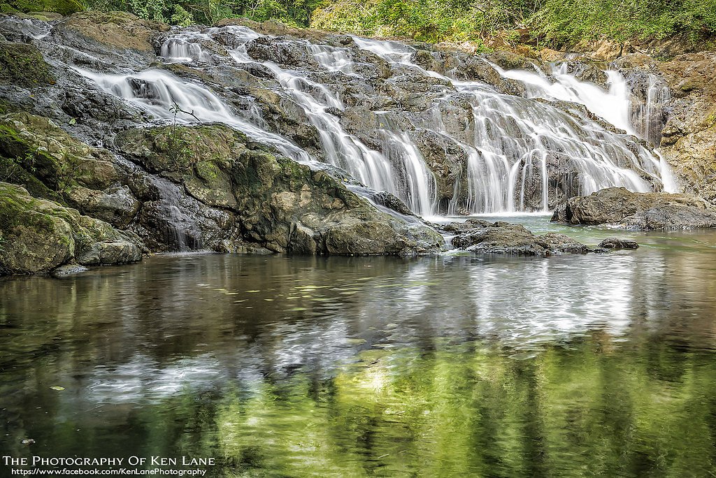
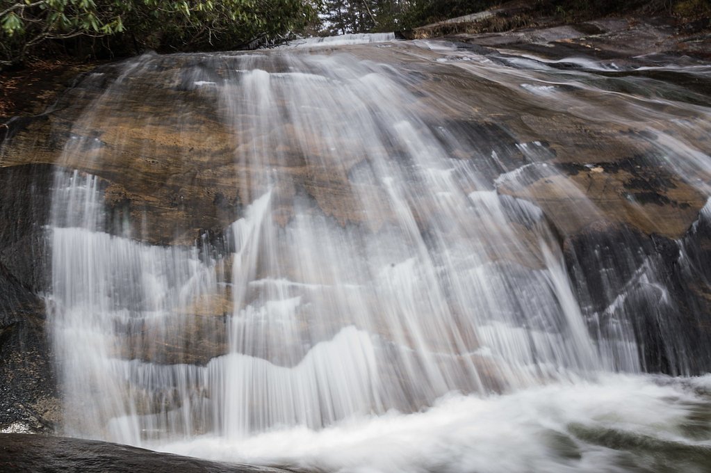
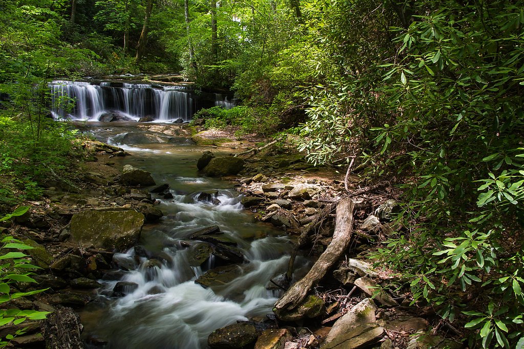
About Upper Falls
Upper Falls is a quietly scenic cascade tucked inside the Nantahala National Forest and managed by the U.S. Forest Service. The falls are an easy-access reward for hikers looking for a brief nature break — the setting is intimate and forested, making it a great spot for photography, picnics, or a short adventure away from busier trailheads. The site is listed on USFS maps and reached via an official trail spur, so you’ll be following a maintained route rather than bushwhacking. Access to the falls follows the USFS-designated MIDDLE FALLS ALT. (Trail #TR64B), a short, well-marked out-and-back that keeps the outing compact. If you’re planning to camp, Swan Cabin campground lies nearby (about 9.92 km away), making overnight stays or a multi-stop trip into Nantahala National Forest convenient for those who want more time to explore the area.
The Setting
Upper Falls sits at 3,652 feet within Nantahala National Forest, fed by the Valley River, in the mountains of North Carolina.
Trail & Hike Details
The Approach
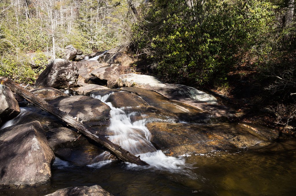
The easy hike follows Middle Falls Alt. (#TR64B), a 0.5-mile out-and-back trail over natural surface. Expect 100 feet of elevation gain. The trail is moderately developed (Class 2).
USFS Trail
MIDDLE FALLS ALT. #TR64B
Trail Class
Moderately Developed
Surface
USFS Segment
0.16 miTrail Description
The official USFS approach is MIDDLE FALLS ALT., Trail #TR64B (Class 2). The trail includes a 0.16-mile segment mapped by the USFS on native-material surface; the full out-and-back route measures roughly 0.5 miles with about 100 feet of elevation gain. Rated easy, the path is a short, mostly gentle hike over natural tread with minimal technical difficulty — expect an unpaved, natural surface and modest grades suitable for most hikers. The route leads directly to a viewing area above the falls and is maintained by the U.S. Forest Service within the Nantahala National Forest.
What to Expect
Dogs are welcome.
Accessibility
The trail is short and relatively flat, but the surface may be uneven. Contact the managing agency for accessibility details.
Frequently Asked Questions
🐶 Are Dogs Allowed at Upper Falls?
✅ Dogs are allowed
Are There Any Fees or Permits Required?
🆖 No fees required
🏊 Is There Swimming at Upper Falls?
❌ Swimming is not allowed
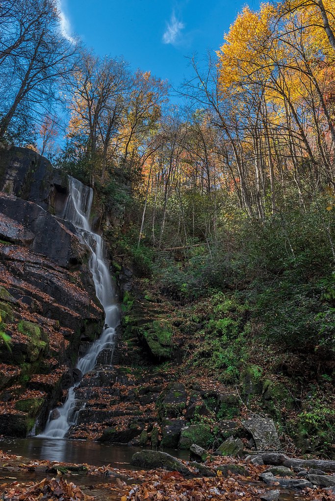
When to Visit
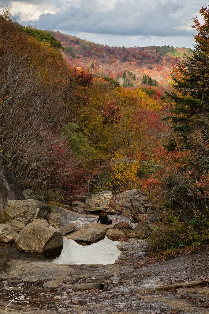
Spring and fall are the best times to visit, as the waterfall flow is typically stronger in spring, and the fall foliage adds vibrant colors to the landscape.
Seasonal Access
The best time to visit is Spring, Summer, and Fall. Winter access may be limited. Check with Nantahala National Forest for seasonal road closures.
Safety Information
Stay on designated trails and viewing platforms. The rocks near the falls can be slippery, and venturing off-trail is dangerous. Be cautious of changing weather conditions.
Current Water Conditions
125 ft³/s
Current discharge — how much water is flowing
About average for this time of year
Based on 115 years of record
2.06 ft
Water depth at gauge
7-Day Discharge Trend
What does this mean for your visit?
Flow is about average for this time of year.
About This Gauge
This gauge is on a nearby waterway and may not reflect exact conditions at the falls.
7-Day Flow Outlook
Based on the USGS gauge VALLEY RIVER AT TOMOTLA, NC (15 km away).
Today
Roaring
143 cfs
6/10Tomorrow
Roaring
152 cfs
6/10Wed
Roaring
145 cfs
6/10Thu
Roaring
162 cfs
6/10Fri
Roaring
157 cfs
6/10Sat
Roaring
152 cfs
6/10Sun
Roaring
147 cfs
6/10Best window: Today — roaring flow, slight chance showers and thunderstorms (trip score 6/10).
Best time of year: this gauge typically runs highest from mid January to mid April, peaking in March.
How we calculate this
This is a transparent outlook, not a precise forecast. We take the waterfall's current flow strength (how it ranks against its historical normal for today, from the nearest USGS stream gauge), carry that ranking forward along the gauge's seasonal curve, and nudge it for forecast rain. Confidence is highest for the next day or two and falls further out. Always check official conditions and your own judgment before visiting — high flows can be dangerous.
Know when to go.
Get a free email alert when waterfalls near Marble hit peak flow. We only send when conditions are worth the trip — no weekly newsletters, no spam.
Weather Forecast
Location & Access
Getting There
Upper Falls can be accessed via the Linville Falls Visitor Center, located off the Blue Ridge Parkway. From the visitor center, follow the trails leading to the falls.
Get Directions on Google MapsParking
Parking is available at the Linville Falls Visitor Center. The lot can fill up quickly during peak seasons, so arriving early is recommended.
Elevation
3,652 feet above sea level
Coordinates
35.270918° N, -83.992688° W
Land Management
Managed by USFS
Visitor Tips & Gear
Wear sturdy shoes as the trail may be uneven in some areas. Arrive early to secure parking, especially during weekends and peak seasons. Bring water and a camera to capture the beautiful scenery.
As an Amazon Associate, we earn from qualifying purchases.
For this easy 0.5 miles trail, lightweight trail shoes and a water bottle are usually sufficient. Sun exposure on the trail makes good sun protection a must in summer.

Polarized Sunglasses (Knockaround)
Cuts glare off the water so you actually see the falls — and your photos turn out better too.

Columbia Watertight II Rain Jacket
Packs into its own pocket, seam-sealed, and keeps you dry from spray and surprise rain.

Earth Pak Waterproof Dry Bag
Keeps your phone and gear dry when waterfall mist soaks everything else.

Waterproof Phone Pouch (AiRunTech)
Cheap insurance — take photos right next to the falls without killing your phone.

JOBY GorillaPod Starter Kit
Wraps around railings and rocks for long-exposure waterfall shots — no flat surface needed.

Osprey Daylite Daypack
Light, organized, and just the right size for a day hike — fits water, snacks, and layers.
Where to Stay

The Junction

Mistletoe Cabin- Private cabin w views, Hottub, pet friendly

Quality Inn & Suites Robbinsville

Stonebrook Lodge Murphy
Browse vacation cabins and private rentals nearby
Unique outdoor stays — tents, yurts, and treehouses
Rent a campervan or RV for your waterfall road trip
Some links are affiliate links. We may earn a commission at no extra cost to you.
Nearby Campground
SWAN CABIN
6.2 miles away · 1 sites
Overview Nestled in a remote area of Nantahala National Forest, this primitive log cabin was built in 1931 by Frank Swan in a different location, then later it was moved to its current location near the Joyce Kilmer-Slickrock Wilderness. The cabin and the surrounding meadows are named for the Swan Family, who came to the area from Pennsylvania in the late 19th century. Swan Cabin offers a peaceful, quiet retreat where visitors can relax on the front porch and enjoy birdsong and views of the surro
Book on Recreation.govAdditional Information
Nearby Attractions
Linville Gorge, Linville Falls, Blue Ridge Parkway, Grandfather Mountain
Wildlife
The area is home to a variety of wildlife, including birds, deer, and small mammals. Be cautious of black bears, which may be present in the region.
Cities near Upper Falls
Nearby Waterfalls
Other waterfalls named Upper Falls
27 other waterfalls share this name across the U.S.
Writing about Upper Falls? Embed this waterfall on your site for free.