

Photo Credits (5)
Difficulty
Moderate
Trail Length
2.4 miles
Trail Type
Out And Back
Elevation Gain
350 ft
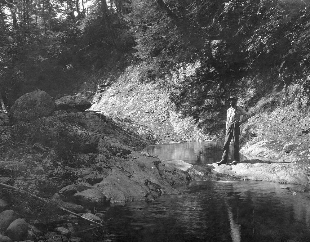
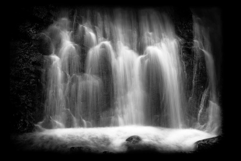
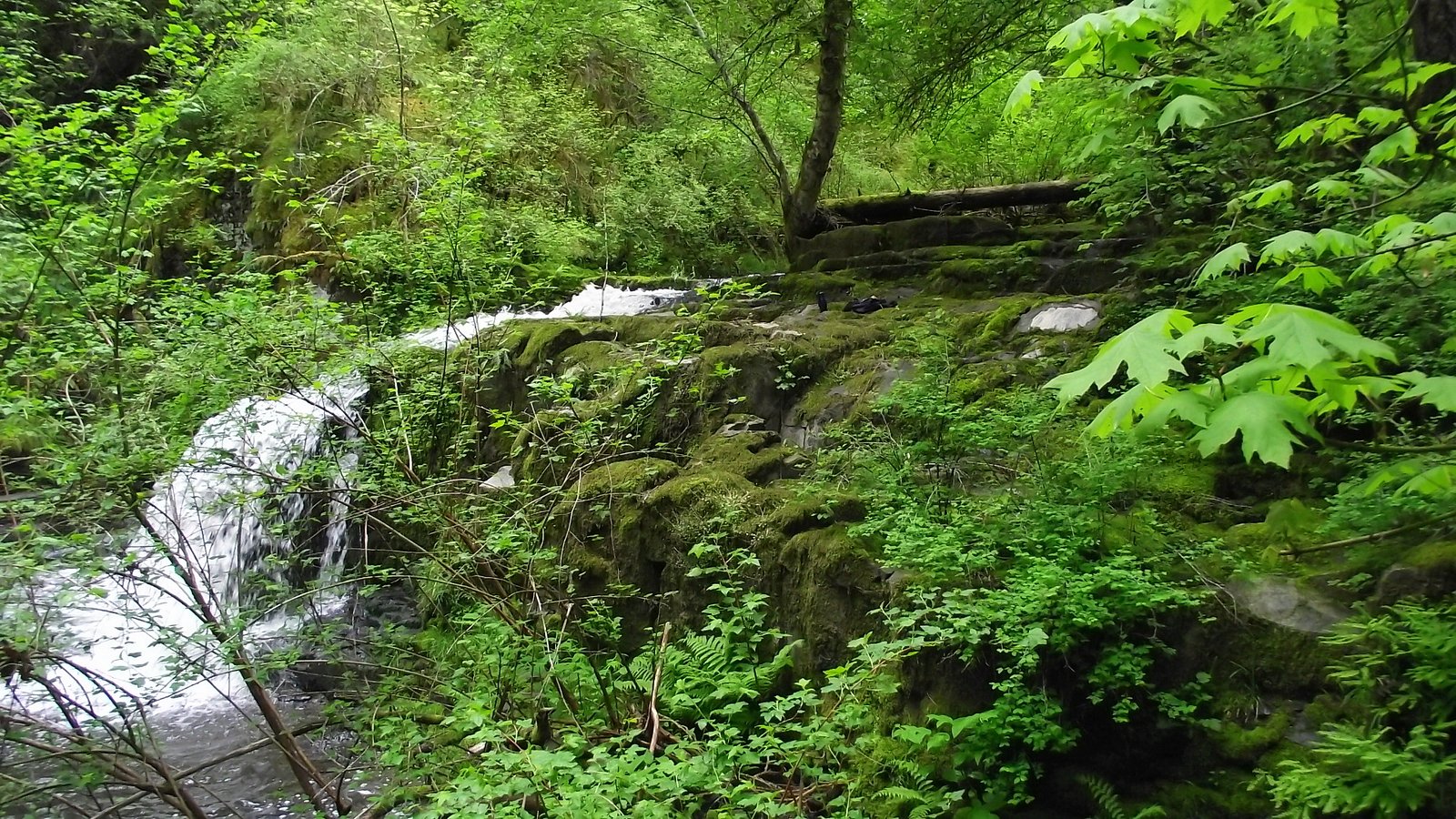
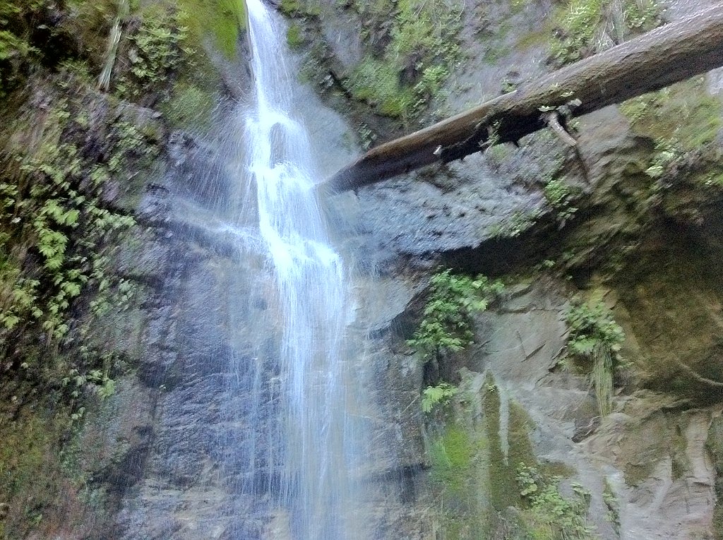
About Upper Falls
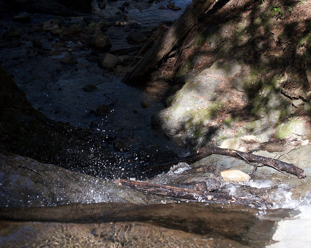
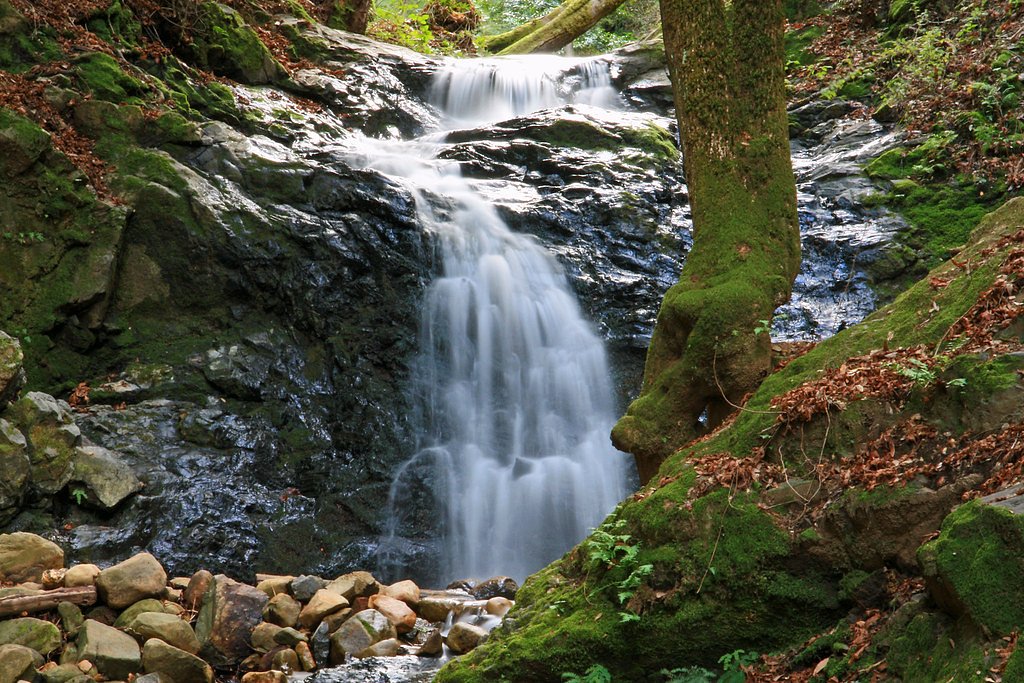
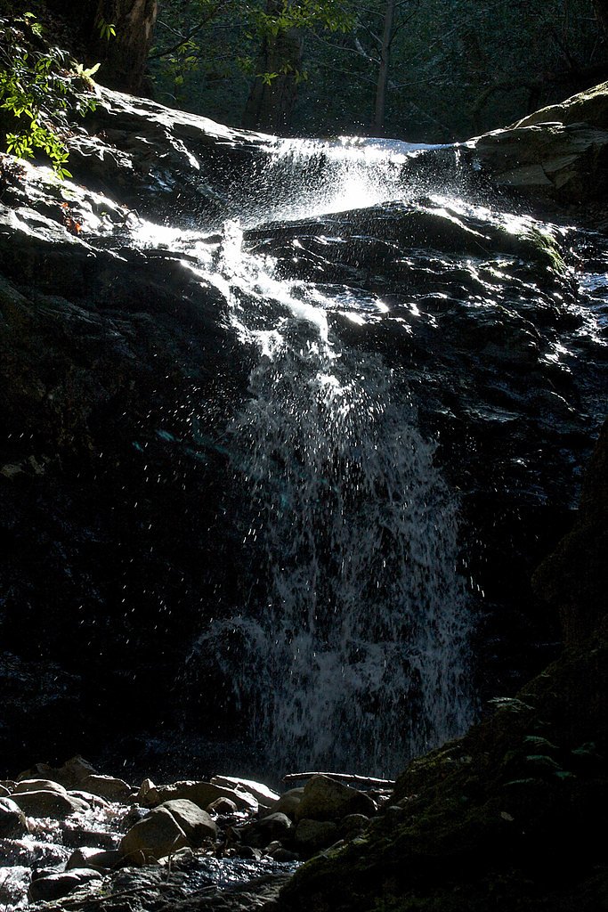
Upper Falls is a small, picturesque cascade tucked into Uvas Canyon County Park, offering a peaceful woodland escape not far from Corralitos. The falls sit on a creek within the park's forested ravines, and visitors will find a tranquil scene of mossy rock slabs and shady canopy; water flow can vary with the seasons, from a lively stream in wetter months to a more modest trickle in late summer. The site is managed as part of the county park system (Uvas Canyon County Park, managed by county authorities), so expect a well-loved local setting rather than a remote wilderness experience. Access to the falls follows a moderate out-and-back route that suits day hikers and families who are comfortable with some uphill. The trail through the park passes through typical riparian and mixed-woodland habitats; on clear days the short hike rewards you with a close view of the cascade and the surrounding green corridor. Pack water and wear good shoes, as sections can be slippery when wet and the creekside terrain is naturally uneven.
The Setting
Upper Falls sits at 1,624 feet within Uvas Canyon County Park, in the hills of California.
Trail & Hike Details
The Approach
The moderate 2.4-mile out-and-back trail gains 350 feet of elevation on the way to the falls.
Trail Description
This is a 2.4-mile out-and-back hike with about 350 feet of elevation gain and is rated moderate. The trail is managed within Uvas Canyon County Park by county authorities; specific USFS trail numbers do not apply. Detailed surface, grade, and technical trail-class data are not documented in the available park records, so hikers should expect natural dirt and creekside paths with occasional roots and rocks. The route is suitable for a half-day outing and is most enjoyable after seasonal rains when the waterfall has higher flow.
What to Expect
Visitors can expect a peaceful natural setting with a small waterfall surrounded by trees and vegetation. The flow of the waterfall may vary depending on recent rainfall and the time of year.
Accessibility
The trail is not wheelchair accessible. Uneven terrain and elevation changes require steady footing.
Frequently Asked Questions
🐶 Are Dogs Allowed at Upper Falls?
❌ Dogs are not allowed
Are There Any Fees or Permits Required?
🆖 No fees required
🏊 Is There Swimming at Upper Falls?
❌ Swimming is not allowed
When to Visit
Spring is typically the best time to visit, as the waterfall is likely to have the strongest flow due to seasonal rains.
Seasonal Access
The best time to visit is Spring, Summer, Fall, and Winter.
Safety Information
Visitors should be cautious of slippery rocks and uneven terrain near the waterfall. Check for potential hazards such as poison oak or wildlife encounters.
7-Day Flow Outlook
Based on the USGS gauge APTOS C NR APTOS CA (13 km away).
Best time of year: this gauge typically runs highest from early February to late April, peaking in March.
How we calculate this
This is a transparent outlook, not a precise forecast. We take the waterfall's current flow strength (how it ranks against its historical normal for today, from the nearest USGS stream gauge), carry that ranking forward along the gauge's seasonal curve, and nudge it for forecast rain. Confidence is highest for the next day or two and falls further out. Always check official conditions and your own judgment before visiting — high flows can be dangerous.
Know when to go.
Get a free email alert when waterfalls near Corralitos hit peak flow. We only send when conditions are worth the trip — no weekly newsletters, no spam.
Weather Forecast
Location & Access
Getting There
Upper Falls is located approximately 4.7 miles from Corralitos, 4.9 miles from Day Valley, and 6.9 miles from Amesti. The coordinates for the waterfall are 37.0797, -121.8022. Access to the falls may require navigating local roads and potentially a short hike.
Get Directions on Google MapsParking
Parking availability is unclear, but visitors may need to park along nearby roads or at designated trailheads if available.
Elevation
1,624 feet above sea level
Coordinates
37.079722° N, -121.802222° W
Land Management
Managed by CNTY
Visitor Tips & Gear
Wear sturdy shoes as the terrain may be uneven. Check weather conditions before visiting, as the area may become slippery after rain.
As an Amazon Associate, we earn from qualifying purchases.
With 2.4 miles and 350 ft of elevation gain, sturdy boots and trekking poles will help on this moderate trail. Icy conditions are common in winter — traction cleats are a smart addition.

Columbia Watertight II Rain Jacket
Packs into its own pocket, seam-sealed, and keeps you dry from spray and surprise rain.

Polarized Sunglasses (Knockaround)
Cuts glare off the water so you actually see the falls — and your photos turn out better too.

Earth Pak Waterproof Dry Bag
Keeps your phone and gear dry when waterfall mist soaks everything else.

Waterproof Phone Pouch (AiRunTech)
Cheap insurance — take photos right next to the falls without killing your phone.

Timberland Euro Sprint Mid Waterproof
Trusted waterproof boot with premium leather and grippy rubber sole — reliable on rocky, wet trails.

TrailBuddy Trekking Poles
Lightweight aluminum, cork grips, and flip-locks that actually hold — a best-seller for good reason.
Where to Stay

Royal Villa - Ocean View - Heated Pools - SEASCAPE'S BEST 1 BEDROOM - 3 BEDS - End Unit

Hampton Inn Morgan Hill

Casablanca Inn on The Beach

Holiday Inn Express Hotel & Suites San Jose-Morgan Hill by IHG
Browse vacation cabins and private rentals nearby
Unique outdoor stays — tents, yurts, and treehouses
Rent a campervan or RV for your waterfall road trip
Some links are affiliate links. We may earn a commission at no extra cost to you.
Nearby Hot Springs
Hot springs near Corralitos, California
Gilroy Hot Springs
Gilroy Hot Springs flows at 106 degrees Fahrenheit within Henry W. Coe State Park, a California Historical Landmark and Nationa...

Mineral Springs
Mineral Springs flows at 84°F near East Foothills in the Santa Clara Valley foothills, creating a modest 25-degree temperature ...
Sargent Estate Warm Spring
Sargent Estate Warm Spring flows at 77°F in the hills east of Gilroy in the Diablo Range. The modest 19-degree temperature rise...
Sulphur Hot Spring
Sulphur Hot Spring flows at 100 degrees in Monterey County near Seaside at just 36 feet elevation, essentially at-grade with th...

Alameda Warm Springs
Alameda Warm Springs flows at 80°F (27°C) in Mission Peak Regional Preserve near Milpitas, a modest thermal seep just 20 degree...

Crohare Spring
Crohare Spring emerges at 70°F from protected conservation lands near Livermore, flowing barely 9 degrees above ambient tempera...
Looking for a soak after your hike? Explore more hot springs near Corralitos, California on SoakingSprings.
Explore California springsAdditional Information
Nearby Attractions
The nearby towns of Corralitos, Day Valley, and Amesti offer small-town charm and local amenities.
Wildlife
The area may feature local wildlife such as birds, deer, and small mammals. Visitors should respect the natural habitat.
Cities near Upper Falls
Nearby Waterfalls
Other waterfalls named Upper Falls
27 other waterfalls share this name across the U.S.
Writing about Upper Falls? Embed this waterfall on your site for free.