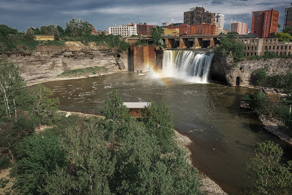
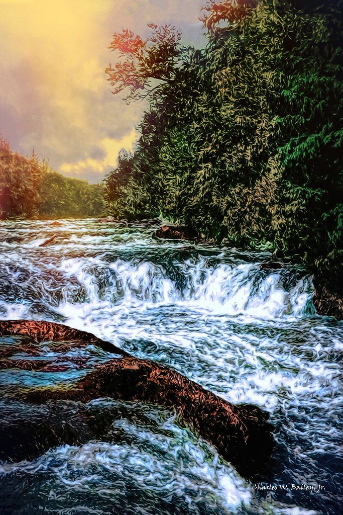
Upper Falls
By Armen Suny · Last verified Mar 2026
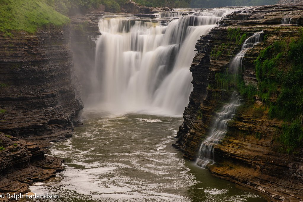

Photo Credits (5)
Difficulty
Moderate
Trail Length
2.4 miles
Trail Type
Out And Back
Elevation Gain
350 ft
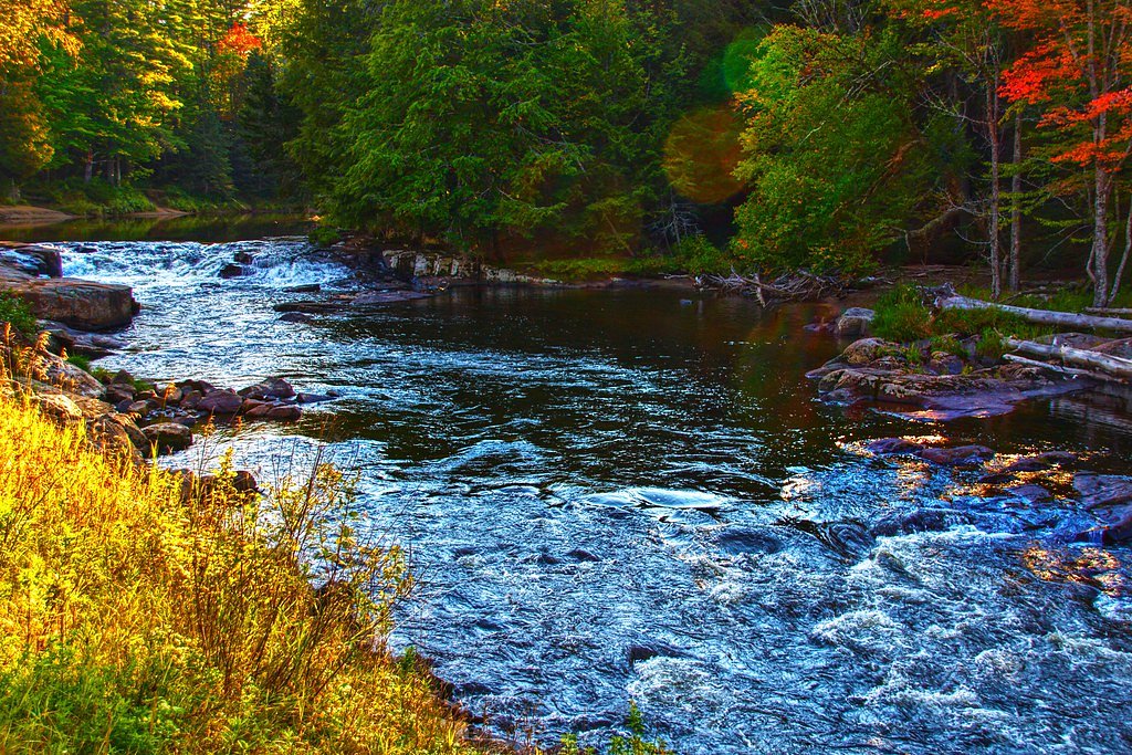
About Upper Falls
Upper Falls is a scenic cascade tucked into the Adirondack region of New York, within easy reach of Saranac Lake, Paul Smiths, and Lake Placid. The fall tumbles through a densely forested corridor of the St. Regis River, offering photographers and nature lovers a tranquil setting framed by mature hardwoods and classic Adirondack terrain. The setting feels remote yet accessible, making it a rewarding stop on a day of exploring the High Peaks area. The waterfall and its approaches lie within the High Peaks Wilderness and are managed by SDC, which owns the parcel and oversees permitted use (Designation: SW). Visitors should come prepared for typical wilderness conditions and practice Leave No Trace—seasonal changes can alter access and the mood of the falls, from brisk spring runoff to quieter summer flows. The site remains a popular spot for quiet observation and photography rather than heavy recreation, so treat it respectfully to preserve the experience for others.
The Setting
Upper Falls sits at 1,604 feet within High Peaks Wilderness, fed by the Raquette River, in the hills of New York.
Trail & Hike Details
The Approach
The moderate 2.4-mile out-and-back trail gains 350 feet of elevation on the way to the falls.
Trail Description
The most common approach to Upper Falls is an out-and-back route of approximately 2.4 miles with about 350 feet of elevation gain, rated moderate in difficulty. Trail surfaces and signage can vary by access point: some portions follow a defined hiking path while short, unmarked boot paths may be encountered near the creek. Conditions change with the seasons—mud, ice, or high water can make footing tricky—so wear sturdy footwear and expect typical Adirondack backcountry tread rather than a paved or heavily maintained corridor.
What to Expect
Visitors can expect a peaceful and picturesque waterfall surrounded by the natural beauty of the Adirondacks. The area is typically quiet and offers opportunities for photography, birdwatching, and enjoying the serene environment.
Accessibility
The trail is not wheelchair accessible. Uneven terrain and elevation changes require steady footing.
Frequently Asked Questions
🐶 Are Dogs Allowed at Upper Falls?
❌ Dogs are not allowed
Are There Any Fees or Permits Required?
🆖 No fees required
🏊 Is There Swimming at Upper Falls?
❌ Swimming is not allowed
When to Visit
Spring and early summer are ideal for viewing the waterfall at its fullest flow, while fall offers stunning foliage. Winter visits may provide a unique view of the frozen waterfall, but trails could be icy or snow-covered.
Seasonal Access
The best time to visit is Spring, Summer, Fall, and Winter.
Safety Information
Visitors should be cautious of slippery rocks and uneven terrain near the waterfall. During winter, icy conditions may make access hazardous. Always check weather conditions before visiting.
Current Water Conditions
1,440 ft³/s
Current discharge — how much water is flowing
Higher than usual for this time of year
Based on 117 years of record
6.09 ft
Water depth at gauge
7-Day Discharge Trend
What does this mean for your visit?
The water is flowing higher than usual for this time of year.
About This Gauge
This gauge is on a nearby waterway and may not reflect exact conditions at the falls.
7-Day Flow Outlook
Based on the USGS gauge RAQUETTE RIVER AT PIERCEFIELD NY (22 km away).
Today
Moderate
1642 cfs
4/10Tomorrow
Moderate
1527 cfs
8/10Tue
Moderate
1547 cfs
4/10Wed
Moderate
1611 cfs
4/10Thu
Moderate
1589 cfs
4/10Fri
Moderate
1536 cfs
4/10Sat
Moderate
1402 cfs
4/10Best window: Tomorrow — moderate flow, mostly sunny (trip score 8/10).
Best time of year: this gauge typically runs highest from late March to early June, peaking in April.
How we calculate this
This is a transparent outlook, not a precise forecast. We take the waterfall's current flow strength (how it ranks against its historical normal for today, from the nearest USGS stream gauge), carry that ranking forward along the gauge's seasonal curve, and nudge it for forecast rain. Confidence is highest for the next day or two and falls further out. Always check official conditions and your own judgment before visiting — high flows can be dangerous.
Know when to go.
Get a free email alert when waterfalls near Saranac Lake hit peak flow. We only send when conditions are worth the trip — no weekly newsletters, no spam.
Weather Forecast
Location & Access
Getting There
Upper Falls is located approximately 17.4 miles from Saranac Lake, 17.5 miles from Paul Smiths, and 21.5 miles from Lake Placid. The coordinates for the waterfall are 44.1415, -74.3293. Access may require navigating local roads and potentially a short hike.
Get Directions on Google MapsParking
Parking availability is unclear, but visitors may find roadside parking or small parking areas nearby. It is recommended to check local maps or visitor reports for updated information.
Elevation
1,604 feet above sea level
Coordinates
44.141500° N, -74.329330° W
Land Management
Managed by SDC
Visitor Tips & Gear
Wear sturdy footwear as trails may be uneven or muddy, especially after rain. Bring insect repellent during warmer months, as bugs can be prevalent in the Adirondack region.
As an Amazon Associate, we earn from qualifying purchases.
With 2.4 miles and 350 ft of elevation gain, sturdy boots and trekking poles will help on this moderate trail. Icy conditions are common in winter — traction cleats are a smart addition.

Columbia Watertight II Rain Jacket
Packs into its own pocket, seam-sealed, and keeps you dry from spray and surprise rain.

Polarized Sunglasses (Knockaround)
Cuts glare off the water so you actually see the falls — and your photos turn out better too.

Earth Pak Waterproof Dry Bag
Keeps your phone and gear dry when waterfall mist soaks everything else.

Waterproof Phone Pouch (AiRunTech)
Cheap insurance — take photos right next to the falls without killing your phone.

Timberland Euro Sprint Mid Waterproof
Trusted waterproof boot with premium leather and grippy rubber sole — reliable on rocky, wet trails.

TrailBuddy Trekking Poles
Lightweight aluminum, cork grips, and flip-locks that actually hold — a best-seller for good reason.
Where to Stay

Trailhead by Weekender

Sandy Point Motel

The Lazy Bear Cabin

Lake Placid Inn: Main Street
Browse vacation cabins and private rentals nearby
Unique outdoor stays — tents, yurts, and treehouses
Rent a campervan or RV for your waterfall road trip
Some links are affiliate links. We may earn a commission at no extra cost to you.
Additional Information
Nearby Attractions
Nearby attractions include Saranac Lake, Paul Smith's College Visitor Interpretive Center, and Lake Placid, which offer additional outdoor activities and scenic views.
Wildlife
The area around Upper Falls is home to a variety of wildlife, including birds, deer, and small mammals. Visitors should be mindful of their surroundings and avoid disturbing the natural habitat.
Cities near Upper Falls
Nearby Waterfalls
Other waterfalls named Upper Falls
27 other waterfalls share this name across the U.S.
Writing about Upper Falls? Embed this waterfall on your site for free.