

Photo Credits (5)
Difficulty
Moderate
Trail Length
2.4 miles
Trail Type
Out And Back
Elevation Gain
350 ft
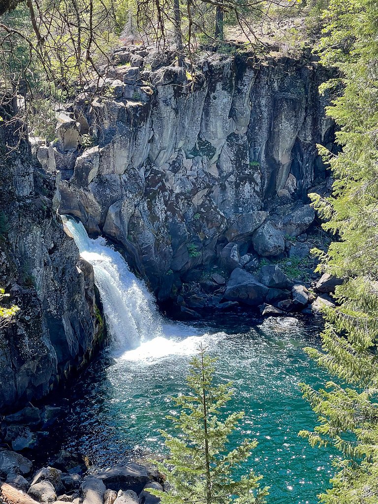
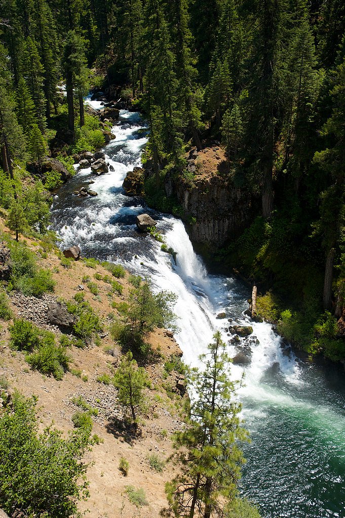
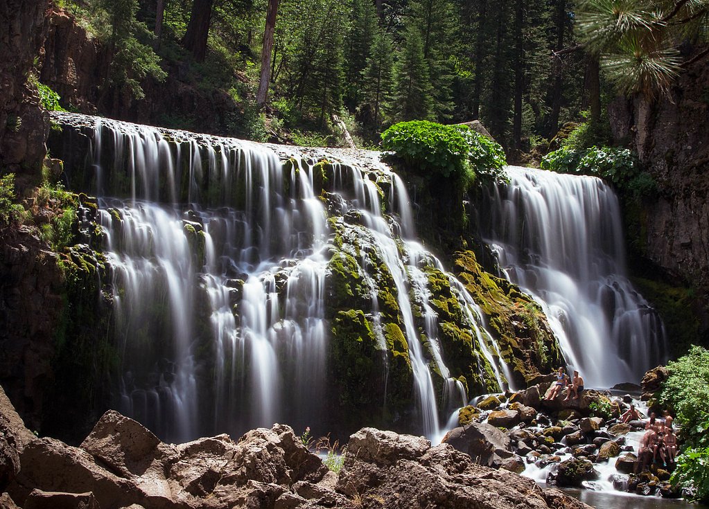
About Upper Falls
Upper Falls is tucked inside California’s Shasta National Forest and is managed by the U.S. Forest Service. The most common approach follows the Upper McCloud River Trail (USFS Trail #01E01). While USFS GIS records list that trail at 14.27 miles in their database, the typical route that hikers take to reach the falls is a 2.4-mile out-and-back with roughly 350 feet of elevation gain and a moderate difficulty rating. The tread is natural (native material) and the USFS lists the trail as Class 4, so sections require careful footing and short scrambling. For those turning this into an overnight trip, Fowlers Campground sits about 1.28 km from the falls. Visitors should bring sturdy shoes, plenty of water, and leave no trace—rewarding forest scenery and the sound of cascading water make the effort worthwhile.
The Setting
Upper Falls sits at 3,458 feet within Shasta National Forest, in the mountains of California.
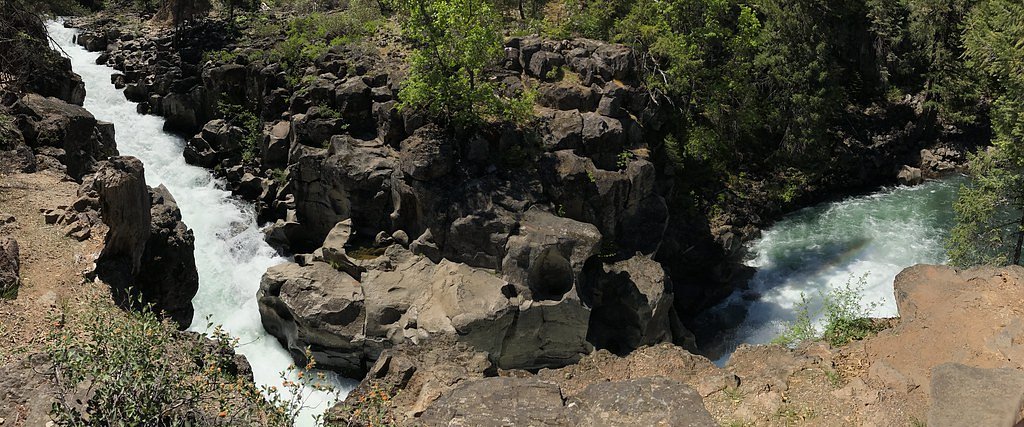
Nearby Falls Worth Visiting
Lower Falls (320 ft) lies 0.9 miles to the west. Also nearby: Middle Falls (50 ft, 0.2 mi).
Trail & Hike Details
The Approach
The moderate hike follows Upper Mccloud River (#01E01), a 2.4-mile out-and-back trail over natural surface. Expect 350 feet of elevation gain with grades of 0-5%. The trail is highly developed (Class 4).
USFS Trail
UPPER MCCLOUD RIVER #01E01
Trail Class
Highly Developed
Surface
Avg Grade
USFS Segment
14.27 miTrail Description
USFS Trail: Upper McCloud River, Trail #01E01. Trail type: out-and-back; typical hiked length to Upper Falls 2.4 miles (USFS GIS length for the trail listed as 14.27 miles). Elevation gain: ~350 ft. Difficulty: Moderate. USFS class: 4. Surface: Native material. Typical grade: 0–5%. Trail notes: natural tread with native surface; expect uneven footing and short sections that require careful footwork or basic scrambling consistent with a Class 4 designation. Nearest camping: Fowlers Campground, approximately 1.28 km from the falls.
What to Expect
Visitors can expect a serene natural setting with the sound of cascading water. The area around Upper Falls may include rocky outcrops, forested surroundings, and opportunities for photography. Seasonal water flow may affect the appearance of the falls.
Accessibility
The trail is not wheelchair accessible. Uneven terrain and elevation changes require steady footing.
Frequently Asked Questions
🐶 Are Dogs Allowed at Upper Falls?
❌ Dogs are not allowed
Are There Any Fees or Permits Required?
🆖 No fees required
🏊 Is There Swimming at Upper Falls?
❌ Swimming is not allowed
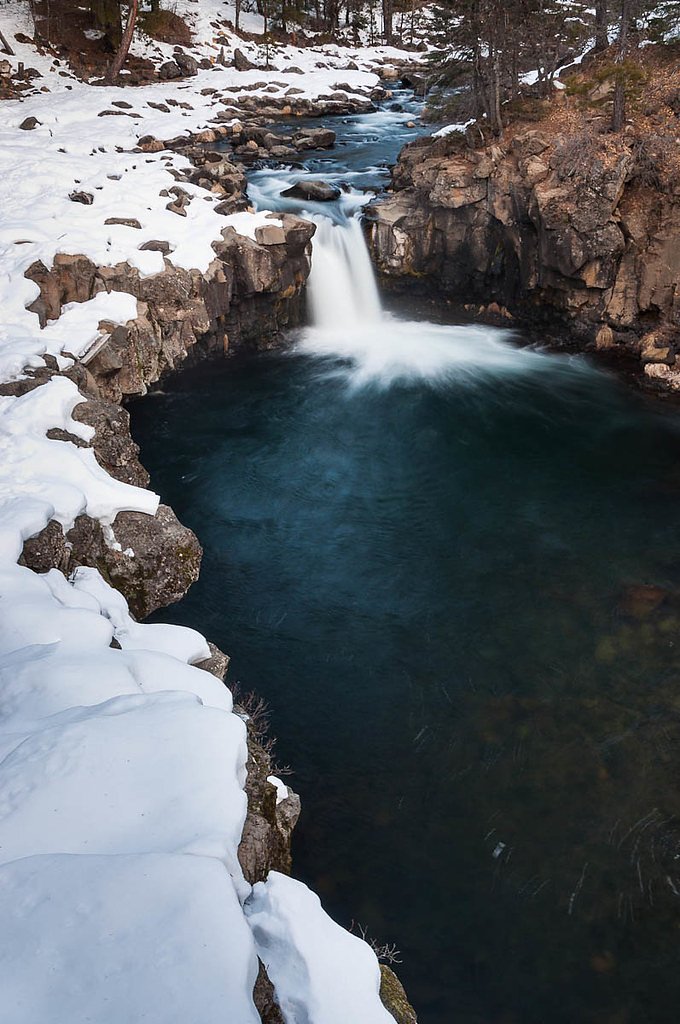
When to Visit
Spring and early summer are typically the best times to visit, as water flow is strongest due to snowmelt. Fall can also be a good time for cooler weather and fewer crowds.
Seasonal Access
The best time to visit is Spring, Summer, and Fall. Winter access may be limited. Check with Shasta National Forest for seasonal road closures.
Safety Information
Be cautious of slippery rocks and fast-moving water near the falls. Always stay on designated trails and avoid venturing too close to the edge of the waterfall. Check weather conditions before your visit, as rain can make trails more hazardous.
Know when to go.
Get a free email alert when waterfalls near McCloud hit peak flow. We only send when conditions are worth the trip — no weekly newsletters, no spam.
Weather Forecast
Location & Access
Getting There
Upper Falls can typically be accessed via a trailhead located within a state or national park. Specific directions depend on the exact location of the waterfall, as there are multiple 'Upper Falls' in California. Visitors should consult local park maps or official websites for precise details.
Get Directions on Google MapsParking
Parking availability may vary depending on the specific location of Upper Falls. Most locations have designated parking areas near the trailhead, but these can fill up quickly during peak seasons.
Elevation
3,458 feet above sea level
Coordinates
41.240416° N, -122.009083° W
Land Management
Managed by USFS
Visitor Tips & Gear
Arrive early to secure parking and avoid crowds. Bring plenty of water, wear sturdy hiking shoes, and check trail conditions before heading out. Be cautious of slippery rocks near the waterfall.
As an Amazon Associate, we earn from qualifying purchases.
With 2.4 miles and 350 ft of elevation gain, sturdy boots and trekking poles will help on this moderate trail. Sun exposure on the trail makes good sun protection a must in summer.

Polarized Sunglasses (Knockaround)
Cuts glare off the water so you actually see the falls — and your photos turn out better too.

Columbia Watertight II Rain Jacket
Packs into its own pocket, seam-sealed, and keeps you dry from spray and surprise rain.

Earth Pak Waterproof Dry Bag
Keeps your phone and gear dry when waterfall mist soaks everything else.

Waterproof Phone Pouch (AiRunTech)
Cheap insurance — take photos right next to the falls without killing your phone.

Timberland Euro Sprint Mid Waterproof
Trusted waterproof boot with premium leather and grippy rubber sole — reliable on rocky, wet trails.

TrailBuddy Trekking Poles
Lightweight aluminum, cork grips, and flip-locks that actually hold — a best-seller for good reason.
Where to Stay

Mount Shasta Resort

McCloud Hotel

Travelodge by Wyndham Dunsmuir

Shasta View Lodge
Browse vacation cabins and private rentals nearby
Unique outdoor stays — tents, yurts, and treehouses
Rent a campervan or RV for your waterfall road trip
Some links are affiliate links. We may earn a commission at no extra cost to you.
Nearby Campground
FOWLERS CAMPGROUND
0.8 miles away · 36 sites
Overview Fowlers Campground is located on the Upper McCloud River five miles east of McCloud, California. The campground is nestled in a mixed conifer and oak woodland. The campground offers paved parking spurs, running water and vault restrooms.Recreation A river-side trail from the campground provides access to the falls. It is approximately three miles round trip to see all three. Swimming and fishing are other popular activities. This section of river has no special restrictions for fishing.
Book on Recreation.govNearby Hot Springs
Hot springs near McCloud, California
Hunt Hot Spring
Hunt Hot Spring produces 136-degree water from the forested slopes near McCloud in Siskiyou County at just 1,712 feet elevation...
Big Bend Hot Springs
Big Bend Hot Springs surges at a scalding 180 degrees Fahrenheit from volcanic terrain at just 1,644 feet elevation, creating o...
Big Bend, California
Big Bend sits along a dramatic curve of the Pit River in Shasta County at 1,720 feet elevation, occupying territory historicall...

Hot Spring, Fumaroles
Hot Spring with fumaroles on Mount Shasta at 14,000 feet elevation represents one of California's highest thermal features, wit...
Little Hot Spring
Little Hot Spring discharges at 169°F in the volcanic terrain south of Lassen, where superheated water rises 117 degrees above ...
Hot Spot
Hot Spot delivers water at 191°F, the hottest spring in this dataset section, creating a temperature differential of 150°F abov...
Looking for a soak after your hike? Explore more hot springs near McCloud, California on SoakingSprings.
Explore California springsAdditional Information
Nearby Attractions
Nearby attractions may include other waterfalls, hiking trails, and scenic viewpoints. Check local park maps for details.
Wildlife
The area around Upper Falls may be home to various wildlife, including birds, deer, and small mammals. Be respectful of wildlife and maintain a safe distance.
Cities near Upper Falls
Nearby Waterfalls
Other waterfalls named Upper Falls
27 other waterfalls share this name across the U.S.
Writing about Upper Falls? Embed this waterfall on your site for free.