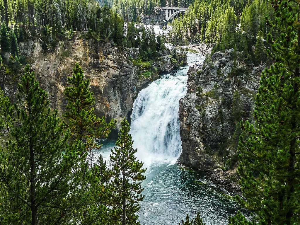
Granite Falls
By Armen Suny · Last verified Mar 2026
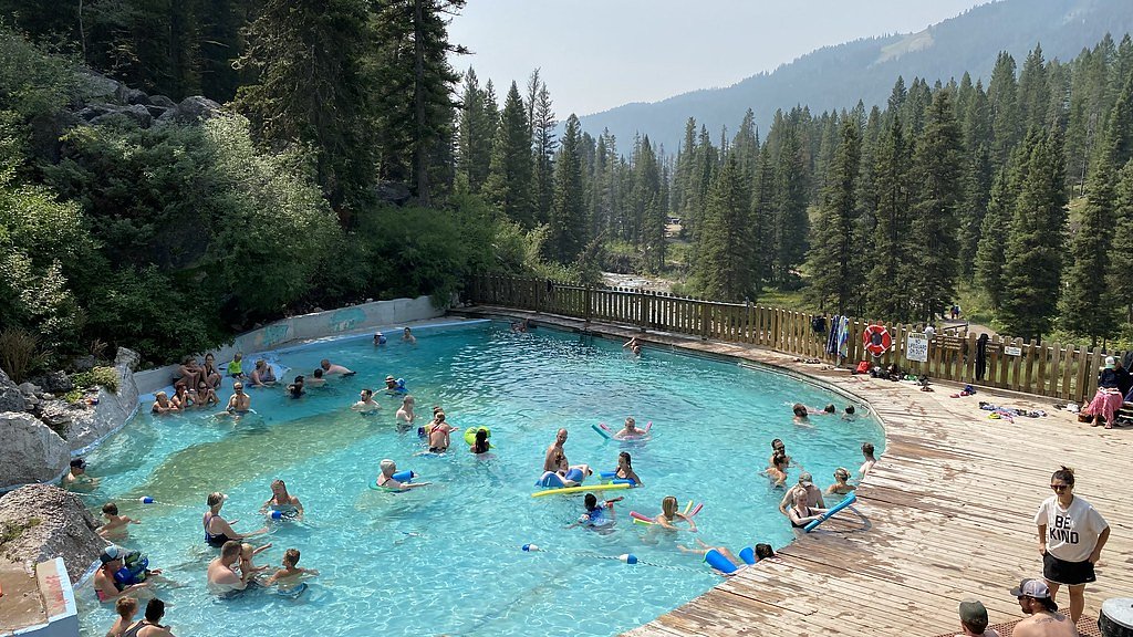
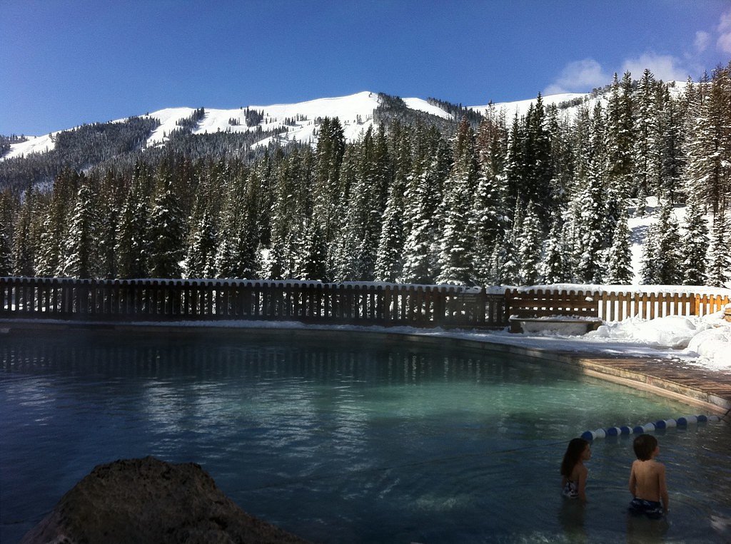
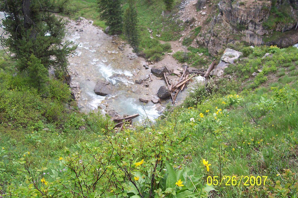
Photo Credits (5)
Difficulty
Moderate
Trail Length
2.4 miles
Trail Type
Out And Back
Elevation Gain
350 ft
About Granite Falls
Granite Falls is a picturesque waterfall located in the Bridger-Teton National Forest in Wyoming. It is known for its cascading waters surrounded by lush forest and rugged mountain scenery. The falls are a popular destination for hikers and nature enthusiasts.
The Setting
Granite Falls sits at 6,886 feet within Teton National Forest, fed by the Hoback River, in the high mountains of Wyoming.
Trail & Hike Details
The Approach
The moderate hike follows Granite Creek (#4018), a 2.4-mile out-and-back trail over natural surface. Expect 350 feet of elevation gain. The trail is developed (Class 3).
USFS Trail
GRANITE CREEK #4018
Trail Class
Developed
Surface
USFS Segment
17.89 miTrail Description
The trail to Granite Falls is short and relatively flat, making it accessible for most visitors. It leads through a forested area and offers beautiful views of the surrounding landscape before reaching the waterfall.
What to Expect
Dogs are welcome.
Accessibility
The trail is not wheelchair accessible. Uneven terrain and elevation changes require steady footing.
Frequently Asked Questions
🐶 Are Dogs Allowed at Granite Falls?
✅ Dogs are allowed
Are There Any Fees or Permits Required?
🆖 No fees required
🏊 Is There Swimming at Granite Falls?
❌ Swimming is not allowed
When to Visit
The best time to visit Granite Falls is during late spring through early fall when the trail is most accessible and the waterfall flow is at its peak due to snowmelt.
Seasonal Access
The best time to visit is Spring, Summer, and Fall. Access roads and trails may close during winter due to snow. Check with Teton National Forest for seasonal road closures.
Safety Information
Water temperature is currently 49°F — cold enough to cause numbness quickly. Avoid prolonged water contact and use caution near the falls.
Be cautious on the gravel road leading to the falls, especially after rain. Watch for wildlife and carry bear spray. Stay on designated trails to avoid accidents.
Current Water Conditions
1,110 ft³/s
Current discharge — how much water is flowing
Much lower than usual for this time of year
Based on 19 years of record
6.24 ft
Water depth at gauge
49°F
Very coldExpect numbness within minutes
7-Day Discharge Trend
What does this mean for your visit?
Flow is well below normal for this time of year, so the waterfall may be a trickle. Water temperature is very cold at 49 degrees F, expect numbness within minutes.
About This Gauge
This gauge is on a nearby waterway and may not reflect exact conditions at the falls.
7-Day Flow Outlook
Based on the USGS gauge HOBACK RIVER NEAR JACKSON, WY (20 km away).
Today
Moderate
1110 cfs
9/10Tomorrow
Moderate
1045 cfs
9/10Tue
Moderate
1029 cfs
9/10Wed
Moderate
996 cfs
9/10Thu
Moderate
975 cfs
9/10Fri
Moderate
1068 cfs
6/10Sat
Strong
1147 cfs
7/10Best window: Today — moderate flow, mostly sunny (trip score 9/10).
Best time of year: this gauge typically runs highest from late April to late July, peaking in June.
How we calculate this
This is a transparent outlook, not a precise forecast. We take the waterfall's current flow strength (how it ranks against its historical normal for today, from the nearest USGS stream gauge), carry that ranking forward along the gauge's seasonal curve, and nudge it for forecast rain. Confidence is highest for the next day or two and falls further out. Always check official conditions and your own judgment before visiting — high flows can be dangerous.
Know when to go.
Get a free email alert when waterfalls near Bondurant hit peak flow. We only send when conditions are worth the trip — no weekly newsletters, no spam.
Weather Forecast
Location & Access
Getting There
Granite Falls is located approximately 30 miles southeast of Jackson, Wyoming. It can be accessed via Granite Creek Road (Forest Road 30500), which is a gravel road that may require a high-clearance vehicle depending on conditions.
Get Directions on Google MapsParking
There is a small parking area near the falls, but it may fill up quickly during peak seasons.
Elevation
6,886 feet above sea level
Coordinates
43.365214° N, -110.443521° W
Land Management
Managed by USFS
Visitor Tips & Gear
Visit early in the day to avoid crowds and secure parking. Be prepared for gravel roads and check road conditions before your trip. Bring sturdy footwear, as the trail may be muddy or uneven in places.
This trail sits at 6,886 ft above sea level
Elevated TrailUV radiation is roughly 28% stronger at this elevation than at sea level, and the dry air accelerates dehydration. Extra sun protection and fluids go a long way.
As an Amazon Associate, we earn from qualifying purchases.

Coppertone Sport SPF 50 Sunscreen
UV intensity jumps ~4% per 1,000 ft — at this elevation you can burn in half the time.

Sun Bum SPF 30 Lip Balm (3-Pack)
Lips have almost no natural UV protection and burn fast in thin, dry mountain air.

Liquid I.V. Electrolyte Packets
You lose moisture ~2x faster at elevation — electrolytes help you absorb water efficiently.

ROCKNIGHT Polarized UV400 Sunglasses
High-altitude glare off rock and water is intense — UV400 lenses block 99%+ of UVA/UVB.
As an Amazon Associate, we earn from qualifying purchases.
With 2.4 miles and 350 ft of elevation gain, sturdy boots and trekking poles will help on this moderate trail. Sun exposure on the trail makes good sun protection a must in summer.

Polarized Sunglasses (Knockaround)
Cuts glare off the water so you actually see the falls — and your photos turn out better too.

Columbia Watertight II Rain Jacket
Packs into its own pocket, seam-sealed, and keeps you dry from spray and surprise rain.

Earth Pak Waterproof Dry Bag
Keeps your phone and gear dry when waterfall mist soaks everything else.

Waterproof Phone Pouch (AiRunTech)
Cheap insurance — take photos right next to the falls without killing your phone.

Timberland Euro Sprint Mid Waterproof
Trusted waterproof boot with premium leather and grippy rubber sole — reliable on rocky, wet trails.

TrailBuddy Trekking Poles
Lightweight aluminum, cork grips, and flip-locks that actually hold — a best-seller for good reason.
Where to Stay

Jackson Hole Hideout

Elk Country Inn

The Virginian Lodge

Antler Inn
Browse vacation cabins and private rentals nearby
Unique outdoor stays — tents, yurts, and treehouses
Rent a campervan or RV for your waterfall road trip
Some links are affiliate links. We may earn a commission at no extra cost to you.
Nearby Campground
Hoback River Area
6.9 miles away · 0 sites
Within the Hoback River Area lies an abundance of recreational opportunity and amazing scenery waiting for you to enjoy. Driving south of Jackson 15 miles and heading east on Highway 191, you will find yourself driving through one of the most beautiful canyons in the surrounding area. Winding through this canyon is the designated Wild and Scenic Hoback River where crystal clear water lends itself to world-class fishing, early-season boating and peaceful camping. Off of Highway 191 to the north
Book on Recreation.govNearby Hot Springs
Hot springs near Bondurant, Wyoming
Granite Falls Hot Springs
This Forest Service-maintained spring produces 112-degree Fahrenheit water at 6,882 feet elevation, accessible via 625-foot wal...

Granite Hot Spring
This spring produces 106-degree Fahrenheit water at 7,035 feet elevation on Forest Service land, emerging 750 feet from the roa...

Astoria Mineral Hot Springs
Astoria Mineral Hot Springs flows at 99°F from a roadside location 75.9 meters from West Johnny Counts Road in Teton County, Wy...

Kelly Warm Spring
Kelly Warm Spring flows at 81 degrees Fahrenheit just 108 meters from Gros Ventre Road at 6,684 feet elevation in Grand Teton N...

Abercrombie Warm Springs
Abercrombie Warm Springs flows at 81°F within Grand Teton National Park, requiring a 104-meter walk from Warm Springs Road. The...
Boyles Hill Springs
Boyles Hill Springs emerges at 86°F near Wilson in Teton County's valley floor, flowing 45.8 degrees above ambient temperature ...
Looking for a soak after your hike? Explore more hot springs near Bondurant, Wyoming on SoakingSprings.
Explore Wyoming springsAdditional Information
Nearby Attractions
Granite Hot Springs is located nearby and is a popular spot for soaking. Visitors can also explore other trails and scenic areas within the Bridger-Teton National Forest.
Wildlife
The area is home to wildlife such as deer, elk, and various bird species. Be cautious of bears and carry bear spray.
Cities near Granite Falls
Nearby Waterfalls
Other waterfalls named Granite Falls
6 other waterfalls share this name across the U.S.
Writing about Granite Falls? Embed this waterfall on your site for free.