
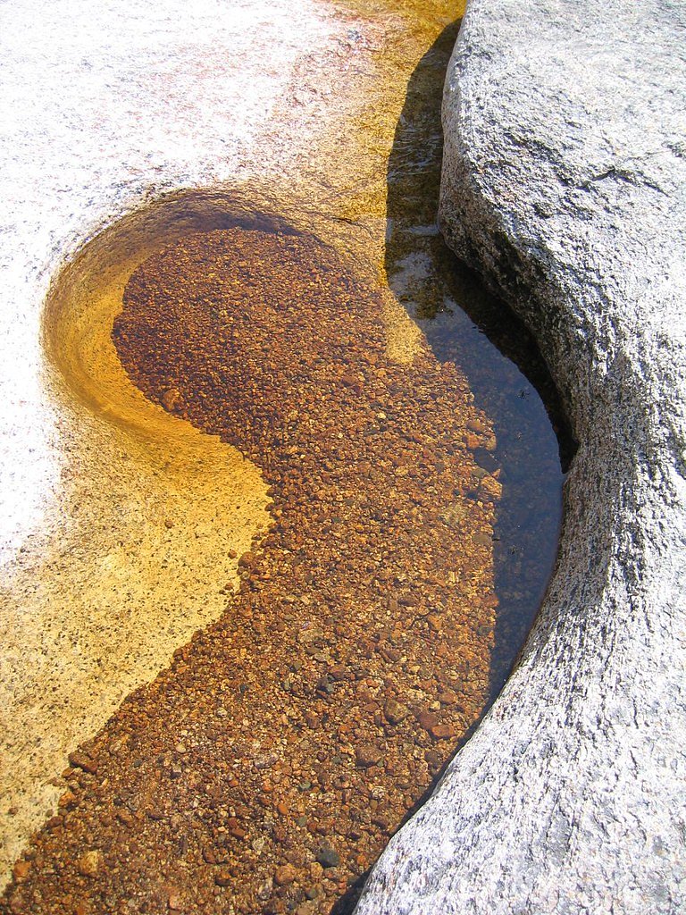
Photo Credits (5)
Difficulty
Moderate
Trail Length
2.4 miles
Trail Type
Out And Back
Elevation Gain
350 ft
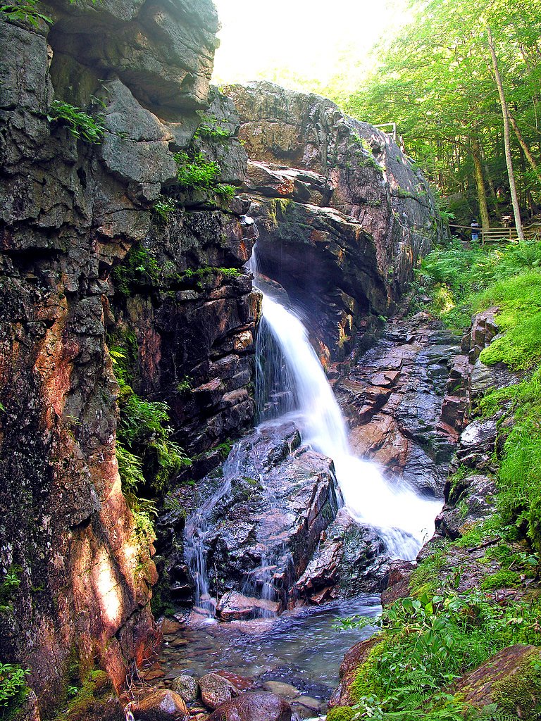
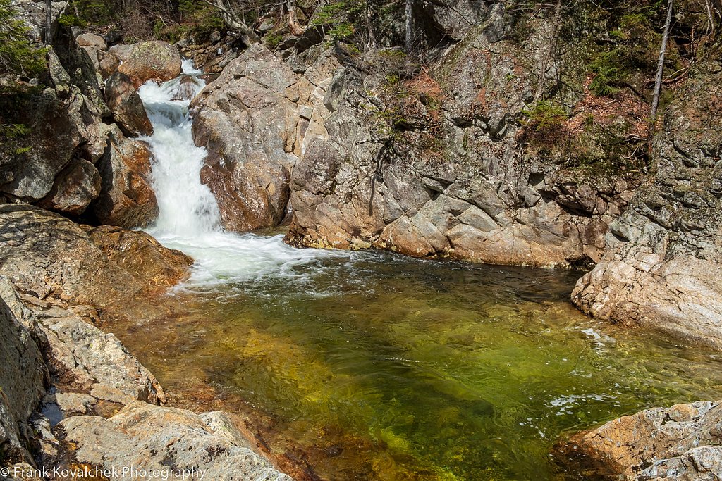
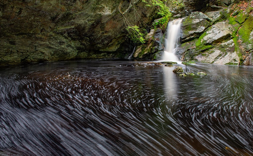
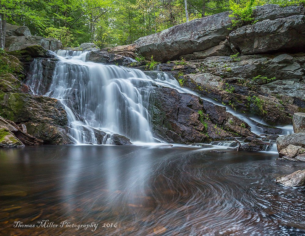
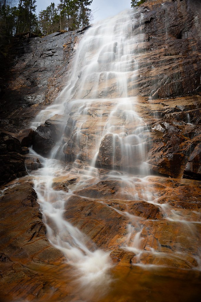
About Upper Falls
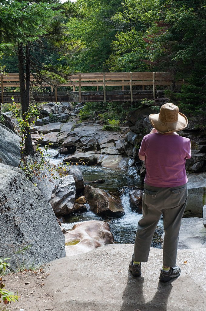
Upper Falls is a picturesque cascade in the White Mountains of New Hampshire, part of the Jackson Falls area and a series of scenic drops along the Wildcat River. The waterfall and its immediate surroundings lie on U.S. Forest Service land within the White Mountain Purchase Unit (National Forest), so trail access and stewardship are managed by the USFS. Many visitors approach Upper Falls via the USFS Base Station Rd SNOMO (Trail #97366), which threads through classic northern hardwood forest to the water. The hike to the falls has a bit more character than a short roadside view—expect a moderately paced outing with a mix of gentle tread and steeper sections. The route is well suited to hikers comfortable with moderate grades and occasional uneven footing; in winter the official trail surface is listed as SNOW, so conditions can change seasonally. Overall this is an inviting White Mountains destination for photographers and day hikers who want a quieter cascade experience on federal forest lands.
The Setting
Upper Falls sits at 1,686 feet within White Mountain Purchase Unit, fed by the Ammonoosuc River, in the hills of New Hampshire.
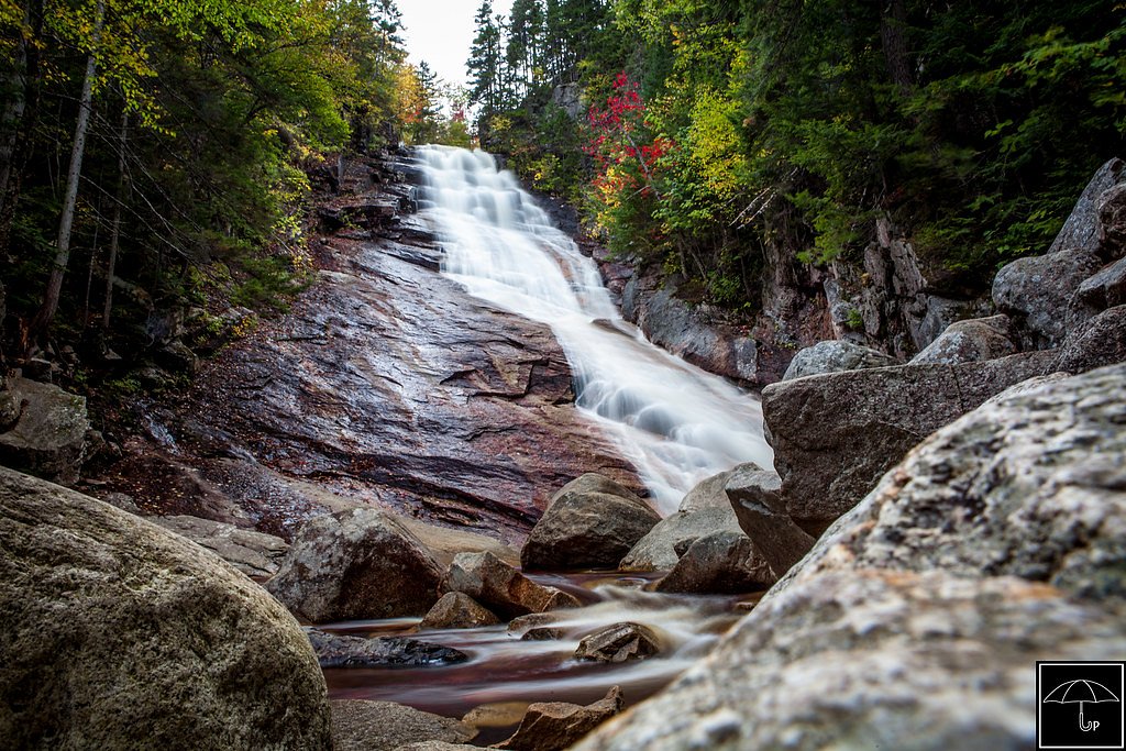
Nearby Falls Worth Visiting
Arethusa Falls (140 ft) lies 8.3 miles to the south. Also nearby: Ripley Falls (100 ft, 7.3 mi).
Trail & Hike Details
The Approach
The moderate hike follows Base Station Rd Snomo (#97366), a 2.4-mile out-and-back trail over snow. Expect 350 feet of elevation gain with grades of 12-20%. The trail is developed (Class 3).
USFS Trail
BASE STATION RD SNOMO #97366
Trail Class
Developed
Surface
Avg Grade
USFS Segment
3.29 miTrail Description
Trail name/number: BASE STATION RD SNOMO (USFS Trail #97366). Land manager: U.S. Forest Service, White Mountain Purchase Unit (National Forest). Trail type: out-and-back. Commonly described length to Upper Falls: about 2.4 miles round trip with roughly 350 feet of elevation gain and rated moderate. USFS GIS records for Base Station Rd SNOMO list the trail at approximately 3.29 miles. Trail class: 3 (per USFS data). Surface: SNOW (USFS-designated surface). Typical grade: 12–20% in steeper sections. Expect uneven tread, short steep pitches, and seasonally variable conditions—plan footwear and timing accordingly.
What to Expect
Dogs are welcome.
Accessibility
The trail is not wheelchair accessible. Uneven terrain and elevation changes require steady footing.
Frequently Asked Questions
🐶 Are Dogs Allowed at Upper Falls?
✅ Dogs are allowed
Are There Any Fees or Permits Required?
🆖 No fees required
🏊 Is There Swimming at Upper Falls?
❌ Swimming is not allowed
When to Visit
Spring and early summer are ideal for visiting, as the water flow is strongest during these seasons. Fall offers beautiful foliage, while winter provides a unique frozen landscape.
Seasonal Access
The best time to visit is Spring, Summer, and Fall. Winter access may be limited. Check with White Mountain Purchase Unit for seasonal road closures.
Safety Information
Rocks near the falls can be very slippery, especially when wet or icy. Exercise caution and supervise children closely. Be aware of changing weather conditions, particularly in winter.
Current Water Conditions
211 ft³/s
Current discharge — how much water is flowing
Higher than usual for this time of year
Based on 86 years of record
2.24 ft
Water depth at gauge
7-Day Discharge Trend
What does this mean for your visit?
The water is flowing higher than usual for this time of year.
About This Gauge
This gauge is on a nearby waterway and may not reflect exact conditions at the falls.
7-Day Flow Outlook
Based on the USGS gauge AMMONOOSUC RIVER AT BETHLEHEM JUNCTION, NH (16 km away).
Today
Barely Flowing
219 cfs
5/10Tomorrow
Barely Flowing
241 cfs
3/10Tue
Low
270 cfs
3/10Wed
Low
265 cfs
3/10Thu
Low
250 cfs
4/10Fri
Low
223 cfs
4/10Sat
Low
219 cfs
4/10Best window: Today — barely flowing flow, sunny (trip score 5/10).
Best time of year: this gauge typically runs highest from late March to mid June, peaking in May.
How we calculate this
This is a transparent outlook, not a precise forecast. We take the waterfall's current flow strength (how it ranks against its historical normal for today, from the nearest USGS stream gauge), carry that ranking forward along the gauge's seasonal curve, and nudge it for forecast rain. Confidence is highest for the next day or two and falls further out. Always check official conditions and your own judgment before visiting — high flows can be dangerous.
Know when to go.
Get a free email alert when waterfalls near Berlin hit peak flow. We only send when conditions are worth the trip — no weekly newsletters, no spam.
Weather Forecast
Location & Access
Getting There
Upper Falls is located near the town of Jackson, New Hampshire. It can be accessed via Carter Notch Road, with parking available nearby.
Get Directions on Google MapsParking
There is limited roadside parking available near the falls. Visitors should park responsibly to avoid blocking traffic.
Elevation
1,686 feet above sea level
Coordinates
44.265064° N, -71.424523° W
Land Management
Managed by USFS
Visitor Tips & Gear
Visit early in the day to avoid crowds, especially during peak seasons. Wear sturdy shoes as the rocks near the falls can be slippery. Be cautious of icy conditions in winter.
As an Amazon Associate, we earn from qualifying purchases.
With 2.4 miles and 350 ft of elevation gain, sturdy boots and trekking poles will help on this moderate trail. Sun exposure on the trail makes good sun protection a must in summer.

Polarized Sunglasses (Knockaround)
Cuts glare off the water so you actually see the falls — and your photos turn out better too.

Columbia Watertight II Rain Jacket
Packs into its own pocket, seam-sealed, and keeps you dry from spray and surprise rain.

Earth Pak Waterproof Dry Bag
Keeps your phone and gear dry when waterfall mist soaks everything else.

Waterproof Phone Pouch (AiRunTech)
Cheap insurance — take photos right next to the falls without killing your phone.

Timberland Euro Sprint Mid Waterproof
Trusted waterproof boot with premium leather and grippy rubber sole — reliable on rocky, wet trails.

TrailBuddy Trekking Poles
Lightweight aluminum, cork grips, and flip-locks that actually hold — a best-seller for good reason.
Where to Stay

Profile Deluxe Motel

White Mountains Getaway with amazing views!

The Glen House

Allegory Inn
Browse vacation cabins and private rentals nearby
Unique outdoor stays — tents, yurts, and treehouses
Rent a campervan or RV for your waterfall road trip
Some links are affiliate links. We may earn a commission at no extra cost to you.
Nearby Campground
DOLLY COPP
11.2 miles away · 175 sites
Overview Located 6 miles south of Gorham, New Hampshire at the base of New England's tallest peak, the historic Dolly Copp Campground is a large facility that accommodates a range of campers and provides access to some of the most popular hikes in the White Mountains. Lush forests, spectacular mountain views and convenience to outdoor recreation and scenic driving draw visitors from all over to Dolly Copp. The surrounding White Mountain National Forest encompasses nearly 800,000 acres in New Hamp
Book on Recreation.govAdditional Information
Nearby Attractions
Jackson Falls, Wildcat Mountain, Mount Washington Auto Road.
Wildlife
The area is home to various bird species, small mammals, and occasionally deer. Visitors should be cautious of ticks during warmer months.
Cities near Upper Falls
Nearby Waterfalls
Other waterfalls named Upper Falls
27 other waterfalls share this name across the U.S.
Writing about Upper Falls? Embed this waterfall on your site for free.