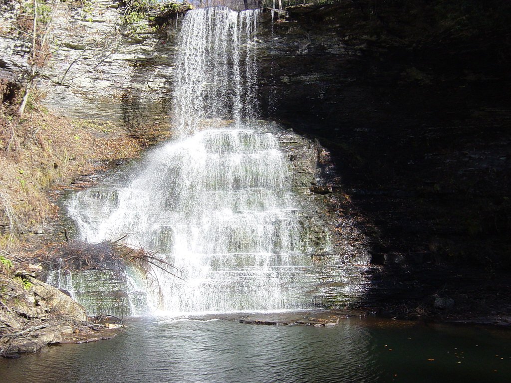
Upper Falls
By Armen Suny · Last verified Mar 2026
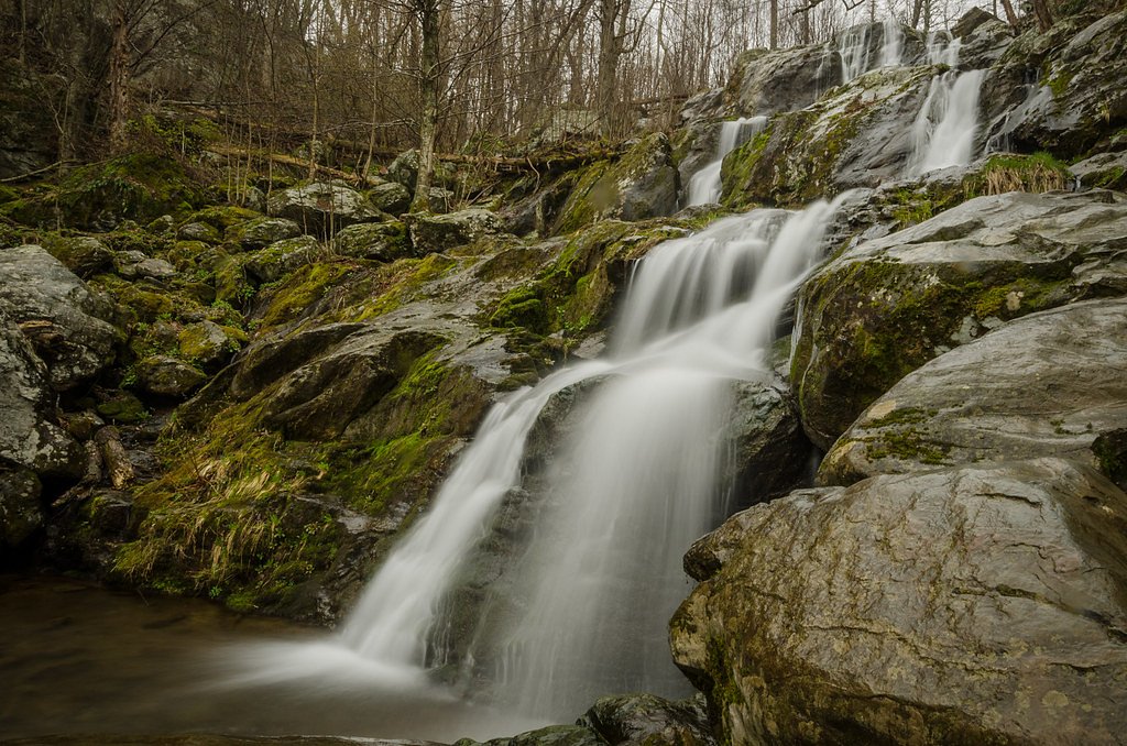
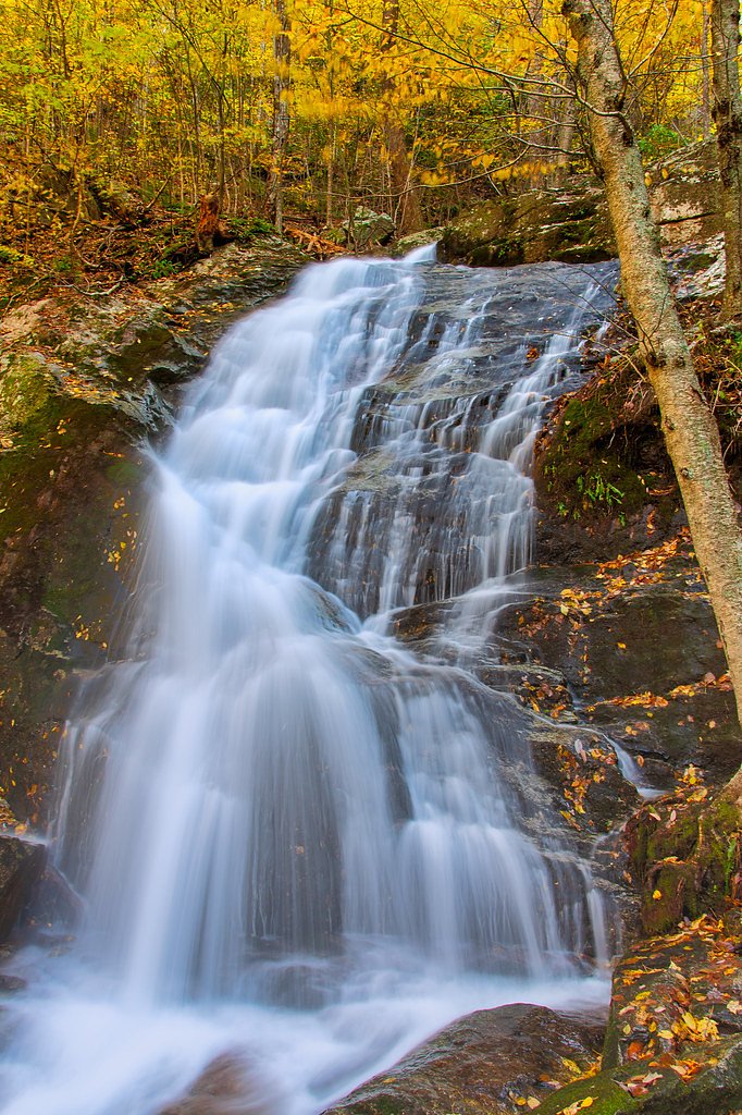
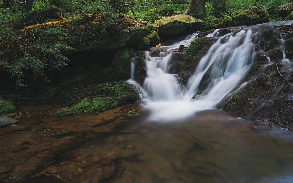


Photo Credits (5)
Difficulty
Moderate
Trail Length
2.0 miles
Trail Type
Out And Back
Elevation Gain
300 ft
About Upper Falls
Upper Falls is a scenic waterfall tucked inside the Jefferson National Forest in Virginia, managed by the U.S. Forest Service. The falls and its viewpoint are a rewarding short destination for hikers and nature lovers seeking woodland scenery and a classic National Forest outing. The site sits along trails maintained by the USFS and is identified on Forest Service maps by the Cascades Overlook route. The approach to the falls is an out-and-back hike of about 2.0 miles round trip with roughly 300 feet of elevation gain, rated moderate. Near the waterfall, the USFS lists a short spur — Cascades Overlook (Trail #70D) — that provides direct access to the overlook, so plan on a brief, steeper final approach to reach the best viewpoints of Upper Falls.
The Setting
Upper Falls sits at 2,986 feet within Jefferson National Forest, fed by the Walker Creek, in the hills of Virginia.
Trail & Hike Details
The Approach
The moderate hike follows Cascades Overlook (#70D), a 2.0-mile out-and-back trail over natural surface. Expect 300 feet of elevation gain with grades of +12-20%. The trail is highly developed (Class 4).
USFS Trail
CASCADES OVERLOOK #70D
Trail Class
Highly Developed
Surface
Avg Grade
USFS Segment
0.03 miTrail Description
The main route to Upper Falls is a 2.0-mile out-and-back hike with approximately 300 feet of elevation gain and a moderate difficulty rating. The overall trail is suitable for most hikers prepared for a moderate climb over forest terrain. For final access to the waterfall viewpoint, the U.S. Forest Service identifies Cascades Overlook (Trail #70D) as a short 0.03 GIS-mile spur. That segment is listed as Class 4 with a native-material surface and a typical grade of +12–20%, so expect a brief but steeper and more rugged approach on native tread to reach the overlook.
What to Expect
Dogs are welcome.
Accessibility
The trail is not wheelchair accessible. Uneven terrain and elevation changes require steady footing.
Frequently Asked Questions
🐶 Are Dogs Allowed at Upper Falls?
✅ Dogs are allowed
Are There Any Fees or Permits Required?
🤑 Fee: $0.00
🏊 Is There Swimming at Upper Falls?
❌ Swimming is not allowed
When to Visit
Spring and fall are ideal for visiting due to pleasant weather and vibrant foliage. Summer is also popular, but trails may be busier.
Seasonal Access
The best time to visit is Spring, Summer, and Fall. Winter access may be limited. Check with Jefferson National Forest for seasonal road closures.
Safety Information
The trail may have uneven terrain, slippery rocks, and muddy sections. Always stay on marked trails and exercise caution near the waterfall. Check for trail closures or weather advisories before visiting.
Current Water Conditions
38 ft³/s
Current discharge — how much water is flowing
Much lower than usual for this time of year
Based on 88 years of record
2.90 ft
Water depth at gauge
7-Day Discharge Trend
What does this mean for your visit?
Flow is well below normal for this time of year, so the waterfall may be a trickle.
About This Gauge
This gauge is on a nearby waterway and may not reflect exact conditions at the falls.
7-Day Flow Outlook
Based on the USGS gauge WALKER CREEK AT BANE, VA (17 km away).
Today
Low
43 cfs
3/10Tomorrow
Low
46 cfs
3/10Tue
Barely Flowing
41 cfs
5/10Wed
Barely Flowing
38 cfs
5/10Thu
Barely Flowing
38 cfs
5/10Fri
Low
43 cfs
3/10Sat
Low
46 cfs
3/10Best window: Tue — barely flowing flow, mostly sunny (trip score 5/10).
How we calculate this
This is a transparent outlook, not a precise forecast. We take the waterfall's current flow strength (how it ranks against its historical normal for today, from the nearest USGS stream gauge), carry that ranking forward along the gauge's seasonal curve, and nudge it for forecast rain. Confidence is highest for the next day or two and falls further out. Always check official conditions and your own judgment before visiting — high flows can be dangerous.
Know when to go.
Get a free email alert when waterfalls near Pembroke hit peak flow. We only send when conditions are worth the trip — no weekly newsletters, no spam.
Weather Forecast
Location & Access
Getting There
Upper Falls is typically accessed via hiking trails within a state park or forest area in Virginia. Specific directions may vary depending on the trailhead used.
Get Directions on Google MapsParking
Parking is available near the trailhead, but availability may be limited during peak seasons.
Elevation
2,986 feet above sea level
Coordinates
37.371792° N, -80.574507° W
Land Management
Managed by USFS
Visitor Tips & Gear
Wear sturdy hiking shoes, bring water, and check weather conditions before your visit. Arrive early to secure parking, especially during weekends or holidays.
As an Amazon Associate, we earn from qualifying purchases.
With 2.0 miles and 300 ft of elevation gain, sturdy boots and trekking poles will help on this moderate trail. Sun exposure on the trail makes good sun protection a must in summer.

Polarized Sunglasses (Knockaround)
Cuts glare off the water so you actually see the falls — and your photos turn out better too.

Columbia Watertight II Rain Jacket
Packs into its own pocket, seam-sealed, and keeps you dry from spray and surprise rain.

Earth Pak Waterproof Dry Bag
Keeps your phone and gear dry when waterfall mist soaks everything else.

Waterproof Phone Pouch (AiRunTech)
Cheap insurance — take photos right next to the falls without killing your phone.

Timberland Euro Sprint Mid Waterproof
Trusted waterproof boot with premium leather and grippy rubber sole — reliable on rocky, wet trails.

TrailBuddy Trekking Poles
Lightweight aluminum, cork grips, and flip-locks that actually hold — a best-seller for good reason.
Where to Stay

The Inn at Virginia Tech - On Campus

Hyatt Place Blacksburg/University

Hilton Garden Inn Blacksburg University

Residence Inn by Marriott Blacksburg-University
Browse vacation cabins and private rentals nearby
Unique outdoor stays — tents, yurts, and treehouses
Rent a campervan or RV for your waterfall road trip
Some links are affiliate links. We may earn a commission at no extra cost to you.
Nearby Campground
Eastern Divide Ranger District
13 miles away · 0 sites
Recreational areas and opportunities within the Eastern Divide Ranger District.
Book on Recreation.govNearby Hot Springs
Hot springs near Pembroke, Virginia

New River White Sulphur Springs
New River White Sulphur Springs produces 85-degree water that flows 30.3 degrees above ambient temperature at 1,780 feet elevat...
Alum Springs
Alum Springs flows at 72°F in Pulaski County, Virginia, emerging 18.4 degrees above the 53.6°F ambient temperature at 1,967 fee...

Old Sweet Spring
Old Sweet Spring flows at 73°F from a site 59.3 meters from Jefferson Lane in Greenbrier County, West Virginia. The spring emer...
Sweet Chalybeate Spring
Sweet Chalybeate Spring flows at 75 degrees Fahrenheit, emerging 21.1 degrees above ambient temperature at 2,010 feet elevation...
Layton Spring
Layton Spring produces 72-degree water that flows 17.2 degrees above ambient temperature at 1,334 feet elevation in the City of...
Falling Spring
Falling Spring emerges at 77 degrees Fahrenheit, flowing 25 degrees above the ambient temperature in the City of Covington, Vir...
Looking for a soak after your hike? Explore more hot springs near Pembroke, Virginia on SoakingSprings.
Explore Virginia springsAdditional Information
Nearby Attractions
Nearby attractions may include other hiking trails, scenic overlooks, and picnic areas within the park or forest.
Wildlife
The area is home to a variety of wildlife, including birds, deer, and small mammals. Be cautious of snakes and other potentially hazardous animals.
Cities near Upper Falls
Nearby Waterfalls
Other waterfalls named Upper Falls
27 other waterfalls share this name across the U.S.
Writing about Upper Falls? Embed this waterfall on your site for free.