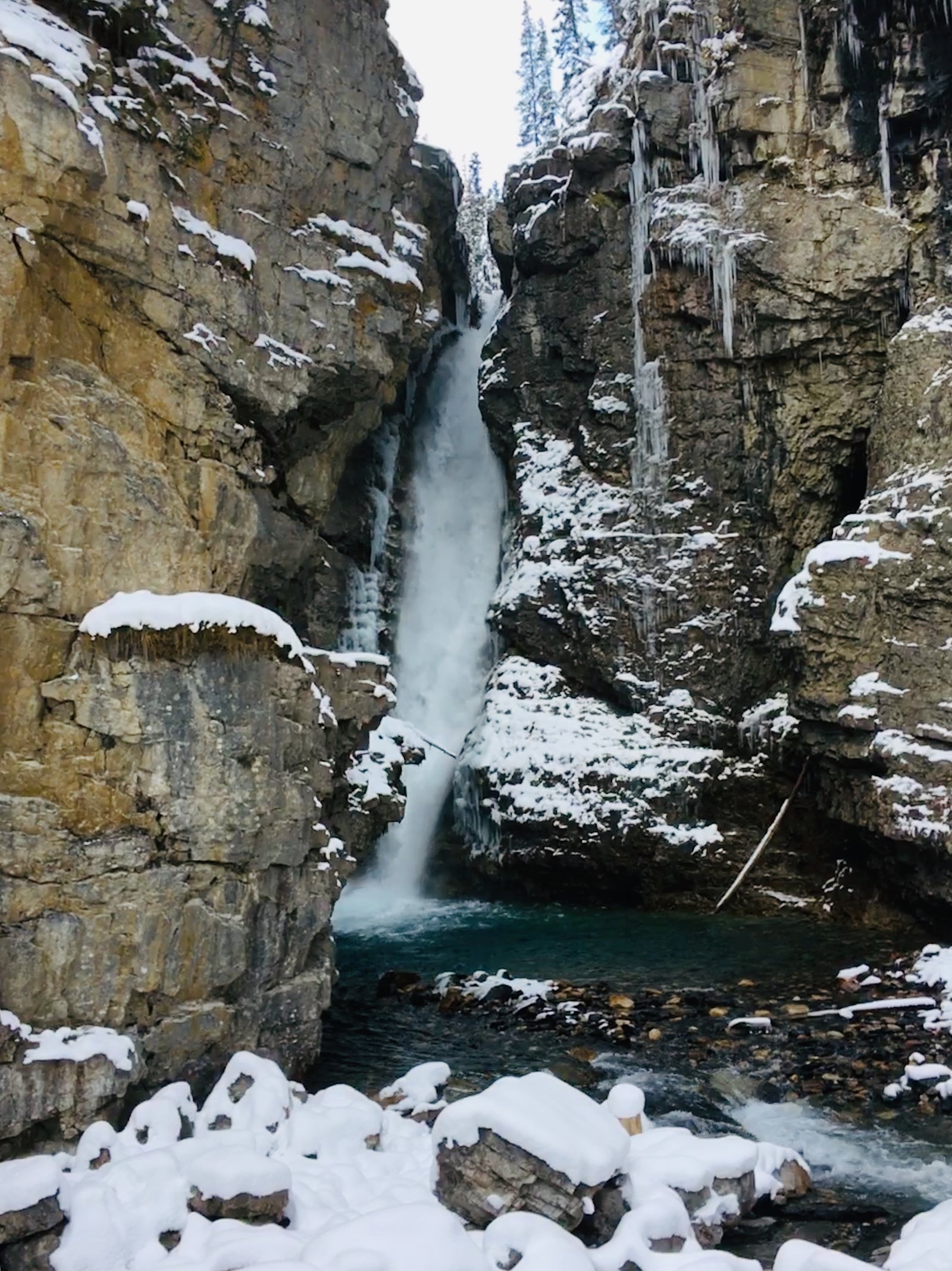
Upper Falls
Alberta • Banff National Park • 30 m
By Armen Suny · Last verified Jun 2026
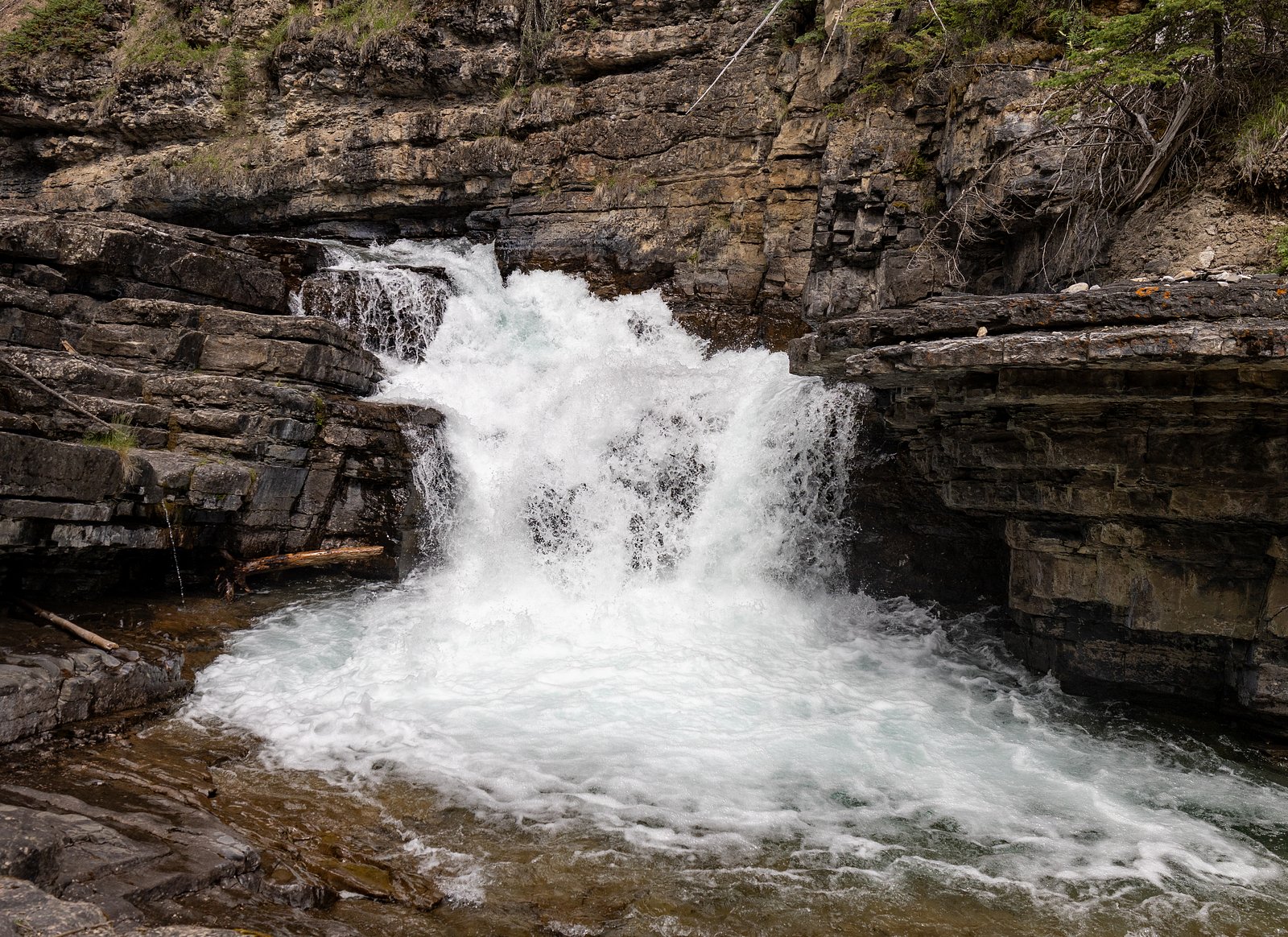
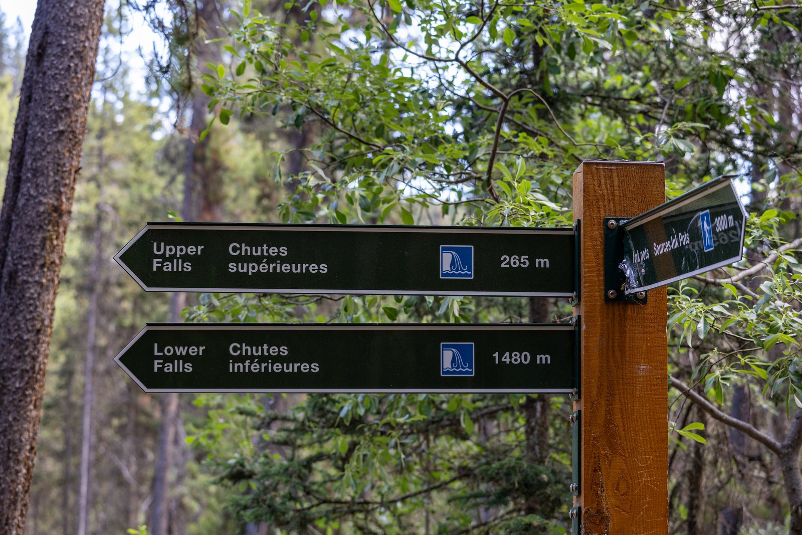
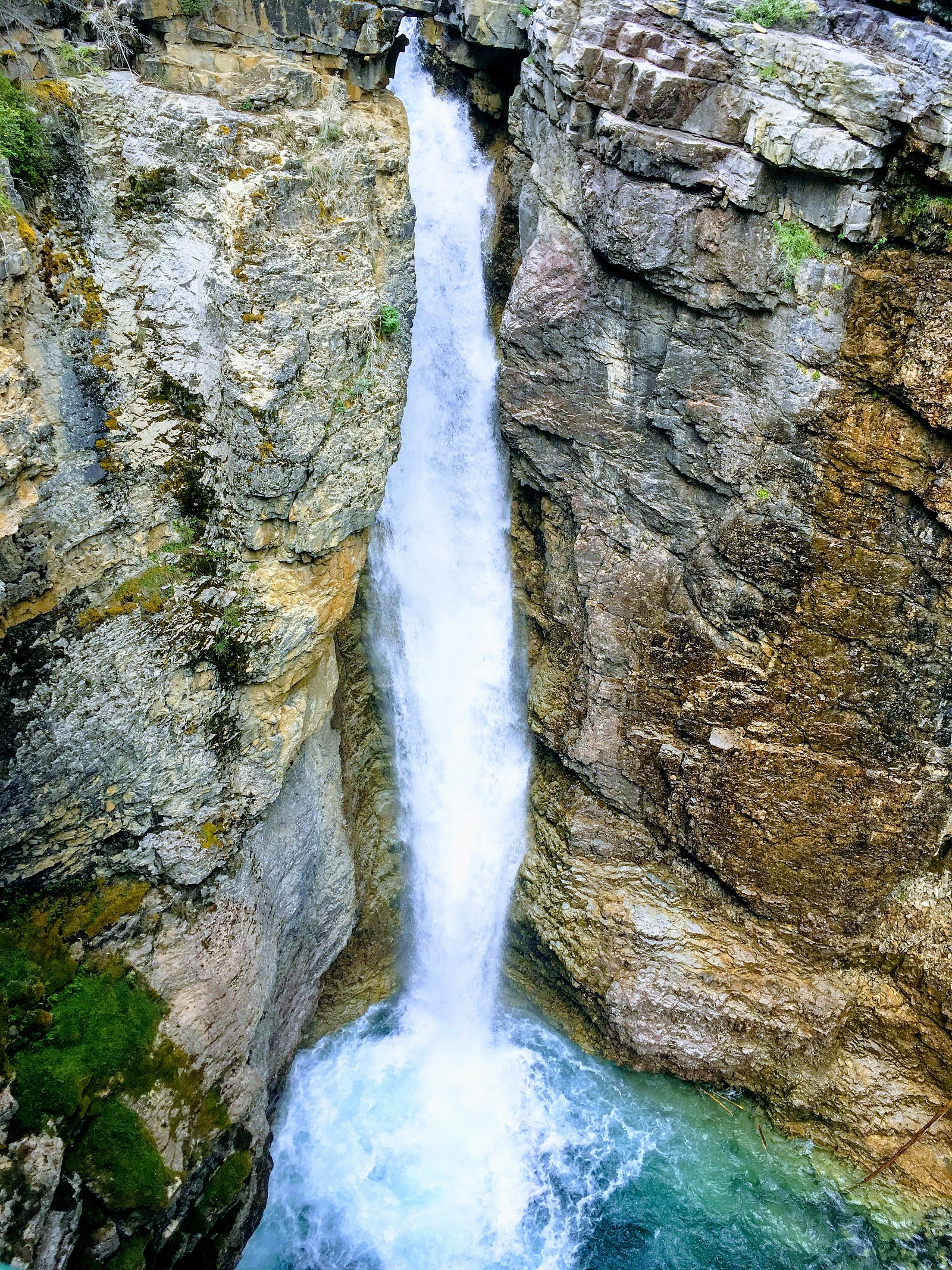
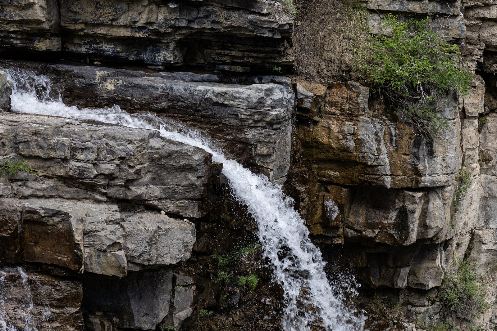
Photo Credits (5)
Difficulty
Moderate
Trail Length
5.6 km
Trail Type
Out And Back
Elevation Gain
276 m
About Upper Falls
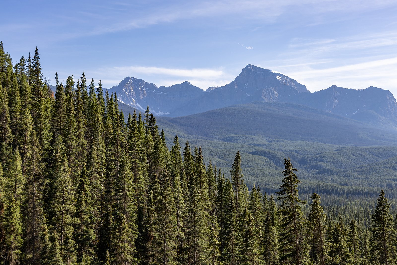
Upper Falls (coordinates 51.2619, -115.8313) is a mountain cascade located in the Canadian Rockies near Banff National Park. It sits roughly 16 miles from Banff and about 23 miles from Lake Louise. The falls are a scenic mountain-waterfall setting typical of the region, steep-walled channels, rocky viewpoints and seasonal variability in flow. Specific historic or measured height information for this particular 'Upper Falls' location is not confirmed here.
The Setting
Upper Falls sits at 1,587 metres within Banff National Park, in the high mountains of Alberta. At 30 metres, it is among the taller waterfalls in Alberta.
Why This Waterfall Exists
Upper Falls flows over layered carbonate rock, primarily limestone and sandstone, laid down about 201-323 million years ago. These soft rocks erode readily, allowing the stream to carve a 100-foot drop into the landscape.
Nearby Falls Worth Visiting
Water Falls (50 m) lies 5.5 kilometres to the west. Also nearby: Lower Falls (9 m, 0.8 km).
Trail & Hike Details
The Approach
The moderate 5.6-km out-and-back trail gains 276 metres of elevation on the way to the falls.
Trail Description
Trail information for this exact 'Upper Falls' location is not fully confirmed here. Typical approaches to Upper Falls in the Banff/Lake Louise area are out-and-back trails that travel through forest and alpine meadows, often with some rocky sections, short steep pitches or stairs near viewpoints, and a final approach that may involve uneven rock or gravel near the river. Trails in this area can range from well-built boardwalks/footpaths to rougher hiking trails. Expect viewpoint areas with limited railings and potentially narrow ledges near the water.
What to Expect
The falls cascade 30 metres over soft fine-grained rock.
Accessibility
The trail is not wheelchair accessible. Uneven terrain and elevation changes require steady footing.
Frequently Asked Questions
🐶 Are Dogs Allowed at Upper Falls?
❌ Dogs are not allowed
Are There Any Fees or Permits Required?
🆖 No fees required
🏊 Is There Swimming at Upper Falls?
❌ Swimming is not allowed
When to Visit
Late spring to early summer (May–June) for highest water flow from snowmelt; summer (July–Aug) for reliable access and warmer weather; fall for foliage and quieter trails. Winter can offer dramatic frozen scenes but access may be hazardous and requires winter equipment and experience.
Seasonal Access
The best time to visit is Spring, Summer, Fall, and Winter. Check with Banff National Park for current conditions.
Safety Information
Hazards include slippery wet rock, steep drop-offs, rapidly rising water during spring melt or after heavy rain, icy conditions in winter, and wildlife encounters (bears). Cell service may be limited, carry a map, let someone know your plan, and bring emergency supplies. If in Banff National Park, obey all park signage and closures. For winter visits, bring traction devices, check avalanche forecasts for backcountry routes, and avoid travel in avalanche-prone terrain without proper training and equipment.
Current Water Conditions
109.0 m³/s
Current discharge — how much water is flowing
About average for this time of year
Based on 117 years of record
2.73 m
Water depth at gauge
7-Day Discharge Trend
What does this mean for your visit?
Flow is about average for this time of year.
About This Gauge
This gauge is on a nearby waterway and may not reflect exact conditions at the falls.
7-Day Flow Outlook
Based on the WSC gauge BOW RIVER AT BANFF (21 km away).
Today
Moderate
109 m³/s
9/10Tomorrow
Moderate
108 m³/s
8/10Tue
Moderate
108 m³/s
8/10Wed
Moderate
106 m³/s
8/10Thu
Moderate
115 m³/s
6/10Fri
Moderate
109 m³/s
9/10Sat
Moderate
103 m³/s
9/10Best window: Today — moderate flow, mainly sunny (trip score 9/10).
Best time of year: this gauge typically runs highest from late May to late August, peaking in June.
How we calculate this
This is a transparent outlook, not a precise forecast. We take the waterfall's current flow strength (how it ranks against its historical normal for today, from the nearest WSC stream gauge), carry that ranking forward along the gauge's seasonal curve, and nudge it for forecast rain. Confidence is highest for the next day or two and falls further out. Always check official conditions and your own judgment before visiting — high flows can be dangerous.
Know when to go.
Get a free email alert when waterfalls near Banff hit peak flow. We only send when conditions are worth the trip — no weekly newsletters, no spam.
Weather Forecast
Location & Access
Getting There
From Banff: drive west on the Trans-Canada Highway (Highway 1) toward Lake Louise. Use the coordinates 51.2619, -115.8313 in a GPS device or mapping app to locate the nearest pullout or trailhead. The access route will likely use a short spur or signed trail off the highway or a nearby forestry road, confirm the local trailhead name and route before you go via Parks Canada or a trusted trail resource (AllTrails, local guidebooks). Expect forested mountain roads and limited cell service in places.
Get Directions on Google MapsParking
Parking is likely limited and may be an unpaved pullout or small trailhead lot. If the falls are inside or adjacent to Banff National Park, a valid park pass is required to park. Arrive early on summer weekends to find space. Check Parks Canada or local trail resources for exact parking location and restrictions.
Elevation
1,587 metres above sea level
Coordinates
51.261864° N, -115.831285° W
Land Management
Managed by Parks Canada Agency
Visitor Tips & Gear
1) Check Parks Canada or local trail guides for the exact trailhead and up-to-date conditions before visiting. 2) Carry a valid park pass if the site is inside Banff National Park. 3) Wear sturdy shoes with good traction; bring microspikes in winter. 4) Stay on established trails and maintain distance from the edge, wet rock is slippery and falls are hazardous. 5) Be bear aware: travel in groups, make noise, carry bear spray and know how to use it. 6) Arrive early on busy days to secure parking and avoid crowds. 7) Leave no trace; pack out what you bring.
As an Amazon Associate, we earn from qualifying purchases.
With 5.6 km and 276 m of elevation gain, sturdy boots and trekking poles will help on this moderate trail. Icy conditions are common in winter — traction cleats are a smart addition.

Columbia Watertight II Rain Jacket
Packs into its own pocket, seam-sealed, and keeps you dry from spray and surprise rain.

Polarized Sunglasses (Knockaround)
Cuts glare off the water so you actually see the falls — and your photos turn out better too.

Earth Pak Waterproof Dry Bag
Keeps your phone and gear dry when waterfall mist soaks everything else.

Waterproof Phone Pouch (AiRunTech)
Cheap insurance — take photos right next to the falls without killing your phone.

Timberland Euro Sprint Mid Waterproof
Trusted waterproof boot with premium leather and grippy rubber sole — reliable on rocky, wet trails.

TrailBuddy Trekking Poles
Lightweight aluminum, cork grips, and flip-locks that actually hold — a best-seller for good reason.
Where to Stay
Browse vacation cabins and private rentals nearby
Unique outdoor stays — tents, yurts, and treehouses
Rent a campervan or RV for your waterfall road trip
Some links are affiliate links. We may earn a commission at no extra cost to you.
Nearby Campground
Johnston Canyon Campground
2.4 km away
Additional Information
Nearby Attractions
Town of Banff, Lake Louise, Moraine Lake, Bow River viewpoints, various trailheads and alpine lakes in the Banff/Lake Louise corridor. Exact nearby trail attractions depend on the precise trailhead for these coordinates.
Wildlife
Black and grizzly bears, elk, deer, bighorn sheep, mountain goats, marmots and various bird species. Practice wildlife safety: keep distance, do not feed wildlife, store food securely.
Cities near Upper Falls
Nearby Waterfalls
Other waterfalls named Upper Falls
27 other waterfalls share this name across Canada.
Writing about Upper Falls? Embed this waterfall on your site for free.