
Photo Credits (5)
Difficulty
Moderate
Trail Length
2.4 miles
Trail Type
Out And Back
Elevation Gain
350 ft
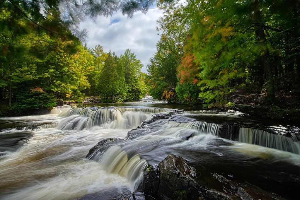
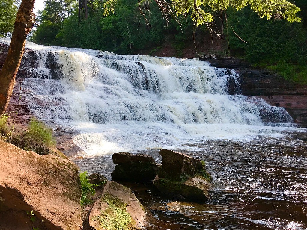
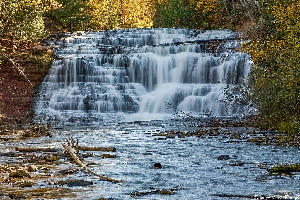
About Upper Falls
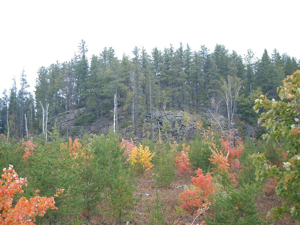
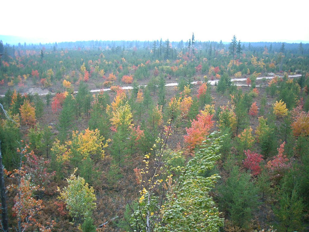
Upper Falls is a quietly photogenic cascade tucked into Michigan’s Upper Peninsula along the Slate River, framed by northern hardwoods and the rugged uplands of the region. The falls are set within the Huron Mountain Club land unit — private property designated PCON and managed by the club — which gives the setting a secluded, largely undisturbed feel. Visitors often praise the peaceful outlooks and forested approach that make Upper Falls a rewarding stop for nature lovers exploring the U.P. Because the falls lie on private Huron Mountain Club property (land owner/manager: PVT; designation: PCON), visitors should be mindful of access rules and any posted restrictions. The route to the viewing area is moderate in effort and best enjoyed by those prepared for a short hike through forested terrain; approach respectfully and leave no trace to help preserve this secluded spot.
The Setting
Upper Falls sits at 837 feet within Huron Mountain Club, fed by the East Branch Salmon Trout River, in the foothills of Michigan.
Nearby Falls Worth Visiting
Eighty Foot Falls (80 ft) lies 2.7 miles to the north.
Trail & Hike Details
The Approach
The moderate 2.4-mile out-and-back trail gains 350 feet of elevation on the way to the falls.
Trail Description
The trail to Upper Falls is an out-and-back route measuring 2.4 miles round trip with about 350 feet of elevation gain and a moderate difficulty rating. The path follows forested terrain from the trailhead to the viewing area at the falls; official USFS trail surface/grade/class data are not available for this route (the land is managed by the private Huron Mountain Club). Hikers should expect natural tread and typical single-track conditions for a moderate woods hike, and observe any access rules posted by the property manager.
What to Expect
Dogs are welcome.
Accessibility
The trail is not wheelchair accessible. Uneven terrain and elevation changes require steady footing.
Frequently Asked Questions
🐶 Are Dogs Allowed at Upper Falls?
✅ Dogs are allowed
Are There Any Fees or Permits Required?
🆖 No fees required
🏊 Is There Swimming at Upper Falls?
❌ Swimming is not allowed
When to Visit
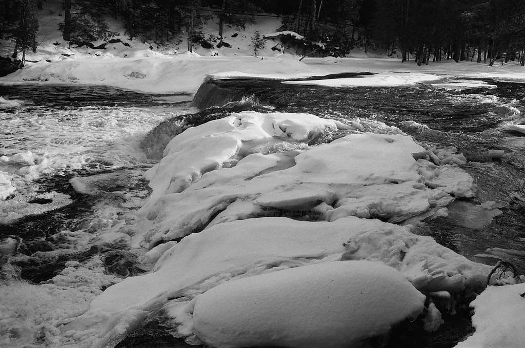
Spring and early summer are ideal for visiting, as the water flow is typically stronger due to snowmelt. Fall offers beautiful foliage, while winter provides a unique view of the frozen waterfall.
Seasonal Access
The best time to visit is Spring, Summer, Fall, and Winter.
Safety Information
Exercise caution near the waterfall, as rocks may be slippery. Be prepared for changing weather conditions and carry a map or GPS device.
Current Water Conditions
16 ft³/s
Current discharge — how much water is flowing
About average for this time of year
Based on 20 years of record
1.65 ft
Water depth at gauge
51°F
ColdBracing — limit time in water
7-Day Discharge Trend
What does this mean for your visit?
Flow is about average for this time of year. Water temperature is a bracing 51 degrees F, limit your time in the water. Mineral content is typical.
Water Quality
Conductance
Dissolved minerals in the water
About This Gauge
7-Day Flow Outlook
Based on the USGS gauge EAST BRANCH SALMON TROUT RIVER NEAR DODGE CITY, MI (3 km away).
Today
Strong
16 cfs
10/10Tomorrow
Strong
15 cfs
10/10Sun
Strong
19 cfs
8/10Mon
Roaring
19 cfs
6/10Tue
Roaring
20 cfs
6/10Wed
Roaring
20 cfs
6/10Thu
Roaring
18 cfs
6/10Best window: Today — strong flow, mostly sunny (trip score 10/10).
Best time of year: this gauge typically runs highest from mid March to mid May, peaking in April.
How we calculate this
This is a transparent outlook, not a precise forecast. We take the waterfall's current flow strength (how it ranks against its historical normal for today, from the nearest USGS stream gauge), carry that ranking forward along the gauge's seasonal curve, and nudge it for forecast rain. Confidence is highest for the next day or two and falls further out. Always check official conditions and your own judgment before visiting — high flows can be dangerous.
Know when to go.
Get a free email alert when waterfalls near Big Bay hit peak flow. We only send when conditions are worth the trip — no weekly newsletters, no spam.
Weather Forecast
Location & Access
Getting There
Upper Falls is located near Big Bay, approximately 6.5 miles away, and can be accessed via local roads. The coordinates for the waterfall are 46.8153, -87.8531. Visitors should follow signs for the Slate River area.
Get Directions on Google MapsParking
Parking is available near the trailhead, but the size and availability of the parking area may vary. It is recommended to arrive early during peak seasons.
Elevation
837 feet above sea level
Coordinates
46.815278° N, -87.853056° W
Land Management
Managed by PVT
Visitor Tips & Gear
Wear sturdy footwear, especially if visiting during wet conditions. Bring insect repellent during the summer months, as mosquitoes and other insects may be present. Arrive early to secure parking and enjoy a quieter experience.
As an Amazon Associate, we earn from qualifying purchases.
With 2.4 miles and 350 ft of elevation gain, sturdy boots and trekking poles will help on this moderate trail. Icy conditions are common in winter — traction cleats are a smart addition.

Columbia Watertight II Rain Jacket
Packs into its own pocket, seam-sealed, and keeps you dry from spray and surprise rain.

Polarized Sunglasses (Knockaround)
Cuts glare off the water so you actually see the falls — and your photos turn out better too.

Earth Pak Waterproof Dry Bag
Keeps your phone and gear dry when waterfall mist soaks everything else.

Waterproof Phone Pouch (AiRunTech)
Cheap insurance — take photos right next to the falls without killing your phone.

Timberland Euro Sprint Mid Waterproof
Trusted waterproof boot with premium leather and grippy rubber sole — reliable on rocky, wet trails.

TrailBuddy Trekking Poles
Lightweight aluminum, cork grips, and flip-locks that actually hold — a best-seller for good reason.
Where to Stay

Independence Stay Hotel and Long term suites

AC4 Northwoods Getaway w Jetted Tub

Lakefront Lookout! Private Sand Beach on Superior

Private Beach! Year-Round Lake Superior Retreat
Browse vacation cabins and private rentals nearby
Unique outdoor stays — tents, yurts, and treehouses
Rent a campervan or RV for your waterfall road trip
Some links are affiliate links. We may earn a commission at no extra cost to you.
Additional Information
Nearby Attractions
Other nearby attractions include Big Bay, the Slate River, and various hiking trails in the area.
Wildlife
The area is home to a variety of wildlife, including deer, birds, and small mammals. Visitors should be cautious of bears and other larger animals.
Cities near Upper Falls
Nearby Waterfalls
Other waterfalls named Upper Falls
27 other waterfalls share this name across the U.S.
Writing about Upper Falls? Embed this waterfall on your site for free.