

Photo Credits (5)
Difficulty
Moderate
Trail Length
3.5 miles
Trail Type
Out And Back
Elevation Gain
600 ft
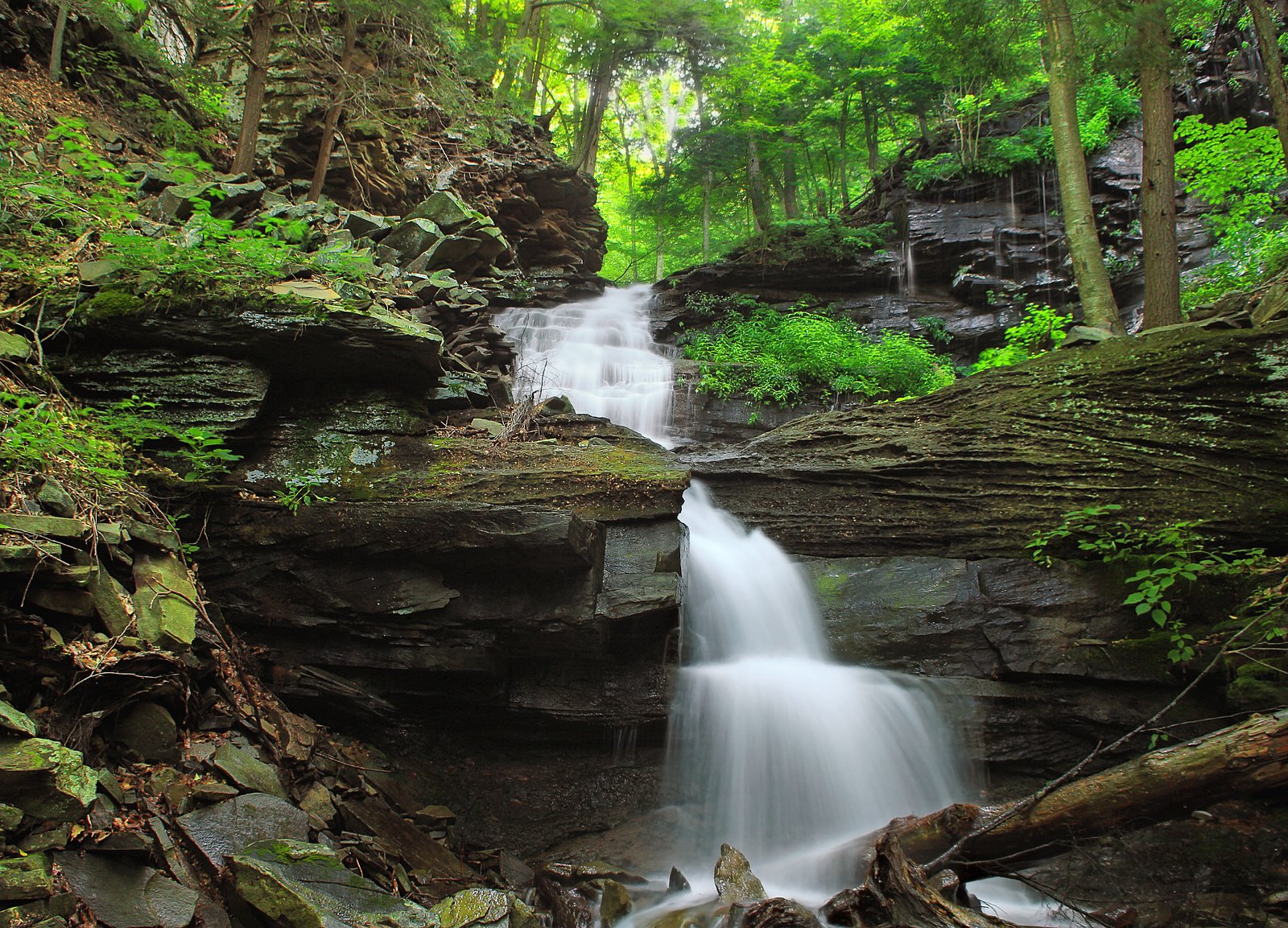
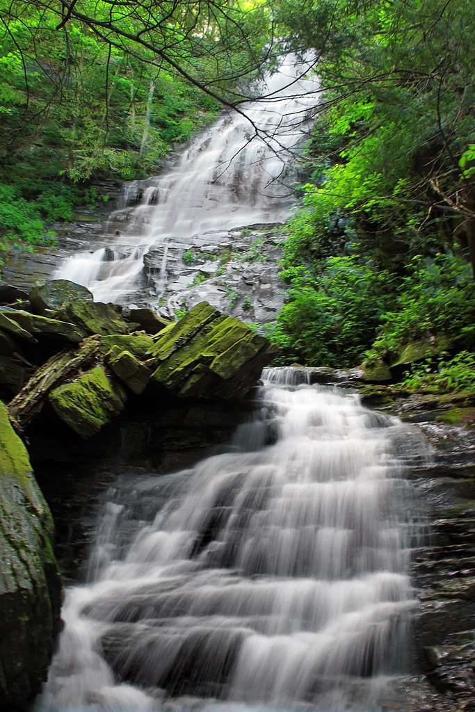
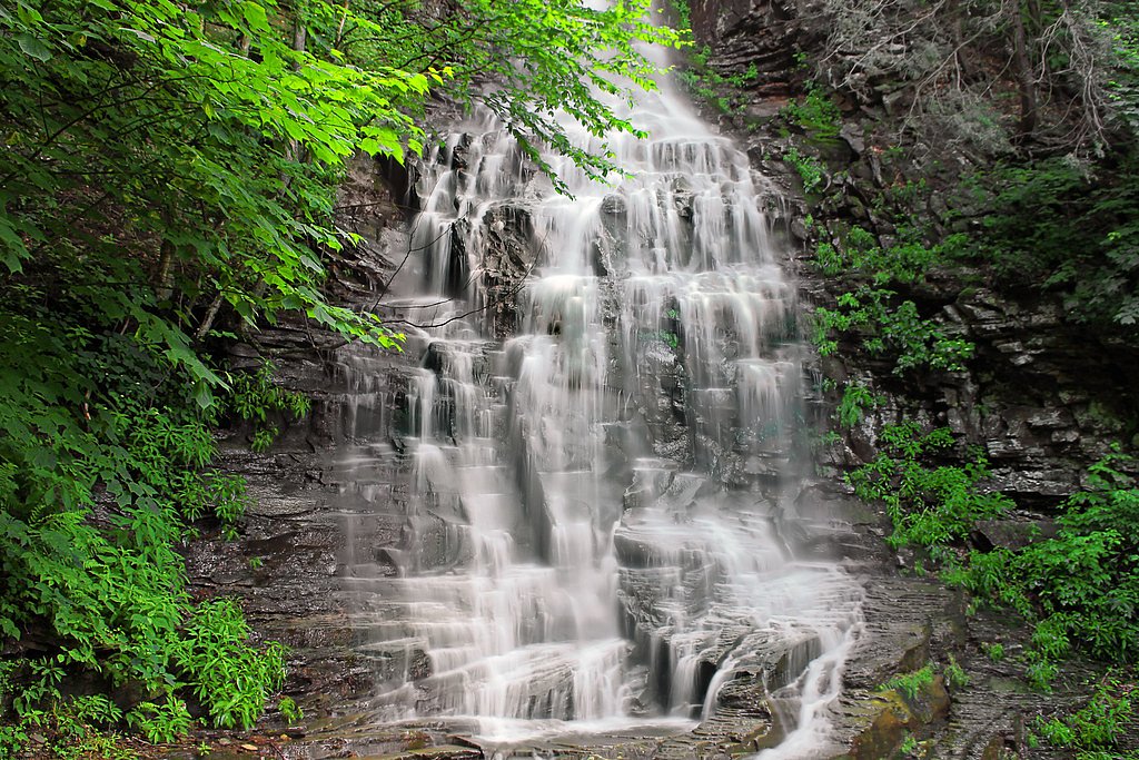
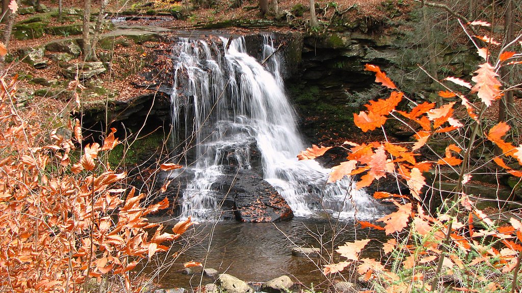
About Angel Falls
Angel Falls is a picturesque waterfall located in the Loyalsock State Forest in Pennsylvania. It is known for its serene setting and cascading waters, making it a popular destination for hikers and nature enthusiasts.
The Setting
Angel Falls sits at 1,414 feet within Loyalsock State Forest, fed by the Muncy Creek, in the foothills of Pennsylvania.
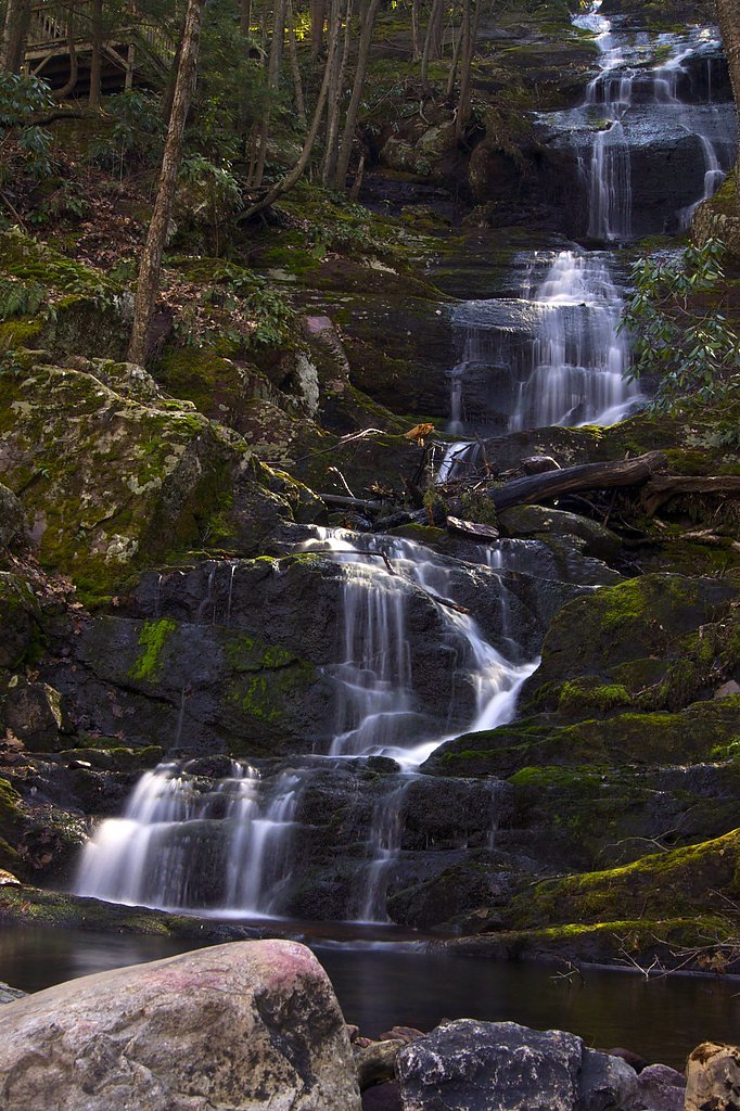
Nearby Falls Worth Visiting
Buttermilk Falls (45 ft) lies 10.5 miles to the northwest. Also nearby: Dry Run Falls (15 ft, 2.5 mi).
Trail & Hike Details
The Approach
The moderate 3.5-mile out-and-back trail gains 600 feet of elevation on the way to the falls.
Trail Description
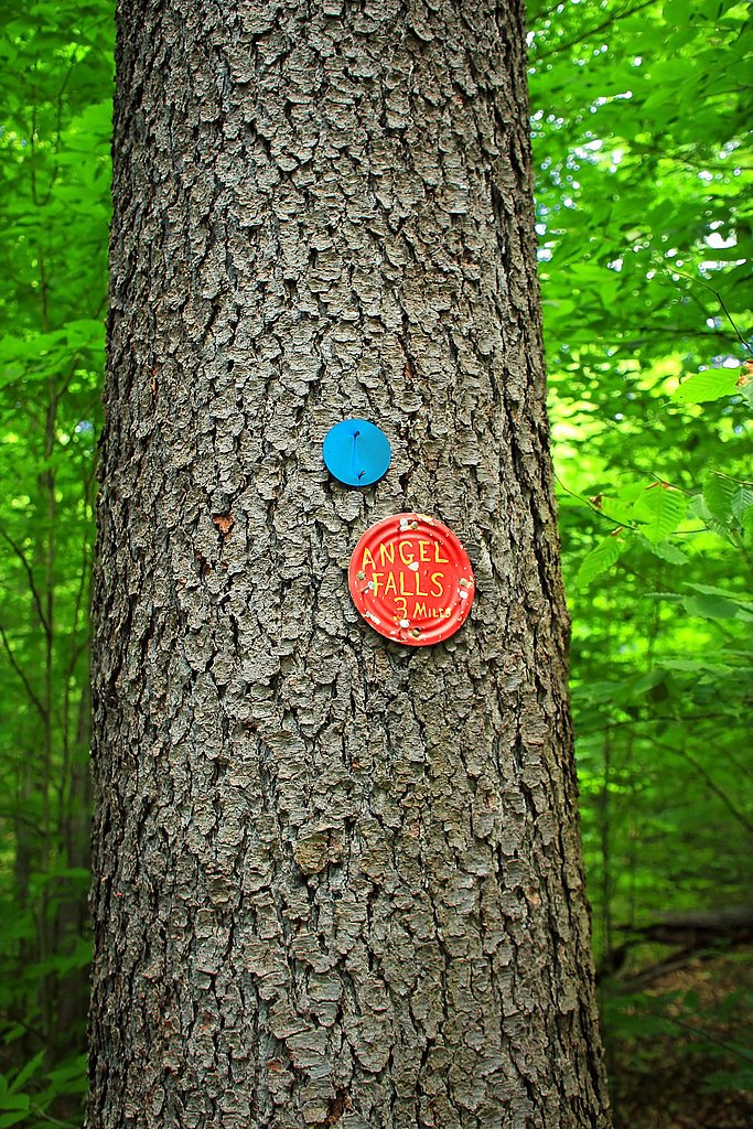
The trail to Angel Falls follows a section of the Loyalsock Trail and features a mix of forested paths, rocky terrain, and moderate elevation gain. The trail is well-marked but may be slippery after rain or during the winter months.
What to Expect
Dogs are welcome.
Accessibility
The trail is not wheelchair accessible. Uneven terrain and elevation changes require steady footing.
Frequently Asked Questions
🐶 Are Dogs Allowed at Angel Falls?
✅ Dogs are allowed
Are There Any Fees or Permits Required?
🆖 No fees required
🏊 Is There Swimming at Angel Falls?
❌ Swimming is not allowed
When to Visit
Spring and early summer are ideal for visiting Angel Falls, as the water flow is typically strongest during these seasons.
Seasonal Access
The best time to visit is Spring, Summer, and Fall. Winter access may be limited.
Safety Information
The trail can be slippery, especially after rain or during winter. Use caution near the waterfall, as the rocks can be wet and unstable. Cell phone service may be limited in the area.
Current Water Conditions
8 ft³/s
Current discharge — how much water is flowing
About average for this time of year
Based on 85 years of record
1.64 ft
Water depth at gauge
7-Day Discharge Trend
What does this mean for your visit?
Flow is about average for this time of year.
About This Gauge
This gauge is on a nearby waterway and may not reflect exact conditions at the falls.
7-Day Flow Outlook
Based on the USGS gauge Muncy Creek near Sonestown, PA (13 km away).
Today
Moderate
8 cfs
6/10Tomorrow
Moderate
9 cfs
4/10Wed
Moderate
7 cfs
8/10Thu
Moderate
6 cfs
8/10Fri
Moderate
8 cfs
4/10Sat
Moderate
8 cfs
4/10Sun
Moderate
8 cfs
4/10Best window: Wed — moderate flow, sunny (trip score 8/10).
Best time of year: this gauge typically runs highest from late February to early May, peaking in April.
How we calculate this
This is a transparent outlook, not a precise forecast. We take the waterfall's current flow strength (how it ranks against its historical normal for today, from the nearest USGS stream gauge), carry that ranking forward along the gauge's seasonal curve, and nudge it for forecast rain. Confidence is highest for the next day or two and falls further out. Always check official conditions and your own judgment before visiting — high flows can be dangerous.
Know when to go.
Get a free email alert when waterfalls near Eagles Mere hit peak flow. We only send when conditions are worth the trip — no weekly newsletters, no spam.
Weather Forecast
Location & Access
Getting There
Angel Falls is located in the Loyalsock State Forest, near the town of Dushore, Pennsylvania. The trailhead can be accessed via Rock Run Road, and visitors should follow signs for the Loyalsock Trail.
Get Directions on Google MapsParking
Parking is available at the trailhead along Rock Run Road. Space may be limited, especially during peak seasons.
Elevation
1,414 feet above sea level
Coordinates
41.393770° N, -76.677093° W
Land Management
Managed by SDNR
Visitor Tips & Gear
Wear sturdy hiking shoes, as the trail can be uneven and slippery. Bring water and snacks, and consider visiting during the spring or after rainfall for the best waterfall flow.
As an Amazon Associate, we earn from qualifying purchases.
With 3.5 miles and 600 ft of elevation gain, sturdy boots and trekking poles will help on this moderate trail. Sun exposure on the trail makes good sun protection a must in summer.

Polarized Sunglasses (Knockaround)
Cuts glare off the water so you actually see the falls — and your photos turn out better too.

Columbia Watertight II Rain Jacket
Packs into its own pocket, seam-sealed, and keeps you dry from spray and surprise rain.

Earth Pak Waterproof Dry Bag
Keeps your phone and gear dry when waterfall mist soaks everything else.

Waterproof Phone Pouch (AiRunTech)
Cheap insurance — take photos right next to the falls without killing your phone.

Timberland Euro Sprint Mid Waterproof
Trusted waterproof boot with premium leather and grippy rubber sole — reliable on rocky, wet trails.

TrailBuddy Trekking Poles
Lightweight aluminum, cork grips, and flip-locks that actually hold — a best-seller for good reason.
Where to Stay

Comfort Inn Williamsport

Holiday Inn Express & Suites Williamsport by IHG

Genetti Hotel, SureStay Collection by Best Western

Holiday Inn Williamsport by IHG
Browse vacation cabins and private rentals nearby
Unique outdoor stays — tents, yurts, and treehouses
Rent a campervan or RV for your waterfall road trip
Some links are affiliate links. We may earn a commission at no extra cost to you.
Additional Information
Nearby Attractions
Other attractions in the Loyalsock State Forest include the Haystacks Trail and the Loyalsock Creek.
Wildlife
The area is home to a variety of wildlife, including deer, birds, and small mammals. Be cautious of ticks during warmer months.
Cities near Angel Falls
Nearby Waterfalls

Other waterfalls named Angel Falls
3 other waterfalls share this name across the U.S.
Writing about Angel Falls? Embed this waterfall on your site for free.