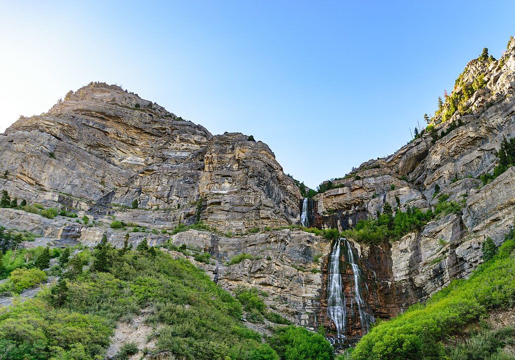
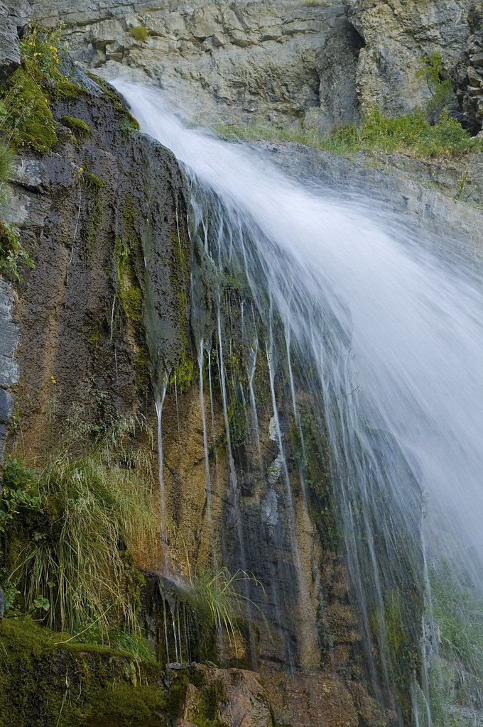
Bridal Veil Falls
Utah • 607 ft
By Armen Suny · Last verified Mar 2026
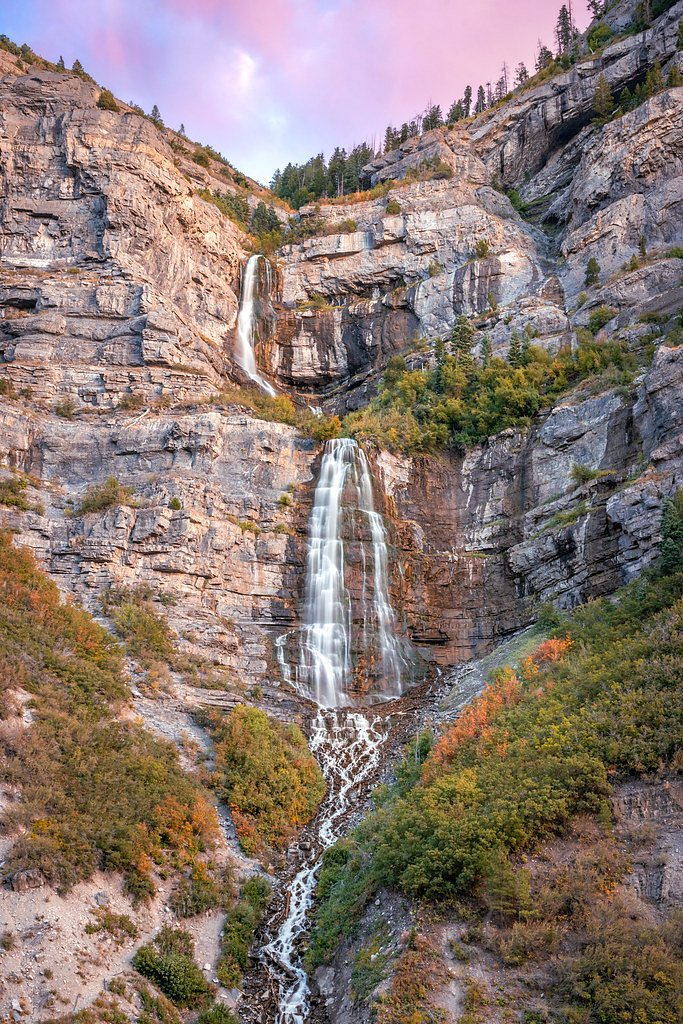
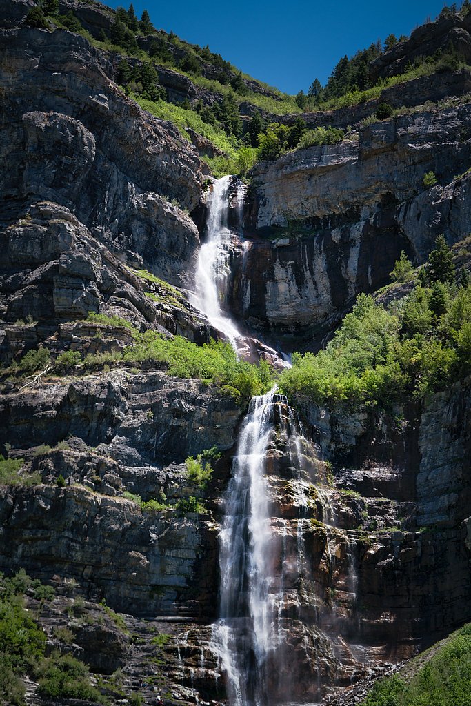
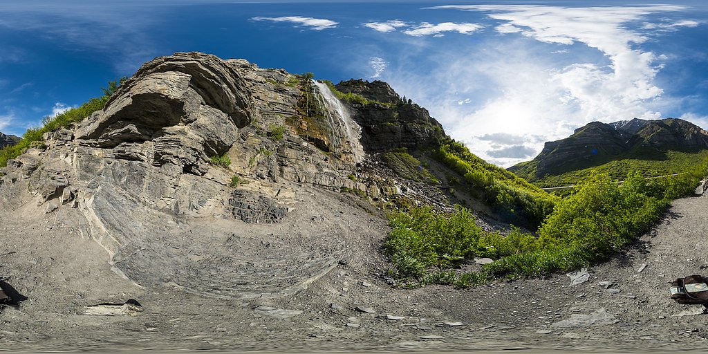
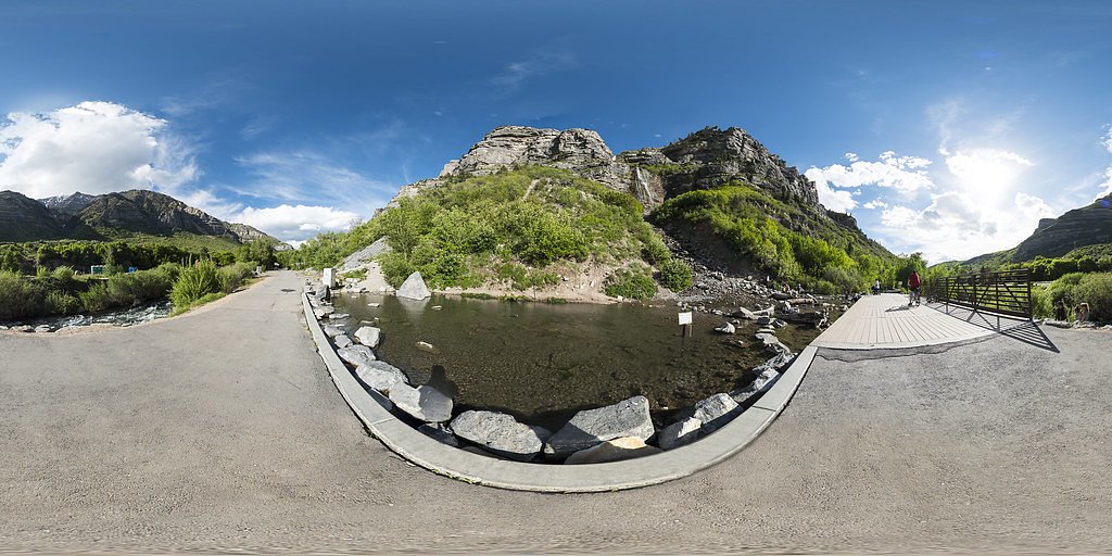

Photo Credits (5)
Difficulty
Easy
Trail Length
1.3 miles
Trail Type
Out And Back
Elevation Gain
200 ft
About Bridal Veil Falls
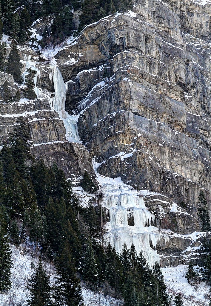
Bridal Veil Falls is a striking 607-foot (185 m) double cataract tucked into the south end of Provo Canyon, close to US‑189. Nestled within the Uinta National Forest and managed by the U.S. Forest Service, the falls are fed by mountain runoff and put on their best show in spring and early summer when snowmelt swells the cascade. Its roadside location makes it an inviting stop for day visitors and photographers who want a dramatic waterfall without a long hike.
The Setting
Bridal Veil Falls sits at 5,899 feet within Uinta National Forest, in the high mountains of Utah. At 607 feet, it is among the taller waterfalls in Utah.
Height: 607 feet
Nearby Falls Worth Visiting
Stewarts Cascades (200 ft) lies 3.4 miles to the north.
Trail & Hike Details
The Approach
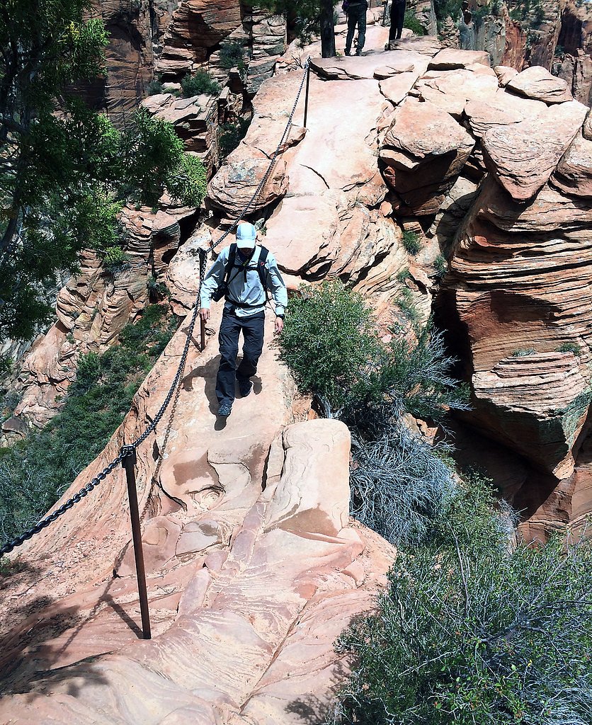
The easy hike follows Provo River Parkway (#2500), a 1.3-mile out-and-back trail over pavement. Expect 200 feet of elevation gain. The trail is fully developed (Class 5).
USFS Trail
PROVO RIVER PARKWAY #2500
Trail Class
Fully Developed
Surface
USFS Segment
0.06 miTrail Description
You can admire Bridal Veil Falls from the parking area or take a short, easy out-and-back hike of about 1.3 miles with roughly 200 feet of elevation gain to reach the base. The route is rated easy and family-friendly and follows the Provo River for much of the approach. A short paved connector of the USFS Provo River Parkway (Trail #2500) is mapped at 0.06 miles — Class 5 with an asphalt surface — which links the parking/viewing area to the main trailhead; the immediate approach is paved then continues on a well-maintained path toward the falls. Nearby features: Battle Creek Falls lies about 10 miles to the north, and the HOPE Campground is approximately 4.16 km away for those planning an overnight stay.
What to Expect
The falls plunge a dramatic 607 feet. Dogs are welcome.
Accessibility
The trail is paved and may be accessible to wheelchairs and strollers. Contact the managing agency to confirm current conditions.
Frequently Asked Questions
🐶 Are Dogs Allowed at Bridal Veil Falls?
✅ Dogs are allowed
Are There Any Fees or Permits Required?
🆖 No fees required
🏊 Is There Swimming at Bridal Veil Falls?
❌ Swimming is not allowed
When to Visit
The best time to visit is during spring and early summer when the water flow is strongest. Fall also offers beautiful foliage in the surrounding canyon.
Seasonal Access
The best time to visit is Spring, Summer, and Fall. Access roads and trails may close during winter due to snow. Watch for flash flood warnings during monsoon season (July through September). Check with Uinta National Forest for seasonal road closures.
Safety Information
Exercise caution near the base of the falls, as rocks can be slippery. During winter, ice and snow may make the trail hazardous. Always stay on marked trails and avoid climbing the falls.
Current Water Conditions
22 ft³/s
Current discharge — how much water is flowing
Much lower than usual for this time of year
Based on 94 years of record
6.27 ft
Water depth at gauge
7-Day Discharge Trend
What does this mean for your visit?
Flow is well below normal for this time of year, so the waterfall may be a trickle.
About This Gauge
This gauge is on a nearby waterway and may not reflect exact conditions at the falls.
7-Day Flow Outlook
Based on the USGS gauge AMERICAN FK AB UPPER POWERPLANT NR AMERICAN FK, UT (14 km away).
Today
Barely Flowing
22 cfs
5/10Tomorrow
Barely Flowing
21 cfs
5/10Fri
Barely Flowing
20 cfs
5/10Sat
Barely Flowing
20 cfs
5/10Sun
Barely Flowing
20 cfs
5/10Mon
Barely Flowing
19 cfs
5/10Tue
Barely Flowing
18 cfs
5/10Best window: Today — barely flowing flow, sunny (trip score 5/10).
Best time of year: this gauge typically runs highest from late April to late July, peaking in June.
How we calculate this
This is a transparent outlook, not a precise forecast. We take the waterfall's current flow strength (how it ranks against its historical normal for today, from the nearest USGS stream gauge), carry that ranking forward along the gauge's seasonal curve, and nudge it for forecast rain. Confidence is highest for the next day or two and falls further out. Always check official conditions and your own judgment before visiting — high flows can be dangerous.
Know when to go.
Get a free email alert when waterfalls near Sundance hit peak flow. We only send when conditions are worth the trip — no weekly newsletters, no spam.
Weather Forecast
Location & Access
Getting There
Bridal Veil Falls is located along US-189 in Provo Canyon, approximately 10 miles northeast of Provo, Utah. The falls are easily visible from the road, and there is a parking area nearby for visitors.
Get Directions on Google MapsParking
There is a designated parking area near the falls, accessible from US-189. Parking is free, but it can fill up quickly during peak times.
Elevation
5,899 feet above sea level
Coordinates
40.337850° N, -111.600743° W
Land Management
Managed by USFS
Visitor Tips & Gear
Arrive early during weekends or holidays to secure parking. Wear sturdy shoes if you plan to hike to the base of the falls, as the trail can be slippery near the water. Bring a camera to capture the stunning scenery.
This trail sits at 5,899 ft above sea level
Elevated TrailUV radiation is roughly 24% stronger at this elevation than at sea level, and the dry air accelerates dehydration. Extra sun protection and fluids go a long way.
As an Amazon Associate, we earn from qualifying purchases.

Coppertone Sport SPF 50 Sunscreen
UV intensity jumps ~4% per 1,000 ft — at this elevation you can burn in half the time.

Sun Bum SPF 30 Lip Balm (3-Pack)
Lips have almost no natural UV protection and burn fast in thin, dry mountain air.

Liquid I.V. Electrolyte Packets
You lose moisture ~2x faster at elevation — electrolytes help you absorb water efficiently.

ROCKNIGHT Polarized UV400 Sunglasses
High-altitude glare off rock and water is intense — UV400 lenses block 99%+ of UVA/UVB.
As an Amazon Associate, we earn from qualifying purchases.
This easy 1.3 miles hike is straightforward — comfortable trail shoes and plenty of water should do. Sun exposure on the trail makes good sun protection a must in summer.

Polarized Sunglasses (Knockaround)
Cuts glare off the water so you actually see the falls — and your photos turn out better too.

Columbia Watertight II Rain Jacket
Packs into its own pocket, seam-sealed, and keeps you dry from spray and surprise rain.

Earth Pak Waterproof Dry Bag
Keeps your phone and gear dry when waterfall mist soaks everything else.

Waterproof Phone Pouch (AiRunTech)
Cheap insurance — take photos right next to the falls without killing your phone.

JOBY GorillaPod Starter Kit
Wraps around railings and rocks for long-exposure waterfall shots — no flat surface needed.

Osprey Daylite Daypack
Light, organized, and just the right size for a day hike — fits water, snacks, and layers.
Where to Stay

La Quinta by Wyndham Orem University Pwy Provo

Residence Inn by Marriott Provo

Best Western Plus Provo University Inn

SpringHill Suites by Marriott Provo
Browse vacation cabins and private rentals nearby
Unique outdoor stays — tents, yurts, and treehouses
Rent a campervan or RV for your waterfall road trip
Some links are affiliate links. We may earn a commission at no extra cost to you.
Nearby Campground
HOPE
2.6 miles away · 26 sites
Overview Hope Campground is located near Provo Canyon along Squaw Peak Road at an elevation of 6,500 feet. This primitive site is popular for its close proximity to Orem and Provo, Utah. Countless recreational activities are available in the surrounding area.Recreation Hiking and biking are popular activities near Hope. The Rock Canyon Trail and Squaw Peak Trail both begin nearby. Squaw Peak Road is open to mountain biking as well.Facilities The campground offers several family campsites with pic
Book on Recreation.govNearby Hot Springs
Hot springs near Sundance, Utah
Wood Springs
Flowing at 73 degrees Fahrenheit in Utah County near Springville, Wood Springs emerges 22 degrees above ambient at 4,540 feet e...
Fault Zone Spring
Fault Zone Spring emerges at 90°F from state-owned lands on Utah Lake's shore, flowing 710 meters from South Centennial Bouleva...

Crater Hot Spring
Crater Hot Spring emerges at 111°F near Saratoga Springs on Utah Lake state lands, delivering highly mineralized water with sub...

Saratoga Hot Springs
Saratoga Hot Springs emerges at 111°F along Utah Lake's northern shore, producing highly mineralized water with 1,490 mg/L tota...
Midway Hot Springs
Midway Hot Springs at the Homestead Crater flows at 100°F inside a beehive-shaped limestone dome created by millennia of minera...

Midway Hot Spring
Midway Hot Spring flows at 115°F in Wasatch County's Heber Valley, running 67.4°F above ambient temperatures at 5,650 feet elev...
Looking for a soak after your hike? Explore more hot springs near Sundance, Utah on SoakingSprings.
Explore Utah springsAdditional Information
Nearby Attractions
Provo River Trail, Sundance Mountain Resort, Deer Creek Reservoir
Wildlife
Visitors may see birds, squirrels, and other small wildlife in the area. Deer and other larger animals may occasionally be spotted in the canyon.
Cities near Bridal Veil Falls
Nearby Waterfalls
Other waterfalls named Bridal Veil Falls
24 other waterfalls share this name across the U.S.
Writing about Bridal Veil Falls? Embed this waterfall on your site for free.