

Photo Credits (5)
Difficulty
Moderate
Trail Length
9.0 miles
Trail Type
Out And Back
Elevation Gain
500 ft
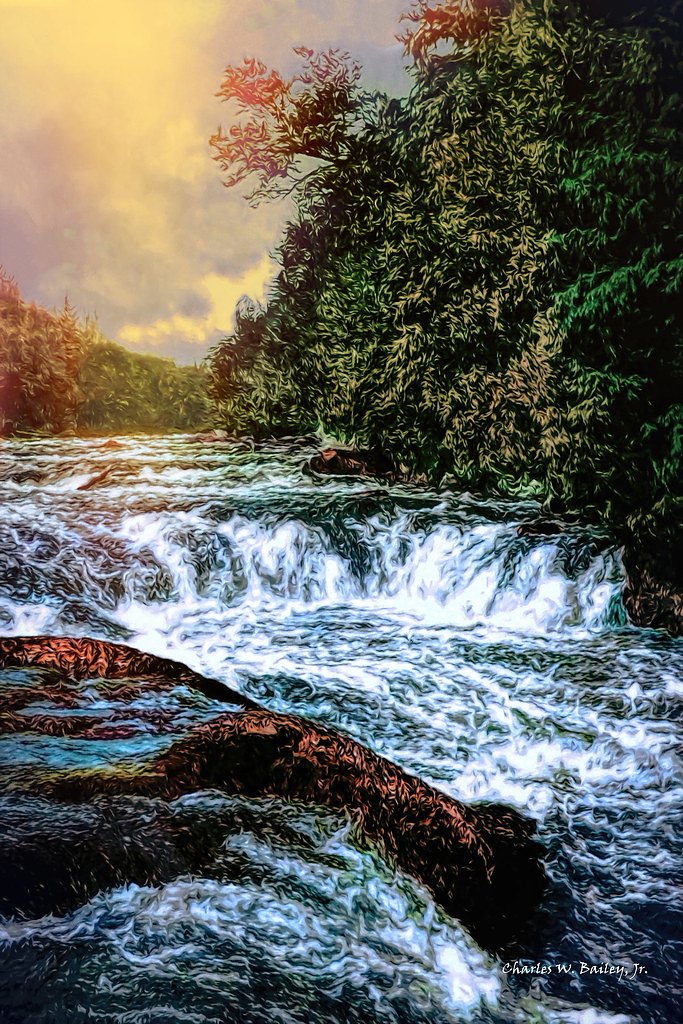
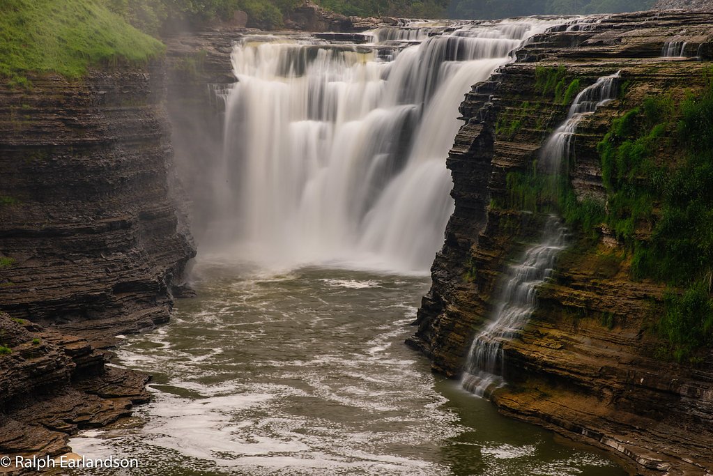
About Raquette Falls
Raquette Falls tumbles along the Raquette River in the Adirondack wilderness, set within the Follensby Pond land unit and managed by an NGO. The site carries a PCON designation, and its conserved setting gives the falls a remote, peaceful character that’s popular with both hikers and paddlers seeking classic northern-forest scenery. The approach rewards a full-day outing: the route to the falls is an approximately 9.0-mile out-and-back with about 500 feet of total elevation gain, so plan accordingly. Expect quiet trails, wooded river corridors, and a satisfying payoff at the cascade — a great destination for those who enjoy longer moderate hikes through conserved lands.
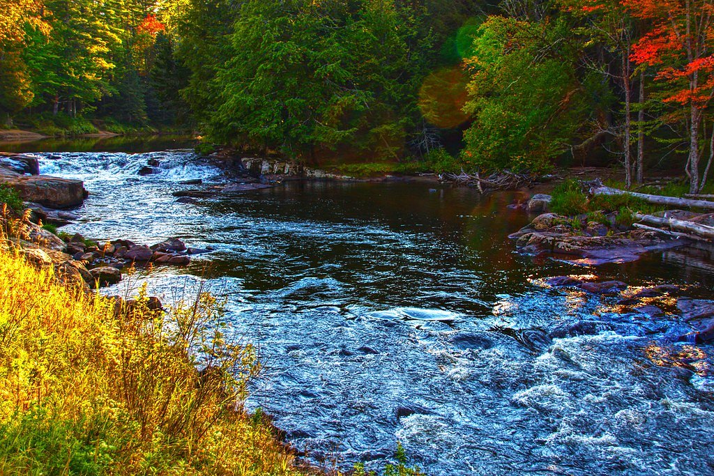
The Setting
Raquette Falls sits at 1,575 feet within Follensby Pond, fed by the Raquette River, in the hills of New York.
Trail & Hike Details
The Approach
The moderate 9.0-mile out-and-back trail gains 500 feet of elevation on the way to the falls.
Trail Description
Raquette Falls Trail is a 9.0-mile out-and-back route with roughly 500 feet of cumulative elevation gain and a moderate difficulty rating. The hike travels through dense forest with a mix of flat sections and gentle inclines; the route is generally well-marked and leads to the falls near the trail’s end. Specific USFS surface/grade/class data are not provided for this trail, so hikers should expect natural tread and variable footing typical of Adirondack footpaths and come prepared for a longer, moderately paced outing.
What to Expect
Dogs are welcome.
Accessibility
The trail is not wheelchair accessible. Uneven terrain and elevation changes require steady footing.
Frequently Asked Questions
🐶 Are Dogs Allowed at Raquette Falls?
✅ Dogs are allowed
Are There Any Fees or Permits Required?
🆖 No fees required
🏊 Is There Swimming at Raquette Falls?
❌ Swimming is not allowed
When to Visit
The best time to visit is late spring through early fall when the trail is most accessible and the weather is mild. Winter visits are possible but require proper gear and preparation.
Seasonal Access
The best time to visit is Spring, Summer, Fall, and Winter.
Safety Information
Be prepared for changing weather conditions, and carry a map or GPS device as cell service may be limited. Watch for slippery rocks near the falls and be cautious of wildlife encounters.
Current Water Conditions
1,270 ft³/s
Current discharge — how much water is flowing
About average for this time of year
Based on 117 years of record
5.82 ft
Water depth at gauge
7-Day Discharge Trend
What does this mean for your visit?
Flow is about average for this time of year.
About This Gauge
This gauge is on a nearby waterway and may not reflect exact conditions at the falls.
7-Day Flow Outlook
Based on the USGS gauge RAQUETTE RIVER AT PIERCEFIELD NY (22 km away).
Today
Barely Flowing
1270 cfs
5/10Tomorrow
Low
1377 cfs
3/10Wed
Moderate
1433 cfs
4/10Thu
Moderate
1414 cfs
4/10Fri
Moderate
1367 cfs
4/10Sat
Moderate
1248 cfs
4/10Sun
Low
1266 cfs
4/10Best window: Today — barely flowing flow, sunny (trip score 5/10).
Best time of year: this gauge typically runs highest from late March to early June, peaking in April.
How we calculate this
This is a transparent outlook, not a precise forecast. We take the waterfall's current flow strength (how it ranks against its historical normal for today, from the nearest USGS stream gauge), carry that ranking forward along the gauge's seasonal curve, and nudge it for forecast rain. Confidence is highest for the next day or two and falls further out. Always check official conditions and your own judgment before visiting — high flows can be dangerous.
Know when to go.
Get a free email alert when waterfalls near Saranac Lake hit peak flow. We only send when conditions are worth the trip — no weekly newsletters, no spam.
Weather Forecast
Location & Access
Getting There
Raquette Falls can be accessed via the Raquette Falls Trail, which begins near the Axton Landing area off Coreys Road. The trailhead is located in the High Peaks Wilderness area of the Adirondack Park.
Get Directions on Google MapsParking
Parking is available at the trailhead near Coreys Road. Spaces may be limited during peak seasons, so arriving early is recommended.
Elevation
1,575 feet above sea level
Coordinates
44.145000° N, -74.324100° W
Land Management
Managed by NGO
Visitor Tips & Gear
Wear sturdy hiking shoes and bring plenty of water, especially during warmer months. Bug spray is recommended in spring and summer due to mosquitoes and black flies. In winter, be prepared for snow and ice, and consider bringing snowshoes or microspikes.
As an Amazon Associate, we earn from qualifying purchases.
With 9.0 miles and 500 ft of elevation gain, sturdy boots and trekking poles will help on this moderate trail. Icy conditions are common in winter — traction cleats are a smart addition.

Columbia Watertight II Rain Jacket
Packs into its own pocket, seam-sealed, and keeps you dry from spray and surprise rain.

Polarized Sunglasses (Knockaround)
Cuts glare off the water so you actually see the falls — and your photos turn out better too.

Earth Pak Waterproof Dry Bag
Keeps your phone and gear dry when waterfall mist soaks everything else.

Waterproof Phone Pouch (AiRunTech)
Cheap insurance — take photos right next to the falls without killing your phone.

Timberland Euro Sprint Mid Waterproof
Trusted waterproof boot with premium leather and grippy rubber sole — reliable on rocky, wet trails.

TrailBuddy Trekking Poles
Lightweight aluminum, cork grips, and flip-locks that actually hold — a best-seller for good reason.
Where to Stay

Trailhead by Weekender

Sandy Point Motel

The Lazy Bear Cabin

Lake Placid Inn: Main Street
Browse vacation cabins and private rentals nearby
Unique outdoor stays — tents, yurts, and treehouses
Rent a campervan or RV for your waterfall road trip
Some links are affiliate links. We may earn a commission at no extra cost to you.
Additional Information
Nearby Attractions
Nearby attractions include the St. Regis Canoe Area, Tupper Lake, and other hiking trails in the High Peaks Wilderness.
Wildlife
The area is home to a variety of wildlife, including deer, black bears, and numerous bird species. Be cautious and store food properly to avoid attracting animals.
Cities near Raquette Falls
Nearby Waterfalls
Writing about Raquette Falls? Embed this waterfall on your site for free.