
Photo Credits (5)
Difficulty
Easy
Trail Length
1.5 miles
Trail Type
Out And Back
Elevation Gain
200 ft
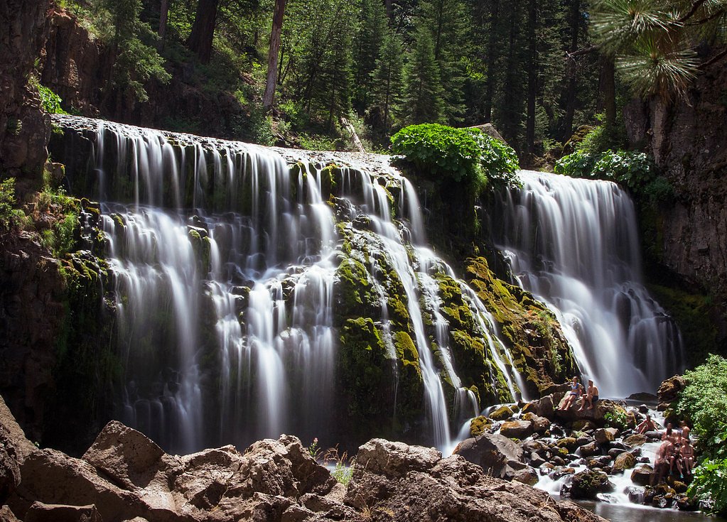
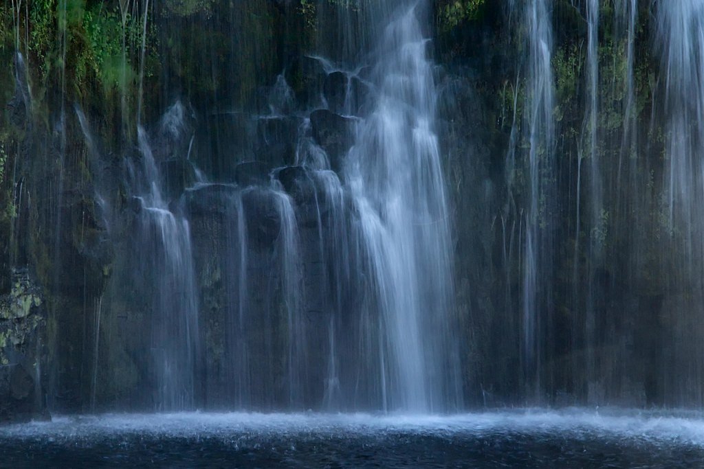
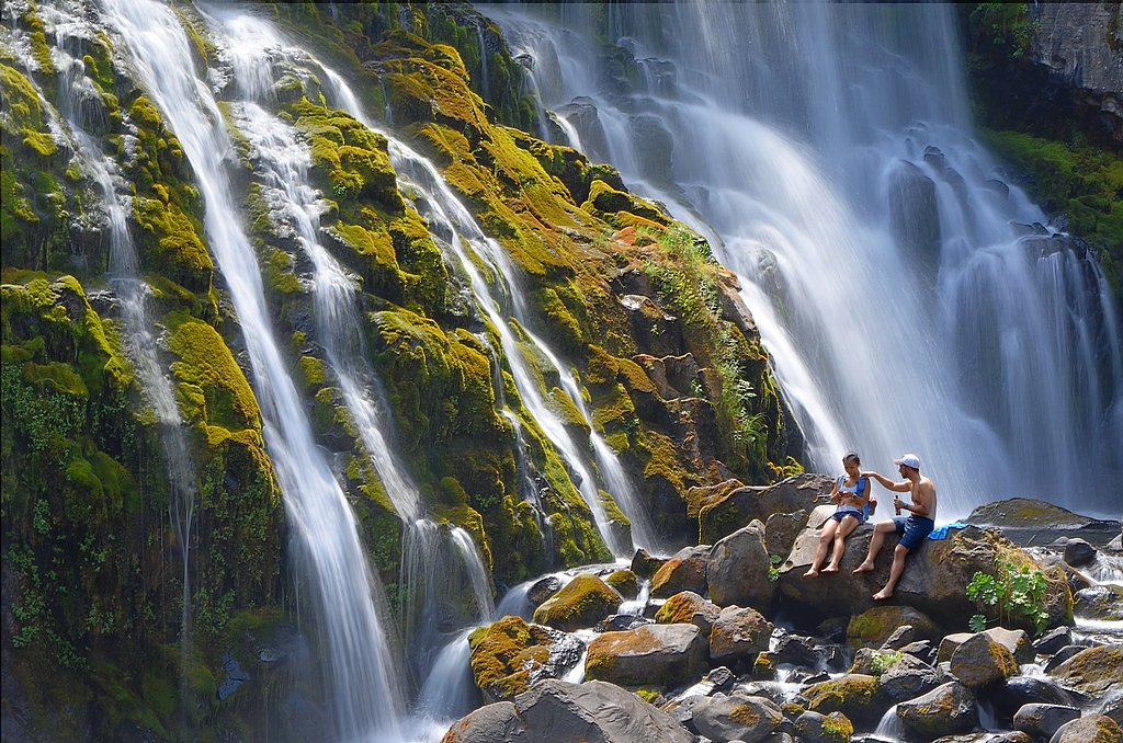
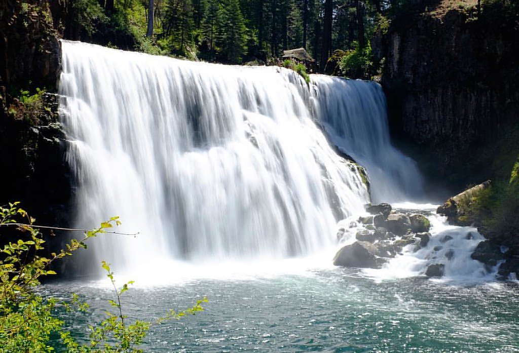
About Middle Falls
Middle Falls sits along the McCloud River in Northern California as the middle tier of a scenic trio of waterfalls (Lower, Middle, and Upper Falls). The falls drop about 50 feet over a broad cascade, framed by mossy rocks and mixed conifer forest, and are a favorite stop for photographers and day hikers. The site is managed by the U.S. Forest Service within Shasta National Forest, so you’ll find maintained viewpoints and clear access when visiting. Access is family-friendly: the hike to Middle Falls is an easy out-and-back route of roughly 1.5 miles round trip with about 200 feet of elevation gain, making it suitable for most skill levels. The U.S. Forest Service maintains a short alternate spur—MIDDLE FALLS ALTERNATE (Trail #01E01LA)—that leads to the primary viewing area. If you’re camping, Fowler’s Campground is nearby (about 1.14 km), so the falls make a convenient half-day outing from camp.
The Setting
Middle Falls sits at 3,386 feet within Shasta National Forest, in the mountains of California. The falls drop 50 feet.
Height: 50 feet
Trail & Hike Details
The Approach
The easy hike follows Middle Falls Alternate (#01E01LA), a 1.5-mile out-and-back trail over imported compacted material. Expect 200 feet of elevation gain with grades of 0-5%. The trail is highly developed (Class 4).
USFS Trail
MIDDLE FALLS ALTERNATE #01E01LA
Trail Class
Highly Developed
Surface
Avg Grade
USFS Segment
0.06 miTrail Description
Trail type: out-and-back, total length ~1.5 miles, elevation gain ~200 ft, difficulty: easy. The route to Middle Falls is well-suited to most visitors and families, with gentle terrain and scenic river views. The U.S. Forest Service maintains an alternate connector named MIDDLE FALLS ALTERNATE (Trail #01E01LA); that USFS spur is Class 4, about 0.06 miles long (GIS), constructed of imported compacted material, and typically grades 0–5%. The broader approach to the falls follows forest paths and viewpoints leading to the main 50-foot cascade; benches and viewing areas are commonly available near the falls.
What to Expect
The falls drop 50 feet. Swimming is permitted. Dogs are welcome.
Accessibility
The trail is not wheelchair accessible. Uneven terrain and elevation changes require steady footing.
Frequently Asked Questions
🐶 Are Dogs Allowed at Middle Falls?
✅ Dogs are allowed
Are There Any Fees or Permits Required?
🆖 No fees required
🏊 Is There Swimming at Middle Falls?
✅ Swimming is allowed
When to Visit
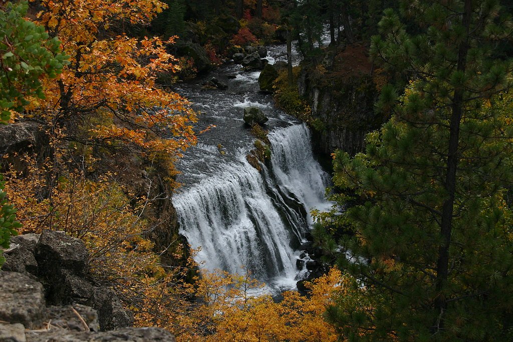
Spring and early summer are the best times to visit, as the waterfall is at its fullest due to snowmelt. Fall offers beautiful foliage, while summer provides warm weather for outdoor activities.
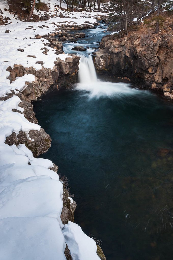
Seasonal Access
The best time to visit is Spring, Summer, and Fall. Winter access may be limited. Check with Shasta National Forest for seasonal road closures.
Safety Information
Be cautious near the edge of the waterfall and avoid slippery rocks. During spring, the river flow can be strong, so swimming and wading should be done with care. Always stay on marked trails to avoid getting lost or damaging the environment.
Know when to go.
Get a free email alert when waterfalls near McCloud hit peak flow. We only send when conditions are worth the trip — no weekly newsletters, no spam.
Weather Forecast
Location & Access
Getting There
Middle Falls is located in the Shasta-Trinity National Forest near the town of McCloud, California. From McCloud, take Highway 89 east for about 15 miles, then follow signs for the McCloud River Falls Trail. The trailhead is well-marked and accessible by car.
Get Directions on Google MapsParking
There is a designated parking area near the McCloud River Falls Trailhead. Parking is generally free, but it can fill up quickly during peak seasons.
Elevation
3,386 feet above sea level
Coordinates
41.243770° N, -122.009722° W
Land Management
Managed by USFS
Visitor Tips & Gear
Arrive early to secure parking, especially during weekends and holidays. Wear sturdy shoes as the trail can be uneven in some areas. Bring water and snacks, and consider visiting the nearby Lower and Upper Falls for a complete experience.
As an Amazon Associate, we earn from qualifying purchases.
This easy 1.5 miles hike is straightforward — comfortable trail shoes and plenty of water should do. Sun exposure on the trail makes good sun protection a must in summer.

Polarized Sunglasses (Knockaround)
Cuts glare off the water so you actually see the falls — and your photos turn out better too.

Columbia Watertight II Rain Jacket
Packs into its own pocket, seam-sealed, and keeps you dry from spray and surprise rain.

Earth Pak Waterproof Dry Bag
Keeps your phone and gear dry when waterfall mist soaks everything else.

Waterproof Phone Pouch (AiRunTech)
Cheap insurance — take photos right next to the falls without killing your phone.

JOBY GorillaPod Starter Kit
Wraps around railings and rocks for long-exposure waterfall shots — no flat surface needed.

Osprey Daylite Daypack
Light, organized, and just the right size for a day hike — fits water, snacks, and layers.
Where to Stay

Mount Shasta Resort

McCloud Hotel

Travelodge by Wyndham Dunsmuir

Shasta View Lodge
Browse vacation cabins and private rentals nearby
Unique outdoor stays — tents, yurts, and treehouses
Rent a campervan or RV for your waterfall road trip
Some links are affiliate links. We may earn a commission at no extra cost to you.
Nearby Campground
FOWLERS CAMPGROUND
0.7 miles away · 36 sites
Overview Fowlers Campground is located on the Upper McCloud River five miles east of McCloud, California. The campground is nestled in a mixed conifer and oak woodland. The campground offers paved parking spurs, running water and vault restrooms.Recreation A river-side trail from the campground provides access to the falls. It is approximately three miles round trip to see all three. Swimming and fishing are other popular activities. This section of river has no special restrictions for fishing.
Book on Recreation.govNearby Hot Springs
Hot springs near McCloud, California
Hunt Hot Spring
Hunt Hot Spring produces 136-degree water from the forested slopes near McCloud in Siskiyou County at just 1,712 feet elevation...
Big Bend Hot Springs
Big Bend Hot Springs surges at a scalding 180 degrees Fahrenheit from volcanic terrain at just 1,644 feet elevation, creating o...
Big Bend, California
Big Bend sits along a dramatic curve of the Pit River in Shasta County at 1,720 feet elevation, occupying territory historicall...

Hot Spring, Fumaroles
Hot Spring with fumaroles on Mount Shasta at 14,000 feet elevation represents one of California's highest thermal features, wit...
Little Hot Spring
Little Hot Spring discharges at 169°F in the volcanic terrain south of Lassen, where superheated water rises 117 degrees above ...
Hot Spot
Hot Spot delivers water at 191°F, the hottest spring in this dataset section, creating a temperature differential of 150°F abov...
Looking for a soak after your hike? Explore more hot springs near McCloud, California on SoakingSprings.
Explore California springsAdditional Information
Nearby Attractions
Lower Falls, Upper Falls, McCloud Reservoir, Mount Shasta
Wildlife
The area is home to various wildlife, including deer, squirrels, and a variety of bird species. Be cautious of bears and other larger animals, especially when hiking early in the morning or late in the evening.
Cities near Middle Falls
Nearby Waterfalls

Other waterfalls named Middle Falls
8 other waterfalls share this name across the U.S.
Writing about Middle Falls? Embed this waterfall on your site for free.