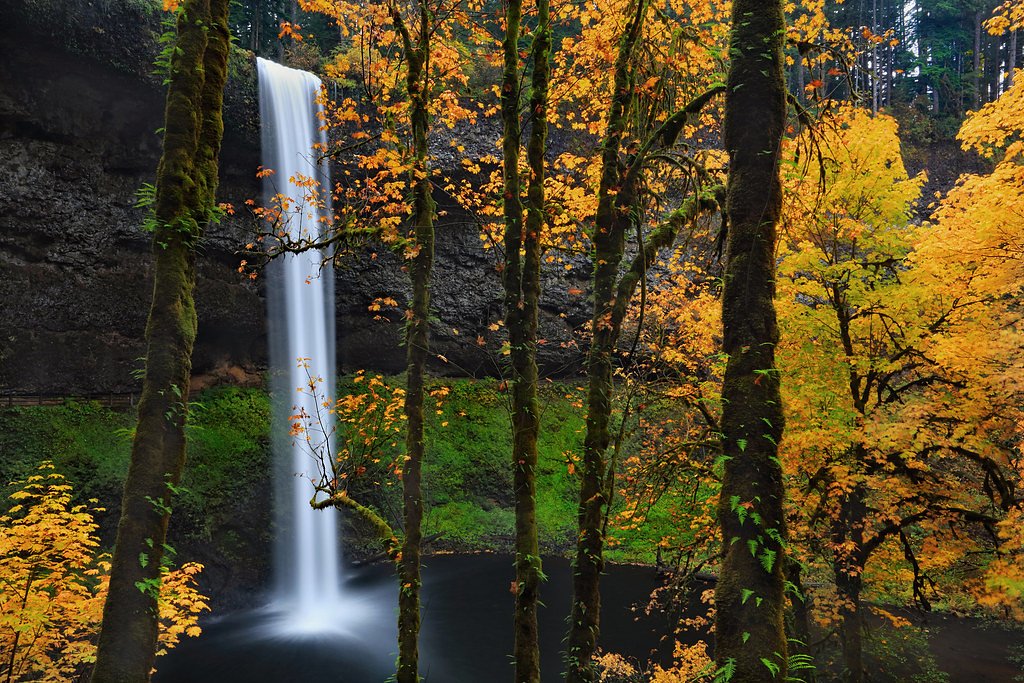
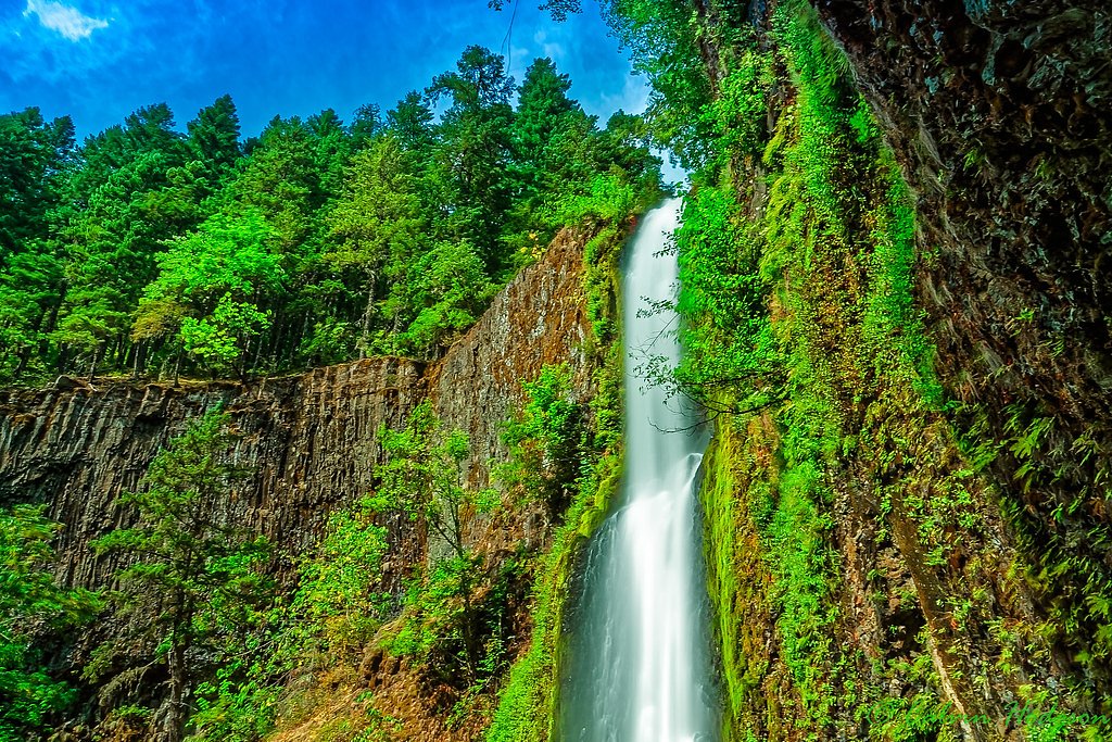
The Falls
By Armen Suny · Last verified Mar 2026
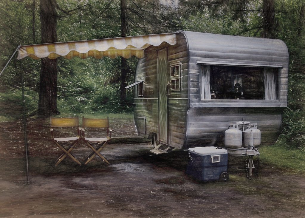
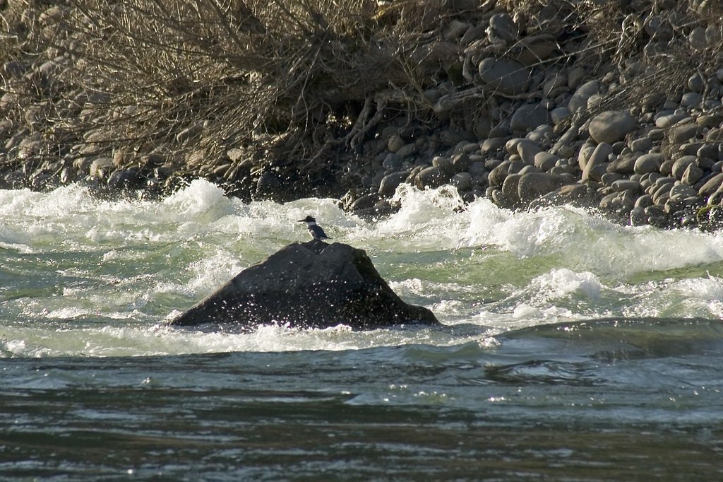


Photo Credits (5)
Difficulty
Moderate
Trail Length
2.4 miles
Trail Type
Out And Back
Elevation Gain
350 ft
About The Falls
The Falls is a quietly scenic waterfall tucked into Oregon’s forested landscape, known for lush greenery and an approachable trail that draws hikers and nature lovers. Specific measurements for the falls’ height aren’t well-documented, which adds a touch of mystery to this peaceful spot where mossy banks and the sound of falling water make for a restorative outing. Most visitors reach The Falls via a moderate, out-and-back route that covers about 2.4 miles with roughly 350 feet of elevation gain, making it a good half-day hike for families and casual hikers. The nearest developed camping is Lazy Bend campground, approximately 16.5 km away, so day-trip planning is common; check local trail conditions before you go and bring footwear suited for potentially wet, uneven trail sections.
The Setting
The Falls sits at 486 feet along the Clackamas River, in the coastal lowlands of Oregon.
Trail & Hike Details
The Approach
The moderate 2.4-mile out-and-back trail gains 350 feet of elevation on the way to the falls.
Trail Description
Out-and-back trail, approximately 2.4 miles total with about 350 feet of elevation gain. Difficulty: moderate. The route follows natural tread that can be uneven and occasionally muddy near the stream crossing; expect tree roots and rocky sections rather than paved surface. No USFS surface/grade/class data is provided for this route in the supplied records, so hikers should plan for typical forest singletrack conditions and check current local trail reports before visiting.
What to Expect
Visitors can expect a picturesque waterfall surrounded by natural beauty. The area may feature dense forests, rocky terrain, and seasonal wildflowers.
Accessibility
The trail is not wheelchair accessible. Uneven terrain and elevation changes require steady footing.
Frequently Asked Questions
🐶 Are Dogs Allowed at The Falls?
❌ Dogs are not allowed
Are There Any Fees or Permits Required?
🆖 No fees required
🏊 Is There Swimming at The Falls?
❌ Swimming is not allowed
When to Visit
Spring and early summer are typically the best times to visit, as water flow is often at its peak due to snowmelt.
Seasonal Access
The best time to visit is Spring, Summer, and Fall. Winter access may be limited.
Safety Information
Trails may be slippery or uneven, especially after rain. Visitors should exercise caution and stay on marked trails. Be aware of potential hazards such as falling rocks or strong currents near the waterfall.
Current Water Conditions
876 ft³/s
Current discharge — how much water is flowing
Much lower than usual for this time of year
Based on 117 years of record
11.17 ft
Water depth at gauge
64°F
CoolRefreshing for swimming
7-Day Discharge Trend
What does this mean for your visit?
Flow is well below normal for this time of year, so the waterfall may be a trickle. Water temperature is a refreshing 64 degrees F, good for a quick swim. Expect crystal clear visibility and excellent dissolved oxygen levels. PH is normal at 7.6 and mineral content is typical.
Water Quality
Dissolved Oxygen
ExcellentSupports aquatic life
pH
NormalWithin healthy range (6.5-8.5)
Water Clarity
Crystal clearExcellent visibility
Conductance
Dissolved minerals in the water
About This Gauge
7-Day Flow Outlook
Based on the USGS gauge CLACKAMAS RIVER AT ESTACADA, OR (5 km away).
Today
Strong
999 cfs
7/10Tomorrow
Strong
1042 cfs
8/10Mon
Strong
974 cfs
8/10Tue
Strong
941 cfs
8/10Wed
Strong
921 cfs
8/10Thu
Strong
914 cfs
8/10Fri
Strong
887 cfs
8/10Best window: Tomorrow — strong flow, rain showers likely (trip score 8/10).
Best time of year: this gauge typically runs highest from late March to late May, peaking in April.
How we calculate this
This is a transparent outlook, not a precise forecast. We take the waterfall's current flow strength (how it ranks against its historical normal for today, from the nearest USGS stream gauge), carry that ranking forward along the gauge's seasonal curve, and nudge it for forecast rain. Confidence is highest for the next day or two and falls further out. Always check official conditions and your own judgment before visiting — high flows can be dangerous.
Know when to go.
Get a free email alert when waterfalls near Estacada hit peak flow. We only send when conditions are worth the trip — no weekly newsletters, no spam.
Weather Forecast
Location & Access
Getting There
The Falls is located in Oregon, but specific directions depend on the exact location of the waterfall. Visitors are encouraged to consult local maps or GPS for accurate navigation.
Get Directions on Google MapsParking
Parking availability may vary depending on the season and location. Visitors should check local resources or park websites for the most up-to-date information.
Elevation
486 feet above sea level
Coordinates
45.323630° N, -122.300135° W
Visitor Tips & Gear
Wear sturdy footwear and bring plenty of water. Check weather conditions before your visit, as trails may become slippery or muddy after rain.
As an Amazon Associate, we earn from qualifying purchases.
With 2.4 miles and 350 ft of elevation gain, sturdy boots and trekking poles will help on this moderate trail. Sun exposure on the trail makes good sun protection a must in summer.

Polarized Sunglasses (Knockaround)
Cuts glare off the water so you actually see the falls — and your photos turn out better too.

Columbia Watertight II Rain Jacket
Packs into its own pocket, seam-sealed, and keeps you dry from spray and surprise rain.

Earth Pak Waterproof Dry Bag
Keeps your phone and gear dry when waterfall mist soaks everything else.

Waterproof Phone Pouch (AiRunTech)
Cheap insurance — take photos right next to the falls without killing your phone.

Timberland Euro Sprint Mid Waterproof
Trusted waterproof boot with premium leather and grippy rubber sole — reliable on rocky, wet trails.

TrailBuddy Trekking Poles
Lightweight aluminum, cork grips, and flip-locks that actually hold — a best-seller for good reason.
Where to Stay

Mount Hood Village

Mt Air Motel

Staypineapple, Hotel Rose, Downtown Portland

The Mark Spencer Hotel
Browse vacation cabins and private rentals nearby
Unique outdoor stays — tents, yurts, and treehouses
Rent a campervan or RV for your waterfall road trip
Some links are affiliate links. We may earn a commission at no extra cost to you.
Nearby Campground
LAZY BEND
10.2 miles away · 22 sites
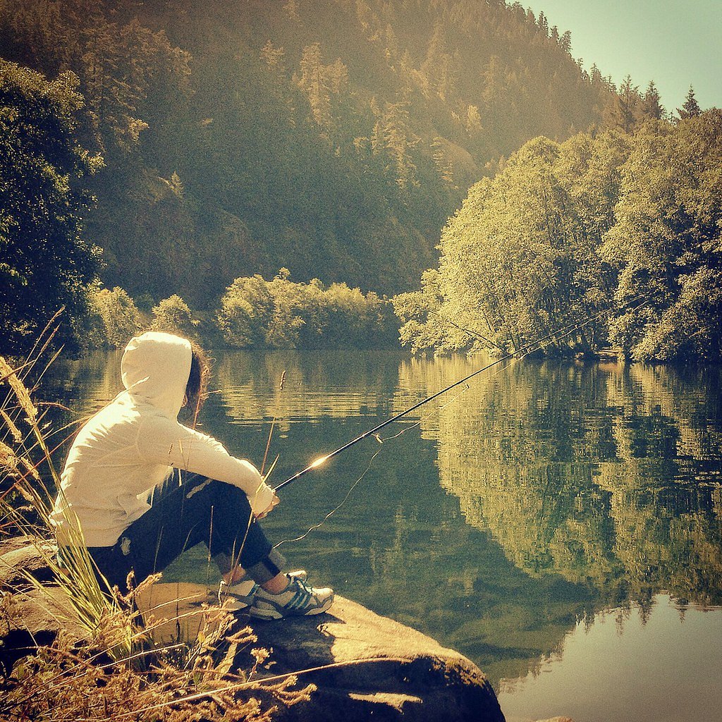
Overview Campground closed due to the 2020 Riverside Wildfire Lazy Bend Campground sits next to the Wild and Scenic Clackamas River, close to the city of Estacada. The adjacent river provides countless opportunities for rafting, kayaking, fishing and swimming. The lush, green campground is comfortable for individuals and families who want to escape into nature in Oregon's Mt. Hood National Forest. Recreation Fishing is very popular on the Clackamas River. Anglers can expect a catch of winter stee
Book on Recreation.govNearby Hot Springs
Hot springs near Estacada, Oregon

Bagby Hot Springs
Bagby Hot Springs flows at 136°F deep in Mount Hood National Forest at 2,272 feet elevation, requiring a 3,720-foot hike from F...

Swim Warm Springs
Swim Warm Springs emerges at 79°F within Mount Hood National Forest at 4,063 feet elevation, flowing just 6.9 meters from White...

Austin Hot Springs
Austin Hot Springs discharges at 186°F along the Clackamas River at 1,680 feet elevation, emerging just 310 feet from Clackamas...

Mount Hood Fumaroles
Mount Hood Fumaroles vent at 194°F from the flanks of Oregon's highest peak, among the state's most extreme geothermal features...
Moffetts (Bonneville) Hot Springs
Moffetts Hot Springs, also called Bonneville Hot Springs, flows at 97 degrees in the Gifford Pinchot National Forest at just 75...
Rock Creek Hot Springs
Rock Creek Hot Springs emerges in the Columbia River Gorge in Skamania County, Washington, with water documented as 'hot' witho...
Looking for a soak after your hike? Explore more hot springs near Estacada, Oregon on SoakingSprings.
Explore Oregon springsAdditional Information
Nearby Attractions
Nearby attractions may include other waterfalls, hiking trails, and scenic viewpoints in the surrounding area.
Wildlife
The area around The Falls may be home to various wildlife, including birds, deer, and small mammals. Visitors should respect wildlife and maintain a safe distance.
Cities near The Falls
Nearby Waterfalls
Other waterfalls named The Falls
20 other waterfalls share this name across the U.S.
Writing about The Falls? Embed this waterfall on your site for free.