The Falls
By Armen Suny · Last verified Mar 2026
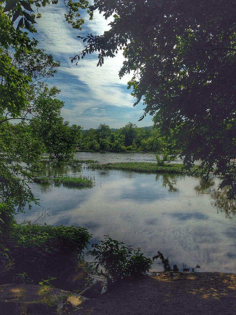

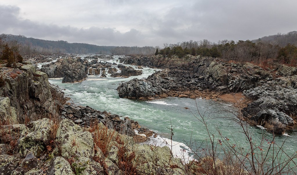
Photo Credits (5)
Difficulty
Moderate
Trail Length
2.0 miles
Trail Type
Out And Back
Elevation Gain
300 ft
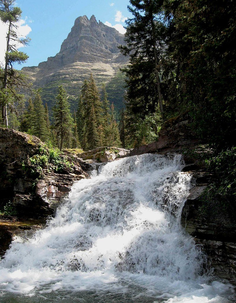
About The Falls
Tucked into the Jefferson National Forest and managed by the U.S. Forest Service, The Falls is a tranquil Virginia cascade framed by lush hardwoods and fern-carpeted banks. The setting is especially photogenic in spring and fall when the canopy and understory are vivid, and while an official height isn't readily available, the falls reward a short, accessible hike and make a popular stop for hikers and photographers exploring this corner of the forest. Access is provided via the Bournes Branch Trail (USFS Trail #317). The common outing is an out-and-back about 2.0 miles round trip with roughly 300 feet of elevation gain, rated moderate. The trail and surrounding federal lands are managed by the USFS, and nearby camping is available at Raven Cliff Recreation Area, about 9.11 km from the trailhead for those who want to turn the visit into an overnight trip.
The Setting
The Falls sits at 2,972 feet within Jefferson National Forest, fed by the New River, in the hills of Virginia.
Trail & Hike Details
The Approach
The moderate hike follows Bournes Branch (#317), a 2.0-mile out-and-back trail over natural surface. Expect 300 feet of elevation gain with grades of +12-20%. The trail is developed (Class 3).
USFS Trail
BOURNES BRANCH #317
Trail Class
Developed
Surface
Avg Grade
USFS Segment
0.35 miTrail Description
Trail: Bournes Branch Trail (USFS Trail #317). Surface: native material; USFS data classifies this route as Class 3 with a typical grade of 12-20%. Length: the commonly hiked route is a 2.0-mile out-and-back with about 300 feet of elevation gain and a moderate difficulty rating. USFS/GIS records show a mapped segment of Trail #317 at 0.35 miles. Expect a narrow, forested tread of dirt and native surface that can become rocky or muddy after rain. Steeper sections reflect the 12-20% grade range, so hikers will encounter short, steeper pitches mixed with gentler stretches; overall the trail is suited to hikers comfortable on uneven, natural surfaces. Pack rain-ready footwear and be prepared for limited trail infrastructure typical of National Forest backcountry routes.
What to Expect
Dogs are welcome.
Accessibility
The trail is not wheelchair accessible. Uneven terrain and elevation changes require steady footing.
Frequently Asked Questions
🐶 Are Dogs Allowed at The Falls?
✅ Dogs are allowed
Are There Any Fees or Permits Required?
🆖 No fees required
🏊 Is There Swimming at The Falls?
❌ Swimming is not allowed
When to Visit
Spring and early summer are ideal for visiting, as the waterfall flow is typically strongest due to seasonal rainfall. Fall offers beautiful foliage, while summer provides warmer weather for hiking.
Seasonal Access
The best time to visit is Spring, Summer, and Fall. Winter access may be limited. Check with Jefferson National Forest for seasonal road closures.
Safety Information
Visitors should exercise caution near the waterfall, as rocks can be slippery. Be prepared for changing weather conditions and carry a map or GPS device. Cell service may be limited in the area.
Current Water Conditions
623 ft³/s
Current discharge — how much water is flowing
Much lower than usual for this time of year
Based on 79 years of record
2.04 ft
Water depth at gauge
7-Day Discharge Trend
What does this mean for your visit?
Flow is well below normal for this time of year, so the waterfall may be a trickle.
About This Gauge
This gauge is on a nearby waterway and may not reflect exact conditions at the falls.
7-Day Flow Outlook
Based on the USGS gauge NEW RIVER AT IVANHOE, VA (15 km away).
Today
Low
710 cfs
3/10Tomorrow
Moderate
759 cfs
4/10Mon
Moderate
780 cfs
4/10Tue
Low
639 cfs
6/10Wed
Barely Flowing
562 cfs
5/10Thu
Low
656 cfs
3/10Fri
Moderate
664 cfs
4/10Best window: Tue — low flow, mostly sunny (trip score 6/10).
Best time of year: this gauge typically runs highest from mid February to late April, peaking in March.
How we calculate this
This is a transparent outlook, not a precise forecast. We take the waterfall's current flow strength (how it ranks against its historical normal for today, from the nearest USGS stream gauge), carry that ranking forward along the gauge's seasonal curve, and nudge it for forecast rain. Confidence is highest for the next day or two and falls further out. Always check official conditions and your own judgment before visiting — high flows can be dangerous.
Know when to go.
Get a free email alert when waterfalls near Stevens Creek hit peak flow. We only send when conditions are worth the trip — no weekly newsletters, no spam.
Weather Forecast
Location & Access
Getting There
The Falls is accessible via a trailhead located in a nearby park or forest area. Visitors should check local maps or park information for exact directions.
Get Directions on Google MapsParking
Parking is typically available near the trailhead, but availability may vary depending on the season and time of day.
Elevation
2,972 feet above sea level
Coordinates
36.756790° N, -81.091200° W
Land Management
Managed by USFS
Visitor Tips & Gear
Wear sturdy hiking shoes, as the trail may be uneven or slippery in places. Bring water and snacks, especially during warmer months. Arrive early to secure parking and avoid crowds.
As an Amazon Associate, we earn from qualifying purchases.
With 2.0 miles and 300 ft of elevation gain, sturdy boots and trekking poles will help on this moderate trail. Sun exposure on the trail makes good sun protection a must in summer.

Polarized Sunglasses (Knockaround)
Cuts glare off the water so you actually see the falls — and your photos turn out better too.

Columbia Watertight II Rain Jacket
Packs into its own pocket, seam-sealed, and keeps you dry from spray and surprise rain.

Earth Pak Waterproof Dry Bag
Keeps your phone and gear dry when waterfall mist soaks everything else.

Waterproof Phone Pouch (AiRunTech)
Cheap insurance — take photos right next to the falls without killing your phone.

Timberland Euro Sprint Mid Waterproof
Trusted waterproof boot with premium leather and grippy rubber sole — reliable on rocky, wet trails.

TrailBuddy Trekking Poles
Lightweight aluminum, cork grips, and flip-locks that actually hold — a best-seller for good reason.
Where to Stay

Spark By Hilton Wytheville East Main Street

Comfort Inn Wytheville - Fort Chiswell

The Washington Inn

Comfort Inn & Suites Hillsville I-77
Browse vacation cabins and private rentals nearby
Unique outdoor stays — tents, yurts, and treehouses
Rent a campervan or RV for your waterfall road trip
Some links are affiliate links. We may earn a commission at no extra cost to you.
Nearby Campground
Raven Cliff Recreation Area
5.7 miles away · 2 sites
Overview There are 20 camping units available on a first-come, first-served basis. Each unit has a gravel parking spur, picnic table and fire grill. Some sites have a pad for tents or pop-up trailers. Recreation vehicles up to 25 feet long can be accommodated in some sites. A day use picnic shelter with picnic tables and an open field for sports is available on a first-come, first-served basis. Toilets and garbage cans are provided in the campground and near the picnic shelter. Drinking water is
Book on Recreation.govNearby Hot Springs
Hot springs near Stevens Creek, Virginia
Alum Springs
Alum Springs flows at 72°F in Pulaski County, Virginia, emerging 18.4 degrees above the 53.6°F ambient temperature at 1,967 fee...

New River White Sulphur Springs
New River White Sulphur Springs produces 85-degree water that flows 30.3 degrees above ambient temperature at 1,780 feet elevat...
Looking for a soak after your hike? Explore more hot springs near Stevens Creek, Virginia on SoakingSprings.
Explore Virginia springsAdditional Information
Nearby Attractions
Nearby attractions may include other hiking trails, scenic overlooks, and local parks. Check with local tourism resources for more information.
Wildlife
The area is home to a variety of wildlife, including birds, deer, and small mammals. Visitors should be cautious of ticks and other insects.
Cities near The Falls
Other waterfalls named The Falls
20 other waterfalls share this name across the U.S.
Writing about The Falls? Embed this waterfall on your site for free.