
Photo Credits (5)
Difficulty
Moderate
Trail Length
2.4 miles
Trail Type
Out And Back
Elevation Gain
350 ft
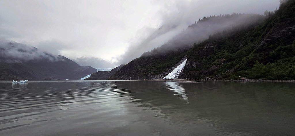
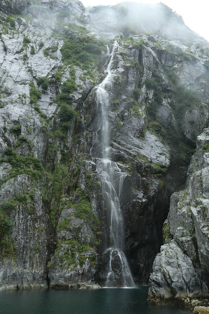
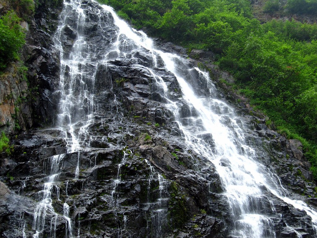
About The Falls
The Falls sits in remote country near the communities of Eagle and Eagle Village, Alaska, offering a quiet, lesser-known waterfall framed by pristine wilderness. Its flow changes with the seasons—spring and early summer typically produce the most dramatic cascades as snowmelt boosts runoff—so visits can feel markedly different depending on timing. Access is along a 2.4-mile out-and-back route that rewards hikers seeking solitude and scenic views; with minimal development around the site, plan for a backcountry experience and bring navigation, extra layers, and bear-aware practices. The nearest developed camping is Eagle Campground, about 31.79 km away, so most visitors treat The Falls as a long day trip or combine it with broader backcountry plans.
Trail & Hike Details
The Approach
The moderate 2.4-mile out-and-back trail gains 350 feet of elevation on the way to the falls.
Trail Description
Out-and-back trail, 2.4 miles total with approximately 350 feet of elevation gain; rated moderate. Formal USFS trail number, surface, and grade data are not documented for this route, so expect a natural tread and variable footing rather than a paved or heavily improved path. Suitable for hikers comfortable with moderate, remote trails and basic route-finding.
What to Expect
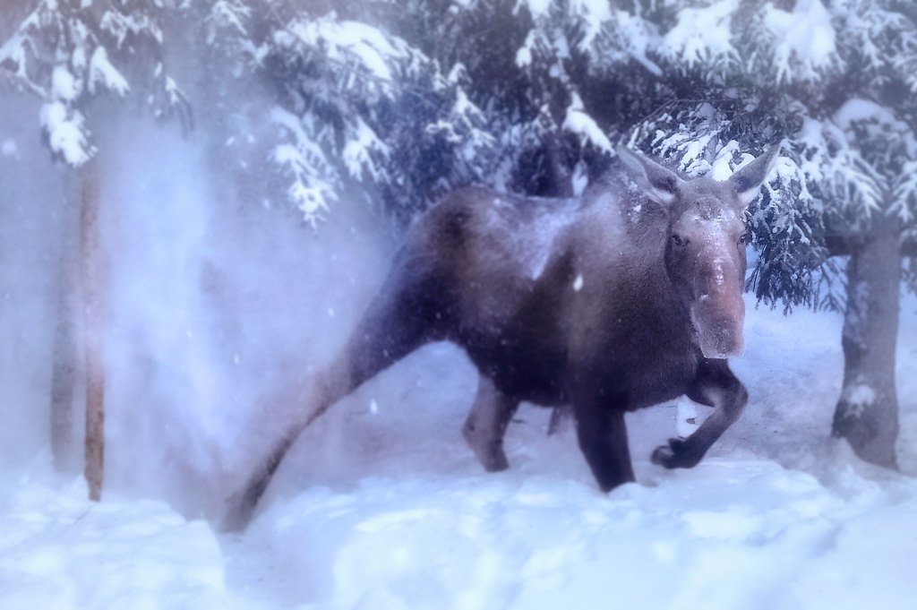
Expect a remote and serene experience surrounded by Alaskan wilderness. The waterfall may be seasonal, with higher flow during spring and early summer. Wildlife sightings are possible, so remain alert and follow safety precautions.
Accessibility
The trail is not wheelchair accessible. Uneven terrain and elevation changes require steady footing.
Frequently Asked Questions
🐶 Are Dogs Allowed at The Falls?
❌ Dogs are not allowed
Are There Any Fees or Permits Required?
🆖 No fees required
🏊 Is There Swimming at The Falls?
❌ Swimming is not allowed
When to Visit
Spring and early summer are the best times to visit, as snowmelt typically enhances the waterfall's flow. Fall offers beautiful foliage, while winter may make access challenging due to snow and ice.
Seasonal Access
The best time to visit is Spring, Summer, and Fall. Winter access may be limited.
Safety Information
This is a remote area with limited cell service. Visitors should inform someone of their plans, carry bear spray, and be prepared for changing weather conditions. Be cautious of wildlife and uneven terrain.
Know when to go.
Get a free email alert when waterfalls near Eagle hit peak flow. We only send when conditions are worth the trip — no weekly newsletters, no spam.
Weather Forecast
Location & Access
Getting There
The Falls is located approximately 33.8 miles from Eagle and 39.2 miles from Eagle Village. Access to the area may require traveling on unpaved roads or trails, and visitors should be prepared for remote conditions. It is recommended to use a reliable map or GPS device to navigate to the coordinates (64.9294, -141.8258).
Get Directions on Google MapsParking
Parking availability is uncertain, but visitors may need to park along nearby roads or designated pullouts. Ensure your vehicle is parked safely and does not obstruct traffic.
Elevation
1,299 feet above sea level
Coordinates
64.929444° N, -141.825833° W
Visitor Tips & Gear
Bring a detailed map or GPS device, as the area is remote and signage may be limited. Dress in layers and wear sturdy footwear suitable for uneven terrain. Carry bear spray and be aware of wildlife in the area.
As an Amazon Associate, we earn from qualifying purchases.
With 2.4 miles and 350 ft of elevation gain, sturdy boots and trekking poles will help on this moderate trail. Sun exposure on the trail makes good sun protection a must in summer.

Polarized Sunglasses (Knockaround)
Cuts glare off the water so you actually see the falls — and your photos turn out better too.

Columbia Watertight II Rain Jacket
Packs into its own pocket, seam-sealed, and keeps you dry from spray and surprise rain.

Earth Pak Waterproof Dry Bag
Keeps your phone and gear dry when waterfall mist soaks everything else.

Waterproof Phone Pouch (AiRunTech)
Cheap insurance — take photos right next to the falls without killing your phone.

Timberland Euro Sprint Mid Waterproof
Trusted waterproof boot with premium leather and grippy rubber sole — reliable on rocky, wet trails.

TrailBuddy Trekking Poles
Lightweight aluminum, cork grips, and flip-locks that actually hold — a best-seller for good reason.
Where to Stay
Browse vacation cabins and private rentals nearby
Unique outdoor stays — tents, yurts, and treehouses
Rent a campervan or RV for your waterfall road trip
Some links are affiliate links. We may earn a commission at no extra cost to you.
Nearby Campground
Eagle Campground
19.8 miles away · 0 sites
This campground has 18 sites and several outhouses within walking distance of historic Fort Egbert and the village of Eagle.
Book on Recreation.govNearby Hot Springs
Hot springs near Eagle, Alaska
Looking for a soak after your hike? Explore more hot springs near Eagle, Alaska on SoakingSprings.
Explore Alaska springsAdditional Information
Nearby Attractions
Nearby attractions include the town of Eagle, which offers historical sites and access to the Yukon River.
Wildlife
The area is home to a variety of wildlife, including bears, moose, and birds. Visitors should remain vigilant and follow wildlife safety guidelines.
Cities near The Falls
Other waterfalls named The Falls
20 other waterfalls share this name across the U.S.
Writing about The Falls? Embed this waterfall on your site for free.