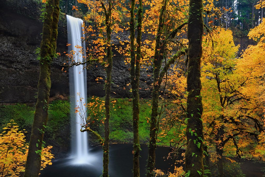
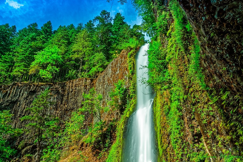
Middle Falls
By Armen Suny · Last verified May 2026
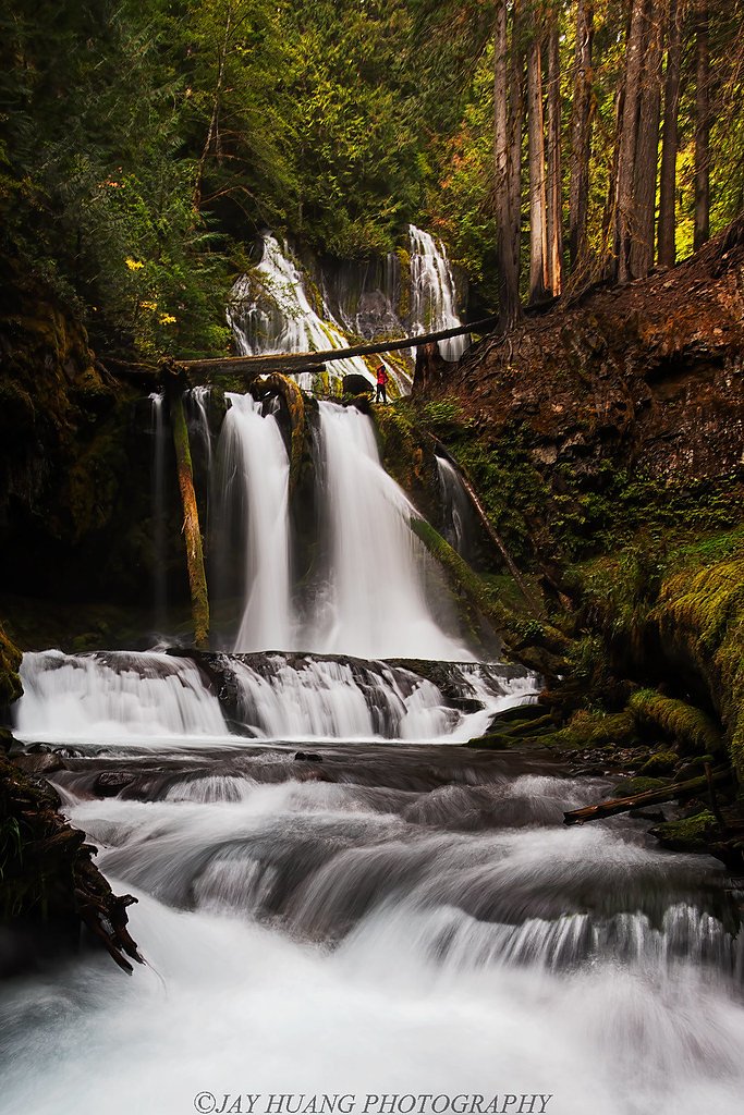
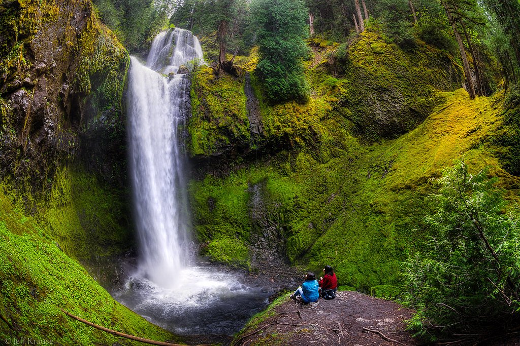
Photo Credits (4)
Difficulty
Easy
Trail Length
3.5 miles
Trail Type
Out And Back
Elevation Gain
200 ft
About Middle Falls
Middle Falls is a picturesque stop along the McCloud River Falls trail system in Oregon, tucked into the green, tranquil setting of the Eagle Creek National Fish Hatchery. The site is managed by the U.S. Fish and Wildlife Service and carries the designation FOTH, which underscores the hatchery’s role in supporting fish and riparian habitat in the area. Visitors are rewarded with a serene waterfall framed by lush forest — a popular photo spot and a peaceful place to pause on a longer river-side ramble. The route to Middle Falls is approachable for most hikers: an easy, out-and-back outing of about 3.5 miles with roughly 200 feet of elevation gain. Middle Falls is the second of three falls along the McCloud River route and is often described as the most impressive, making it a satisfying destination for families and casual hikers alike.
The Setting
Middle Falls sits at 682 feet within Eagle Creek National Fish Hatchery, fed by the Clackamas River, in the foothills of Oregon.
Trail & Hike Details
The Approach
The easy 3.5-mile out-and-back trail gains 200 feet of elevation on the way to the falls.
Trail Description
The trail to Middle Falls follows the McCloud River Falls route as a well-maintained, relatively flat out-and-back roughly 3.5 miles round trip, with about 200 feet of cumulative elevation gain. Rated easy, the trail stays mostly forested and offers frequent river views as it passes by the sequence of three waterfalls; Middle Falls is the second and commonly considered the most striking. Expect an accessible path with a gentle grade suitable for most abilities — ideal for a relaxed day-hike rather than technical scrambling.
What to Expect
Swimming is permitted. Dogs are welcome.
Accessibility
The trail is not wheelchair accessible. Uneven terrain and elevation changes require steady footing.
Frequently Asked Questions
🐶 Are Dogs Allowed at Middle Falls?
✅ Dogs are allowed
Are There Any Fees or Permits Required?
🆖 No fees required
🏊 Is There Swimming at Middle Falls?
✅ Swimming is allowed
When to Visit
Spring and early summer are the best times to visit, as the waterfall is typically at its fullest due to snowmelt. Fall offers beautiful foliage, while summer provides warm weather for hiking.
Seasonal Access
The best time to visit is Spring, Summer, and Fall. Winter access may be limited.
Safety Information
Exercise caution near the waterfall, as rocks can be slippery. Be aware of changing weather conditions and avoid the trail during heavy rain or snow.
Current Water Conditions
876 ft³/s
Current discharge — how much water is flowing
Much lower than usual for this time of year
Based on 117 years of record
11.17 ft
Water depth at gauge
64°F
CoolRefreshing for swimming
7-Day Discharge Trend
What does this mean for your visit?
Flow is well below normal for this time of year, so the waterfall may be a trickle. Water temperature is a refreshing 64 degrees F, good for a quick swim. Expect crystal clear visibility and excellent dissolved oxygen levels. PH is normal at 7.6 and mineral content is typical.
Water Quality
Dissolved Oxygen
ExcellentSupports aquatic life
pH
NormalWithin healthy range (6.5-8.5)
Water Clarity
Crystal clearExcellent visibility
Conductance
Dissolved minerals in the water
About This Gauge
7-Day Flow Outlook
Based on the USGS gauge CLACKAMAS RIVER AT ESTACADA, OR (8 km away).
Today
Strong
999 cfs
7/10Tomorrow
Strong
1042 cfs
8/10Mon
Strong
974 cfs
8/10Tue
Strong
941 cfs
8/10Wed
Strong
921 cfs
8/10Thu
Strong
914 cfs
8/10Fri
Strong
887 cfs
8/10Best window: Tomorrow — strong flow, rain showers likely (trip score 8/10).
Best time of year: this gauge typically runs highest from late March to late May, peaking in April.
How we calculate this
This is a transparent outlook, not a precise forecast. We take the waterfall's current flow strength (how it ranks against its historical normal for today, from the nearest USGS stream gauge), carry that ranking forward along the gauge's seasonal curve, and nudge it for forecast rain. Confidence is highest for the next day or two and falls further out. Always check official conditions and your own judgment before visiting — high flows can be dangerous.
Know when to go.
Get a free email alert when waterfalls near Estacada hit peak flow. We only send when conditions are worth the trip — no weekly newsletters, no spam.
Weather Forecast
Location & Access
Getting There
Middle Falls can be accessed via the McCloud River Falls Trail, which is located near the town of McCloud, Oregon. The trailhead is well-marked and accessible by car.
Get Directions on Google MapsParking
There is a designated parking area near the trailhead, which typically has enough space for visitors. However, it may fill up during peak seasons.
Elevation
682 feet above sea level
Coordinates
45.294986° N, -122.256717° W
Land Management
Managed by FWS
Visitor Tips & Gear
Arrive early during peak seasons to secure parking. Wear sturdy shoes as the trail may be muddy in spring or after rain. Bring water and snacks, as there are no facilities along the trail.
As an Amazon Associate, we earn from qualifying purchases.
This easy 3.5 miles hike is straightforward — comfortable trail shoes and plenty of water should do. Sun exposure on the trail makes good sun protection a must in summer.

Polarized Sunglasses (Knockaround)
Cuts glare off the water so you actually see the falls — and your photos turn out better too.

Columbia Watertight II Rain Jacket
Packs into its own pocket, seam-sealed, and keeps you dry from spray and surprise rain.

Earth Pak Waterproof Dry Bag
Keeps your phone and gear dry when waterfall mist soaks everything else.

Waterproof Phone Pouch (AiRunTech)
Cheap insurance — take photos right next to the falls without killing your phone.

Sawyer Squeeze Water Filter
The backcountry standard — filters 99.9% of bacteria and weighs just 3 oz.

JOBY GorillaPod Starter Kit
Wraps around railings and rocks for long-exposure waterfall shots — no flat surface needed.
Where to Stay

Mount Hood Village

Mt Air Motel

Staypineapple, Hotel Rose, Downtown Portland

The Mark Spencer Hotel
Browse vacation cabins and private rentals nearby
Unique outdoor stays — tents, yurts, and treehouses
Rent a campervan or RV for your waterfall road trip
Some links are affiliate links. We may earn a commission at no extra cost to you.
Nearby Campground
LAZY BEND
7.6 miles away · 22 sites
Overview Campground closed due to the 2020 Riverside Wildfire Lazy Bend Campground sits next to the Wild and Scenic Clackamas River, close to the city of Estacada. The adjacent river provides countless opportunities for rafting, kayaking, fishing and swimming. The lush, green campground is comfortable for individuals and families who want to escape into nature in Oregon's Mt. Hood National Forest. Recreation Fishing is very popular on the Clackamas River. Anglers can expect a catch of winter stee
Book on Recreation.govNearby Hot Springs
Hot springs near Estacada, Oregon

Bagby Hot Springs
Bagby Hot Springs flows at 136°F deep in Mount Hood National Forest at 2,272 feet elevation, requiring a 3,720-foot hike from F...

Swim Warm Springs
Swim Warm Springs emerges at 79°F within Mount Hood National Forest at 4,063 feet elevation, flowing just 6.9 meters from White...

Austin Hot Springs
Austin Hot Springs discharges at 186°F along the Clackamas River at 1,680 feet elevation, emerging just 310 feet from Clackamas...

Mount Hood Fumaroles
Mount Hood Fumaroles vent at 194°F from the flanks of Oregon's highest peak, among the state's most extreme geothermal features...
Moffetts (Bonneville) Hot Springs
Moffetts Hot Springs, also called Bonneville Hot Springs, flows at 97 degrees in the Gifford Pinchot National Forest at just 75...
Rock Creek Hot Springs
Rock Creek Hot Springs emerges in the Columbia River Gorge in Skamania County, Washington, with water documented as 'hot' witho...
Looking for a soak after your hike? Explore more hot springs near Estacada, Oregon on SoakingSprings.
Explore Oregon springsAdditional Information
Nearby Attractions
Lower Falls and Upper Falls are located along the same trail. The town of McCloud offers dining and lodging options.
Wildlife
The area is home to various wildlife, including birds, deer, and small mammals. Be cautious of ticks and other insects.
Cities near Middle Falls
Nearby Waterfalls
Other waterfalls named Middle Falls
8 other waterfalls share this name across the U.S.
Writing about Middle Falls? Embed this waterfall on your site for free.