Photo Credits (5)
Difficulty
Moderate
Trail Length
2.4 miles
Trail Type
Out And Back
Elevation Gain
350 ft
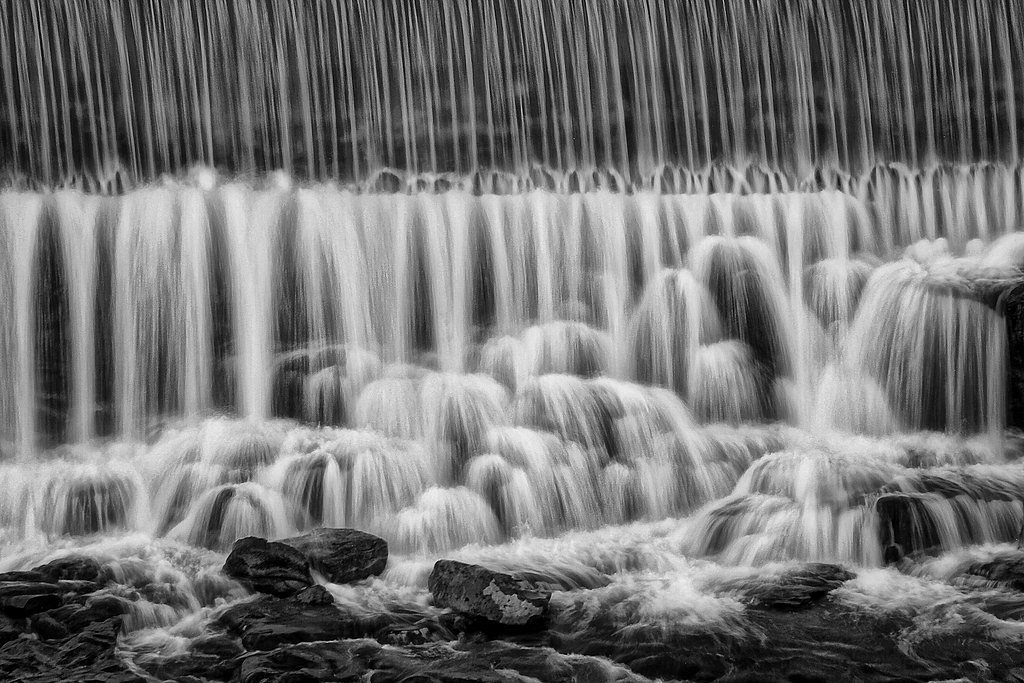
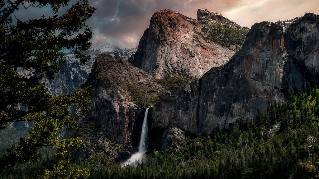
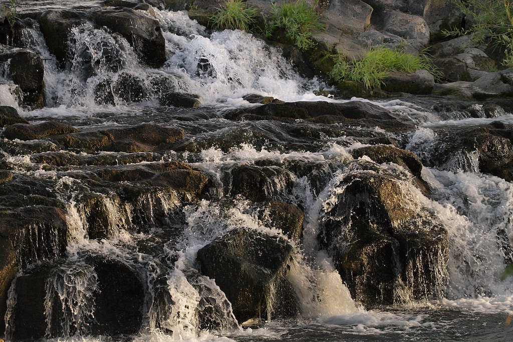
About The Falls
The Falls in Idaho is a quietly scenic cascade set on public lands managed by the Bureau of Land Management’s Bruneau Field Office. A compact but rewarding destination, it draws hikers and photographers who appreciate a short outing with a scenic payoff. The setting feels remote and natural—an easy escape for those looking to sample Idaho’s rugged landscape without committing to a long backcountry expedition. The site sits on BLM-managed ground (designation: PUB), so access and conditions can change with season and weather; the Bruneau Field Office is the best source for up-to-date trail and access information. The Falls is well suited to day visitors and moderate hikers—bring water, sun protection, and sturdy footwear, and be prepared for variable trail conditions typical of BLM routes in the region.
The Setting
The Falls sits at 5,463 feet within Bruneau Field Office, fed by the Cottonwood Creek, in the high mountains of Idaho.
Trail & Hike Details
The Approach
The moderate 2.4-mile out-and-back trail gains 350 feet of elevation on the way to the falls.
Trail Description
This is an approximately 2.4-mile out-and-back route with about 350 feet of elevation gain and a moderate difficulty rating. The BLM lists it as a straightforward out-and-back hike; more detailed surface, grade, or official trail class information is not specified in the available land unit data. Trail conditions can vary, so check with the Bruneau Field Office before you go for current access, parking, and any seasonal advisories.
What to Expect
Visitors can expect a serene natural environment with the sound of cascading water and opportunities for photography. The area may also feature surrounding forested landscapes or open vistas.
Accessibility
The trail is not wheelchair accessible. Uneven terrain and elevation changes require steady footing.
Frequently Asked Questions
🐶 Are Dogs Allowed at The Falls?
❌ Dogs are not allowed
Are There Any Fees or Permits Required?
🆖 No fees required
🏊 Is There Swimming at The Falls?
❌ Swimming is not allowed
When to Visit
Spring and early summer are typically the best times to visit, as water flow is often at its peak due to snowmelt.
Seasonal Access
The best time to visit is Spring, Summer, and Fall. Access roads and trails may close during winter due to snow.
Safety Information
Trails may be slippery, especially after rain or during spring snowmelt. Visitors should exercise caution near the water and avoid getting too close to the edge of the falls.
Current Water Conditions
1 ft³/s
Current discharge — how much water is flowing
Much lower than usual for this time of year
7-Day Discharge Trend
What does this mean for your visit?
Flow is well below normal for this time of year, so the waterfall may be a trickle.
About This Gauge
This gauge is on a nearby waterway and may not reflect exact conditions at the falls.
7-Day Flow Outlook
Based on the USGS gauge COTTONWOOD CREEK NR HARVEY POINT NR BRUNEAU, ID (9 km away).
Today
Barely Flowing
1 cfs
5/10Tomorrow
Barely Flowing
1 cfs
5/10Wed
Low
1 cfs
3/10Thu
Barely Flowing
1 cfs
5/10Fri
Barely Flowing
1 cfs
5/10Sat
Barely Flowing
1 cfs
5/10Sun
Barely Flowing
1 cfs
5/10Best window: Today — barely flowing flow, areas of smoke (trip score 5/10).
How we calculate this
This is a transparent outlook, not a precise forecast. We take the waterfall's current flow strength (how it ranks against its historical normal for today, from the nearest USGS stream gauge), carry that ranking forward along the gauge's seasonal curve, and nudge it for forecast rain. Confidence is highest for the next day or two and falls further out. Always check official conditions and your own judgment before visiting — high flows can be dangerous.
Know when to go.
Get a free email alert when waterfalls near Grand View hit peak flow. We only send when conditions are worth the trip — no weekly newsletters, no spam.
Weather Forecast
Location & Access
Getting There
The Falls can typically be accessed via a short drive from nearby towns or cities in Idaho. Specific directions depend on the exact location of the waterfall, which may vary as there are multiple waterfalls referred to as 'The Falls' in Idaho.
Get Directions on Google MapsParking
Parking availability may vary depending on the specific location of The Falls. Visitors are advised to check local resources or signage for parking details.
Elevation
5,463 feet above sea level
Coordinates
42.529615° N, -116.188161° W
Land Management
Managed by BLM
Visitor Tips & Gear
Wear sturdy footwear and bring water, as trail conditions and distances may vary. Check weather conditions before visiting, especially during spring when trails may be muddy.
This trail sits at 5,463 ft above sea level
Elevated TrailUV radiation is roughly 22% stronger at this elevation than at sea level, and the dry air accelerates dehydration. Extra sun protection and fluids go a long way.
As an Amazon Associate, we earn from qualifying purchases.

Coppertone Sport SPF 50 Sunscreen
UV intensity jumps ~4% per 1,000 ft — at this elevation you can burn in half the time.

Sun Bum SPF 30 Lip Balm (3-Pack)
Lips have almost no natural UV protection and burn fast in thin, dry mountain air.

Liquid I.V. Electrolyte Packets
You lose moisture ~2x faster at elevation — electrolytes help you absorb water efficiently.

ROCKNIGHT Polarized UV400 Sunglasses
High-altitude glare off rock and water is intense — UV400 lenses block 99%+ of UVA/UVB.
As an Amazon Associate, we earn from qualifying purchases.
With 2.4 miles and 350 ft of elevation gain, sturdy boots and trekking poles will help on this moderate trail. Sun exposure on the trail makes good sun protection a must in summer.

Polarized Sunglasses (Knockaround)
Cuts glare off the water so you actually see the falls — and your photos turn out better too.

Columbia Watertight II Rain Jacket
Packs into its own pocket, seam-sealed, and keeps you dry from spray and surprise rain.

Earth Pak Waterproof Dry Bag
Keeps your phone and gear dry when waterfall mist soaks everything else.

Waterproof Phone Pouch (AiRunTech)
Cheap insurance — take photos right next to the falls without killing your phone.

Timberland Euro Sprint Mid Waterproof
Trusted waterproof boot with premium leather and grippy rubber sole — reliable on rocky, wet trails.

TrailBuddy Trekking Poles
Lightweight aluminum, cork grips, and flip-locks that actually hold — a best-seller for good reason.
Where to Stay
Browse vacation cabins and private rentals nearby
Unique outdoor stays — tents, yurts, and treehouses
Rent a campervan or RV for your waterfall road trip
Some links are affiliate links. We may earn a commission at no extra cost to you.
Nearby Hot Springs
Hot springs near Grand View, Idaho
Lower Birch Spring
Lower Birch Spring barely qualifies as thermal at 77 degrees Fahrenheit -- just 26 degrees above the ambient air in Owyhee Coun...
Indian Bathtub Hot Springs
Indian Bathtub Hot Springs holds at a body-temperature 99 degrees Fahrenheit on BLM land near Mountain Home Air Force Base, sit...
Lower Indian Bathtub Hot Springs
Lower Indian Bathtub Hot Springs flows at 108 degrees Fahrenheit with a discharge of 1.0 cubic feet per second -- a substantial...
Bruneau Hot Spring
Bruneau Hot Spring sits at just 2,625 feet in the low desert of Elmore County, where annual rainfall barely reaches 9.6 inches ...
Buckaroo Hot Spring
Buckaroo Hot Spring emerges at 109 degrees Fahrenheit in the same southern Idaho desert corridor as neighboring Bruneau Hot Spr...
Indian Hot Springs
Indian Hot Springs pours out at 160 degrees Fahrenheit on BLM land near Glenns Ferry, running 106.8 degrees above the surroundi...
Looking for a soak after your hike? Explore more hot springs near Grand View, Idaho on SoakingSprings.
Explore Idaho springsAdditional Information
Nearby Attractions
Nearby attractions may include other waterfalls, hiking trails, or scenic viewpoints in Idaho. Specific recommendations depend on the exact location of The Falls.
Wildlife
The area may feature local wildlife such as birds, deer, or small mammals. Visitors should observe wildlife from a safe distance.
Cities near The Falls
Other waterfalls named The Falls
20 other waterfalls share this name across the U.S.
Writing about The Falls? Embed this waterfall on your site for free.