
Photo Credits (5)
Difficulty
Moderate
Trail Length
2.4 miles
Trail Type
Out And Back
Elevation Gain
350 ft
About The Falls
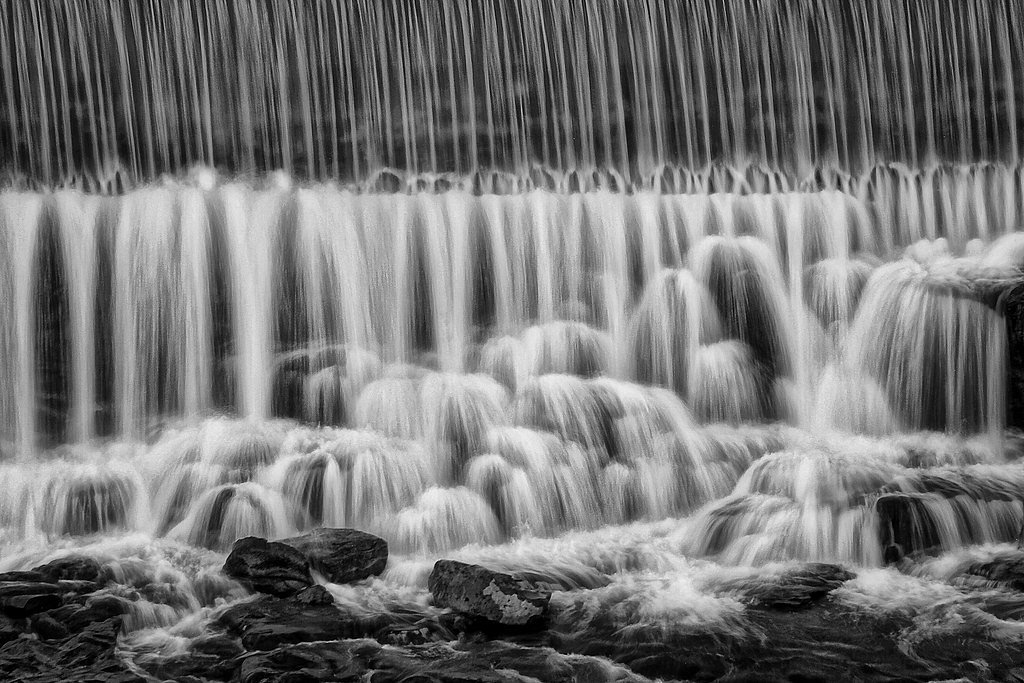
The Falls is a peaceful, scenic cascade tucked into the forests near Auburn, Fairview, and Grover, Idaho. Nestled within Caribou National Forest and managed by the U.S. Forest Service, the site feels comfortably wild yet accessible — a favorite stop for hikers and photographers looking for a short nature escape. The route to the water crosses native forest floor and opens to a pleasant view of the falls framed by local timber. Access is provided via the USFS WEBSTER CREEK Trail (Trail #5112), and the area is convenient for overnight trips: Johnson Guard Station campground sits about 8.95 km away for those who want to turn the visit into a multi-day outing. With a moderate approach and modest elevation gain, The Falls is an inviting destination for families and day-hikers seeking a quick, restorative mountain outing.
The Setting
The Falls sits at 7,047 feet within Caribou National Forest, fed by the Blackfoot River, in the high mountains of Idaho.
Trail & Hike Details
The Approach
The moderate hike follows Webster Creek (#5112), a 2.4-mile out-and-back trail over natural surface. Expect 350 feet of elevation gain. The trail is moderately developed (Class 2).
USFS Trail
WEBSTER CREEK #5112
Trail Class
Moderately Developed
Surface
USFS Segment
0.07 miTrail Description
The primary access is the WEBSTER CREEK (Trail #5112) approach. The overall hike is an out-and-back of about 2.4 miles with roughly 350 feet of elevation gain and is rated moderate. According to USFS trail data, Trail #5112 is Class 2 and the tread is native material; the USFS GIS records a 0.07-mile segment for the official trail at the falls. Expect natural dirt and root surface underfoot and short, non-technical sections (Class 2) — suitable for most hikers prepared for uneven terrain and seasonal changes in trail conditions.
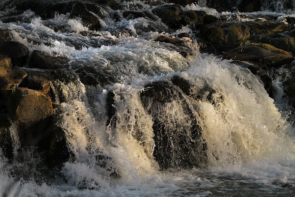
What to Expect
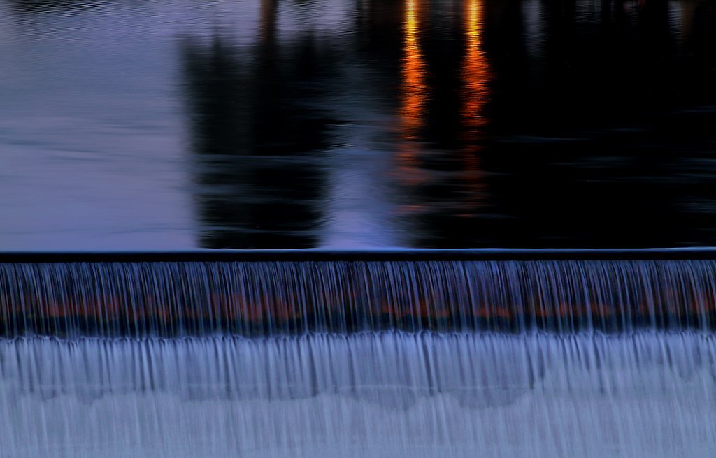
Visitors can expect a peaceful natural setting with the sound of cascading water. The area may feature lush vegetation, especially in spring and summer, and the waterfall flow may vary depending on recent rainfall or snowmelt.
Accessibility
The trail is not wheelchair accessible. Uneven terrain and elevation changes require steady footing.
Frequently Asked Questions
🐶 Are Dogs Allowed at The Falls?
❌ Dogs are not allowed
Are There Any Fees or Permits Required?
🆖 No fees required
🏊 Is There Swimming at The Falls?
❌ Swimming is not allowed
When to Visit
Spring and early summer are typically the best times to visit, as the waterfall flow is strongest due to snowmelt. Fall offers beautiful foliage, while winter may bring icy conditions.
Seasonal Access
The best time to visit is Spring, Summer, and Fall. Access roads and trails may close during winter due to snow. Check with Caribou National Forest for seasonal road closures.
Safety Information
Be cautious of slippery rocks near the waterfall. Weather conditions can change rapidly, so be prepared for rain or sudden temperature drops. Inform someone of your plans before heading out.
Current Water Conditions
Based on a USGS gauge 20.3 miles away
54 ft³/s
Current discharge — how much water is flowing
Lower than usual for this time of year
Based on 52 years of record
2.05 ft
Water depth at gauge
7-Day Discharge Trend
What does this mean for your visit?
Flow is lower than usual for this time of year.
About This Gauge
This gauge is on a regional waterway. Conditions at the falls may differ, especially after local rain.
7-Day Flow Outlook
Based on the USGS gauge BLACKFOOT RIVER AB RESERVOIR NR HENRY ID (33 km away).
Today
Roaring
58 cfs
6/10Tomorrow
Roaring
60 cfs
6/10Wed
Roaring
61 cfs
6/10Thu
Roaring
63 cfs
6/10Fri
Roaring
53 cfs
9/10Sat
Roaring
48 cfs
9/10Sun
Roaring
48 cfs
9/10Best window: Fri — roaring flow, mostly sunny (trip score 9/10).
Best time of year: this gauge typically runs highest from early April to early July, peaking in May.
How we calculate this
This is a transparent outlook, not a precise forecast. We take the waterfall's current flow strength (how it ranks against its historical normal for today, from the nearest USGS stream gauge), carry that ranking forward along the gauge's seasonal curve, and nudge it for forecast rain. Confidence is highest for the next day or two and falls further out. Always check official conditions and your own judgment before visiting — high flows can be dangerous.
Know when to go.
Get a free email alert when waterfalls near Auburn hit peak flow. We only send when conditions are worth the trip — no weekly newsletters, no spam.
Weather Forecast
Location & Access
Getting There
The Falls is located approximately 5.6 miles from Auburn, 9.0 miles from Fairview, and 9.2 miles from Grover. The coordinates for the location are 42.7619, -111.1127. Access may require driving on rural roads, so ensure your vehicle is suitable for such conditions.
Get Directions on Google MapsParking
Parking availability is unclear, but visitors may find small pullouts or informal parking areas near the trailhead. It is recommended to arrive early during peak seasons to secure a spot.
Elevation
7,047 feet above sea level
Coordinates
42.761872° N, -111.112711° W
Land Management
Managed by USFS
Visitor Tips & Gear
Wear sturdy footwear and bring plenty of water. Check weather conditions before your visit, as trails may become muddy or slippery after rain. Cell service may be limited in the area.
This trail sits at 7,047 ft above sea level
Elevated TrailUV radiation is roughly 28% stronger at this elevation than at sea level, and the dry air accelerates dehydration. Extra sun protection and fluids go a long way.
As an Amazon Associate, we earn from qualifying purchases.

Coppertone Sport SPF 50 Sunscreen
UV intensity jumps ~4% per 1,000 ft — at this elevation you can burn in half the time.

Sun Bum SPF 30 Lip Balm (3-Pack)
Lips have almost no natural UV protection and burn fast in thin, dry mountain air.

Liquid I.V. Electrolyte Packets
You lose moisture ~2x faster at elevation — electrolytes help you absorb water efficiently.

ROCKNIGHT Polarized UV400 Sunglasses
High-altitude glare off rock and water is intense — UV400 lenses block 99%+ of UVA/UVB.
As an Amazon Associate, we earn from qualifying purchases.
With 2.4 miles and 350 ft of elevation gain, sturdy boots and trekking poles will help on this moderate trail. Sun exposure on the trail makes good sun protection a must in summer.

Polarized Sunglasses (Knockaround)
Cuts glare off the water so you actually see the falls — and your photos turn out better too.

Columbia Watertight II Rain Jacket
Packs into its own pocket, seam-sealed, and keeps you dry from spray and surprise rain.

Earth Pak Waterproof Dry Bag
Keeps your phone and gear dry when waterfall mist soaks everything else.

Waterproof Phone Pouch (AiRunTech)
Cheap insurance — take photos right next to the falls without killing your phone.

Timberland Euro Sprint Mid Waterproof
Trusted waterproof boot with premium leather and grippy rubber sole — reliable on rocky, wet trails.

TrailBuddy Trekking Poles
Lightweight aluminum, cork grips, and flip-locks that actually hold — a best-seller for good reason.
Where to Stay

Fairfield Inn by Marriott Afton Star Valley

Wolf Den Log Cabin Motel and RV Park

Townhomes on the Green

Cabin Creek Inn
Browse vacation cabins and private rentals nearby
Unique outdoor stays — tents, yurts, and treehouses
Rent a campervan or RV for your waterfall road trip
Some links are affiliate links. We may earn a commission at no extra cost to you.
Nearby Campground
JOHNSON GUARD STATION
5.6 miles away · 1 sites
Overview Johnson Guard Station is located 30 miles east of Soda Springs, Idaho, on a site that was established in 1910. The current building was constructed in 1934, and is named after James J. Johnson, who served as ranger of the Georgetown Ranger District from 1907-1913. It's been used for various purposes over the years, from serving as summer headquarters to housing work crews. The cabin is accessible by car in warmer months and by snowmobile in winter. The cabin provides a few conveniences,
Book on Recreation.govNearby Hot Springs
Hot springs near Auburn, Idaho
Johnson Springs
Johnson Springs emerges at 115 degrees Fahrenheit at 6,080 feet elevation in Lincoln County near Afton, located just 220 feet f...
Auburn Hot Springs
Auburn Hot Springs discharges water at 144°F in Wyoming's Salt River Range, making it one of the state's genuinely scalding the...
Alpine Warm Spring
Alpine Warm Spring emerges at 99°F near Hoback at 5,580 feet elevation, maintaining water 55.6°F above ambient in mountain terr...

Soda Springs
The town of Soda Springs, Idaho sits atop a carbonated aquifer that produces thousands of mineral springs, a geological oddity ...
Henry Warm Spring
Henry Warm Spring surfaces at a modest 86°F in Caribou County near Soda Springs, sitting at 6,165 feet in southeastern Idaho's ...
Pescadero Warm Spring
Pescadero Warm Spring surfaces at a mild 79 degrees Fahrenheit in Bear Lake County, Idaho, sitting right along Pescadero Road a...
Looking for a soak after your hike? Explore more hot springs near Auburn, Idaho on SoakingSprings.
Explore Idaho springsAdditional Information
Nearby Attractions
Nearby towns include Auburn, Fairview, and Grover. The surrounding area may offer additional hiking trails and scenic viewpoints.
Wildlife
The area may be home to various wildlife, including birds, deer, and small mammals. Be cautious and respectful of wildlife during your visit.
Cities near The Falls
Other waterfalls named The Falls
20 other waterfalls share this name across the U.S.
Writing about The Falls? Embed this waterfall on your site for free.