Photo Credits (5)
Difficulty
Moderate
Trail Length
2.5 miles
Trail Type
Out And Back
Elevation Gain
500 ft
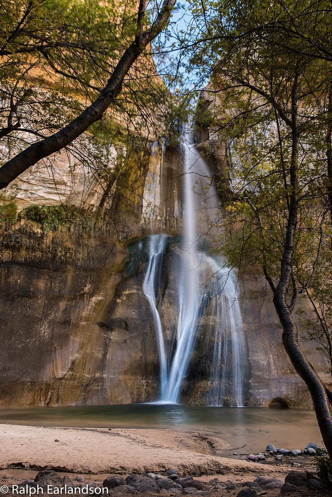
About The Falls
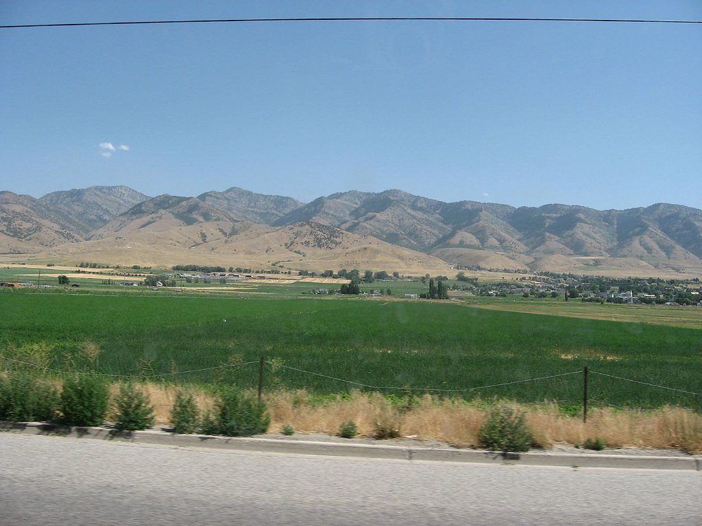
The Falls in Utah is a picturesque waterfall set amid scenic, varied terrain and a favorite stop for hikers and nature enthusiasts. Reaching the cascade is a rewarding effort: the route is a moderate 2.5-mile out-and-back hike with about 500 feet of elevation gain, making it a great half-day outing for anyone comfortable with steady climbs. The hike moves through a pleasant mix of shaded and open stretches, with the landscape opening up as you approach the water. The setting is peaceful and framed by natural beauty; the trail is generally well-marked but includes some rocky, uneven sections, so good footwear and a steady pace will help you get the most out of the visit.
The Setting
The Falls sits at 6,204 feet along the East Fork Virgin River, in the high mountains of Utah.
Trail & Hike Details
The Approach
The moderate 2.5-mile out-and-back trail gains 500 feet of elevation on the way to the falls.
Trail Description
Moderate 2.5-mile out-and-back hike with roughly 500 feet of elevation gain. The trail is well-marked and alternates between shaded and open areas; expect some rocky and uneven footing in places. Difficulty: moderate. Trail type: out-and-back.
What to Expect
Dogs are welcome.
Accessibility
The trail is not wheelchair accessible. Uneven terrain and elevation changes require steady footing.
Frequently Asked Questions
🐶 Are Dogs Allowed at The Falls?
✅ Dogs are allowed
Are There Any Fees or Permits Required?
🆖 No fees required
🏊 Is There Swimming at The Falls?
❌ Swimming is not allowed
When to Visit
The best time to visit is during spring or early summer when the waterfall flow is strongest due to snowmelt. Fall also offers beautiful foliage, while summer provides warm weather for hiking.
Seasonal Access
The best time to visit is Spring, Summer, and Fall. Access roads and trails may close during winter due to snow. Watch for flash flood warnings during monsoon season (July through September).
Safety Information
The trail may be slippery after rain or snow. Watch for loose rocks and uneven surfaces. Always stay on the marked trail to avoid accidents.
Current Water Conditions
5 ft³/s
Current discharge — how much water is flowing
Lower than usual for this time of year
Based on 59 years of record
9.99 ft
Water depth at gauge
7-Day Discharge Trend
What does this mean for your visit?
Flow is lower than usual for this time of year.
About This Gauge
This gauge is on a nearby waterway and may not reflect exact conditions at the falls.
7-Day Flow Outlook
Based on the USGS gauge EAST FORK VIRGIN RIVER NEAR GLENDALE, UT (11 km away).
Today
Barely Flowing
5 cfs
5/10Tomorrow
Barely Flowing
5 cfs
5/10Wed
Barely Flowing
5 cfs
5/10Thu
Barely Flowing
5 cfs
5/10Fri
Barely Flowing
5 cfs
5/10Sat
Barely Flowing
5 cfs
5/10Sun
Barely Flowing
5 cfs
5/10Best window: Today — barely flowing flow, sunny (trip score 5/10).
Best time of year: this gauge typically runs highest from late January to mid April, peaking in March.
How we calculate this
This is a transparent outlook, not a precise forecast. We take the waterfall's current flow strength (how it ranks against its historical normal for today, from the nearest USGS stream gauge), carry that ranking forward along the gauge's seasonal curve, and nudge it for forecast rain. Confidence is highest for the next day or two and falls further out. Always check official conditions and your own judgment before visiting — high flows can be dangerous.
Know when to go.
Get a free email alert when waterfalls near Glendale hit peak flow. We only send when conditions are worth the trip — no weekly newsletters, no spam.
Weather Forecast
Location & Access
Getting There
The Falls is located near the town of Provo, Utah, and can be accessed via a trailhead in the area. Specific directions may vary depending on the starting point, so it is recommended to use a reliable map or GPS for navigation.
Get Directions on Google MapsParking
Parking is available near the trailhead, but spaces may be limited during peak seasons. Arrive early to secure a spot.
Elevation
6,204 feet above sea level
Coordinates
37.291171° N, -112.492431° W
Visitor Tips & Gear
Wear sturdy hiking shoes and bring plenty of water, especially during warmer months. Arrive early to avoid crowds and secure parking. Check weather conditions before heading out, as the trail may be slippery after rain.
This trail sits at 6,204 ft above sea level
Elevated TrailUV radiation is roughly 25% stronger at this elevation than at sea level, and the dry air accelerates dehydration. Extra sun protection and fluids go a long way.
As an Amazon Associate, we earn from qualifying purchases.

Coppertone Sport SPF 50 Sunscreen
UV intensity jumps ~4% per 1,000 ft — at this elevation you can burn in half the time.

Sun Bum SPF 30 Lip Balm (3-Pack)
Lips have almost no natural UV protection and burn fast in thin, dry mountain air.

Liquid I.V. Electrolyte Packets
You lose moisture ~2x faster at elevation — electrolytes help you absorb water efficiently.

ROCKNIGHT Polarized UV400 Sunglasses
High-altitude glare off rock and water is intense — UV400 lenses block 99%+ of UVA/UVB.
As an Amazon Associate, we earn from qualifying purchases.
With 2.5 miles and 500 ft of elevation gain, sturdy boots and trekking poles will help on this moderate trail. Sun exposure on the trail makes good sun protection a must in summer.

Polarized Sunglasses (Knockaround)
Cuts glare off the water so you actually see the falls — and your photos turn out better too.

Columbia Watertight II Rain Jacket
Packs into its own pocket, seam-sealed, and keeps you dry from spray and surprise rain.

Earth Pak Waterproof Dry Bag
Keeps your phone and gear dry when waterfall mist soaks everything else.

Waterproof Phone Pouch (AiRunTech)
Cheap insurance — take photos right next to the falls without killing your phone.

Timberland Euro Sprint Mid Waterproof
Trusted waterproof boot with premium leather and grippy rubber sole — reliable on rocky, wet trails.

TrailBuddy Trekking Poles
Lightweight aluminum, cork grips, and flip-locks that actually hold — a best-seller for good reason.
Where to Stay

The Wandering Star Inn

Arrowhead Country Cabins

The Knotty Pine

Mount Carmel Motel in Southern Utah Desert Room 6
Browse vacation cabins and private rentals nearby
Unique outdoor stays — tents, yurts, and treehouses
Rent a campervan or RV for your waterfall road trip
Some links are affiliate links. We may earn a commission at no extra cost to you.
Nearby Campground
Clay Flat Kiosk
13.1 miles away · 0 sites
"The Clay Flay Kiosk is located on the Yellowjacket road approximately two miles south of Highway 89, just north of Kanab, UT. It serves as a staging area for ATVs, UTVs, and horse trailers. It accesses Harris Mountain and Moncur Spring. You will also find several dispersed camping sites in this area. This area is also used for grazing. Please be cautious and respectful of the wildlife and range improvements. "
Book on Recreation.govNearby Hot Springs
Hot springs near Glendale, Utah
Red Canyon
Red Canyon Spring flows at 72°F at 5,360 feet elevation in Kane County's red rock country near Kanab, running 18.6 degrees abov...
Lefevre
Lefevre Spring discharges at 90°F from BLM land at 6,460 feet elevation near Panguitch, accessible via a 441-meter walk from th...
Tebbs
Tebbs flows at 68 degrees Fahrenheit in Garfield County at 6,460 feet elevation, emerging exactly 20 degrees above the regional...

Dixie (Laverkin) Hot Springs
Dixie Hot Springs flows at 108°F just 25 meters from road access in Washington County, making it one of southwestern Utah's hot...
Berry Springs
Berry Springs emerges at 75°F near Hurricane in Washington County, Utah, at 2,860 feet elevation in the red rock landscape of U...
Virgin River Spring
A 70-degree spring flowing at 2,760 feet elevation in Washington County, barely thermal at just 5.6 degrees above the warm ambi...
Looking for a soak after your hike? Explore more hot springs near Glendale, Utah on SoakingSprings.
Explore Utah springsAdditional Information
Nearby Attractions
Nearby attractions include Bridal Veil Falls, Provo Canyon, and the Sundance Mountain Resort.
Wildlife
Visitors may encounter wildlife such as deer, birds, and small mammals along the trail. Be cautious and avoid feeding or approaching animals.
Cities near The Falls
Other waterfalls named The Falls
20 other waterfalls share this name across the U.S.
Writing about The Falls? Embed this waterfall on your site for free.