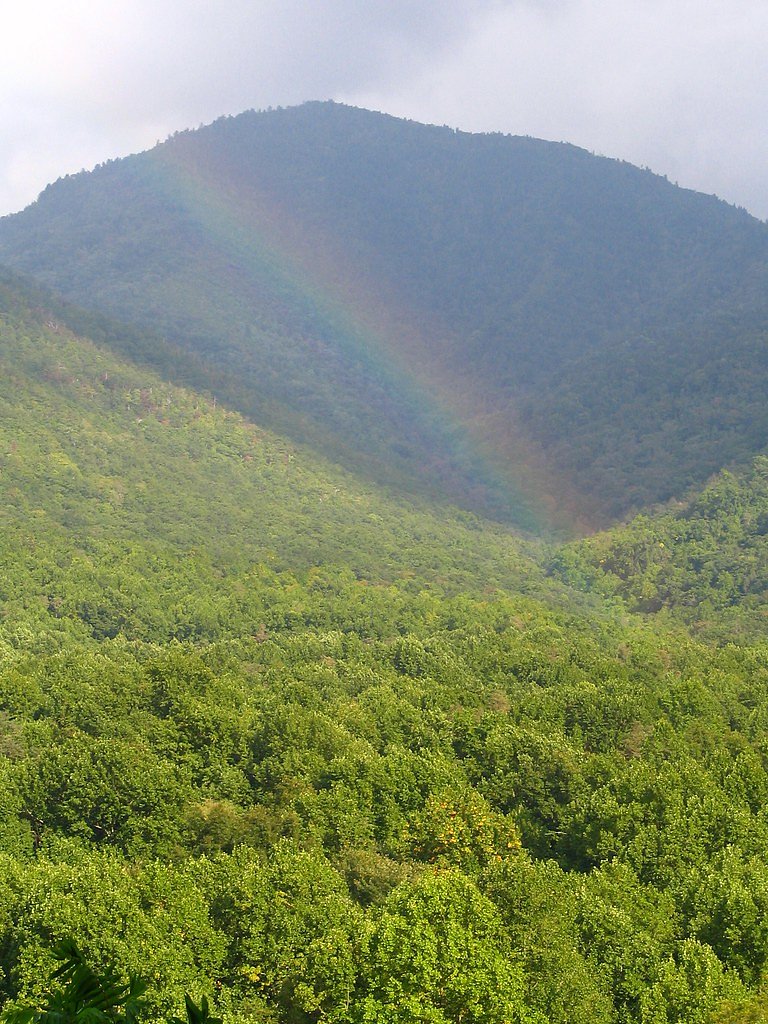
Rainbow Falls
Tennessee • 80 ft
By Armen Suny · Last verified Mar 2026
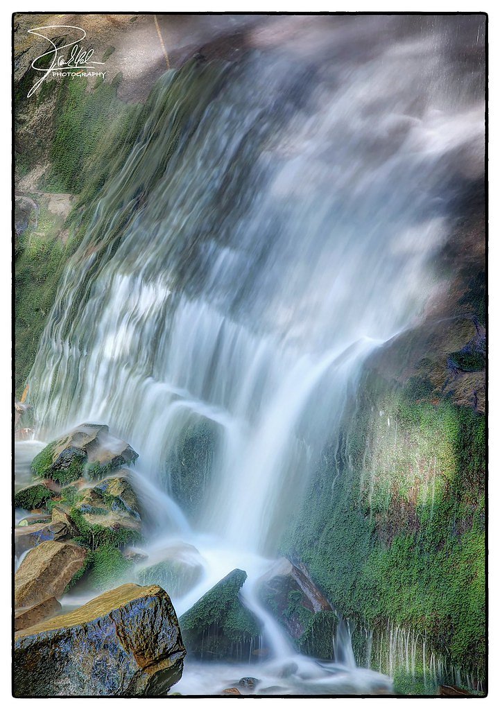
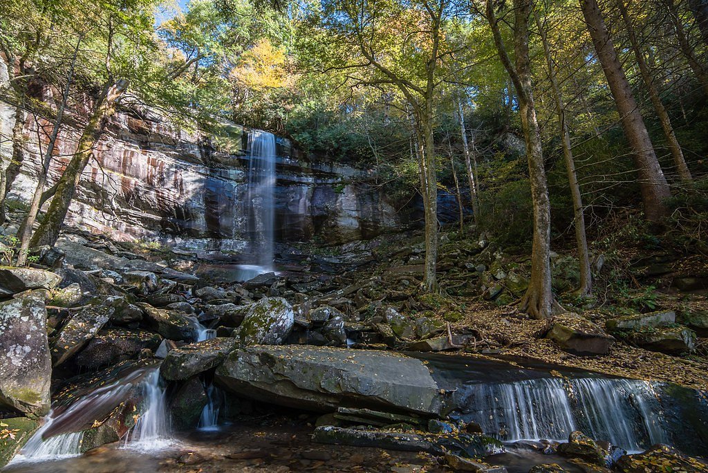
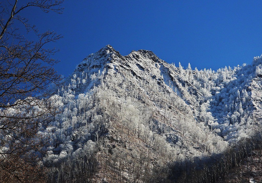
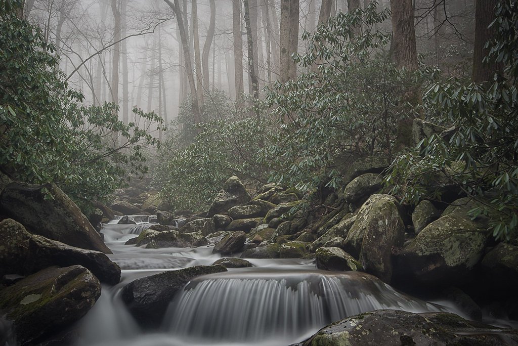

Photo Credits (5)
Difficulty
Hard
Trail Length
5.4 miles
Trail Type
Out And Back
Elevation Gain
800 ft
About Rainbow Falls
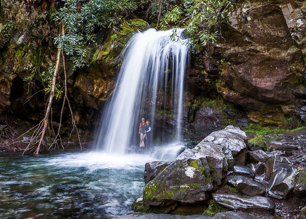
Rainbow Falls is a stunning 80-foot waterfall located in the Great Smoky Mountains National Park near Gatlinburg, Tennessee. It is named for the rainbow that often appears in the mist on sunny afternoons.
The Setting
Rainbow Falls sits at 4,199 feet within Great Smoky Mountains National Park, in the mountains of Tennessee. The falls drop 80 feet.
Height: 80 feet
Nearby Falls Worth Visiting
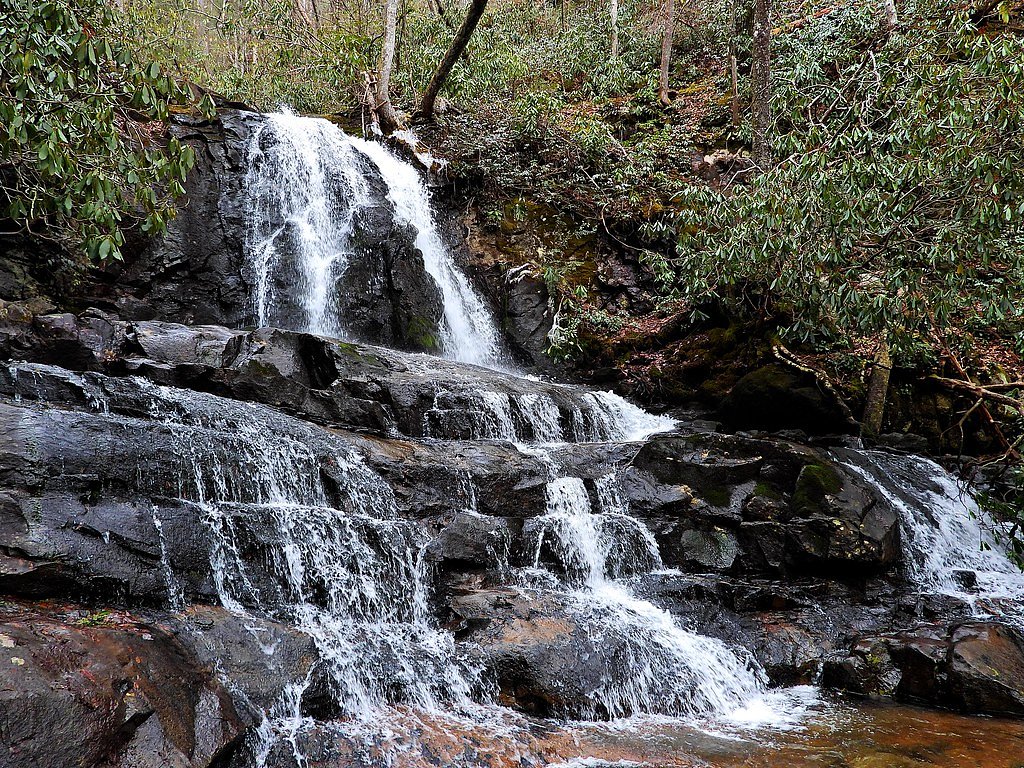
Ramsey Cascades (100 ft) lies 9.7 miles to the east. Also nearby: Laurel Falls (80 ft, 7.3 mi) and Grotto Falls (25 ft, 1.1 mi).
Trail & Hike Details
The Approach
The hard 5.4-mile out-and-back trail gains 800 feet of elevation on the way to the falls.
Trail Description
The Rainbow Falls Trail is a challenging but rewarding hike through the lush forests of the Great Smoky Mountains. The trail features a steady incline with rocky and uneven terrain, leading to the breathtaking Rainbow Falls. The trail continues beyond the falls to Mount LeConte for those seeking a longer hike.
What to Expect
The falls cascade 80 feet.
Accessibility
The trail involves steep, uneven terrain with significant elevation change and is not accessible to mobility devices.
Frequently Asked Questions
🐶 Are Dogs Allowed at Rainbow Falls?
❌ Dogs are not allowed
Are There Any Fees or Permits Required?
🆖 No fees required
🏊 Is There Swimming at Rainbow Falls?
❌ Swimming is not allowed
When to Visit
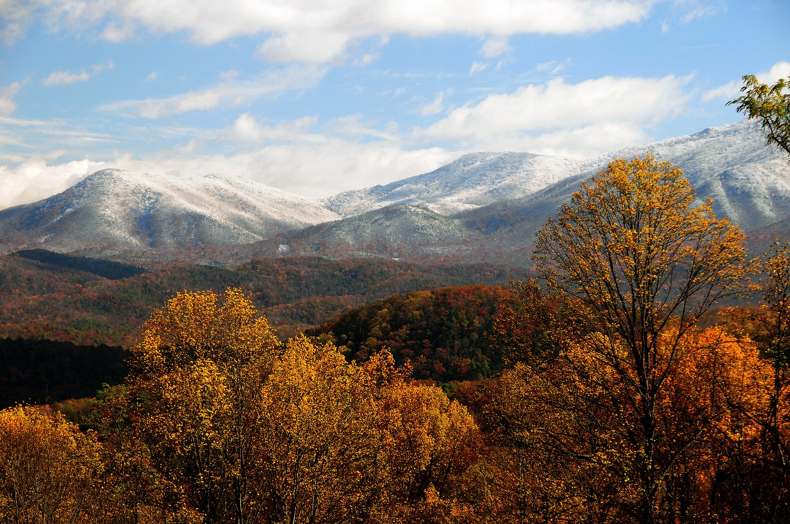
Spring and early summer are ideal for viewing the waterfall at its fullest, but fall offers beautiful foliage, and winter provides a chance to see the falls partially frozen.
Seasonal Access
The best time to visit is Spring, Summer, Fall, and Winter. Check the National Park Service website for current conditions.
Safety Information
The trail can be slippery, especially after rain. Watch for loose rocks and roots. Carry plenty of water and be prepared for sudden weather changes. Black bears are present in the area; follow park guidelines for bear safety.
Current Water Conditions
176 ft³/s
Current discharge — how much water is flowing
About average for this time of year
Based on 3 years of record
3.80 ft
Water depth at gauge
7-Day Discharge Trend
What does this mean for your visit?
Flow is about average for this time of year.
About This Gauge
7-Day Flow Outlook
Based on the USGS gauge WEST PRONG LITTLE PIGEON R NR GATLINBURG, TN (7 km away).
Today
Strong
201 cfs
7/10Tomorrow
Strong
720 cfs
7/10Fri
Strong
420 cfs
7/10Sat
Strong
351 cfs
7/10Sun
Strong
288 cfs
7/10Mon
Strong
236 cfs
7/10Tue
Strong
299 cfs
7/10Best window: Today — strong flow, sunny then chance showers and thunderstorms (trip score 7/10).
Best time of year: this gauge typically runs highest from mid March to early April, peaking in February.
How we calculate this
This is a transparent outlook, not a precise forecast. We take the waterfall's current flow strength (how it ranks against its historical normal for today, from the nearest USGS stream gauge), carry that ranking forward along the gauge's seasonal curve, and nudge it for forecast rain. Confidence is highest for the next day or two and falls further out. Always check official conditions and your own judgment before visiting — high flows can be dangerous.
Know when to go.
Get a free email alert when waterfalls near Gatlinburg hit peak flow. We only send when conditions are worth the trip — no weekly newsletters, no spam.
Weather Forecast
Location & Access
Getting There
Rainbow Falls is accessible via the Rainbow Falls Trailhead, located off Cherokee Orchard Road, approximately 3.5 miles from Gatlinburg, Tennessee.
Get Directions on Google MapsParking
Parking is available at the Rainbow Falls Trailhead, but it can fill up quickly, especially during peak seasons. Arrive early to secure a spot.
Elevation
4,199 feet above sea level
Coordinates
35.662327° N, -83.464098° W
Land Management
Managed by NPS
Visitor Tips & Gear
Start early to avoid crowds and ensure you have enough daylight for the hike. Wear sturdy hiking shoes and bring plenty of water. Be prepared for changing weather conditions, as the trail is in a mountainous area.
As an Amazon Associate, we earn from qualifying purchases.
This challenging 5.4 miles trail gains 800 ft in elevation — come prepared with proper hiking boots and trekking poles. Icy conditions are common in winter — traction cleats are a smart addition.
America the Beautiful Annual Pass
Covers entrance fees at 2,000+ federal recreation sites — required at most National Parks.

Columbia Watertight II Rain Jacket
Packs into its own pocket, seam-sealed, and keeps you dry from spray and surprise rain.

Sawyer Squeeze Water Filter
The backcountry standard — filters 99.9% of bacteria and weighs just 3 oz.

Polarized Sunglasses (Knockaround)
Cuts glare off the water so you actually see the falls — and your photos turn out better too.

Earth Pak Waterproof Dry Bag
Keeps your phone and gear dry when waterfall mist soaks everything else.

Waterproof Phone Pouch (AiRunTech)
Cheap insurance — take photos right next to the falls without killing your phone.

Timberland Euro Sprint Mid Waterproof
Trusted waterproof boot with premium leather and grippy rubber sole — reliable on rocky, wet trails.
Where to Stay

Brookside Lodge - Gatlinburg - On the River

Baymont by Wyndham Gatlinburg On The River

The Circle Of Life, Hot Tub, Theater Room, 560 FREE tickets each paid day

Sidney James Mountain Lodge
Browse vacation cabins and private rentals nearby
Unique outdoor stays — tents, yurts, and treehouses
Rent a campervan or RV for your waterfall road trip
Some links are affiliate links. We may earn a commission at no extra cost to you.
Nearby Campground
TWIN CREEKS PICNIC PAVILION
2.7 miles away · 1 sites
Overview Twin Creeks Picnic Pavilion is the largest in the park, surrounded by the scenic forest of the Great Smoky Mountains National Park. Located in a secluded and private section of the Smokies, this pavilion is a popular place for group trips.Recreation Great Smoky Mountains National Park is a hiker's paradise, with over 800 miles of maintained trails ranging from short, leg-stretchers to strenuous treks, with a number of which accessible near the picnic area. Hiking is not the only reason f
Book on Recreation.govNearby Hot Springs
Hot springs near Gatlinburg, Tennessee

Looking for a soak after your hike? Explore more hot springs near Gatlinburg, Tennessee on SoakingSprings.
Explore Tennessee springsAdditional Information
Nearby Attractions
Nearby attractions include Gatlinburg, the Roaring Fork Motor Nature Trail, and Mount LeConte.
Wildlife
The area is home to black bears, deer, and a variety of bird species. Always maintain a safe distance from wildlife.
Cities near Rainbow Falls
Nearby Waterfalls
Other waterfalls named Rainbow Falls
31 other waterfalls share this name across the U.S.
Writing about Rainbow Falls? Embed this waterfall on your site for free.