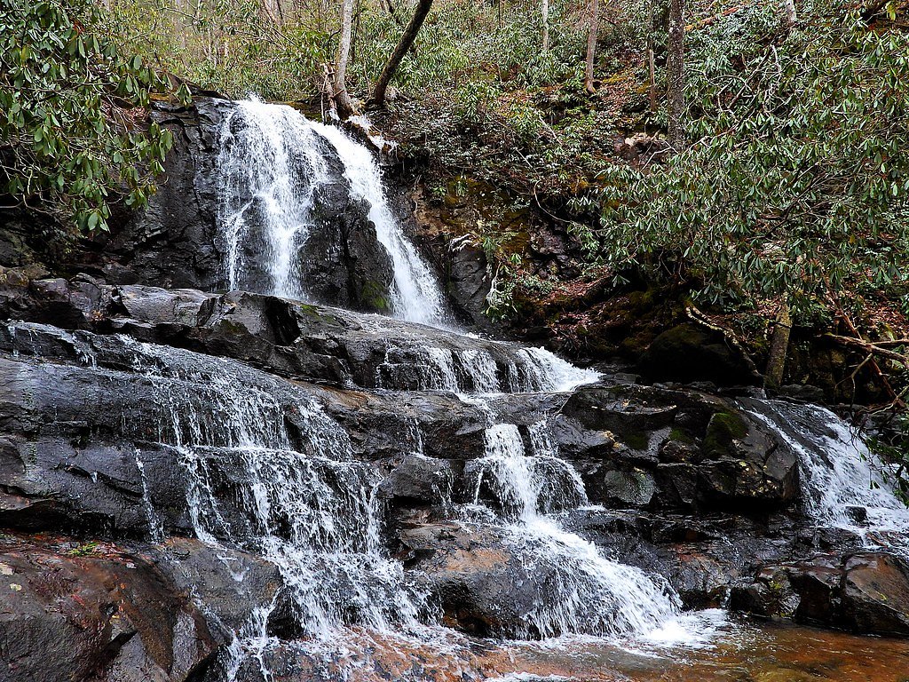
Laurel Falls
Tennessee • 80 ft
By Armen Suny · Last verified Mar 2026
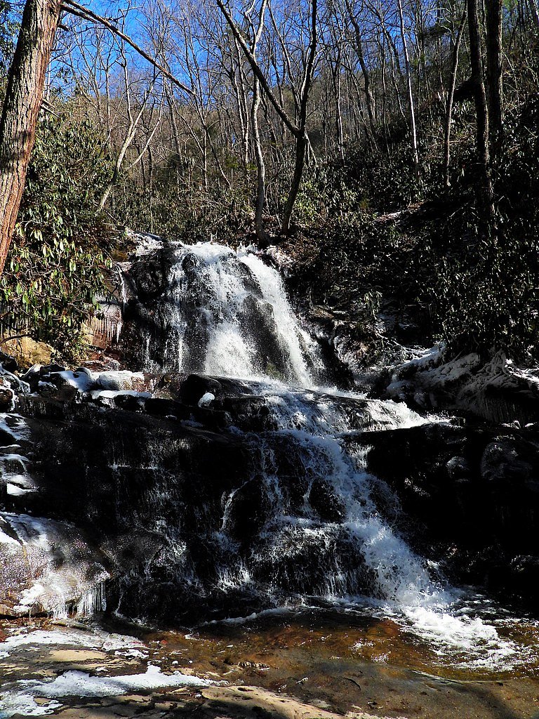
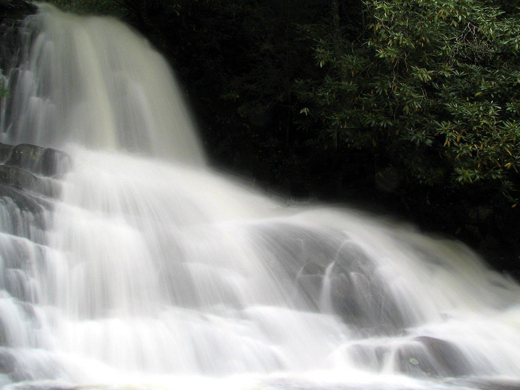
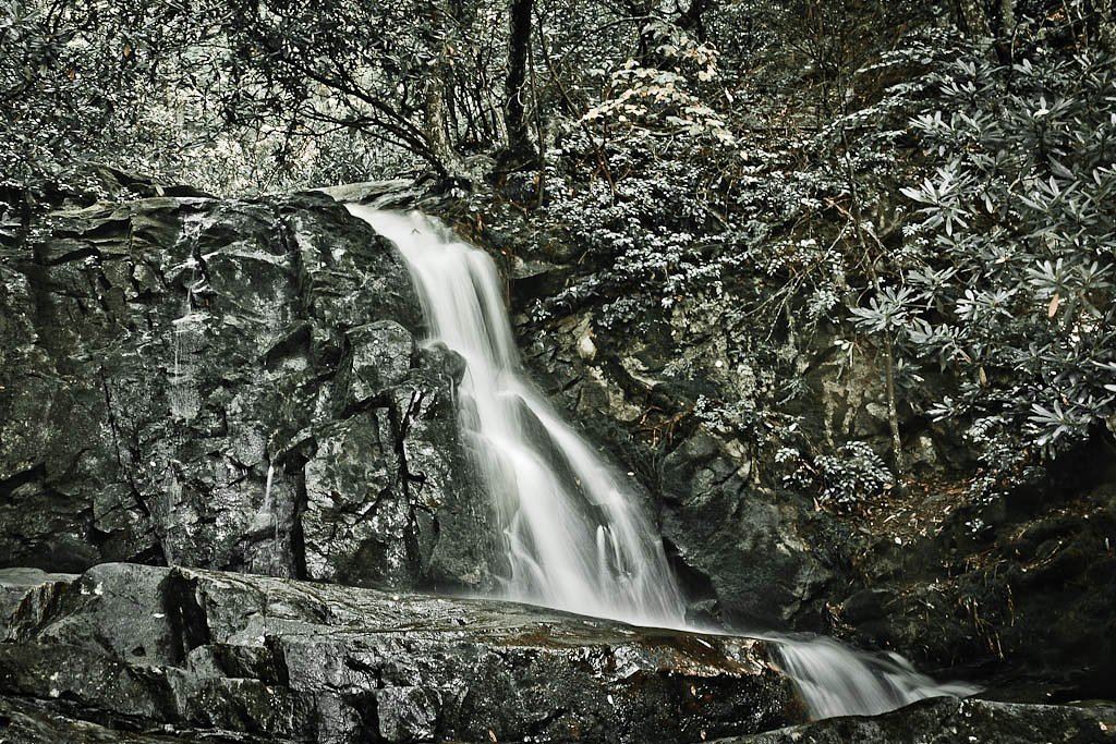
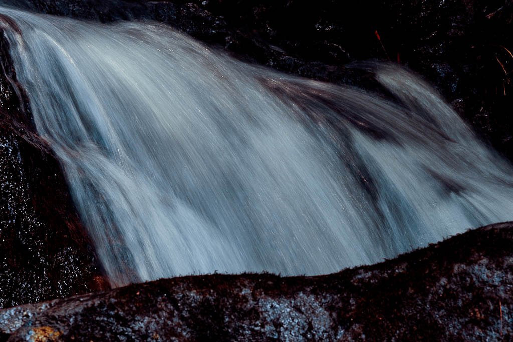

Photo Credits (5)
Difficulty
Easy
Trail Length
2.6 miles
Trail Type
Out And Back
Elevation Gain
314 ft
About Laurel Falls
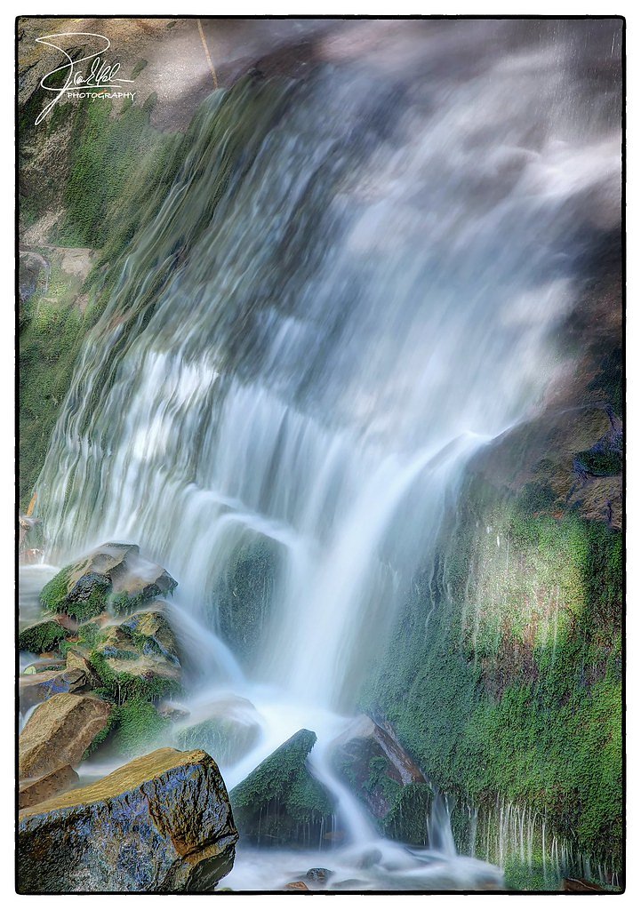
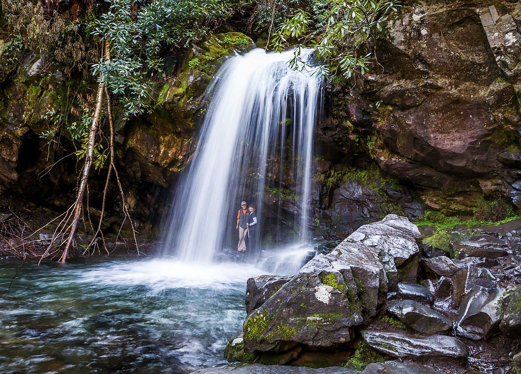
Laurel Falls is one of the most popular waterfalls in the Great Smoky Mountains National Park, located in Tennessee. It is a picturesque, multi-tiered waterfall with a total drop of approximately 80 feet, divided into an upper and lower section.
The Setting
Laurel Falls sits at 2,595 feet within Great Smoky Mountains National Park, in the hills of Tennessee. The falls drop 80 feet.
Height: 80 feet
Nearby Falls Worth Visiting
Rainbow Falls (80 ft) lies 7.3 miles to the east. Also nearby: Grotto Falls (25 ft, 8.1 mi).
Trail & Hike Details
The Approach
The easy 2.6-mile out-and-back trail gains 314 feet of elevation on the way to the falls.
Trail Description
The Laurel Falls Trail is a paved path that leads to the waterfall, making it accessible for most visitors. The trail is relatively flat with a gentle incline, and it offers scenic views of the surrounding forest. The waterfall itself is a stunning sight, with water cascading over two tiers into a small pool below.
What to Expect
The falls cascade 80 feet.
Accessibility
The trail is not wheelchair accessible. Uneven terrain and elevation changes require steady footing.
Frequently Asked Questions
🐶 Are Dogs Allowed at Laurel Falls?
❌ Dogs are not allowed
Are There Any Fees or Permits Required?
🆖 No fees required
🏊 Is There Swimming at Laurel Falls?
❌ Swimming is not allowed
When to Visit
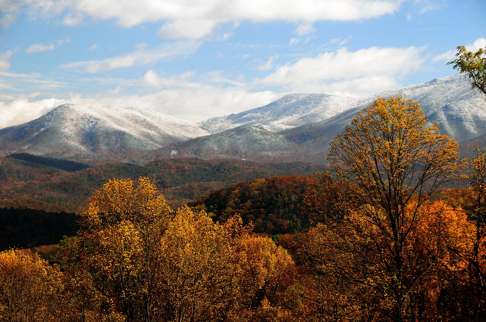
Spring and early summer are ideal times to visit, as the waterfall flow is typically strongest due to seasonal rainfall. Fall offers beautiful foliage, while winter provides a quieter experience with fewer visitors.
Seasonal Access
The best time to visit is Spring, Summer, and Fall. Winter access may be limited. Check the National Park Service website for current conditions.
Safety Information
The trail can be slippery when wet, and there are steep drop-offs near the waterfall. Stay on the trail and supervise children closely. Be aware of wildlife and do not feed or approach animals.
Current Water Conditions
675 ft³/s
Current discharge — how much water is flowing
Much higher than usual for this time of year
Based on 3 years of record
5.22 ft
Water depth at gauge
7-Day Discharge Trend
What does this mean for your visit?
The water is flowing much higher than usual, expect an impressive display.
About This Gauge
7-Day Flow Outlook
Based on the USGS gauge WEST PRONG LITTLE PIGEON R NR GATLINBURG, TN (6 km away).
Today
Roaring
428 cfs
6/10Tomorrow
Roaring
394 cfs
6/10Tue
Roaring
430 cfs
6/10Wed
Roaring
442 cfs
6/10Thu
Roaring
1493 cfs
6/10Fri
Roaring
872 cfs
6/10Sat
Roaring
728 cfs
6/10Best window: Today — roaring flow, showers and thunderstorms (trip score 6/10).
Best time of year: this gauge typically runs highest from mid March to early April, peaking in February.
How we calculate this
This is a transparent outlook, not a precise forecast. We take the waterfall's current flow strength (how it ranks against its historical normal for today, from the nearest USGS stream gauge), carry that ranking forward along the gauge's seasonal curve, and nudge it for forecast rain. Confidence is highest for the next day or two and falls further out. Always check official conditions and your own judgment before visiting — high flows can be dangerous.
Know when to go.
Get a free email alert when waterfalls near Gatlinburg hit peak flow. We only send when conditions are worth the trip — no weekly newsletters, no spam.
Weather Forecast
Location & Access
Getting There
Laurel Falls is located along Little River Road in the Great Smoky Mountains National Park. The trailhead is about 3.8 miles from the Sugarlands Visitor Center, heading toward Cades Cove.
Get Directions on Google MapsParking
Parking is available at the trailhead, but it is limited and fills up quickly, especially during peak seasons. Arrive early to secure a spot.
Elevation
2,595 feet above sea level
Coordinates
35.677461° N, -83.593159° W
Land Management
Managed by NPS
Visitor Tips & Gear
Arrive early to avoid crowds and secure parking. Wear sturdy shoes, as the paved trail can be slippery when wet. Bring water and snacks, and be prepared for limited cell service in the area.
As an Amazon Associate, we earn from qualifying purchases.
This easy 2.6 miles hike is straightforward — comfortable trail shoes and plenty of water should do. Sun exposure on the trail makes good sun protection a must in summer.
America the Beautiful Annual Pass
Covers entrance fees at 2,000+ federal recreation sites — required at most National Parks.

Polarized Sunglasses (Knockaround)
Cuts glare off the water so you actually see the falls — and your photos turn out better too.

Columbia Watertight II Rain Jacket
Packs into its own pocket, seam-sealed, and keeps you dry from spray and surprise rain.

Earth Pak Waterproof Dry Bag
Keeps your phone and gear dry when waterfall mist soaks everything else.

Waterproof Phone Pouch (AiRunTech)
Cheap insurance — take photos right next to the falls without killing your phone.

JOBY GorillaPod Starter Kit
Wraps around railings and rocks for long-exposure waterfall shots — no flat surface needed.

Osprey Daylite Daypack
Light, organized, and just the right size for a day hike — fits water, snacks, and layers.
Where to Stay

The Circle Of Life, Hot Tub, Theater Room, 560 FREE tickets each paid day

Smokies Sanctuary - Smoky Mtn A-Frame Hot Tub Mountain Views Firepit

Brookside Lodge - Gatlinburg - On the River

Black Bear Hibernation - A Gorgeous Smoky Mountain Cabin with Mountain Views
Browse vacation cabins and private rentals nearby
Unique outdoor stays — tents, yurts, and treehouses
Rent a campervan or RV for your waterfall road trip
Some links are affiliate links. We may earn a commission at no extra cost to you.
Nearby Campground
APPALACHIAN CLUBHOUSE
1.8 miles away · 1 sites
Overview The Appalachian Clubhouse is a historic building constructed in 1934 in the Elkmont Historic District. The structure has been rehabilitated by the National Park Service to closely resemble its 1930's appearance, with the addition of few modern amenities such as electricity and running water. The building was originally used a gathering spot by lessees and guests of the Appalachian Club whose members, mostly from Knoxville, built rustic cabins nearby to serve as weekend or summer retreats
Book on Recreation.govNearby Hot Springs
Hot springs near Gatlinburg, Tennessee

Looking for a soak after your hike? Explore more hot springs near Gatlinburg, Tennessee on SoakingSprings.
Explore Tennessee springsAdditional Information
Nearby Attractions
Nearby attractions include Cades Cove, Clingmans Dome, and the Sugarlands Visitor Center.
Wildlife
The area is home to black bears, deer, and a variety of bird species. Visitors should exercise caution and follow park guidelines for wildlife encounters.
Cities near Laurel Falls
Nearby Waterfalls
Other waterfalls named Laurel Falls
5 other waterfalls share this name across the U.S.
Writing about Laurel Falls? Embed this waterfall on your site for free.