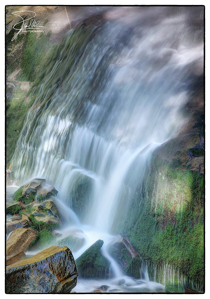
Rainbow Falls
Tennessee • 80 ft
By Armen Suny · Last verified Mar 2026
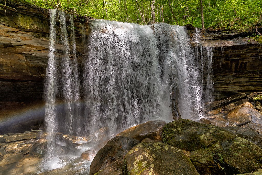
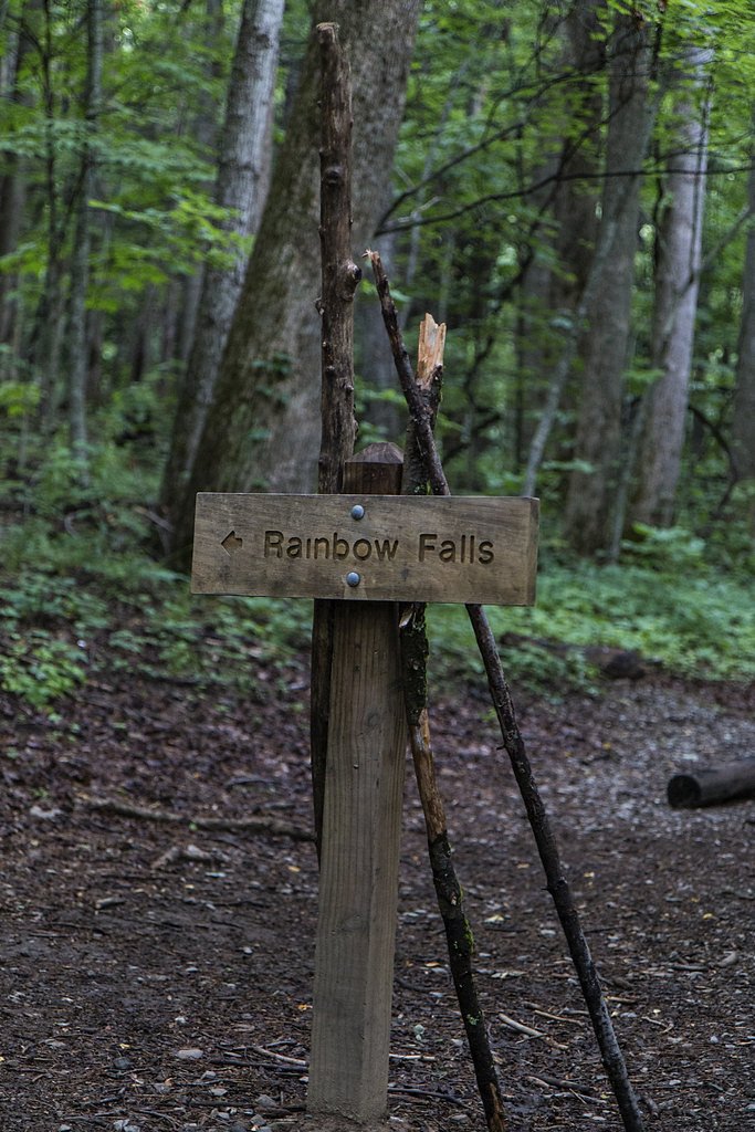
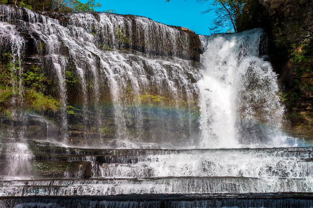
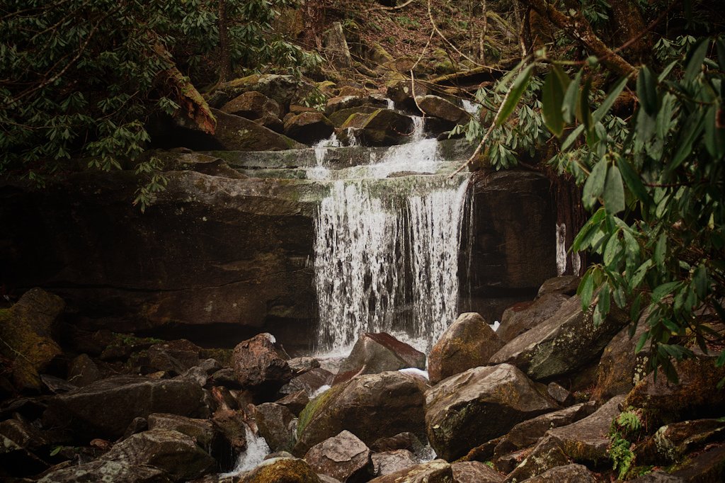
Photo Credits (5)
Difficulty
Moderate
Trail Length
2.4 miles
Trail Type
Out And Back
Elevation Gain
350 ft
About Rainbow Falls
Rainbow Falls is an 80-foot cascade tucked into the heart of Great Smoky Mountains National Park, managed by the National Park Service. The falls earn their name on sunny days when mist catches the light and throws a bright rainbow across the basin — a rewarding payoff after a scenic forest approach. The setting is classic Smokies: mature hardwoods, cool shade, and the steady sound of water that draws hikers to the viewpoint. The most common approach is the Rainbow Falls Trail, a moderately challenging out-and-back route that covers 2.4 miles round trip with roughly 350 feet of elevation gain. The trail threads through lush, wooded slopes with some rocky tread and a few small stream crossings, so sturdy footwear is recommended. The hike’s steady incline and the dramatic payoff at the 80-foot falls make this a popular, day-hike highlight within the national park.
The Setting
Rainbow Falls sits at 1,155 feet along the Collins River, in the foothills of Tennessee. The falls drop 80 feet.
Height: 80 feet
Trail & Hike Details
The Approach
The moderate 2.4-mile out-and-back trail gains 350 feet of elevation on the way to the falls.
Trail Description
Trail type: out-and-back; Distance: 2.4 miles round trip; Elevation gain: ~350 feet; Difficulty: moderate. The Rainbow Falls Trail is a single-track hiking route with mostly natural/rocky surface and a steady uphill grade leading to the falls. Expect uneven, rocky sections and a few small stream crossings; the route is non-technical but requires good footing. The trail’s steady climb rewards hikers with a clear view of the 80-foot waterfall at the end.
What to Expect
The falls cascade 80 feet.
Accessibility
The trail is not wheelchair accessible. Uneven terrain and elevation changes require steady footing.
Frequently Asked Questions
🐶 Are Dogs Allowed at Rainbow Falls?
❌ Dogs are not allowed
Are There Any Fees or Permits Required?
🤑 Fee: $5.00
🏊 Is There Swimming at Rainbow Falls?
❌ Swimming is not allowed
When to Visit
The best time to visit Rainbow Falls is during the spring and early summer when the water flow is strongest, or in the fall for beautiful foliage. Winter visits may offer a chance to see the falls partially frozen.
Seasonal Access
The best time to visit is Spring, Summer, and Fall. Winter access may be limited.
Safety Information
The trail can be slippery after rain, and there are several stream crossings. Watch your footing and stay on the marked trail. Be aware of wildlife and carry bear spray if hiking alone or in less crowded times.
Current Water Conditions
282 ft³/s
Current discharge — how much water is flowing
About average for this time of year
Based on 101 years of record
2.15 ft
Water depth at gauge
7-Day Discharge Trend
What does this mean for your visit?
Flow is about average for this time of year.
About This Gauge
This gauge is on a nearby waterway and may not reflect exact conditions at the falls.
7-Day Flow Outlook
Based on the USGS gauge COLLINS RIVER NEAR MCMINNVILLE, TN (24 km away).
Today
Barely Flowing
282 cfs
5/10Tomorrow
Low
298 cfs
3/10Fri
Low
314 cfs
3/10Sat
Low
360 cfs
3/10Sun
Low
370 cfs
3/10Mon
Low
374 cfs
3/10Tue
Low
351 cfs
3/10Best window: Today — barely flowing flow, sunny (trip score 5/10).
Best time of year: this gauge typically runs highest from early February to mid April, peaking in March.
How we calculate this
This is a transparent outlook, not a precise forecast. We take the waterfall's current flow strength (how it ranks against its historical normal for today, from the nearest USGS stream gauge), carry that ranking forward along the gauge's seasonal curve, and nudge it for forecast rain. Confidence is highest for the next day or two and falls further out. Always check official conditions and your own judgment before visiting — high flows can be dangerous.
Know when to go.
Get a free email alert when waterfalls near Woodbury hit peak flow. We only send when conditions are worth the trip — no weekly newsletters, no spam.
Weather Forecast
Location & Access
Getting There
Rainbow Falls is accessed via the Rainbow Falls Trail, which begins at the Rainbow Falls Trailhead located off Cherokee Orchard Road near Gatlinburg, Tennessee.
Get Directions on Google MapsParking
Parking is available at the Rainbow Falls Trailhead, but it can fill up quickly, especially during peak seasons. Arrive early to secure a spot.
Elevation
1,155 feet above sea level
Coordinates
35.797013° N, -85.972766° W
Visitor Tips & Gear
Start early to avoid crowds and secure parking. Wear sturdy hiking shoes due to the rocky and uneven terrain. Bring plenty of water and snacks, as the hike can be strenuous. Check weather conditions before heading out, as rain can make the trail slippery.
As an Amazon Associate, we earn from qualifying purchases.
With 2.4 miles and 350 ft of elevation gain, sturdy boots and trekking poles will help on this moderate trail. Sun exposure on the trail makes good sun protection a must in summer.

Polarized Sunglasses (Knockaround)
Cuts glare off the water so you actually see the falls — and your photos turn out better too.

Columbia Watertight II Rain Jacket
Packs into its own pocket, seam-sealed, and keeps you dry from spray and surprise rain.

Earth Pak Waterproof Dry Bag
Keeps your phone and gear dry when waterfall mist soaks everything else.

Waterproof Phone Pouch (AiRunTech)
Cheap insurance — take photos right next to the falls without killing your phone.

Timberland Euro Sprint Mid Waterproof
Trusted waterproof boot with premium leather and grippy rubber sole — reliable on rocky, wet trails.

TrailBuddy Trekking Poles
Lightweight aluminum, cork grips, and flip-locks that actually hold — a best-seller for good reason.
Where to Stay

Wingate by Wyndham Murfreesboro-NEAR MTSU

Embassy Suites Murfreesboro - Hotel & Conference Center

Hampton Inn Mcminnville, Tn

Holiday Inn Murfreesboro by IHG
Browse vacation cabins and private rentals nearby
Unique outdoor stays — tents, yurts, and treehouses
Rent a campervan or RV for your waterfall road trip
Some links are affiliate links. We may earn a commission at no extra cost to you.
Nearby Campground
RAGLAND BOTTOM
18.8 miles away · 57 sites
Overview Ragland Bottom Campground is located on the shores of the scenic Center Hill Lake on central Tennessee's Highland Rim. The lake stretches 64 miles up the Caney Fork River, where visitors come to enjoy boating, fishing and water sports. The 415 miles of forested shoreline provide excellent hiking, hunting and camping opportunities. 2025 Events: The annual Halloween event will be held Saturday, October 25, 2025. Recreation Boating, waterskiing, canoeing and fishing are popular activities
Book on Recreation.govAdditional Information
Nearby Attractions
Nearby attractions include the Gatlinburg Trail, Alum Cave Trail, and Clingmans Dome, all located within the Great Smoky Mountains National Park.
Wildlife
The area is home to a variety of wildlife, including black bears, deer, and numerous bird species. Always maintain a safe distance from wildlife.
Cities near Rainbow Falls
Other waterfalls named Rainbow Falls
31 other waterfalls share this name across the U.S.
Writing about Rainbow Falls? Embed this waterfall on your site for free.