Photo Credits (1)
Difficulty
Moderate
Trail Length
2.4 miles
Trail Type
Out And Back
Elevation Gain
350 ft
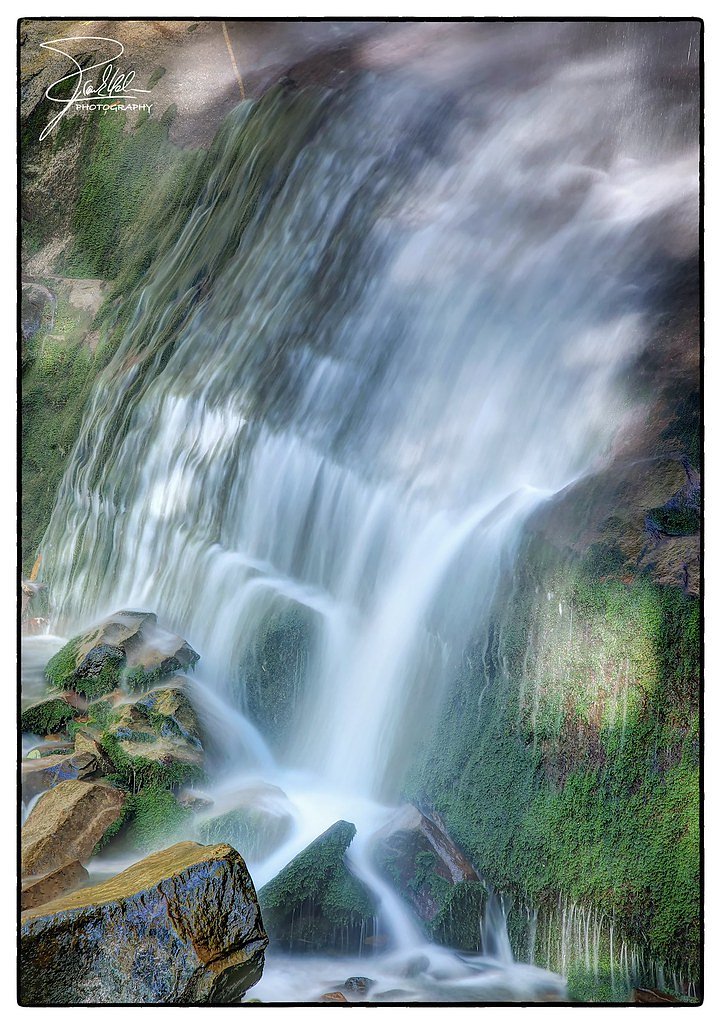
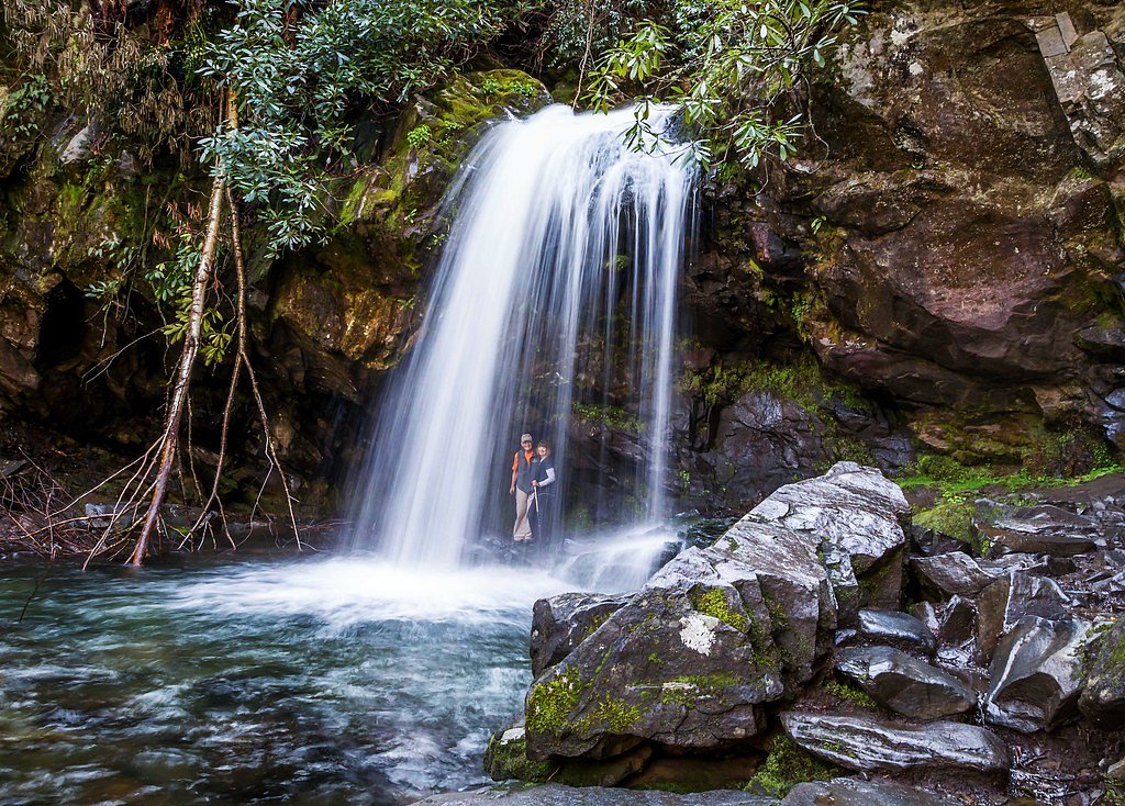
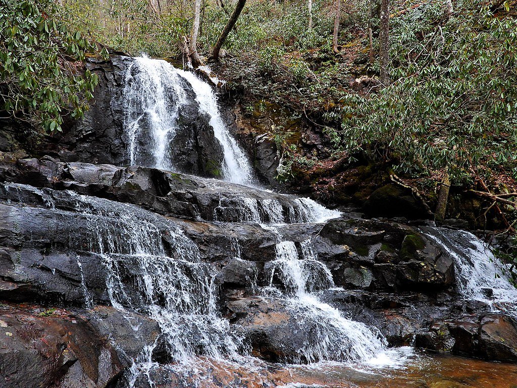
About Wilson Falls
Tucked inside Great Smoky Mountains National Park and managed by the National Park Service, Wilson Falls is a quietly scenic cascade that rewards hikers seeking a peaceful outing away from busier sights. The waterfall’s forested setting and gentle soundscape make it a great choice for photographers and anyone looking for a short nature escape. Because it sits within the national park, visitors should follow park regulations and practice Leave No Trace.
The Setting
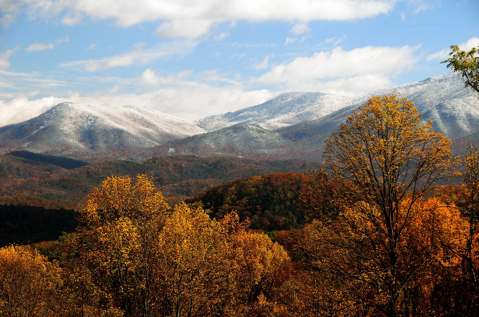
Wilson Falls sits at 5,207 feet within Great Smoky Mountains National Park, in the high mountains of Tennessee.
Nearby Falls Worth Visiting
Rainbow Falls (80 ft) lies 5.2 miles to the north. Also nearby: Laurel Falls (80 ft, 8.6 mi) and Grotto Falls (25 ft, 6.2 mi).
Trail & Hike Details
The Approach
The moderate 2.4-mile out-and-back trail gains 350 feet of elevation on the way to the falls.
Trail Description
Trail stats: 2.4 miles round-trip (out-and-back) with approximately 350 feet of elevation gain; rated moderate. The available park data does not list a USFS trail number or official surface/grade/class for this route. Expect a moderately strenuous hike for the distance and gain; carry water, wear appropriate footwear, and consult Great Smoky Mountains National Park maps or rangers for the most current trail conditions before you go.
What to Expect
Wilson Falls offers a tranquil experience with scenic views of the waterfall and surrounding forest. The area may have uneven terrain and limited facilities.
Accessibility
The trail is not wheelchair accessible. Uneven terrain and elevation changes require steady footing.
Frequently Asked Questions
🐶 Are Dogs Allowed at Wilson Falls?
❌ Dogs are not allowed
Are There Any Fees or Permits Required?
🆖 No fees required
🏊 Is There Swimming at Wilson Falls?
❌ Swimming is not allowed
When to Visit
Spring and fall are typically the best times to visit, as the waterfall may have higher flow and the weather is more comfortable.
Seasonal Access
The best time to visit is Spring, Summer, and Fall. Access roads and trails may close during winter due to snow. Check the National Park Service website for current conditions.
Safety Information
Trail conditions may be uneven or slippery, especially after rain. Visitors should exercise caution and avoid visiting during severe weather.
Current Water Conditions
432 ft³/s
Current discharge — how much water is flowing
Higher than usual for this time of year
Based on 3 years of record
4.67 ft
Water depth at gauge
7-Day Discharge Trend
What does this mean for your visit?
The water is flowing higher than usual for this time of year.
About This Gauge
This gauge is on a nearby waterway and may not reflect exact conditions at the falls.
7-Day Flow Outlook
Based on the USGS gauge WEST PRONG LITTLE PIGEON R NR GATLINBURG, TN (13 km away).
Today
Roaring
493 cfs
6/10Tomorrow
Roaring
570 cfs
6/10Wed
Roaring
586 cfs
6/10Thu
Roaring
1980 cfs
6/10Fri
Roaring
1156 cfs
6/10Sat
Roaring
966 cfs
6/10Sun
Roaring
792 cfs
6/10Best window: Today — roaring flow, mostly sunny then chance showers and thunderstorms (trip score 6/10).
Best time of year: this gauge typically runs highest from mid March to early April, peaking in February.
How we calculate this
This is a transparent outlook, not a precise forecast. We take the waterfall's current flow strength (how it ranks against its historical normal for today, from the nearest USGS stream gauge), carry that ranking forward along the gauge's seasonal curve, and nudge it for forecast rain. Confidence is highest for the next day or two and falls further out. Always check official conditions and your own judgment before visiting — high flows can be dangerous.
Know when to go.
Get a free email alert when waterfalls near Gatlinburg hit peak flow. We only send when conditions are worth the trip — no weekly newsletters, no spam.
Weather Forecast
Location & Access
Getting There
Wilson Falls is located in Tennessee, but specific directions to the trailhead or parking area are not well-documented. Visitors are advised to consult local maps or guides for accurate navigation.
Get Directions on Google MapsParking
Parking availability is unclear. Visitors should prepare for limited or informal parking options near the trailhead.
Elevation
5,207 feet above sea level
Coordinates
35.589219° N, -83.485120° W
Land Management
Managed by NPS
Visitor Tips & Gear
Bring a detailed map or GPS device, as trail markings and directions may be unclear. Wear sturdy footwear and carry water.
As an Amazon Associate, we earn from qualifying purchases.
With 2.4 miles and 350 ft of elevation gain, sturdy boots and trekking poles will help on this moderate trail. Sun exposure on the trail makes good sun protection a must in summer.
America the Beautiful Annual Pass
Covers entrance fees at 2,000+ federal recreation sites — required at most National Parks.

Polarized Sunglasses (Knockaround)
Cuts glare off the water so you actually see the falls — and your photos turn out better too.

Columbia Watertight II Rain Jacket
Packs into its own pocket, seam-sealed, and keeps you dry from spray and surprise rain.

Earth Pak Waterproof Dry Bag
Keeps your phone and gear dry when waterfall mist soaks everything else.

Waterproof Phone Pouch (AiRunTech)
Cheap insurance — take photos right next to the falls without killing your phone.

Timberland Euro Sprint Mid Waterproof
Trusted waterproof boot with premium leather and grippy rubber sole — reliable on rocky, wet trails.

TrailBuddy Trekking Poles
Lightweight aluminum, cork grips, and flip-locks that actually hold — a best-seller for good reason.
Where to Stay
Browse vacation cabins and private rentals nearby
Unique outdoor stays — tents, yurts, and treehouses
Rent a campervan or RV for your waterfall road trip
Some links are affiliate links. We may earn a commission at no extra cost to you.
Nearby Campground
TWIN CREEKS PICNIC PAVILION
6.8 miles away · 1 sites
Overview Twin Creeks Picnic Pavilion is the largest in the park, surrounded by the scenic forest of the Great Smoky Mountains National Park. Located in a secluded and private section of the Smokies, this pavilion is a popular place for group trips.Recreation Great Smoky Mountains National Park is a hiker's paradise, with over 800 miles of maintained trails ranging from short, leg-stretchers to strenuous treks, with a number of which accessible near the picnic area. Hiking is not the only reason f
Book on Recreation.govNearby Hot Springs
Hot springs near Gatlinburg, Tennessee

Looking for a soak after your hike? Explore more hot springs near Gatlinburg, Tennessee on SoakingSprings.
Explore Tennessee springsAdditional Information
Nearby Attractions
Nearby attractions are not well-documented, but visitors may explore other natural areas in Tennessee.
Wildlife
The area may feature typical Tennessee wildlife, including birds, deer, and small mammals.
Cities near Wilson Falls
Nearby Waterfalls
Other waterfalls named Wilson Falls
2 other waterfalls share this name across the U.S.
Writing about Wilson Falls? Embed this waterfall on your site for free.