Photo Credits (4)
Difficulty
Moderate
Trail Length
2.4 miles
Trail Type
Out And Back
Elevation Gain
350 ft
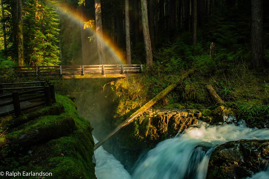
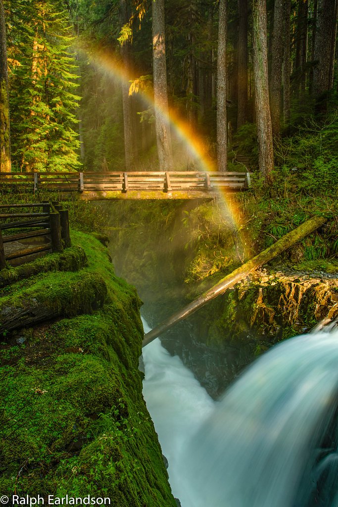
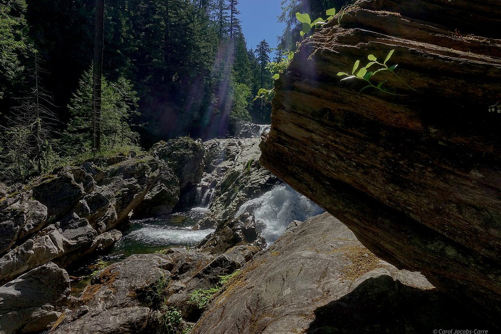
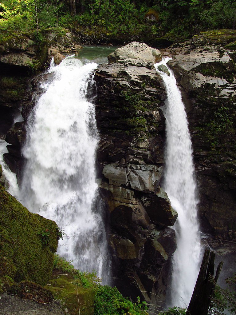
About Rainbow Falls
Rainbow Falls is a scenic cascade tucked into Mt. Baker National Forest and managed by the U.S. Forest Service. On sunny days the falls throw up a fine mist that often produces vivid rainbows, making it a favorite short-hike destination for photographers and families alike. Access is via the USFS Rainbow Ridge Trail (Trail #655), which provides a direct, forested approach to the falls. The hike to the viewing area is moderate in effort — about 2.4 miles round trip with roughly 350 feet of elevation gain — and is commonly done as an out-and-back. Park Creek Campground lies about 3.97 km from the trailhead if you’re looking to combine the visit with an overnight stay. Before you go, check current Forest Service conditions and trail notices for the latest information.
The Setting
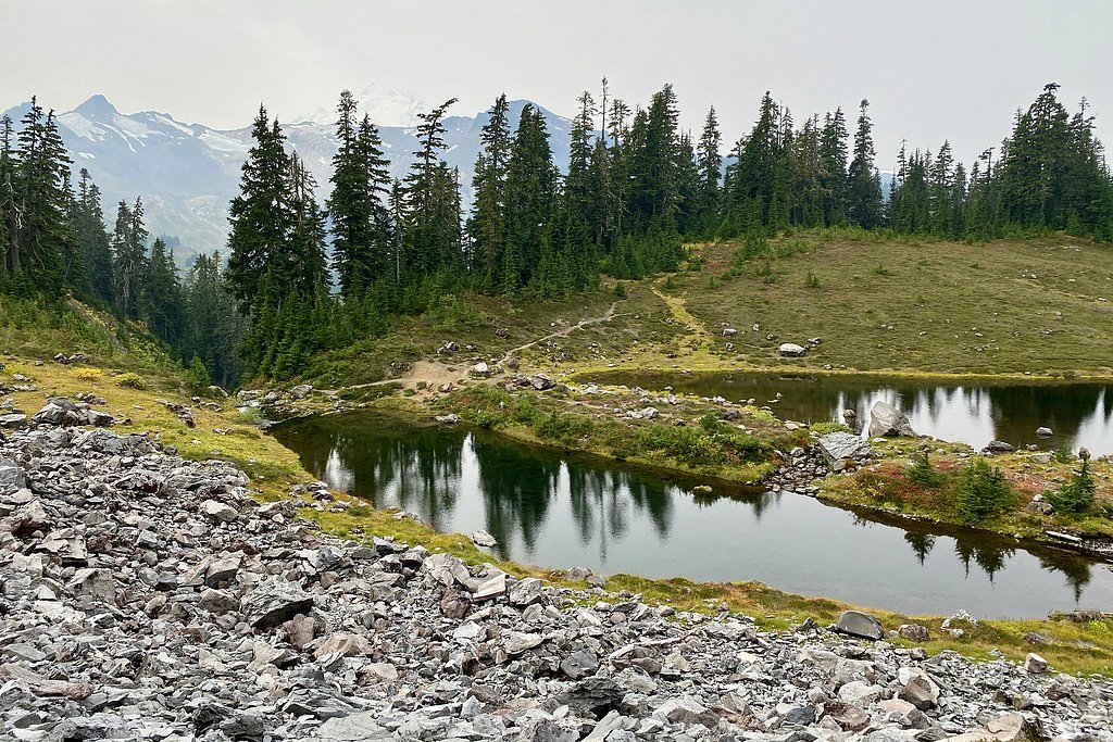
Rainbow Falls sits at 1,686 feet within Mt. Baker National Forest, fed by the Baker River, in the hills of Washington.
Trail & Hike Details
The Approach
The moderate hike follows Rainbow Ridge (#655), a 2.4-mile out-and-back trail over natural surface. Expect 350 feet of elevation gain with grades of 12-20%. The trail is moderately developed (Class 2).
USFS Trail
RAINBOW RIDGE #655
Trail Class
Moderately Developed
Surface
Avg Grade
USFS Segment
0.65 miTrail Description
USFS Trail: Rainbow Ridge (Trail #655). Trail class: 2 — a maintained singletrack with some steeper sections and occasional route-finding, not technical scrambling. Surface: NAT (native material) — natural dirt tread with roots and rocks typical of forest trails. Typical grade: 12–20% on the steeper pitches, so expect short, fairly steep stretches. Official USFS GIS records list the trail segment at 0.65 miles, while the commonly reported hike to the falls is about 2.4 miles round trip (out-and-back) with ~350 ft elevation gain. Difficulty: Moderate. Hikers should wear sturdy shoes, be prepared for uneven footing, and consult USFS updates for seasonal conditions.
What to Expect
Rainbow Falls offers a serene natural setting with cascading water and the potential for rainbows in the mist. The surrounding area is lush with greenery, typical of the North Cascades region.
Accessibility
The trail is not wheelchair accessible. Uneven terrain and elevation changes require steady footing.
Frequently Asked Questions
🐶 Are Dogs Allowed at Rainbow Falls?
❌ Dogs are not allowed
Are There Any Fees or Permits Required?
🆖 No fees required
🏊 Is There Swimming at Rainbow Falls?
❌ Swimming is not allowed
When to Visit
Spring and summer are typically the best times to visit, as water flow is higher due to snowmelt, and the weather is more favorable.
Seasonal Access
The best time to visit is Spring, Summer, and Fall. Winter access may be limited. Check with Mt. Baker National Forest for seasonal road closures.
Safety Information
Visitors should be cautious of slippery rocks near the waterfall and changing weather conditions. Always stay on marked trails and avoid getting too close to the water's edge.
Current Water Conditions
695 ft³/s
Current discharge — how much water is flowing
Lower than usual for this time of year
Based on 13 years of record
8.08 ft
Water depth at gauge
7-Day Discharge Trend
What does this mean for your visit?
Flow is lower than usual for this time of year.
About This Gauge
This gauge is on a nearby waterway and may not reflect exact conditions at the falls.
7-Day Flow Outlook
Based on the USGS gauge BAKER RIVER AB BLUM CREEK NEAR CONCRETE, WA (10 km away).
Today
Low
792 cfs
3/10Tomorrow
Moderate
893 cfs
5/10Sun
Low
791 cfs
4/10Mon
Low
833 cfs
4/10Tue
Low
797 cfs
4/10Wed
Low
724 cfs
4/10Thu
Low
639 cfs
4/10Best window: Tomorrow — moderate flow, chance light rain (trip score 5/10).
Best time of year: this gauge typically runs highest from early May to mid July, peaking in June.
How we calculate this
This is a transparent outlook, not a precise forecast. We take the waterfall's current flow strength (how it ranks against its historical normal for today, from the nearest USGS stream gauge), carry that ranking forward along the gauge's seasonal curve, and nudge it for forecast rain. Confidence is highest for the next day or two and falls further out. Always check official conditions and your own judgment before visiting — high flows can be dangerous.
Know when to go.
Get a free email alert when waterfalls near Concrete hit peak flow. We only send when conditions are worth the trip — no weekly newsletters, no spam.
Weather Forecast
Location & Access
Getting There
Rainbow Falls is located approximately 14.6 miles from Concrete, 16.8 miles from Glacier, and 16.9 miles from Rockport. The coordinates for the falls are 48.771, -121.6768. Access is typically via forest roads, and conditions may vary depending on the season.
Get Directions on Google MapsParking
Parking availability is not well-documented, but visitors should expect limited parking near the trailhead or along the roadside.
Elevation
1,686 feet above sea level
Coordinates
48.770955° N, -121.676808° W
Land Management
Managed by USFS
Visitor Tips & Gear
Check weather and road conditions before visiting, as access may be affected by seasonal changes. Bring appropriate footwear and gear for hiking, as trail conditions are not well-documented.
As an Amazon Associate, we earn from qualifying purchases.
With 2.4 miles and 350 ft of elevation gain, sturdy boots and trekking poles will help on this moderate trail. Sun exposure on the trail makes good sun protection a must in summer.

Polarized Sunglasses (Knockaround)
Cuts glare off the water so you actually see the falls — and your photos turn out better too.

Columbia Watertight II Rain Jacket
Packs into its own pocket, seam-sealed, and keeps you dry from spray and surprise rain.

Earth Pak Waterproof Dry Bag
Keeps your phone and gear dry when waterfall mist soaks everything else.

Waterproof Phone Pouch (AiRunTech)
Cheap insurance — take photos right next to the falls without killing your phone.

Timberland Euro Sprint Mid Waterproof
Trusted waterproof boot with premium leather and grippy rubber sole — reliable on rocky, wet trails.

TrailBuddy Trekking Poles
Lightweight aluminum, cork grips, and flip-locks that actually hold — a best-seller for good reason.
Where to Stay

Mt Baker Hotel

Coast Abbotsford Hotel & Suites

Clarion Hotel & Conference Centre

Super 8 by Wyndham Abbotsford BC
Browse vacation cabins and private rentals nearby
Unique outdoor stays — tents, yurts, and treehouses
Rent a campervan or RV for your waterfall road trip
Some links are affiliate links. We may earn a commission at no extra cost to you.
Nearby Campground
Park Creek Campground
2.5 miles away · 16 sites
Overview Park Creek Campground sits along the banks of Park Creek in the stunning Mt. Baker-Snoqualmie National Forest. The unique setting offers many recreational activities and scenic views. Baker Lake is close by, and many hiking trails and climbing routes are within a short driving distance.Recreation In addition to being a great basecamp for hiking, boating and fishing in summer and early fall, Park Creek can be a starting point for snowshoeing in the winter months. Trails in the area can en
Book on Recreation.govNearby Hot Springs
Hot springs near Concrete, Washington
Baker Hot Spring
Baker Hot Spring emerges at 108 degrees Fahrenheit on US Forest Service land in Mt. Baker National Forest, flowing 59.5 degrees...

Sherman Crater Fumaroles
Sherman Crater Fumaroles register 266 degrees Fahrenheit at 9,463 feet elevation within the active volcanic crater atop Mount B...
Dorr Fumarole Field
Dorr Fumarole Field reaches 194 degrees at 8,168 feet elevation on Mount Baker's active volcanic slopes, producing superheated ...
Sulphur Creek Hot Springs
Sulphur Creek Hot Springs flows at 99 degrees Fahrenheit at 2,973 feet elevation in Mount Baker National Forest's remote backco...
Kennedy Hot Spring
Kennedy Hot Spring flows at 100 degrees at 3,520 feet elevation in the Mt. Baker National Forest, emerging 58.7 degrees above a...
Gamma Hot Springs
Gamma Hot Springs produces 140-degree water at 5,397 feet elevation in the Mt. Baker National Forest, emerging 104.6 degrees ab...
Looking for a soak after your hike? Explore more hot springs near Concrete, Washington on SoakingSprings.
Explore Washington springsAdditional Information
Nearby Attractions
Nearby attractions include the North Cascades National Park, Baker Lake, and the towns of Concrete, Glacier, and Rockport.
Wildlife
The area is home to diverse wildlife, including birds, deer, and other forest animals. Visitors should be cautious of bears and other larger wildlife.
Cities near Rainbow Falls
Nearby Waterfalls
Other waterfalls named Rainbow Falls
31 other waterfalls share this name across the U.S.
Writing about Rainbow Falls? Embed this waterfall on your site for free.