Rainbow Falls
Ontario • 24 m
By Armen Suny · Last verified Jun 2026
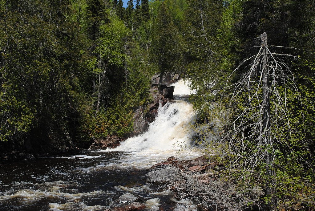
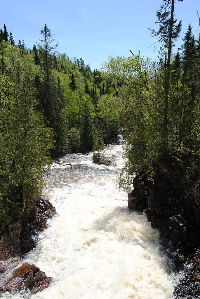
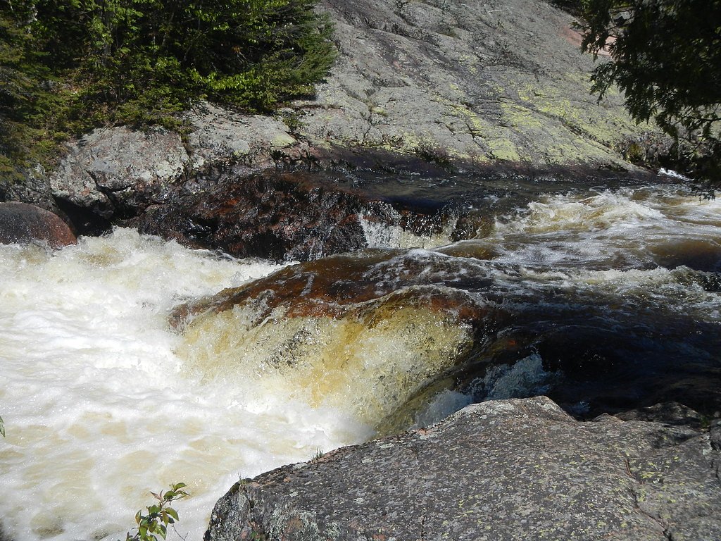
Photo Credits (4)
Difficulty
Moderate
Trail Length
1.9 km
Trail Type
Out And Back
Elevation Gain
40 m
About Rainbow Falls
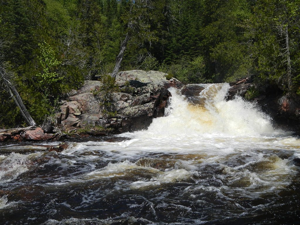
Rainbow Falls (coordinates 48.8468, -87.3998) is a freshwater waterfall on a tributary feeding into the Lake Superior watershed in northern Ontario, located roughly between the towns of Nipigon (≈44.3 miles) and Marathon (≈48.4 miles). Local reports indicate a scenic, natural cascade in a forested, rocky setting typical of Lake Superior’s north shore. Specific published measurements and formal trail designation appear to be limited; visitors should verify conditions locally before travel.
The Setting
Rainbow Falls sits at 284 metres within Rainbow Falls Provincial Park (Recreational Class), in the foothills of Ontario. The falls drop 24 metres.
Why This Waterfall Exists
Rainbow Falls flows over hard intrusive rock, primarily granodiorite and granite, laid down over 2.5-3.2 billion years ago. These resistant rocks form a durable ledge that water cannot easily wear away, creating a 80-foot drop where softer material downstream has already eroded.
Trail & Hike Details
The Approach
The moderate 1.9-km out-and-back trail gains 40 metres of elevation on the way to the falls.
Trail Description
There does not appear to be a widely maintained, named trail to this specific Rainbow Falls. Access is typically via a short, informal footpath from a nearby pullout or roadside access point. Expect uneven, rocky ground, tree roots, and possible wet/muddy sections. The approach may cross small stream channels and could require short bushwhacking if the path is not clearly worn.
What to Expect
The falls cascade 24 metres over hard intrusive rock.
Accessibility
The trail is not wheelchair accessible. Uneven terrain and elevation changes require steady footing.
Frequently Asked Questions
🐶 Are Dogs Allowed at Rainbow Falls?
❌ Dogs are not allowed
Are There Any Fees or Permits Required?
🆖 No fees required
🏊 Is There Swimming at Rainbow Falls?
❌ Swimming is not allowed
When to Visit
Spring (late April–June) for highest flows and dramatic runoff. Summer (July–August) for easier access and warmer conditions. Fall for foliage and reduced insect activity. Winter visits can offer frozen, photogenic scenes but may require winter travel experience and traction devices; ice and snow make approaches hazardous.
Seasonal Access
The best time to visit is Spring, Summer, Fall, and Winter. Check with the managing park or local authority for current conditions.
Safety Information
Hazards include slippery bedrock, fast or cold water, hidden submerged objects, unstable banks, and limited safety infrastructure (no railings). Weather can change quickly; hypothermia is a risk even in summer if you get wet. Cell phone coverage may be unreliable, notify someone of your plans and expected return time. Wildlife encounters (including bears) are possible, store food securely and follow local wildlife guidance. Use caution on winter ice and avoid approaching edges of frozen waterfalls where ice can be unstable.
Current Water Conditions
0.0 m³/s
Current discharge — how much water is flowing
Lower than usual for this time of year
Based on 36 years of record
3.09 m
Water depth at gauge
7-Day Discharge Trend
What does this mean for your visit?
Flow is lower than usual for this time of year.
About This Gauge
This gauge is on a nearby waterway and may not reflect exact conditions at the falls.
7-Day Flow Outlook
Based on the WSC gauge WHITESAND RIVER ABOVE SCHREIBER AT MINOVA MINE (15 km away).
Today
Moderate
0.0 m³/s
5/10Tomorrow
Moderate
0.0 m³/s
5/10Tue
Moderate
0.0 m³/s
6/10Wed
Moderate
0.0 m³/s
5/10Thu
Moderate
0.0 m³/s
5/10Fri
Moderate
0.0 m³/s
6/10Sat
Moderate
0.0 m³/s
5/10Best window: Tue — moderate flow, fog (trip score 6/10).
Best time of year: this gauge typically runs highest from mid April to early June, peaking in May.
How we calculate this
This is a transparent outlook, not a precise forecast. We take the waterfall's current flow strength (how it ranks against its historical normal for today, from the nearest WSC stream gauge), carry that ranking forward along the gauge's seasonal curve, and nudge it for forecast rain. Confidence is highest for the next day or two and falls further out. Always check official conditions and your own judgment before visiting — high flows can be dangerous.
Know when to go.
Get a free email alert when waterfalls near Nipigon hit peak flow. We only send when conditions are worth the trip — no weekly newsletters, no spam.
Weather Forecast
Location & Access
Getting There
The falls are reached from Highway 17 / Trans-Canada Highway corridor between Nipigon and Marathon. Exact parking and approach vary; expect a short unpaved spur or informal pullout and a natural footpath through forest or along a stream bank to the waterfall. Cell coverage may be intermittent in this region.
Get Directions on Google MapsParking
Likely a small roadside pullout or informal parking area; parking may be limited and not developed. Visitors should park well off the highway and follow local signage or private property restrictions.
Elevation
284 metres above sea level
Coordinates
48.846771° N, -87.399770° W
Land Management
Managed by Ontario Parks
Visitor Tips & Gear
• Wear sturdy, grippy footwear; rock surfaces will be slippery. • Give yourself extra time for travel, distances are long between towns and services. • Check recent visitor reports, local park/municipal resources, or highway services for road/bridge conditions. • Bring water, food, a map, and a charged phone; do not rely on cell service. • Respect private property; stay on public right-of-way and avoid trespassing. • In bear country: carry bear spray and make noise while approaching wooded areas.
As an Amazon Associate, we earn from qualifying purchases.
With 1.9 km and 40 m of elevation gain, sturdy boots and trekking poles will help on this moderate trail. Icy conditions are common in winter — traction cleats are a smart addition.

Columbia Watertight II Rain Jacket
Packs into its own pocket, seam-sealed, and keeps you dry from spray and surprise rain.

Polarized Sunglasses (Knockaround)
Cuts glare off the water so you actually see the falls — and your photos turn out better too.

Earth Pak Waterproof Dry Bag
Keeps your phone and gear dry when waterfall mist soaks everything else.

Waterproof Phone Pouch (AiRunTech)
Cheap insurance — take photos right next to the falls without killing your phone.

Timberland Euro Sprint Mid Waterproof
Trusted waterproof boot with premium leather and grippy rubber sole — reliable on rocky, wet trails.

TrailBuddy Trekking Poles
Lightweight aluminum, cork grips, and flip-locks that actually hold — a best-seller for good reason.
Where to Stay
Browse vacation cabins and private rentals nearby
Unique outdoor stays — tents, yurts, and treehouses
Rent a campervan or RV for your waterfall road trip
Some links are affiliate links. We may earn a commission at no extra cost to you.
Nearby Campground
Rainbow Falls Park - Whitesand Lake Campground
0.9 km away
Additional Information
Nearby Attractions
The towns of Nipigon and Marathon provide services and access points to Lake Superior’s north shore. Pukaskwa National Park and other Lake Superior coastal features are regionally nearby but at longer driving distances. Scenic Lake Superior shoreline and local provincial forest access roads offer additional outdoor opportunities.
Wildlife
Typical northern Ontario species may be present, including black bears, moose, white-tailed deer, foxes, and a variety of birds (raptors, waterfowl, songbirds). Insect activity (black flies, mosquitoes) can be high in spring/early summer.
Cities near Rainbow Falls
Other waterfalls named Rainbow Falls
31 other waterfalls share this name across Canada.
Writing about Rainbow Falls? Embed this waterfall on your site for free.