Rainbow Falls
British Columbia • 140 m
By Armen Suny · Last verified Jun 2026
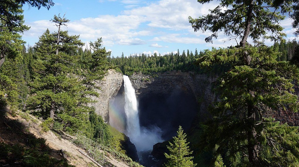

Photo Credits (2)
Difficulty
Easy
Trail Type
Out And Back
About Rainbow Falls
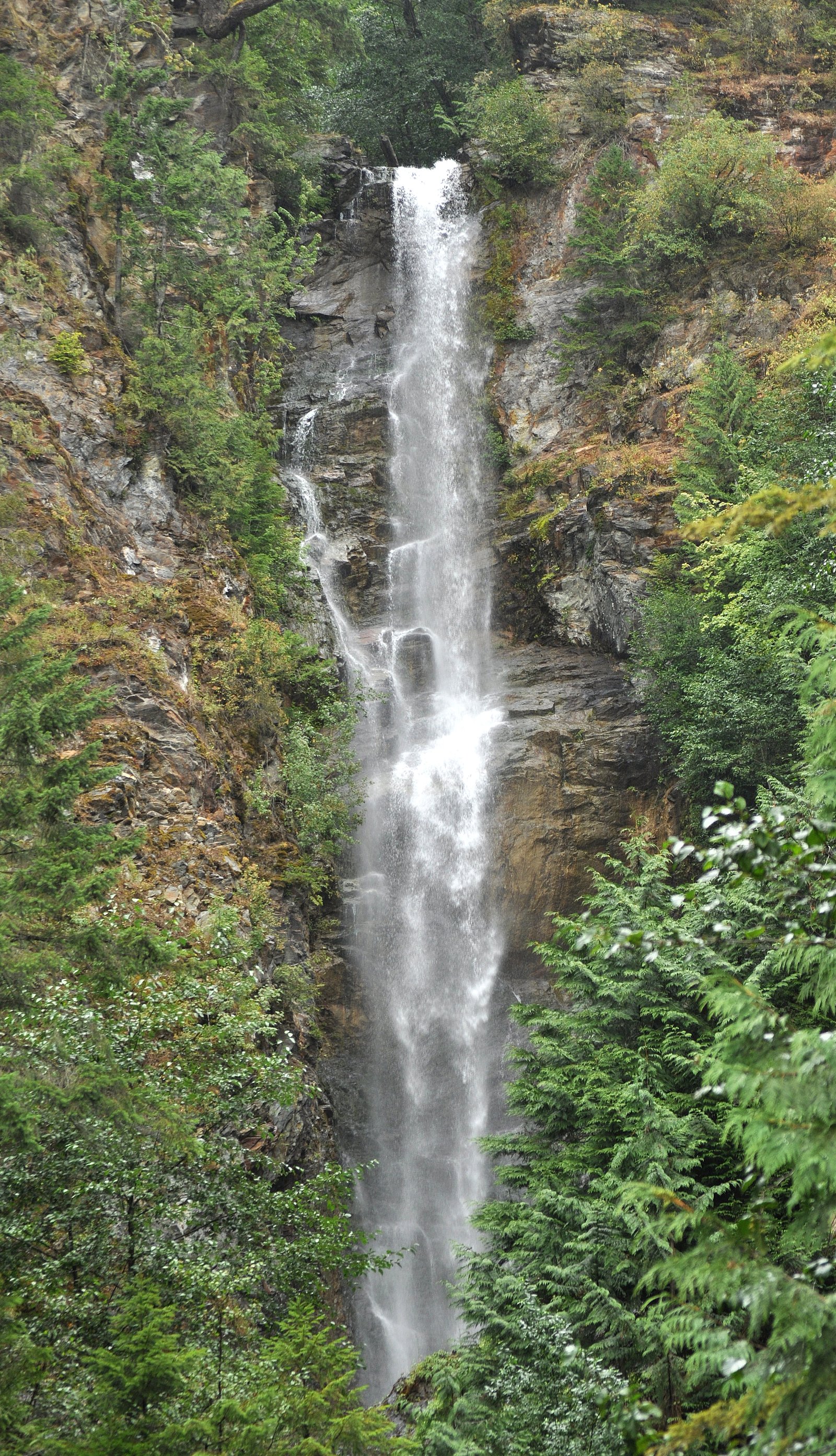
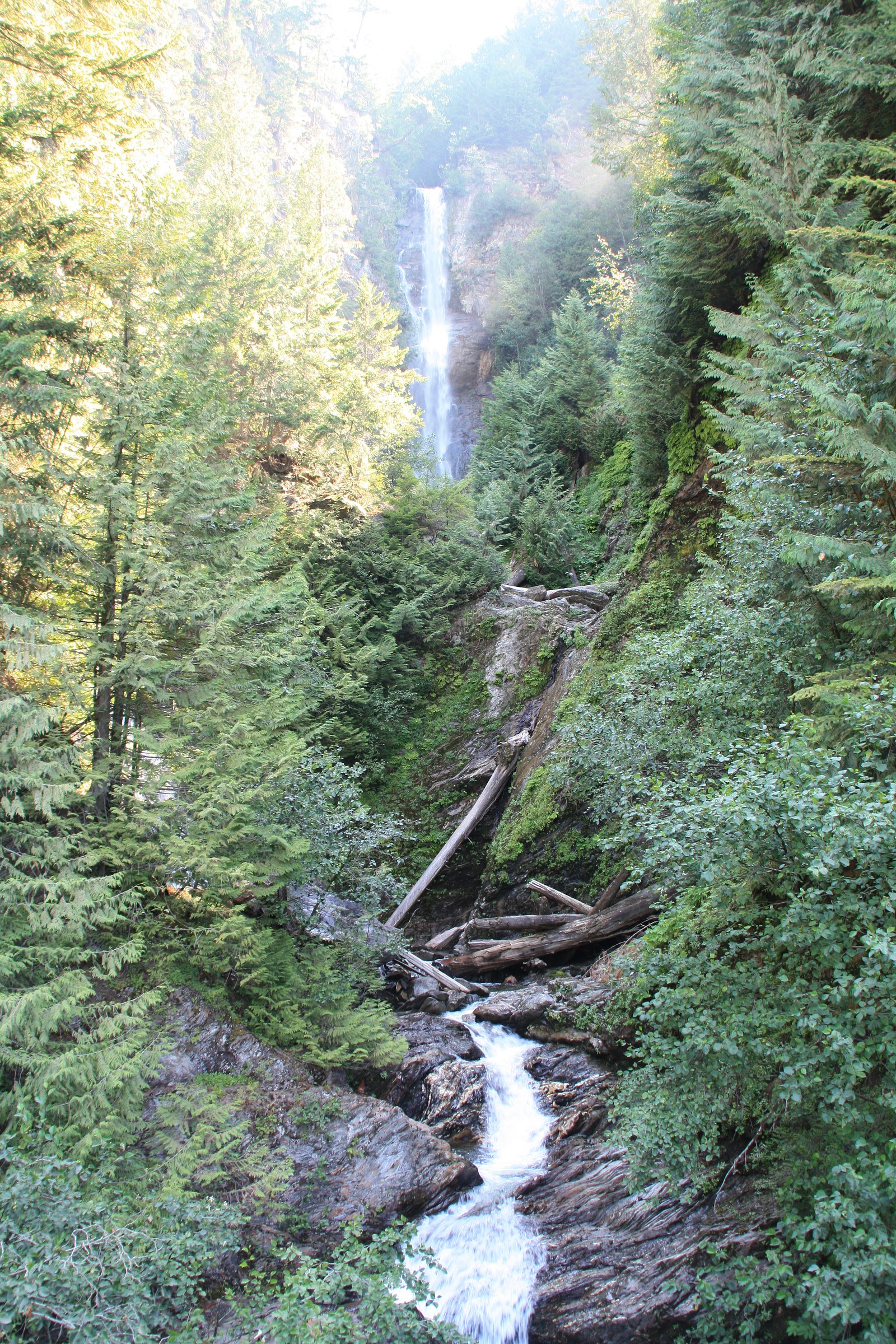
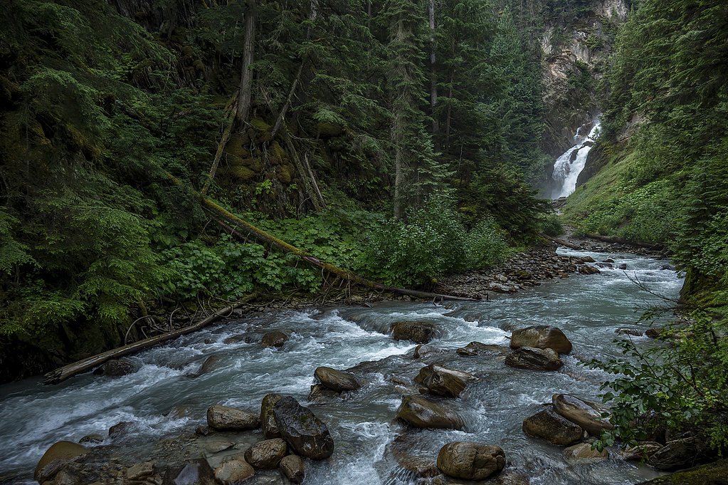
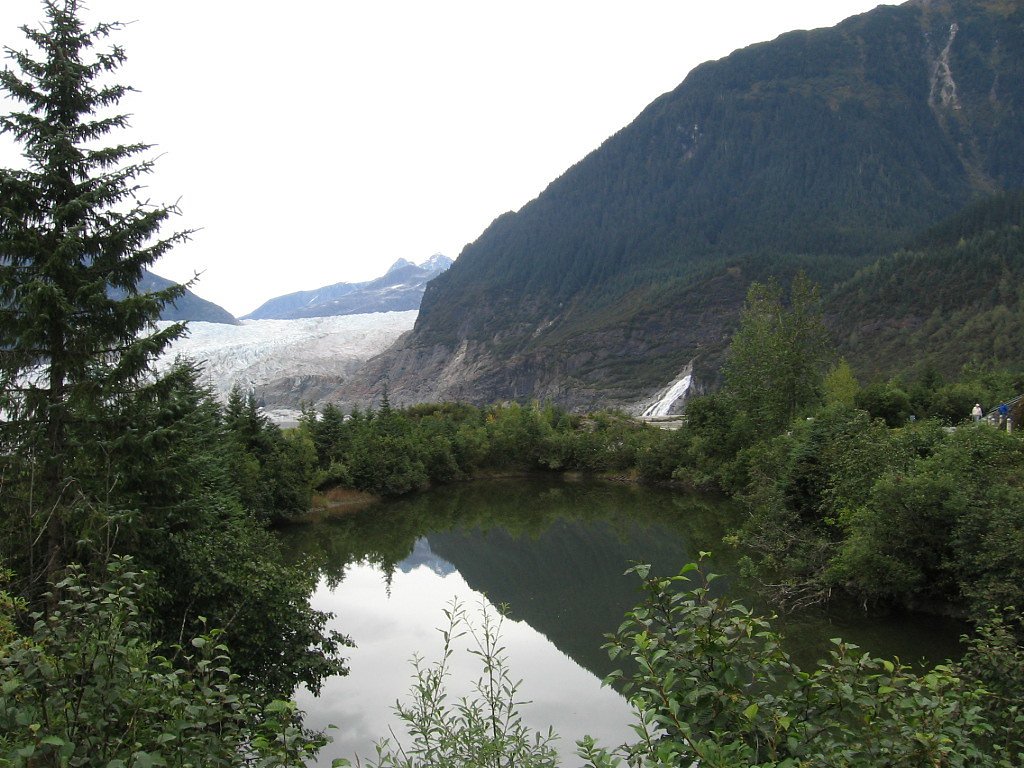
Slollicum Creek Falls is a perennial plunge waterfall located near Harrison Lake, British Columbia, Canada. The falls, often mistakenly assumed to be Rainbow Falls, can be viewed without difficulty from a bridge on the unpaved East Harrison FSR below. An additional, equally tall plunge exists above the visible falls; however cannot be seen from below due to the angle afforded. Rainbow Falls itself is a separate waterfall on the same water course where Slollicum Creek discharges into Harrison Lake at its namesake recreation site. Access to this location seems to be boat only.
The Setting
Rainbow Falls sits at 103 metres in the coastal lowlands of British Columbia. At 140 metres, it is among the taller waterfalls in British Columbia.
Why This Waterfall Exists
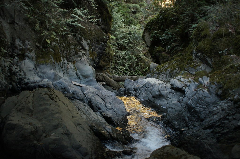
Rainbow Falls flows over layered sedimentary rock laid down about 66-252 million years ago. Over time, the stream has worn through these layers at different rates, creating a 460-foot drop that forms the waterfall.
Nearby Falls Worth Visiting
Bear Creek Falls (20 m) lies 7.6 kilometres to the north. Also nearby: Eagle Falls (15 m, 9.2 km) and Walian Creek Falls (7 m, 10.0 km).
Trail & Hike Details
Trail Description
Trail conditions are typically natural singletrack or unpaved footpaths through forest. The route may include roots, rocks, and some short steep sections; sections may be muddy or slippery after rain. Wayfinding may be informal in places. Because official trail details are uncertain for this specific waterfall, plan as if the trail is minimally maintained and bring navigation tools (map/GPS).
What to Expect
The falls plunge a dramatic 140 metres over layered sedimentary rock.
Accessibility
The trail is short and relatively flat, but the surface may be uneven. Contact the managing agency for accessibility details.
Frequently Asked Questions
🐶 Are Dogs Allowed at Rainbow Falls?
❌ Dogs are not allowed
Are There Any Fees or Permits Required?
🆖 No fees required
🏊 Is There Swimming at Rainbow Falls?
❌ Swimming is not allowed
When to Visit
Late spring to early summer for highest flows; early fall for lower crowds and fall colors. Winter may bring snow, ice, and hazardous trail conditions, visit only with appropriate experience and equipment.
Seasonal Access
The best time to visit is Spring, Summer, and Fall. Winter access may be limited. Check with the managing park or local authority for current conditions.
Safety Information
Hazards may include slippery rocks and roots, steep or unstable banks near the falls, high or rapidly rising water after rain or during spring melt, and limited cell coverage. Wear appropriate footwear, avoid going onto wet rocks or cliff edges, and never underestimate stream currents. Check local conditions and weather before visiting. If unfamiliar with backcountry travel in winter, avoid the site during snowy/icy months or go only with proper gear and experience.
Current Water Conditions
5.5 m³/s
Current discharge — how much water is flowing
Much lower than usual for this time of year
Based on 47 years of record
8.89 m
Water depth at gauge
7-Day Discharge Trend
What does this mean for your visit?
Flow is well below normal for this time of year, so the waterfall may be a trickle.
About This Gauge
This gauge is on a nearby waterway and may not reflect exact conditions at the falls.
7-Day Flow Outlook
Based on the WSC gauge CHEHALIS RIVER NEAR HARRISON MILLS (17 km away).
Today
Barely Flowing
5.5 m³/s
5/10Tomorrow
Barely Flowing
5.4 m³/s
4/10Tue
Barely Flowing
5.2 m³/s
4/10Wed
Barely Flowing
5.1 m³/s
4/10Thu
Barely Flowing
4.9 m³/s
4/10Fri
Barely Flowing
4.7 m³/s
4/10Sat
Barely Flowing
4.9 m³/s
3/10Best window: Today — barely flowing flow, sunny (trip score 5/10).
Best time of year: this gauge typically runs highest from mid April to early June, peaking in November.
How we calculate this
This is a transparent outlook, not a precise forecast. We take the waterfall's current flow strength (how it ranks against its historical normal for today, from the nearest WSC stream gauge), carry that ranking forward along the gauge's seasonal curve, and nudge it for forecast rain. Confidence is highest for the next day or two and falls further out. Always check official conditions and your own judgment before visiting — high flows can be dangerous.
Know when to go.
Get a free email alert when waterfalls near Chilliwack hit peak flow. We only send when conditions are worth the trip — no weekly newsletters, no spam.
Weather Forecast
Location & Access
Getting There
The falls lie in the vicinity northeast of Chilliwack, BC (coordinates 49.3972, -121.7558). Access is typically via local secondary roads and forest service or gravel roads; expect at least some unpaved driving. Visitors should consult local maps or the regional district/BC Parks/forest service for the most current access details before traveling.
Get Directions on Google MapsParking
Parking is likely limited to a small trailhead or roadside pullout. Surfaces may be unpaved and there may be no formal lot, toilets, or other services. Park legally and avoid blocking gates or private driveways.
Elevation
103 metres above sea level
Coordinates
49.397201° N, -121.755794° W
Visitor Tips & Gear
• Check recent trip reports or local resources (BC Parks, regional park pages, AllTrails) for up-to-date access and trail condition information. • Wear sturdy, closed-toe footwear with good traction; the approach may be steep and slippery. • Carry water, a basic first-aid kit, and a charged phone. Expect limited services. • Park respectfully and legally; many small trailheads have limited space. • Avoid cliff edges and wet rocks near the falls, they can be very slippery. • Leave no trace: pack out garbage and avoid disturbing vegetation and stream banks.
Where to Stay
Browse vacation cabins and private rentals nearby
Unique outdoor stays — tents, yurts, and treehouses
Rent a campervan or RV for your waterfall road trip
Some links are affiliate links. We may earn a commission at no extra cost to you.
Nearby Campground
Cascade Peninsula Campground
5 km away
Nearby Hot Springs
Hot springs near Chilliwack, British Columbia
Dorr Fumarole Field
Dorr Fumarole Field reaches 194 degrees at 8,168 feet elevation on Mount Baker's active volcanic slopes, producing superheated ...

Sherman Crater Fumaroles
Sherman Crater Fumaroles register 266 degrees Fahrenheit at 9,463 feet elevation within the active volcanic crater atop Mount B...
Baker Hot Spring
Baker Hot Spring emerges at 108 degrees Fahrenheit on US Forest Service land in Mt. Baker National Forest, flowing 59.5 degrees...
Looking for a soak after your hike? Explore more hot springs near Chilliwack, British Columbia on SoakingSprings.
Explore British Columbia springsAdditional Information
Nearby Attractions
Chilliwack (regional services and amenities), Harrison Lake and Harrison Hot Springs, local provincial parks and hiking areas near the Vedder and Chilliwack River valleys. Mount Baker (Washington) is a prominent regional landmark visible from parts of the area on clear days.
Wildlife
Typical coastal-foothills wildlife may include black bears, deer, coyotes, small mammals, and a variety of birds. Be bear aware: make noise on approach, store food securely, and know how to respond to wildlife encounters.
Cities near Rainbow Falls
Nearby Waterfalls
Other waterfalls named Rainbow Falls
31 other waterfalls share this name across Canada.
Writing about Rainbow Falls? Embed this waterfall on your site for free.