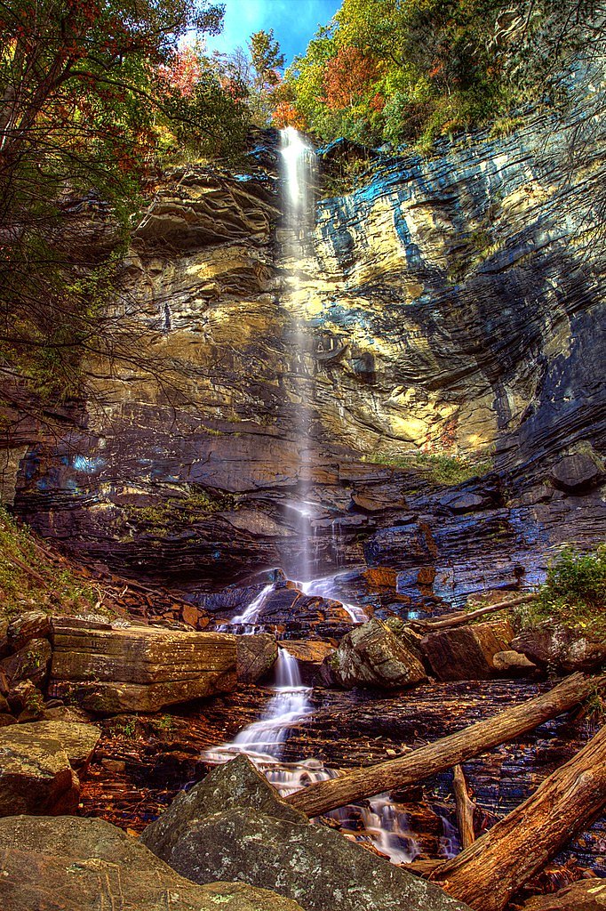
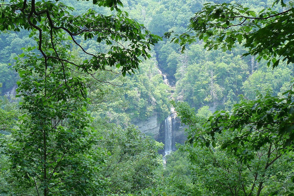
Rainbow Falls
South Carolina • 100 ft
By Armen Suny · Last verified Mar 2026
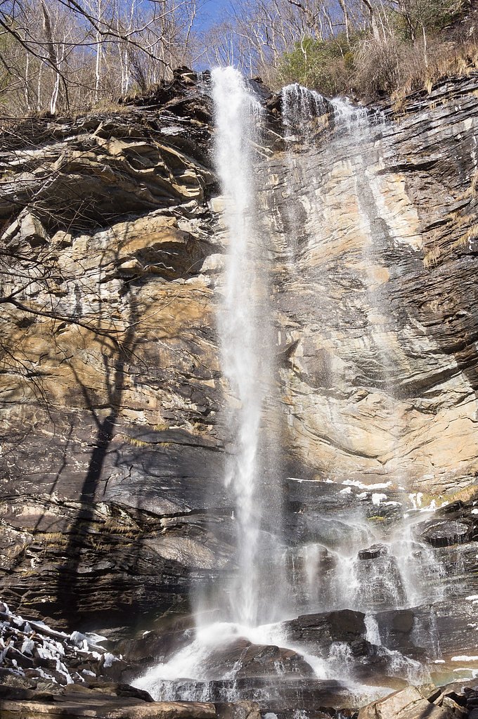
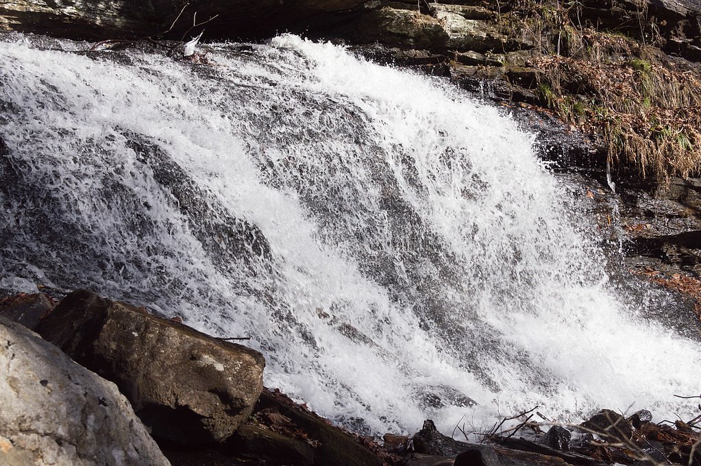
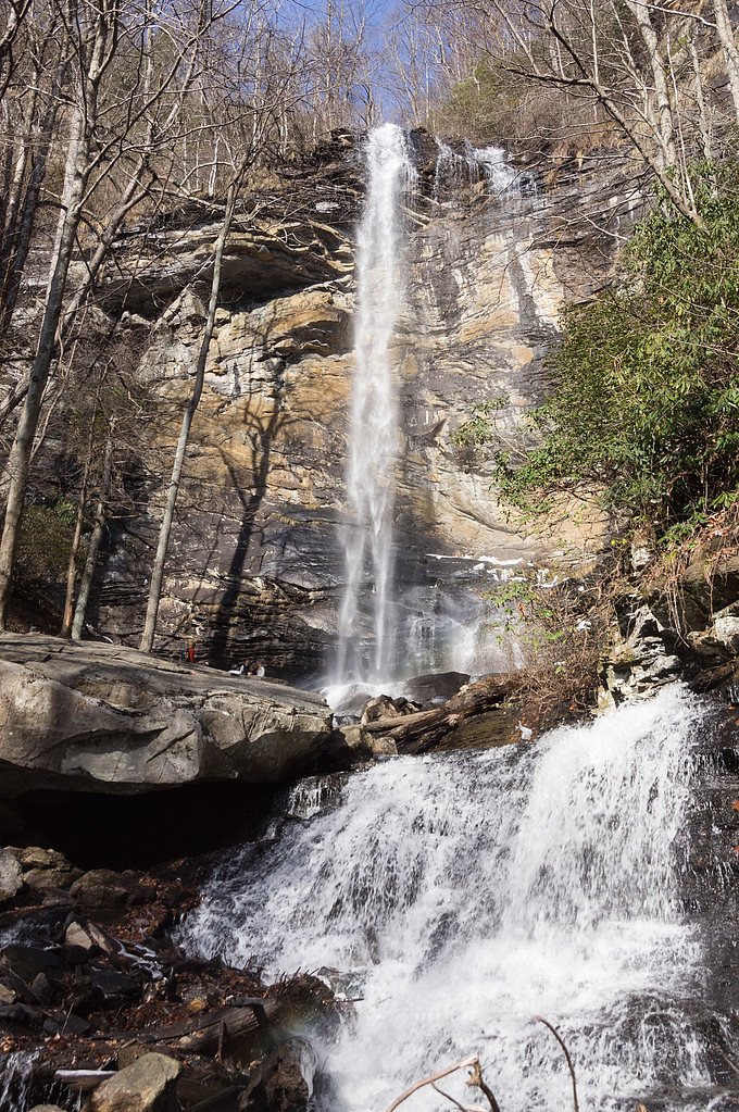
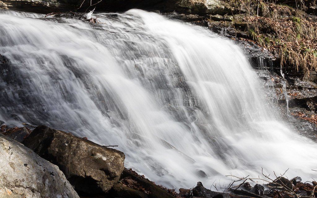
Photo Credits (5)
Difficulty
Moderate
Trail Length
2.4 miles
Trail Type
Out And Back
Elevation Gain
350 ft
About Rainbow Falls
Rainbow Falls is a striking 100-foot cascade tucked into the steep, forested ravines of Jones Gap State Park. The falls tumble over a dramatic rock face into a misty plunge pool, framed by dense hardwoods and rhododendron that make the site especially photogenic in spring and after heavy rain. The setting feels wild and secluded despite being reachable on a well-established park trail. Access to the falls is along the Rainbow Falls Trail, a rewarding out-and-back route that showcases the rugged beauty of Jones Gap. Hikers who enjoy short, scenic excursions will find the route satisfying: it combines rocky stream crossings, shaded forest, and a final vantage point with close-up views of the plunging water and surrounding cliffs.
The Setting
Rainbow Falls sits at 2,867 feet along the Middle Saluda River, in the hills of South Carolina. At 100 feet, it is among the taller waterfalls in South Carolina.
Height: 100 feet
Nearby Falls Worth Visiting
Raven Cliff Falls, the tallest waterfall in South Carolina at 420 feet, lies 4.6 miles to the west. Also nearby: High Falls (125 ft, 4.3 mi) and Triple Falls (125 ft, 4.7 mi).
Trail & Hike Details
The Approach
The moderate 2.4-mile out-and-back trail gains 350 feet of elevation on the way to the falls.
Trail Description
Rainbow Falls Trail is a moderate, 2.4-mile out-and-back route with about 350 feet of elevation gain. The trail crosses rocky terrain and climbs several steep sections before reaching the waterfall; it is generally well-marked but does include uneven footing and exposed roots, so good shoes and steady footing are recommended. Expect a mix of packed dirt and rock underfoot, a moderate grade on the steeper pitches, and a final viewpoint that puts you close to the 100-foot cascade.
What to Expect
The falls cascade 100 feet. Dogs are welcome.
Accessibility
The trail is not wheelchair accessible. Uneven terrain and elevation changes require steady footing.
Frequently Asked Questions
🐶 Are Dogs Allowed at Rainbow Falls?
✅ Dogs are allowed
Are There Any Fees or Permits Required?
🤑 Fee: $6.00
🏊 Is There Swimming at Rainbow Falls?
❌ Swimming is not allowed
When to Visit
Spring and fall are the best times to visit Rainbow Falls, as the weather is mild, and the foliage adds to the scenic beauty. Summer is also popular, but it can be hot and humid. Winter visits are possible but may require extra caution due to icy conditions.
Seasonal Access
The best time to visit is Spring, Summer, and Fall. Winter access may be limited.
Safety Information
The trail is steep and can be slippery, especially after rain. Use caution near the waterfall, as the rocks can be wet and dangerous. Carry sufficient water and be prepared for a strenuous hike.
Current Water Conditions
26 ft³/s
Current discharge — how much water is flowing
Lower than usual for this time of year
Based on 36 years of record
1.50 ft
Water depth at gauge
7-Day Discharge Trend
What does this mean for your visit?
Flow is lower than usual for this time of year.
About This Gauge
7-Day Flow Outlook
Based on the USGS gauge MIDDLE SALUDA RIVER NEAR CLEVELAND, SC (5 km away).
Today
Moderate
30 cfs
4/10Tomorrow
Moderate
31 cfs
4/10Sun
Moderate
29 cfs
4/10Mon
Moderate
30 cfs
4/10Tue
Low
28 cfs
6/10Wed
Low
23 cfs
6/10Thu
Moderate
28 cfs
4/10Best window: Tue — low flow, sunny (trip score 6/10).
Best time of year: this gauge typically runs highest from late March to early May, peaking in April.
How we calculate this
This is a transparent outlook, not a precise forecast. We take the waterfall's current flow strength (how it ranks against its historical normal for today, from the nearest USGS stream gauge), carry that ranking forward along the gauge's seasonal curve, and nudge it for forecast rain. Confidence is highest for the next day or two and falls further out. Always check official conditions and your own judgment before visiting — high flows can be dangerous.
Know when to go.
Get a free email alert when waterfalls near Caesars Head hit peak flow. We only send when conditions are worth the trip — no weekly newsletters, no spam.
Weather Forecast
Location & Access
Getting There
Rainbow Falls is located within Jones Gap State Park. The trailhead can be accessed from the park's main entrance, which is off Jones Gap Road. Follow signs for the Rainbow Falls Trail.
Get Directions on Google MapsParking
Parking is available at the Jones Gap State Park parking area. Note that parking is limited, and the park may reach capacity during peak times.
Elevation
2,867 feet above sea level
Coordinates
35.134561° N, -82.588180° W
Visitor Tips & Gear
Arrive early to secure parking and avoid crowds. Wear sturdy hiking boots with good traction, and bring plenty of water and snacks. Be prepared for steep sections and uneven terrain. Check the weather forecast before your visit, as conditions can change quickly.
As an Amazon Associate, we earn from qualifying purchases.
With 2.4 miles and 350 ft of elevation gain, sturdy boots and trekking poles will help on this moderate trail. Sun exposure on the trail makes good sun protection a must in summer.

Polarized Sunglasses (Knockaround)
Cuts glare off the water so you actually see the falls — and your photos turn out better too.

Columbia Watertight II Rain Jacket
Packs into its own pocket, seam-sealed, and keeps you dry from spray and surprise rain.

Earth Pak Waterproof Dry Bag
Keeps your phone and gear dry when waterfall mist soaks everything else.

Waterproof Phone Pouch (AiRunTech)
Cheap insurance — take photos right next to the falls without killing your phone.

Timberland Euro Sprint Mid Waterproof
Trusted waterproof boot with premium leather and grippy rubber sole — reliable on rocky, wet trails.

TrailBuddy Trekking Poles
Lightweight aluminum, cork grips, and flip-locks that actually hold — a best-seller for good reason.
Where to Stay

Holiday Inn Express - Brevard by IHG

Hampton Inn Brevard

Comfort Inn & Suites Brevard North

On Farm: Charming Hendersonville Retreat!
Browse vacation cabins and private rentals nearby
Unique outdoor stays — tents, yurts, and treehouses
Rent a campervan or RV for your waterfall road trip
Some links are affiliate links. We may earn a commission at no extra cost to you.
Nearby Campground
SYCAMORE FLATS PICNIC SHELTER
11.9 miles away · 1 sites
Overview Sycamore Flats Picnic Shelter is located along the Davidson River on the Pisgah National Forest. This picnic area was named for the sycamore trees which line the banks of the river.The shelter is available on a first come, first served basis from mid-November to April 15th. Reservations are available April 16th through mid-November. Some amenities may not be available during the off-season. This is a popular destination with limited parking, please plan accordingly.Recreation Sycamore Fl
Book on Recreation.govAdditional Information
Nearby Attractions
Other attractions in Jones Gap State Park include the Jones Gap Trail, the Middle Saluda River, and several other waterfalls such as Falls Creek Falls.
Wildlife
The area is home to a variety of wildlife, including deer, squirrels, and numerous bird species. Be cautious of snakes, which may be present along the trail.
Cities near Rainbow Falls
Nearby Waterfalls
Other waterfalls named Rainbow Falls
31 other waterfalls share this name across the U.S.
Writing about Rainbow Falls? Embed this waterfall on your site for free.