High Falls
North Carolina • 150 ft
By Armen Suny · Last verified Mar 2026

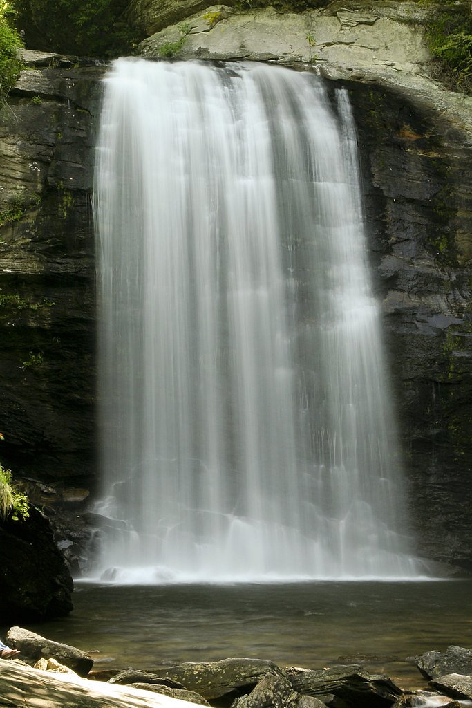
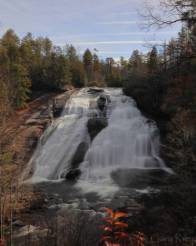
Photo Credits (5)
Difficulty
Easy
Trail Length
1.2 miles
Trail Type
Out And Back
Elevation Gain
200 ft
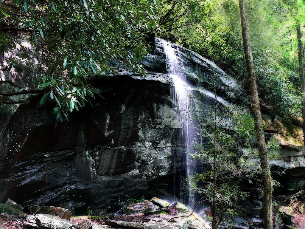
About High Falls
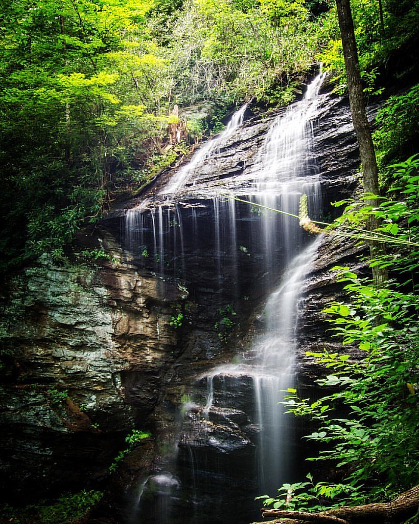
High Falls (also called Cullowhee Falls) is a striking 150-foot cascade tucked into the forested slopes of Pisgah National Forest. Managed by the U.S. Forest Service, the falls are framed by a short, scenic gorge that draws visitors for photo-worthy views and the roar of falling water. The setting feels wild and intimate despite the waterfall’s popularity, making it a rewarding stop for both families and solo hikers seeking a classic North Carolina waterfall experience. Access to High Falls is reached via the USFS Pink Beds Connector (Trail TR118A), which threads through mixed hardwoods and spruce-fir pockets as it approaches the waterfall. For campers, Wolf Ford Horse Camp is a convenient option less than 3.2 km (about 2 miles) away, offering a nearby basecamp for a longer Pisgah exploration. The site’s management by the Forest Service helps preserve the trail and viewpoints while keeping the vibe welcoming and accessible for casual day hikers.
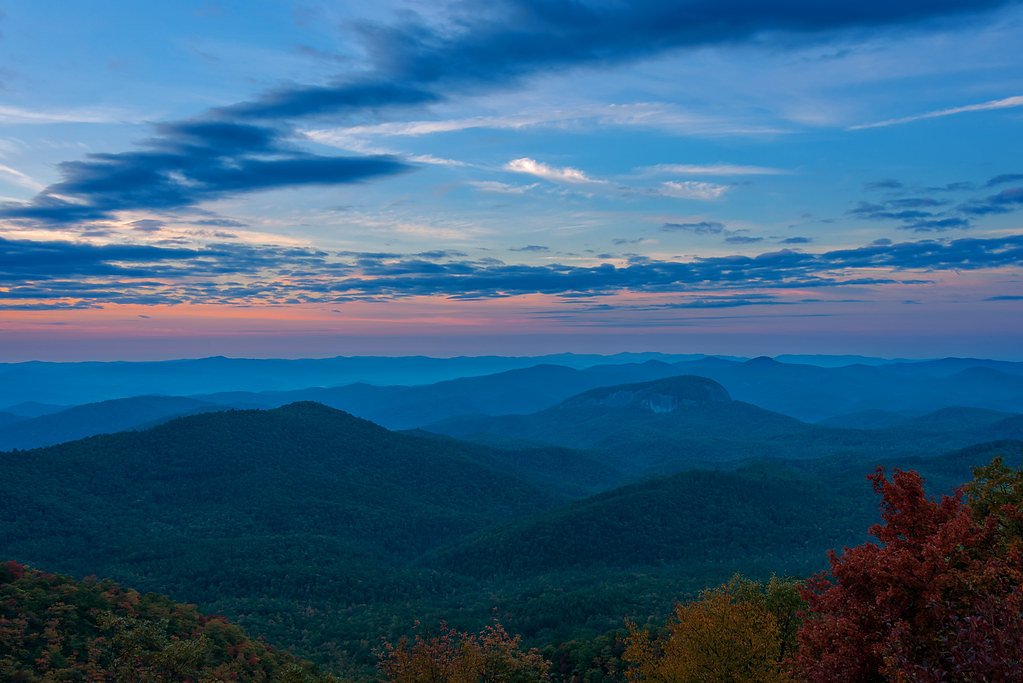
The Setting
High Falls sits at 2,982 feet within Pisgah National Forest, fed by the Davidson River, in the hills of North Carolina. At 150 feet, it is among the taller waterfalls in North Carolina.
Height: 150 feet
Nearby Falls Worth Visiting
Looking Glass Falls (60 ft) lies 4.1 miles to the southwest. Also nearby: Second Falls (50 ft, 6.6 mi) and Slick Rock Falls (30 ft, 5.3 mi).
Trail & Hike Details
The Approach
The easy hike follows Pink Beds Connector (#TR118A), a 1.2-mile out-and-back trail over natural surface. Expect 200 feet of elevation gain. The trail is developed (Class 3).
USFS Trail
PINK BEDS CONNECTOR #TR118A
Trail Class
Developed
Surface
USFS Segment
0.94 miTrail Description
The trail to High Falls is an easy, 1.2-mile out-and-back with about 200 feet of elevation gain, making it accessible for most visitors. Much of the approach follows the USFS Pink Beds Connector (Trail TR118A), a Class 3 trail with a native-material surface; the USFS records TR118A at roughly 0.94 GIS miles on maps. The route begins at the High Falls Access Area and on-the-ground surfaces are primarily packed native materials with gentle inclines; the well-marked trail leads to a viewing area near the base of the falls that provides excellent photo opportunities.
What to Expect
The falls cascade 150 feet. Dogs are welcome.
Accessibility
The trail is not wheelchair accessible. Uneven terrain and elevation changes require steady footing.
Frequently Asked Questions
🐶 Are Dogs Allowed at High Falls?
✅ Dogs are allowed
Are There Any Fees or Permits Required?
🆖 No fees required
🏊 Is There Swimming at High Falls?
❌ Swimming is not allowed
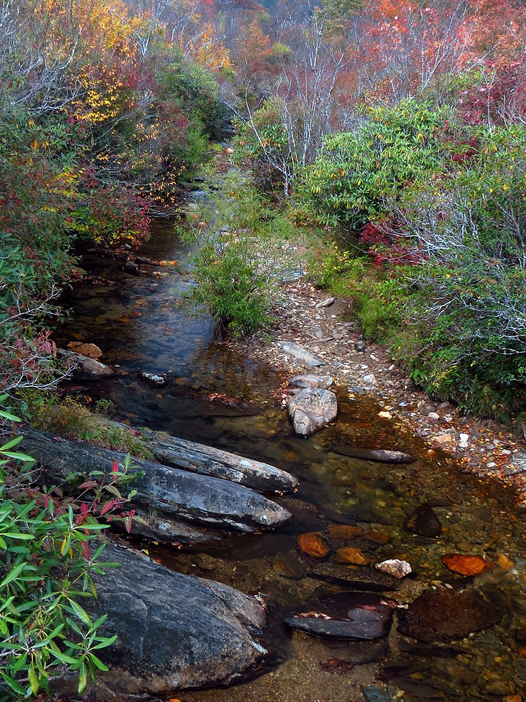
When to Visit
The best time to visit High Falls is during spring and fall. Spring offers lush greenery and higher water flow, while fall provides stunning foliage. Summer is also popular but can be crowded.
Seasonal Access
The best time to visit is Spring, Summer, Fall, and Winter. Check with Pisgah National Forest for seasonal road closures.
Safety Information
Stay on designated trails and viewing areas. Rocks near the falls can be slippery, and the water flow is strong. Avoid climbing on rocks or getting too close to the edge.
Current Water Conditions
53 ft³/s
Current discharge — how much water is flowing
About average for this time of year
Based on 102 years of record
0.69 ft
Water depth at gauge
72°F
ComfortablePleasant for swimming
7-Day Discharge Trend
What does this mean for your visit?
Flow is about average for this time of year. The water is a comfortable 72 degrees F, pleasant for swimming.
About This Gauge
This gauge is on a nearby waterway and may not reflect exact conditions at the falls.
7-Day Flow Outlook
Based on the USGS gauge DAVIDSON RIVER NEAR BREVARD, NC (9 km away).
Today
Moderate
63 cfs
6/10Tomorrow
Strong
64 cfs
7/10Tue
Strong
58 cfs
7/10Wed
Strong
59 cfs
7/10Thu
Strong
65 cfs
7/10Fri
Strong
63 cfs
7/10Sat
Strong
69 cfs
7/10Best window: Tomorrow — strong flow, patchy fog then showers and thunderstorms likely (trip score 7/10).
Best time of year: this gauge typically runs highest from mid February to late April, peaking in March.
How we calculate this
This is a transparent outlook, not a precise forecast. We take the waterfall's current flow strength (how it ranks against its historical normal for today, from the nearest USGS stream gauge), carry that ranking forward along the gauge's seasonal curve, and nudge it for forecast rain. Confidence is highest for the next day or two and falls further out. Always check official conditions and your own judgment before visiting — high flows can be dangerous.
Know when to go.
Get a free email alert when waterfalls near Brevard hit peak flow. We only send when conditions are worth the trip — no weekly newsletters, no spam.
Weather Forecast
Location & Access
Getting There
High Falls is located within DuPont State Recreational Forest, approximately 5.4 miles from Brevard, North Carolina. The trailhead is accessible via Staton Road, with clear signage directing visitors to the High Falls parking area.
Get Directions on Google MapsParking
There is a designated parking area at the High Falls Access Area off Staton Road. Parking is free but can fill up quickly during peak seasons.
Elevation
2,982 feet above sea level
Coordinates
35.349278° N, -82.732905° W
Land Management
Managed by USFS
Visitor Tips & Gear
Arrive early to secure parking, especially during weekends and peak seasons. Wear sturdy shoes as the trail can be muddy after rain. Bring a camera to capture the stunning views. Be cautious near the water as rocks can be slippery.
As an Amazon Associate, we earn from qualifying purchases.
This easy 1.2 miles hike is straightforward — comfortable trail shoes and plenty of water should do. Icy conditions are common in winter — traction cleats are a smart addition.

Columbia Watertight II Rain Jacket
Packs into its own pocket, seam-sealed, and keeps you dry from spray and surprise rain.

Polarized Sunglasses (Knockaround)
Cuts glare off the water so you actually see the falls — and your photos turn out better too.

Earth Pak Waterproof Dry Bag
Keeps your phone and gear dry when waterfall mist soaks everything else.

Waterproof Phone Pouch (AiRunTech)
Cheap insurance — take photos right next to the falls without killing your phone.

Kahtoola MICROspikes
Cult-favorite traction cleats that grip ice and wet rock — essential for winter waterfall hikes.

JOBY GorillaPod Starter Kit
Wraps around railings and rocks for long-exposure waterfall shots — no flat surface needed.
Where to Stay

Hampton Inn Brevard

Comfort Inn & Suites Brevard North

Holiday Inn Express - Brevard by IHG

Pilot Cove
Browse vacation cabins and private rentals nearby
Unique outdoor stays — tents, yurts, and treehouses
Rent a campervan or RV for your waterfall road trip
Some links are affiliate links. We may earn a commission at no extra cost to you.
Nearby Campground
Wolf Ford Horse Camp
2 miles away · 0 sites
Located off Yellow Gap, about three miles east of the Cradle of Forestry in America Visitors Center, this 13-site camp provides access to many miles of equestrian trails in the South Mills River area.
Book on Recreation.govNearby Hot Springs
Hot springs near Brevard, North Carolina

Looking for a soak after your hike? Explore more hot springs near Brevard, North Carolina on SoakingSprings.
Explore North Carolina springsAdditional Information
Nearby Attractions
Nearby attractions include Triple Falls, Hooker Falls, and Bridal Veil Falls, all located within DuPont State Recreational Forest. The town of Brevard is also nearby and offers dining and shopping options.
Wildlife
Visitors may encounter deer, birds, and other small wildlife along the trail. Be cautious of snakes during warmer months.
Cities near High Falls
Nearby Waterfalls

Other waterfalls named High Falls
31 other waterfalls share this name across the U.S.
-
01
Bridgeville
Current flow 127 ft³/s -
02
Copenhagen
Current flow 412 ft³/s -
03
Cranberry Lake
Current flow 185 ft³/s -
04
Grahamsville
Current flow 3 ft³/s -
05
Lake Placid
-
06
Lyon Mountain
-
07
Lyon Mountain
-
08
Philmont
Current flow 91 ft³/s -
09
Prospect
Current flow 5 ft³/s -
10
Rochester
Current flow 820 ft³/s -
11
St. Regis Falls
Current flow 166 ft³/s
Writing about High Falls? Embed this waterfall on your site for free.