Photo Credits (5)
Difficulty
Moderate
Trail Length
2.4 miles
Trail Type
Out And Back
Elevation Gain
350 ft
About High Falls
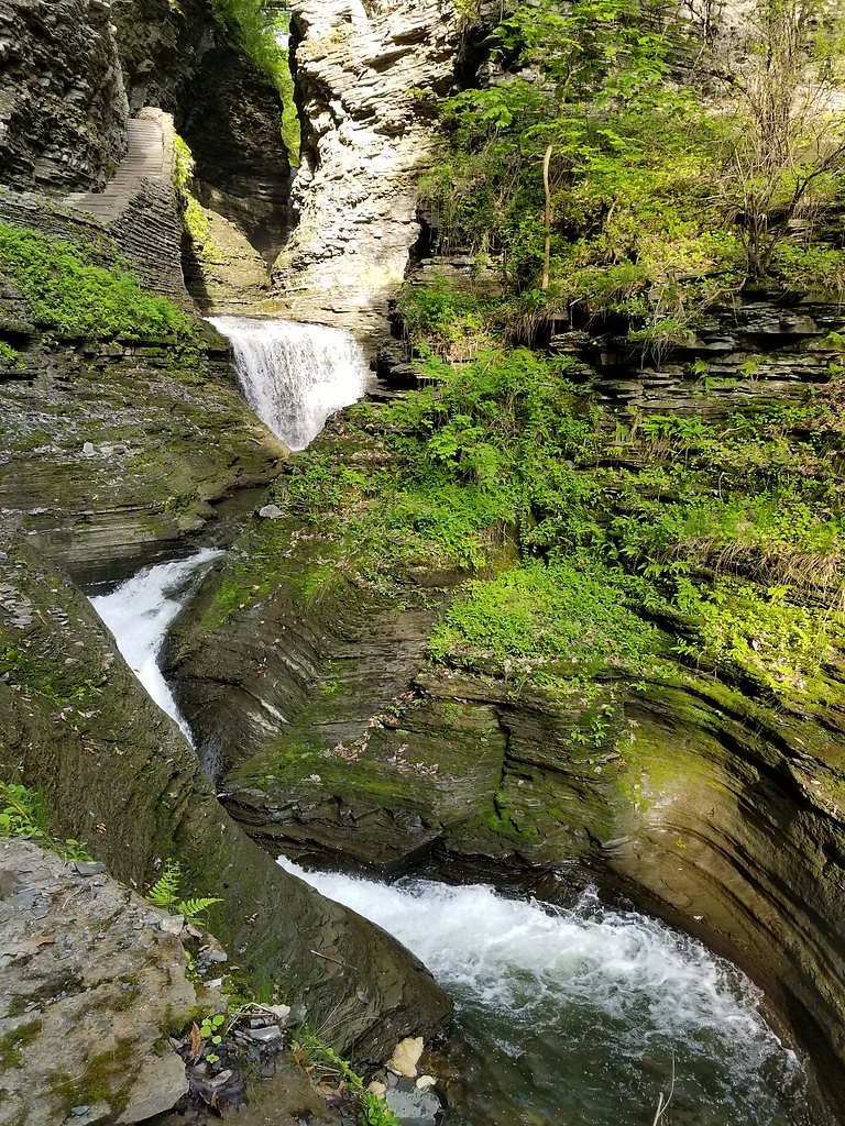
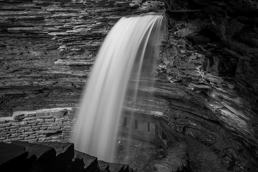
High Falls is a picturesque cascade tucked into the Neversink River Unique Area (designation SOTH), a protected parcel managed by OTHS. The falls offer a photogenic riverside setting that rewards a short hike with peaceful views and great opportunities for nature photography. Being on land overseen by OTHS gives the site a tucked-away feel while remaining accessible to day visitors. Access to the falls is via a moderately rated route: the trail is an out-and-back roughly 2.4 miles in length with about 350 feet of elevation gain. That moderate climb makes High Falls a satisfying half-day outing for hikers who enjoy a short, scenic hike — check with OTHS for any access notes or seasonal conditions before you go.
The Setting
High Falls sits at 860 feet within Neversink River Unique Area, fed by the Neversink River, in the foothills of New York.
Trail & Hike Details
The Approach
The moderate 2.4-mile out-and-back trail gains 350 feet of elevation on the way to the falls.
Trail Description
Trail type: out-and-back. Length: 2.4 miles (round trip). Elevation gain: approximately 350 feet. Difficulty: moderate. The trail provides a steady, moderate ascent to the falls; surface, grade and official trail class are not specified in the provided land-unit records. Managed land unit: Neversink River Unique Area (manager/land owner: OTHS).
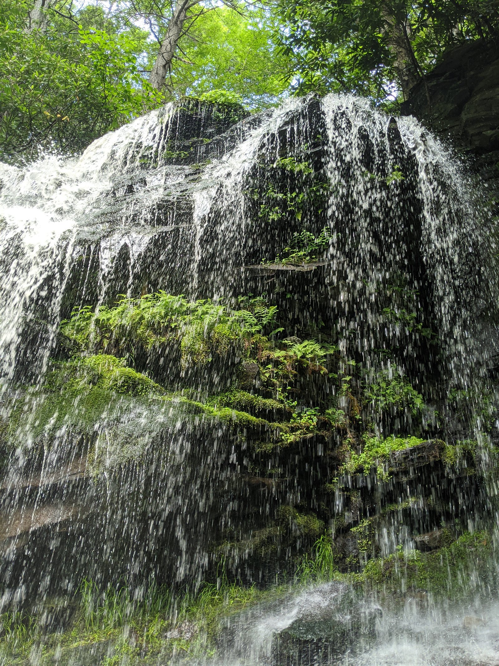
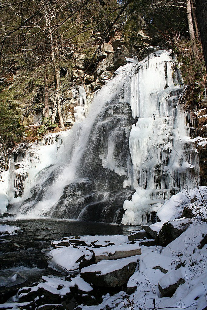
What to Expect
Visitors can expect a beautiful waterfall surrounded by lush greenery, especially during the spring and summer months. Fall offers stunning foliage, while winter may provide frozen waterfall views.
Accessibility
The trail is not wheelchair accessible. Uneven terrain and elevation changes require steady footing.
Frequently Asked Questions
🐶 Are Dogs Allowed at High Falls?
❌ Dogs are not allowed
Are There Any Fees or Permits Required?
🆖 No fees required
🏊 Is There Swimming at High Falls?
❌ Swimming is not allowed
When to Visit
Spring and early summer are ideal for viewing the waterfall at its fullest flow, while fall offers vibrant foliage.
Seasonal Access
The best time to visit is Spring, Summer, and Fall. Winter access may be limited.
Safety Information
Be cautious of slippery rocks near the waterfall. During winter, trails may be icy and require additional care. Always stay on marked trails and avoid getting too close to the edge of the falls.
Current Water Conditions
130 ft³/s
Current discharge — how much water is flowing
About average for this time of year
Based on 33 years of record
4.89 ft
Water depth at gauge
66°F
CoolRefreshing for swimming
7-Day Discharge Trend
What does this mean for your visit?
Flow is about average for this time of year. Water temperature is a refreshing 66 degrees F, good for a quick swim.
About This Gauge
This gauge is on a nearby waterway and may not reflect exact conditions at the falls.
7-Day Flow Outlook
Based on the USGS gauge NEVERSINK RIVER AT BRIDGEVILLE NY (10 km away).
Today
Moderate
130 cfs
6/10Tomorrow
Moderate
146 cfs
4/10Wed
Moderate
132 cfs
8/10Thu
Moderate
132 cfs
8/10Fri
Moderate
148 cfs
4/10Sat
Moderate
157 cfs
6/10Sun
Moderate
150 cfs
6/10Best window: Wed — moderate flow, mostly sunny (trip score 8/10).
Best time of year: this gauge typically runs highest from early March to mid April, peaking in April.
How we calculate this
This is a transparent outlook, not a precise forecast. We take the waterfall's current flow strength (how it ranks against its historical normal for today, from the nearest USGS stream gauge), carry that ranking forward along the gauge's seasonal curve, and nudge it for forecast rain. Confidence is highest for the next day or two and falls further out. Always check official conditions and your own judgment before visiting — high flows can be dangerous.
Know when to go.
Get a free email alert when waterfalls near Bridgeville hit peak flow. We only send when conditions are worth the trip — no weekly newsletters, no spam.
Weather Forecast
Location & Access
Getting There
High Falls is located in the town of High Falls, New York, within the Catskill region. It is accessible by car, and directions can vary depending on the specific waterfall referred to as 'High Falls,' as there are multiple waterfalls with this name in the state.
Get Directions on Google MapsParking
Parking is typically available near the trailhead or viewing area, but availability may vary depending on the specific location.
Elevation
860 feet above sea level
Coordinates
41.553425° N, -74.647661° W
Land Management
Managed by OTHS
Visitor Tips & Gear
Check the weather before visiting, as trail conditions can vary. Wear sturdy footwear and bring water. If visiting in winter, be cautious of icy conditions.
As an Amazon Associate, we earn from qualifying purchases.
With 2.4 miles and 350 ft of elevation gain, sturdy boots and trekking poles will help on this moderate trail. Sun exposure on the trail makes good sun protection a must in summer.

Polarized Sunglasses (Knockaround)
Cuts glare off the water so you actually see the falls — and your photos turn out better too.

Columbia Watertight II Rain Jacket
Packs into its own pocket, seam-sealed, and keeps you dry from spray and surprise rain.

Earth Pak Waterproof Dry Bag
Keeps your phone and gear dry when waterfall mist soaks everything else.

Waterproof Phone Pouch (AiRunTech)
Cheap insurance — take photos right next to the falls without killing your phone.

Timberland Euro Sprint Mid Waterproof
Trusted waterproof boot with premium leather and grippy rubber sole — reliable on rocky, wet trails.

TrailBuddy Trekking Poles
Lightweight aluminum, cork grips, and flip-locks that actually hold — a best-seller for good reason.
Where to Stay

Hampton Inn Monticello, Ny

Days Inn by Wyndham Wurtsboro

Best Western Monticello

Sleep Inn & Suites Middletown - Goshen
Browse vacation cabins and private rentals nearby
Unique outdoor stays — tents, yurts, and treehouses
Rent a campervan or RV for your waterfall road trip
Some links are affiliate links. We may earn a commission at no extra cost to you.
Additional Information
Nearby Attractions
The Catskill region offers numerous hiking trails, scenic views, and other waterfalls to explore.
Wildlife
The area may feature wildlife such as birds, deer, and small mammals. Be cautious and respect wildlife habitats.
Cities near High Falls
Nearby Waterfalls
Other waterfalls named High Falls
31 other waterfalls share this name across the U.S.
-
01
Copenhagen
Current flow 439 ft³/s -
02
Cranberry Lake
Current flow 560 ft³/s -
03
Grahamsville
Current flow 4 ft³/s -
04
Lake Placid
Current flow 3 ft³/s -
05
Lyon Mountain
Current flow 120 ft³/s -
06
Lyon Mountain
-
07
Philmont
Current flow 138 ft³/s -
08
Prospect
Current flow 18 ft³/s -
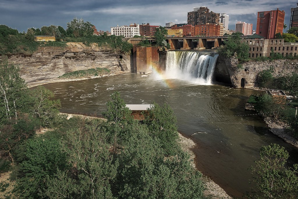
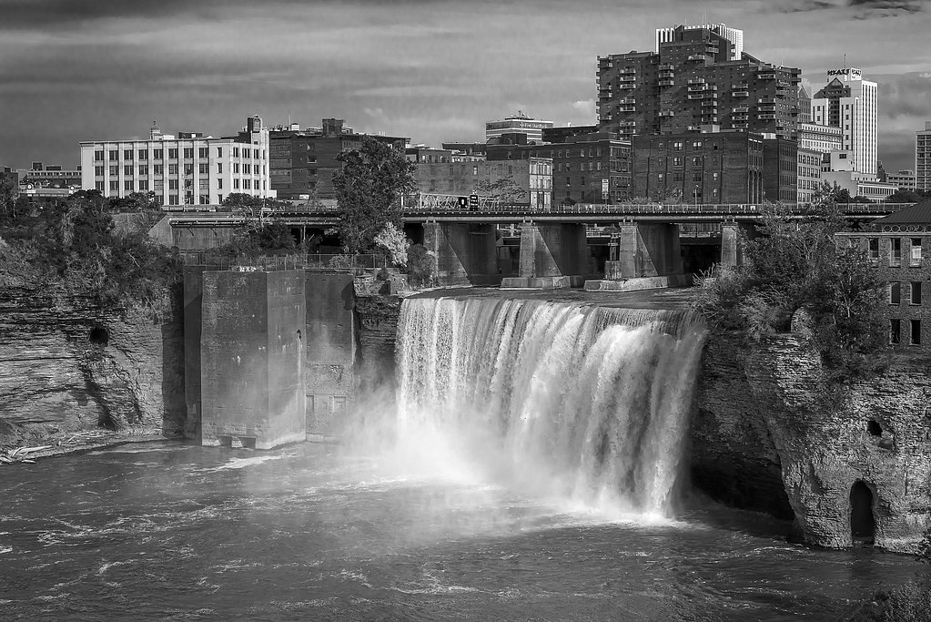
09
Rochester
Current flow 1,950 ft³/s -
10
St. Regis Falls
Current flow 379 ft³/s
Writing about High Falls? Embed this waterfall on your site for free.