
Photo Credits (5)
Difficulty
Easy
Trail Length
1.5 miles
Trail Type
Out And Back
Elevation Gain
200 ft
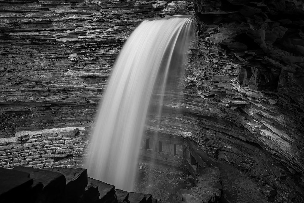
About High Falls
High Falls tumbles into a scenic, forested gorge within the Five Ponds Wilderness in New York, on land owned and managed by SDC (land unit: Five Ponds Wilderness; designation: SW). The falls are a compact but photogenic highlight for hikers and nature photographers, offering a peaceful backcountry atmosphere framed by mature northern hardwoods. Because the site sits on SDC-managed wilderness land, expect a relatively undeveloped, natural setting rather than heavy infrastructure. Access to High Falls is straightforward and rewarding: a short out-and-back route leads you to the viewpoint without demanding technical scrambling. The fall’s combination of easy approach and classic wilderness surroundings makes it a great half-day outing for families and casual hikers looking to experience the quieter side of the Five Ponds Wilderness.
The Setting
High Falls sits at 1,601 feet within Five Ponds Wilderness, fed by the Oswegatchie River, in the hills of New York.
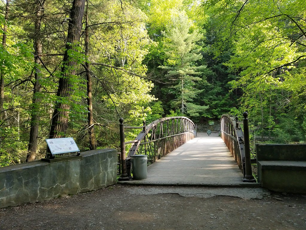
Trail & Hike Details
The Approach
The easy 1.5-mile out-and-back trail gains 200 feet of elevation on the way to the falls.
Trail Description
Trail: 1.5 miles out-and-back; elevation gain: 200 ft; difficulty: easy. The route is a short, well-defined forest trail that gains modest elevation en route to the falls, making it suitable for most visitors. Managed as part of SDC’s Five Ponds Wilderness unit, the trail’s natural tread and gentle grades keep the approach straightforward—expect an uncomplicated hike on a primary footpath rather than a heavily developed walkway.
What to Expect
Dogs are welcome.
Accessibility
The trail is not wheelchair accessible. Uneven terrain and elevation changes require steady footing.
Frequently Asked Questions
🐶 Are Dogs Allowed at High Falls?
✅ Dogs are allowed
Are There Any Fees or Permits Required?
🆖 No fees required
🏊 Is There Swimming at High Falls?
❌ Swimming is not allowed
When to Visit
Spring and early summer are ideal for visiting High Falls, as the water flow is typically strongest during these seasons. Fall offers beautiful foliage, while winter may provide a unique frozen waterfall view.
Seasonal Access
The best time to visit is Spring, Summer, and Fall. Winter access may be limited.
Safety Information
Exercise caution near the waterfall, as rocks can be slippery. Stay on marked trails to avoid getting lost or encountering hazardous areas.
Current Water Conditions
566 ft³/s
Current discharge — how much water is flowing
Higher than usual for this time of year
Based on 82 years of record
3.24 ft
Water depth at gauge
7-Day Discharge Trend
What does this mean for your visit?
The water is flowing higher than usual for this time of year.
About This Gauge
This gauge is on a nearby waterway and may not reflect exact conditions at the falls.
7-Day Flow Outlook
Based on the USGS gauge OSWEGATCHIE RIVER NEAR OSWEGATCHIE NY (22 km away).
Today
Barely Flowing
507 cfs
5/10Tomorrow
Barely Flowing
441 cfs
5/10Tue
Low
533 cfs
3/10Wed
Moderate
573 cfs
4/10Thu
Moderate
547 cfs
4/10Fri
Moderate
512 cfs
4/10Sat
Moderate
406 cfs
4/10Best window: Today — barely flowing flow, sunny (trip score 5/10).
Best time of year: this gauge typically runs highest from early March to mid May, peaking in April.
How we calculate this
This is a transparent outlook, not a precise forecast. We take the waterfall's current flow strength (how it ranks against its historical normal for today, from the nearest USGS stream gauge), carry that ranking forward along the gauge's seasonal curve, and nudge it for forecast rain. Confidence is highest for the next day or two and falls further out. Always check official conditions and your own judgment before visiting — high flows can be dangerous.
Know when to go.
Get a free email alert when waterfalls near Cranberry Lake hit peak flow. We only send when conditions are worth the trip — no weekly newsletters, no spam.
Weather Forecast
Location & Access
Getting There
High Falls is located in the Catskill Mountains region of New York. It can be accessed via local roads, with parking available near the trailhead.
Get Directions on Google MapsParking
There is a designated parking area near the trailhead, but availability may be limited during peak seasons.
Elevation
1,601 feet above sea level
Coordinates
44.068674° N, -74.910186° W
Land Management
Managed by SDC
Visitor Tips & Gear
Arrive early during weekends or holidays to secure parking. Wear sturdy footwear as the trail and areas near the falls can be uneven or slippery. Bring water and snacks, especially during warmer months.
As an Amazon Associate, we earn from qualifying purchases.
This easy 1.5 miles hike is straightforward — comfortable trail shoes and plenty of water should do. Sun exposure on the trail makes good sun protection a must in summer.

Polarized Sunglasses (Knockaround)
Cuts glare off the water so you actually see the falls — and your photos turn out better too.

Columbia Watertight II Rain Jacket
Packs into its own pocket, seam-sealed, and keeps you dry from spray and surprise rain.

Earth Pak Waterproof Dry Bag
Keeps your phone and gear dry when waterfall mist soaks everything else.

Waterproof Phone Pouch (AiRunTech)
Cheap insurance — take photos right next to the falls without killing your phone.

JOBY GorillaPod Starter Kit
Wraps around railings and rocks for long-exposure waterfall shots — no flat surface needed.

Osprey Daylite Daypack
Light, organized, and just the right size for a day hike — fits water, snacks, and layers.
Where to Stay

Adirondack Luxury Getaway

Waterfront Harrisville Home with Outdoor Fireplace!

HARRISVILLE Love Shack

Oswegatchie River Cabin with Kayaks and Fire Pit!
Browse vacation cabins and private rentals nearby
Unique outdoor stays — tents, yurts, and treehouses
Rent a campervan or RV for your waterfall road trip
Some links are affiliate links. We may earn a commission at no extra cost to you.
Additional Information
Nearby Attractions
Nearby attractions include other waterfalls in the Catskill region, such as Kaaterskill Falls, as well as hiking trails and scenic viewpoints.
Wildlife
The area is home to various wildlife, including birds, deer, and small mammals. Visitors may also encounter insects such as mosquitoes during warmer months.
Cities near High Falls
Nearby Waterfalls
Other waterfalls named High Falls
31 other waterfalls share this name across the U.S.
-
01
Bridgeville
Current flow 136 ft³/s -
02
Copenhagen
Current flow 612 ft³/s -
03
Grahamsville
Current flow 6 ft³/s -
04
Lake Placid
Current flow 3 ft³/s -
05
Lyon Mountain
Current flow 295 ft³/s -
06
Lyon Mountain
-
07
Philmont
Current flow 135 ft³/s -
08
Prospect
Current flow 15 ft³/s -
09
Rochester
Current flow 1,360 ft³/s -
10
St. Regis Falls
Current flow 724 ft³/s
Writing about High Falls? Embed this waterfall on your site for free.