
Photo Credits (5)
Difficulty
Moderate
Trail Length
2.4 miles
Trail Type
Out And Back
Elevation Gain
350 ft
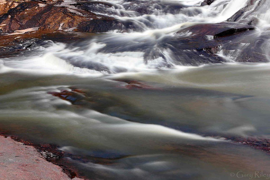
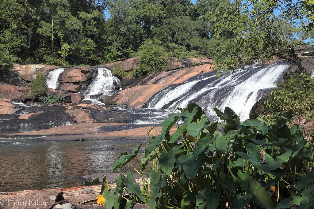
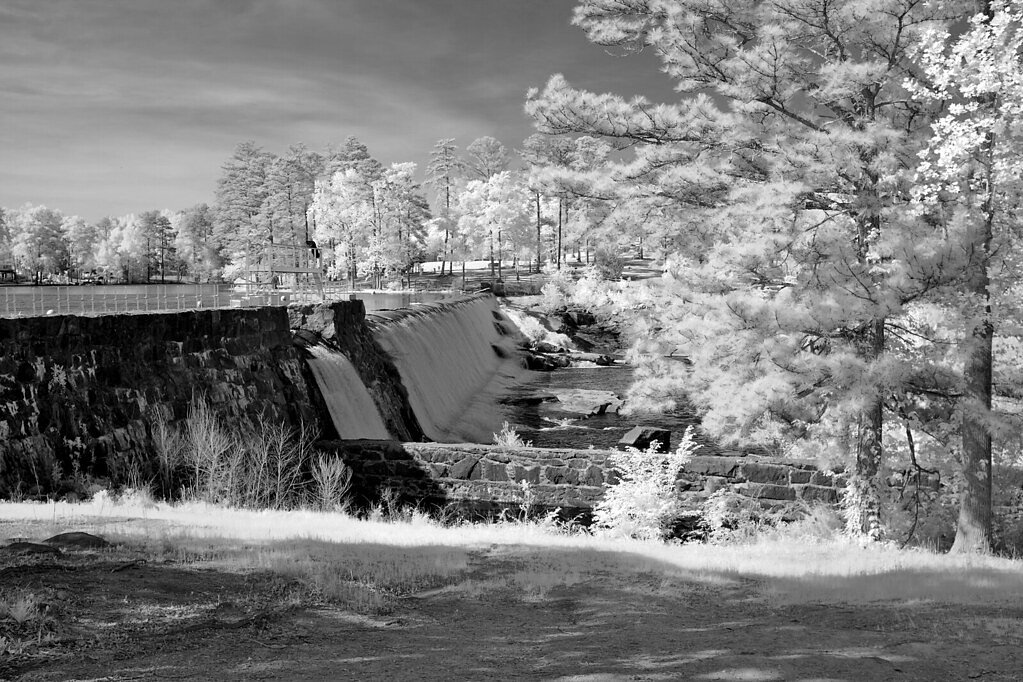
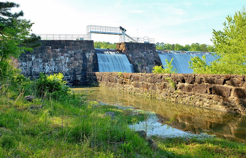
About High Falls
High Falls is a picturesque waterfall in Georgia where the Towaliga River drops over rocky ledges into a scenic cascade. The setting invites photographers and nature lovers with its layered rock and forested surroundings; the area described here is managed by the U.S. Forest Service and lies within the Chattahoochee National Forest (managed by the USFS). The falls make a rewarding destination year-round, offering both close-up views of rushing water and peaceful forest sounds along the river corridor. The hike to the overlook is a satisfying half-day outing for moderately fit visitors. The nearest developed camping is Frank Gross Campground, just 1.56 km from the falls, making overnight trips convenient for those who want to catch sunrise or linger after the mid-day crowds. Expect a welcoming, natural atmosphere and multiple vantage points for different photo angles and quiet wildlife-watching opportunities.
The Setting
High Falls sits at 2,297 feet within Chattahoochee National Forest, fed by the Toccoa River, in the hills of Georgia.
Nearby Falls Worth Visiting
Cochrans Falls (600 ft) lies 10.1 miles to the southwest.
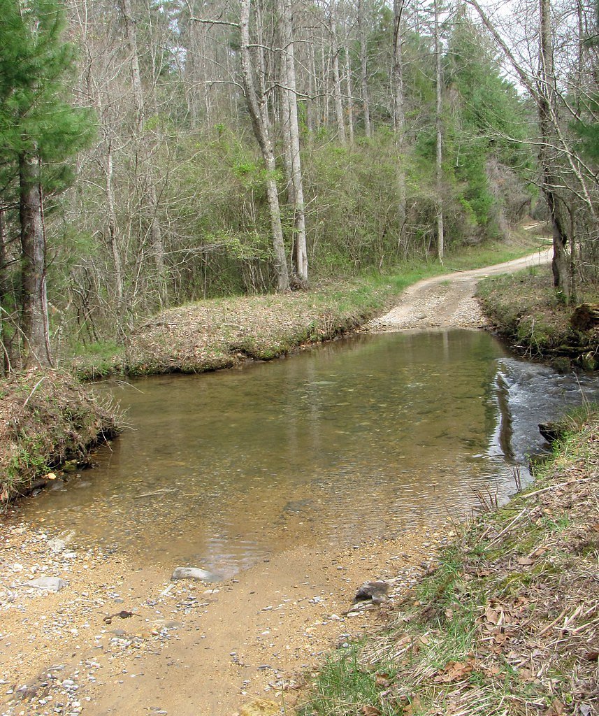
Trail & Hike Details
The Approach
The moderate 2.4-mile out-and-back trail gains 350 feet of elevation on the way to the falls.
Trail Description
The official route to High Falls is an out-and-back trail of 2.4 miles with about 350 feet of elevation gain and a moderate difficulty rating. The tread is well-maintained and moves through forested terrain with several viewpoints that open onto the river and falls; much of the route is relatively gentle but includes short uphill sections that account for the stated elevation gain. USFS trail data lists the route length, gain, and difficulty as noted above; the trail is managed by the U.S. Forest Service within the Chattahoochee National Forest. Because Frank Gross Campground is only about 1.56 km away, the trail is a convenient option for campers and anyone planning an overnight stay nearby.
What to Expect
Dogs are welcome.
Accessibility
The trail is not wheelchair accessible. Uneven terrain and elevation changes require steady footing.
Frequently Asked Questions
🐶 Are Dogs Allowed at High Falls?
✅ Dogs are allowed
Are There Any Fees or Permits Required?
🤑 Fee: $5.00
🏊 Is There Swimming at High Falls?
❌ Swimming is not allowed
When to Visit
Spring and fall are ideal times to visit due to pleasant weather and vibrant foliage. However, the falls are accessible year-round and can be enjoyed in any season.
Seasonal Access
The best time to visit is Spring, Summer, Fall, and Winter. Check with Chattahoochee National Forest for seasonal road closures.
Safety Information
Exercise caution near the falls as rocks can be slippery. Stay on marked trails and avoid venturing too close to the water. Be aware of potential wildlife encounters.
Current Water Conditions
279 ft³/s
Current discharge — how much water is flowing
Lower than usual for this time of year
Based on 93 years of record
1.38 ft
Water depth at gauge
7-Day Discharge Trend
What does this mean for your visit?
Flow is lower than usual for this time of year.
About This Gauge
This gauge is on a nearby waterway and may not reflect exact conditions at the falls.
7-Day Flow Outlook
Based on the USGS gauge TOCCOA RIVER NEAR DIAL, GA (13 km away).
Today
Roaring
318 cfs
6/10Tomorrow
Roaring
316 cfs
6/10Sat
Roaring
322 cfs
6/10Sun
Roaring
338 cfs
6/10Mon
Roaring
339 cfs
6/10Tue
Roaring
331 cfs
6/10Wed
Roaring
319 cfs
6/10Best window: Today — roaring flow, mostly sunny then chance showers and thunderstorms (trip score 6/10).
Best time of year: this gauge typically runs highest from mid February to early May, peaking in April.
How we calculate this
This is a transparent outlook, not a precise forecast. We take the waterfall's current flow strength (how it ranks against its historical normal for today, from the nearest USGS stream gauge), carry that ranking forward along the gauge's seasonal curve, and nudge it for forecast rain. Confidence is highest for the next day or two and falls further out. Always check official conditions and your own judgment before visiting — high flows can be dangerous.
Know when to go.
Get a free email alert when waterfalls near Morganton hit peak flow. We only send when conditions are worth the trip — no weekly newsletters, no spam.
Weather Forecast
Location & Access
Getting There
High Falls is located within High Falls State Park, approximately 1 hour south of Atlanta, Georgia. The park is accessible via I-75, and clear signage directs visitors to the entrance.
Get Directions on Google MapsParking
Ample parking is available at High Falls State Park near the trailheads and picnic areas. Parking fees may apply as part of the park entrance fee.
Elevation
2,297 feet above sea level
Coordinates
34.712588° N, -84.139082° W
Land Management
Managed by USFS
Visitor Tips & Gear
Arrive early during weekends or holidays to secure parking and avoid crowds. Wear sturdy shoes as some areas near the falls may be slippery. Bring water and snacks, especially during warmer months.
As an Amazon Associate, we earn from qualifying purchases.
With 2.4 miles and 350 ft of elevation gain, sturdy boots and trekking poles will help on this moderate trail. Icy conditions are common in winter — traction cleats are a smart addition.

Columbia Watertight II Rain Jacket
Packs into its own pocket, seam-sealed, and keeps you dry from spray and surprise rain.

Polarized Sunglasses (Knockaround)
Cuts glare off the water so you actually see the falls — and your photos turn out better too.

Earth Pak Waterproof Dry Bag
Keeps your phone and gear dry when waterfall mist soaks everything else.

Waterproof Phone Pouch (AiRunTech)
Cheap insurance — take photos right next to the falls without killing your phone.

Timberland Euro Sprint Mid Waterproof
Trusted waterproof boot with premium leather and grippy rubber sole — reliable on rocky, wet trails.

TrailBuddy Trekking Poles
Lightweight aluminum, cork grips, and flip-locks that actually hold — a best-seller for good reason.
Where to Stay

Eagles Landing

Meadow Retreat - Hot Tub, Fire Pit & Games

Incredible Views! - Pet Friendly - Aska Adventure Area - Bearfoot Bungalow

Dahlonega Resort and Vineyard
Browse vacation cabins and private rentals nearby
Unique outdoor stays — tents, yurts, and treehouses
Rent a campervan or RV for your waterfall road trip
Some links are affiliate links. We may earn a commission at no extra cost to you.
Nearby Campground
Frank Gross Campground
1 miles away · 8 sites
Overview Frank Gross is a U.S. Forest Service Campground located approximately 2 hours north of Atlanta in the North Georgia Mountains of the Chattahoochee National Forest. Frank Gross Campground offers visitors year-round recreation opportunities such as camping, fishing, picnicking, and hiking. Trout fishing is popular here in North Georgia so having a campsite such as Frank Gross adjacent to the Rock Creek is an amazing opportunity for avid fisherman. Eight campsites are neatly arranged for pr
Book on Recreation.govAdditional Information
Nearby Attractions
High Falls State Park also features a lake for fishing and boating, picnic areas, and a campground for overnight stays.
Wildlife
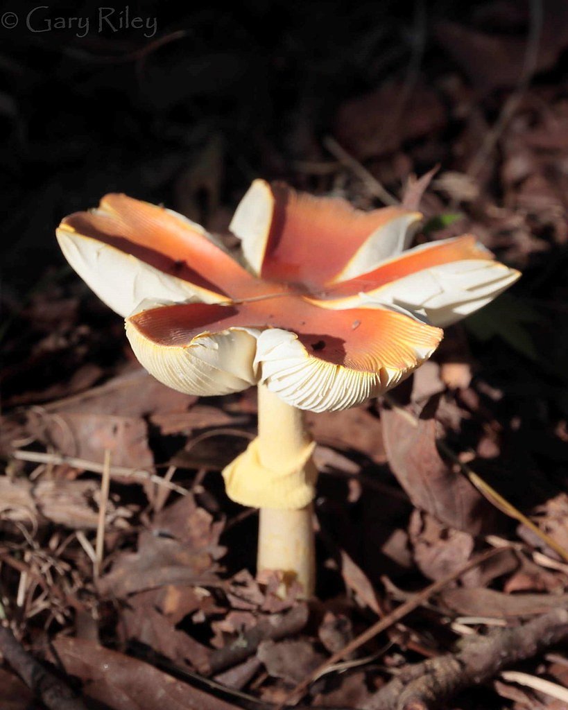
The area is home to various bird species, deer, and other small wildlife. Visitors may also encounter turtles and fish in the river.
Cities near High Falls
Nearby Waterfalls
Other waterfalls named High Falls
31 other waterfalls share this name across the U.S.
-
01
Bridgeville
Current flow 124 ft³/s -
02
Copenhagen
Current flow 919 ft³/s -
03
Cranberry Lake
Current flow 878 ft³/s -
04
Grahamsville
Current flow 4 ft³/s -
05
Lake Placid
Current flow 2 ft³/s -
06
Lyon Mountain
Current flow 152 ft³/s -
07
Lyon Mountain
-
08
Philmont
Current flow 143 ft³/s -
09
Prospect
Current flow 20 ft³/s -
10
Rochester
Current flow 996 ft³/s -
11
St. Regis Falls
Current flow 679 ft³/s
Writing about High Falls? Embed this waterfall on your site for free.