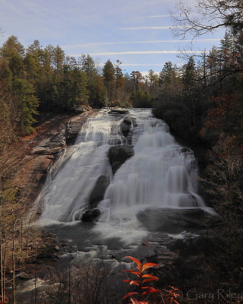
High Falls
North Carolina • 125 ft
By Armen Suny · Last verified Mar 2026
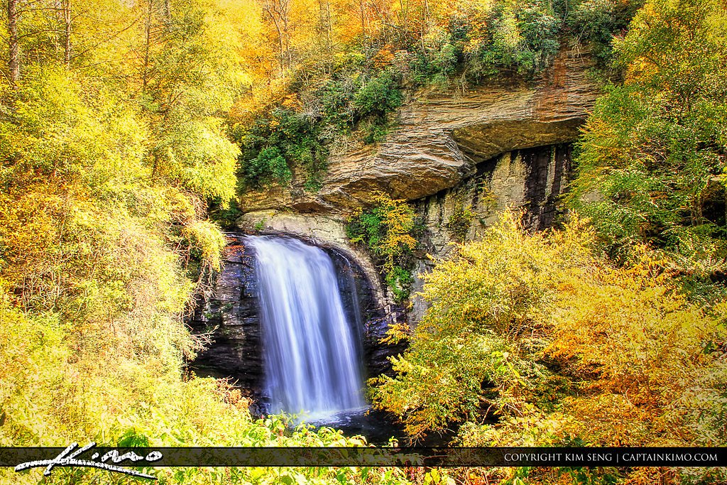
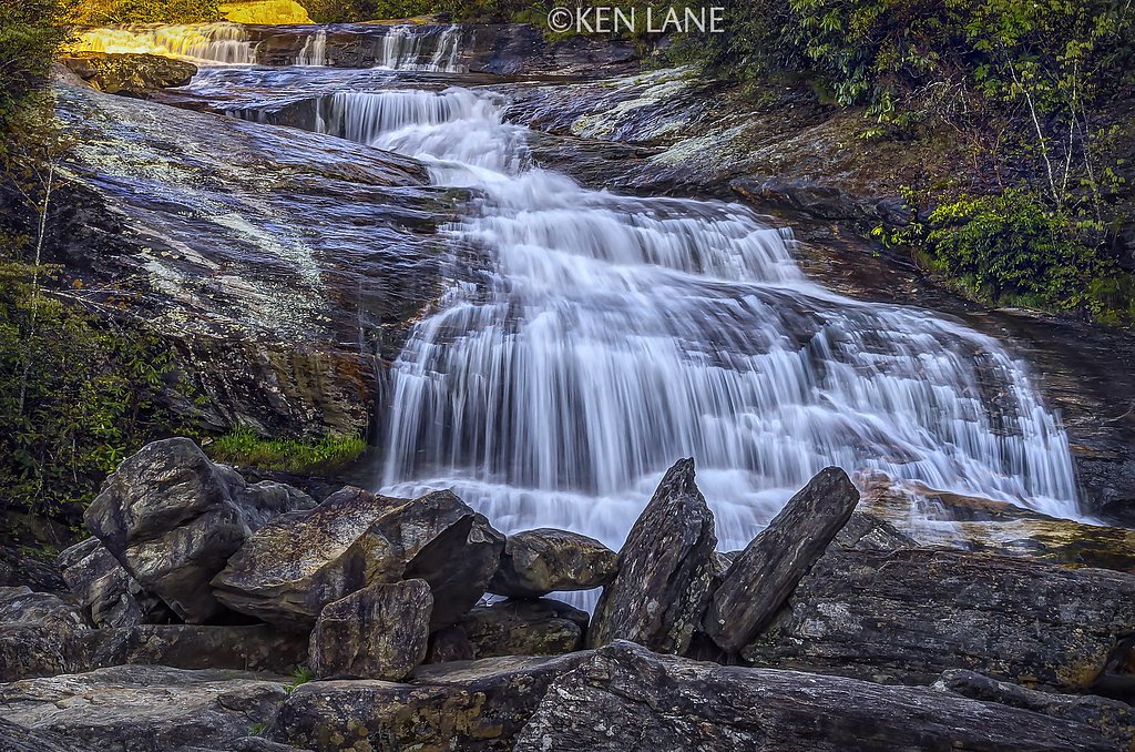
Photo Credits (5)
Difficulty
Easy
Trail Length
1.2 miles
Trail Type
Out And Back
Elevation Gain
200 ft
About High Falls
High Falls plunges about 125 feet through a wide, picturesque cascade in DuPont State Recreational Forest, making it one of the forest’s most photographed and popular scenic highlights. The falls’ broad sheet of water and forested amphitheater create dramatic views from several vantage points, and a well-placed viewing area near the base gives visitors a chance to feel the spray and frame great photos. An optional side trail leads up to a charming covered bridge that spans the river above the falls, adding a classic touch to the setting. The hike to High Falls is approachable and family-friendly, drawing day hikers and photographers alike who want an easy outdoor escape. Nestled in the shaded woods of DuPont State Recreational Forest, the site rewards a short walk with big scenery — perfect for a relaxed half-day outing or as part of a longer waterfall loop in the area.
The Setting
High Falls sits at 2,979 feet along the Tuckasegee River, in the hills of North Carolina. At 125 feet, it is among the taller waterfalls in North Carolina.
Height: 125 feet
Trail & Hike Details
The Approach
The easy 1.2-mile out-and-back trail gains 200 feet of elevation on the way to the falls.
Trail Description
This is a short, well-maintained out-and-back trail of roughly 1.2 miles round-trip with about 200 feet of elevation gain; it’s rated easy and features a gentle incline that’s accessible for most visitors. The path is clearly marked and commonly busy during peak times, so expect other hikers and plenty of photo stops along the way. Near the end of the trail you’ll find a designated viewing area at the base of High Falls, plus an optional side spur that climbs to a covered bridge above the cascade for an alternate perspective. No USFS trail number or specific surface/grade/class data is provided for this route; the route’s short distance and mild gain make it a good option for families and casual hikers.
What to Expect
The falls cascade 125 feet. Dogs are welcome.
Accessibility
The trail is not wheelchair accessible. Uneven terrain and elevation changes require steady footing.
Frequently Asked Questions
🐶 Are Dogs Allowed at High Falls?
✅ Dogs are allowed
Are There Any Fees or Permits Required?
🆖 No fees required
🏊 Is There Swimming at High Falls?
❌ Swimming is not allowed
When to Visit
Spring and fall are particularly beautiful due to blooming wildflowers and vibrant foliage, but the waterfall is impressive year-round.
Seasonal Access
The best time to visit is Spring, Summer, Fall, and Winter.
Safety Information
Stay on marked trails and avoid climbing on rocks near the waterfall, as they can be slippery. Be cautious of strong currents and avoid entering the water.
Current Water Conditions
65 ft³/s
Current discharge — how much water is flowing
Much lower than usual for this time of year
Based on 21 years of record
4.01 ft
Water depth at gauge
7-Day Discharge Trend
What does this mean for your visit?
Flow is well below normal for this time of year, so the waterfall may be a trickle.
About This Gauge
This gauge is on a nearby waterway and may not reflect exact conditions at the falls.
7-Day Flow Outlook
Based on the USGS gauge TUCKASEGEE RIVER AT SR 1172 NR CULLOWHEE, NC (9 km away).
Today
Moderate
74 cfs
4/10Tomorrow
Moderate
78 cfs
4/10Wed
Moderate
78 cfs
4/10Thu
Moderate
83 cfs
4/10Fri
Moderate
92 cfs
4/10Sat
Moderate
89 cfs
4/10Sun
Moderate
85 cfs
4/10Best window: Today — moderate flow, patchy fog then slight chance showers and thunderstorms (trip score 4/10).
Best time of year: this gauge typically runs highest from late December to late January, peaking in January.
How we calculate this
This is a transparent outlook, not a precise forecast. We take the waterfall's current flow strength (how it ranks against its historical normal for today, from the nearest USGS stream gauge), carry that ranking forward along the gauge's seasonal curve, and nudge it for forecast rain. Confidence is highest for the next day or two and falls further out. Always check official conditions and your own judgment before visiting — high flows can be dangerous.
Know when to go.
Get a free email alert when waterfalls near Glenville hit peak flow. We only send when conditions are worth the trip — no weekly newsletters, no spam.
Weather Forecast
Location & Access
Getting There
High Falls is located within DuPont State Recreational Forest, near Brevard, North Carolina. The main access point is the High Falls Access Area, which is well-marked and easily reachable by car.
Get Directions on Google MapsParking
Parking is available at the High Falls Access Area. The lot is spacious but can fill up quickly during peak seasons, so arriving early is recommended.
Elevation
2,979 feet above sea level
Coordinates
35.203709° N, -83.160145° W
Visitor Tips & Gear
Wear sturdy shoes as the trail can be muddy after rain. Arrive early to secure parking, especially during weekends and holidays. Bring a camera to capture the stunning views.
As an Amazon Associate, we earn from qualifying purchases.
This easy 1.2 miles hike is straightforward — comfortable trail shoes and plenty of water should do. Icy conditions are common in winter — traction cleats are a smart addition.

Columbia Watertight II Rain Jacket
Packs into its own pocket, seam-sealed, and keeps you dry from spray and surprise rain.

Polarized Sunglasses (Knockaround)
Cuts glare off the water so you actually see the falls — and your photos turn out better too.

Earth Pak Waterproof Dry Bag
Keeps your phone and gear dry when waterfall mist soaks everything else.

Waterproof Phone Pouch (AiRunTech)
Cheap insurance — take photos right next to the falls without killing your phone.

Kahtoola MICROspikes
Cult-favorite traction cleats that grip ice and wet rock — essential for winter waterfall hikes.

JOBY GorillaPod Starter Kit
Wraps around railings and rocks for long-exposure waterfall shots — no flat surface needed.
Where to Stay

Private Mtn Love Shack w/ fast wifi, BBQ & view

Chalet at Peek's Creek

The Lodge Nantahala River

Riverside Relaxer w/Hot Tub+Fire Pit +Wifi & view
Browse vacation cabins and private rentals nearby
Unique outdoor stays — tents, yurts, and treehouses
Rent a campervan or RV for your waterfall road trip
Some links are affiliate links. We may earn a commission at no extra cost to you.
Nearby Campground
BALSAM LAKE LODGE
9.1 miles away · 1 sites
Overview Balsam Lake Lodge is nestled in the center of the 39,000-acre Roy Taylor Forest within the Nantahala National Forest. The lodge overlooks Balsam Lake and offers spectacular mountain views.The lodge opened its doors to the public when the Forest Service acquired the dwelling and lake in 1982. Since then groups have rented the lodge for meetings, recreation and environmental activities. NOTE: Balsam Lake Lodge is not a campground and has no campsites available for sewer, water, or electric
Book on Recreation.govNearby Hot Springs
Hot springs near Glenville, North Carolina

Looking for a soak after your hike? Explore more hot springs near Glenville, North Carolina on SoakingSprings.
Explore North Carolina springsAdditional Information
Nearby Attractions
Other waterfalls in DuPont State Recreational Forest, such as Triple Falls and Hooker Falls, are located nearby and can be visited on the same trip.
Wildlife
The area is home to a variety of wildlife, including deer, birds, and small mammals. Keep an eye out for native flora and fauna along the trail.
Cities near High Falls
Nearby Waterfalls

Other waterfalls named High Falls
31 other waterfalls share this name across the U.S.
-
01
Bridgeville
-
02
Copenhagen
Current flow 334 ft³/s -
03
Cranberry Lake
Current flow 637 ft³/s -
04
Grahamsville
Current flow 5 ft³/s -
05
Lake Placid
Current flow 3 ft³/s -
06
Lyon Mountain
-
07
Lyon Mountain
-
08
Philmont
Current flow 140 ft³/s -
09
Prospect
Current flow 23 ft³/s -
10
Rochester
Current flow 2,110 ft³/s -
11
St. Regis Falls
Current flow 441 ft³/s
Writing about High Falls? Embed this waterfall on your site for free.