Photo Credits (5)
Difficulty
Moderate
Trail Length
2.4 miles
Trail Type
Out And Back
Elevation Gain
350 ft
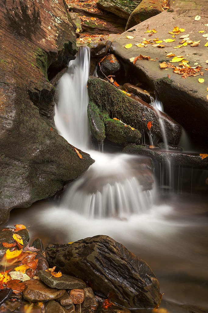
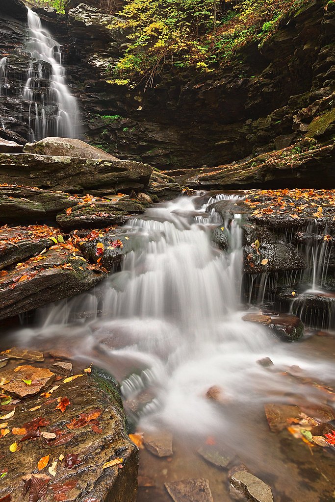
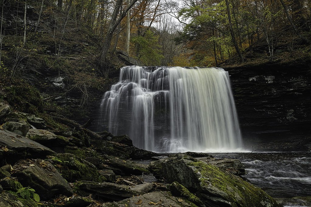
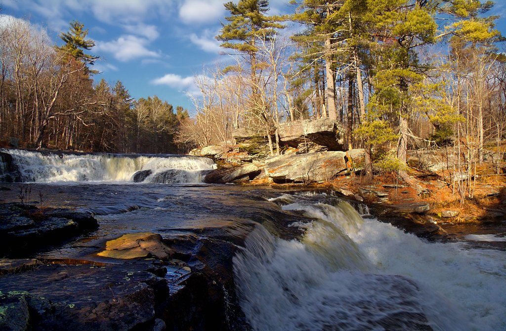
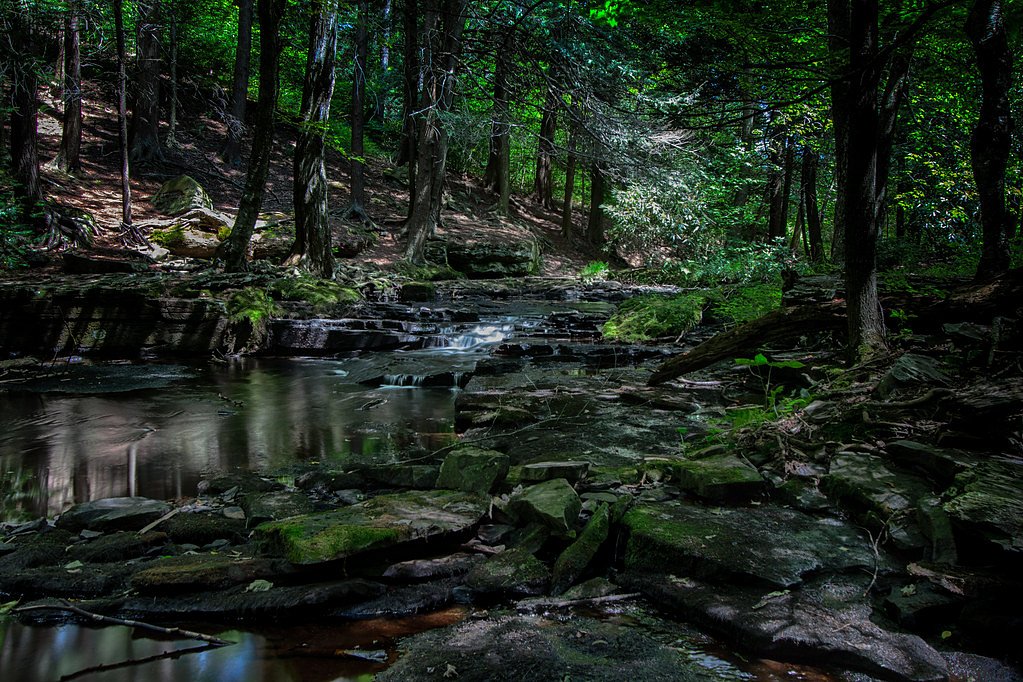
About High Falls
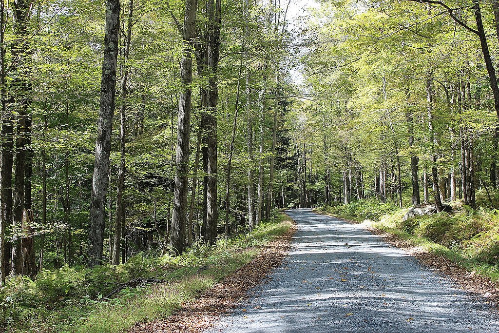
High Falls sits in northeastern Pennsylvania just a short drive from Hemlock Farms and the town of Hawley, offering a photogenic cascade set among quiet woodland. The waterfall is a favorite for nature lovers and photographers seeking scenic water views without committing to a long backcountry trek. The setting feels intimate and restorative, making it an appealing half-day outing for hikers, families, and anyone wanting a peaceful stretch of river and forest. Access to High Falls is provided by a moderate 2.4-mile out-and-back trail that climbs roughly 350 feet, so you’ll want to expect some steady uphill sections on the return. The trail’s manageable length and elevation make it a good choice for hikers with moderate fitness; check local trail guides or park notices before you go for the latest conditions and any seasonal advisories.
The Setting
High Falls sits at 1,335 feet along the Lackawaxen River, in the foothills of Pennsylvania.
Trail & Hike Details
The Approach
The moderate 2.4-mile out and back trail gains 350 feet of elevation on the way to the falls.
Trail Description
Out-and-back trail, 2.4 miles round-trip with about 350 feet of elevation gain. Difficulty: Moderate. Surface, grade class, and an official trail number/name are not provided in available data — consult local trail maps or land-manager resources for surface conditions, accessibility details, and up-to-date route information before hiking.
What to Expect
Visitors can expect a peaceful natural setting with cascading water and surrounding forested areas. The falls may be more impressive during spring or after heavy rainfall.
Accessibility
The trail is not wheelchair accessible. Uneven terrain and elevation changes require steady footing.
Frequently Asked Questions
🐶 Are Dogs Allowed at High Falls?
❌ Dogs are not allowed
Are There Any Fees or Permits Required?
🆖 No fees required
🏊 Is There Swimming at High Falls?
❌ Swimming is not allowed
When to Visit
Spring and fall are typically the best times to visit, as water flow is higher and the surrounding foliage is vibrant. Summer is also popular, but the area may be busier.
Seasonal Access
The best time to visit is Spring, Summer, and Fall. Winter access may be limited.
Safety Information
Trails may be uneven or slippery, especially after rain. Visitors should exercise caution near the water and avoid getting too close to the edge of the falls.
Current Water Conditions
125 ft³/s
Current discharge — how much water is flowing
About average for this time of year
Based on 5 years of record
3.73 ft
Water depth at gauge
75°F
ComfortablePleasant for swimming
7-Day Discharge Trend
What does this mean for your visit?
Flow is about average for this time of year. The water is a comfortable 75 degrees F, pleasant for swimming.
About This Gauge
7-Day Flow Outlook
Based on the USGS gauge Lackawaxen River near Baoba, PA (7 km away).
Today
Barely Flowing
125 cfs
5/10Tomorrow
Barely Flowing
134 cfs
5/10Wed
Low
142 cfs
3/10Thu
Barely Flowing
115 cfs
5/10Fri
Barely Flowing
121 cfs
5/10Sat
Low
160 cfs
3/10Sun
Low
186 cfs
3/10Best window: Today — barely flowing flow, mostly sunny (trip score 5/10).
Best time of year: this gauge typically runs highest from early March to late March, peaking in March.
How we calculate this
This is a transparent outlook, not a precise forecast. We take the waterfall's current flow strength (how it ranks against its historical normal for today, from the nearest USGS stream gauge), carry that ranking forward along the gauge's seasonal curve, and nudge it for forecast rain. Confidence is highest for the next day or two and falls further out. Always check official conditions and your own judgment before visiting — high flows can be dangerous.
Know when to go.
Get a free email alert when waterfalls near Hemlock Farms hit peak flow. We only send when conditions are worth the trip — no weekly newsletters, no spam.
Weather Forecast
Location & Access
Getting There
High Falls is located approximately 6.5 miles from Hemlock Farms and 6.7 miles from Hawley. The coordinates for the falls are 41.4034, -75.1038. Access may require navigating local roads, and visitors should check for signage or trailheads leading to the falls.
Get Directions on Google MapsParking
Parking availability is unclear, but visitors may need to park along nearby roads or at designated trailheads if available.
Hours
Elevation
1,335 feet above sea level
Coordinates
41.403423° N, -75.103784° W
Visitor Tips & Gear
Wear sturdy footwear and bring a map or GPS device, as trail conditions and signage may vary. Check weather conditions before visiting, as trails could be slippery after rain.
As an Amazon Associate, we earn from qualifying purchases.
With 2.4 miles and 350 ft of elevation gain, sturdy boots and trekking poles will help on this moderate trail. Sun exposure on the trail makes good sun protection a must in summer.

Polarized Sunglasses (Knockaround)
Cuts glare off the water so you actually see the falls — and your photos turn out better too.

Columbia Watertight II Rain Jacket
Packs into its own pocket, seam-sealed, and keeps you dry from spray and surprise rain.

Earth Pak Waterproof Dry Bag
Keeps your phone and gear dry when waterfall mist soaks everything else.

Waterproof Phone Pouch (AiRunTech)
Cheap insurance — take photos right next to the falls without killing your phone.

Timberland Euro Sprint Mid Waterproof
Trusted waterproof boot with premium leather and grippy rubber sole — reliable on rocky, wet trails.

TrailBuddy Trekking Poles
Lightweight aluminum, cork grips, and flip-locks that actually hold — a best-seller for good reason.
Where to Stay

Comfort Inn Pocono Lakes Region

Silver Birches Resort

Lakeside, Dock, Hot Tub, Kayaks, Arcade, Playset

Tanglwood Resort
Browse vacation cabins and private rentals nearby
Unique outdoor stays — tents, yurts, and treehouses
Rent a campervan or RV for your waterfall road trip
Some links are affiliate links. We may earn a commission at no extra cost to you.
Nearby Campground
Alosa Campsites
23.1 miles away · 6 sites
Overview The Alosa Campsites are boat-in only sites located on the west (Pennsylvanian) shore of the Delaware River near Bushkill, Pennsylvania. The side of the river with the campsites will be on your right while traveling downstream. This section of the river offers unspoiled views, excellent boating, fishing, and birding opportunities within the Delaware Water Gap National Recreation Area and the Middle Delaware National Scenic and Recreational River. These reservation-only campsites are avail
Book on Recreation.govAdditional Information
Nearby Attractions
Nearby attractions include Lake Wallenpaupack, Promised Land State Park, and the town of Hawley, which offers dining and shopping options.
Wildlife
The area may feature local wildlife such as deer, birds, and small mammals. Visitors should respect wildlife and maintain a safe distance.
Cities near High Falls
Nearby Waterfalls
Other waterfalls named High Falls
31 other waterfalls share this name across the U.S.
-
01
Bridgeville
Current flow 133 ft³/s -
02
Copenhagen
Current flow 606 ft³/s -
03
Cranberry Lake
Current flow 905 ft³/s -
04
Grahamsville
Current flow 5 ft³/s -
05
Lake Placid
Current flow 3 ft³/s -
06
Lyon Mountain
Current flow 380 ft³/s -
07
Lyon Mountain
-
08
Philmont
Current flow 143 ft³/s -
09
Prospect
Current flow 15 ft³/s -
10
Rochester
Current flow 1,080 ft³/s -
11
St. Regis Falls
Current flow 739 ft³/s
Writing about High Falls? Embed this waterfall on your site for free.