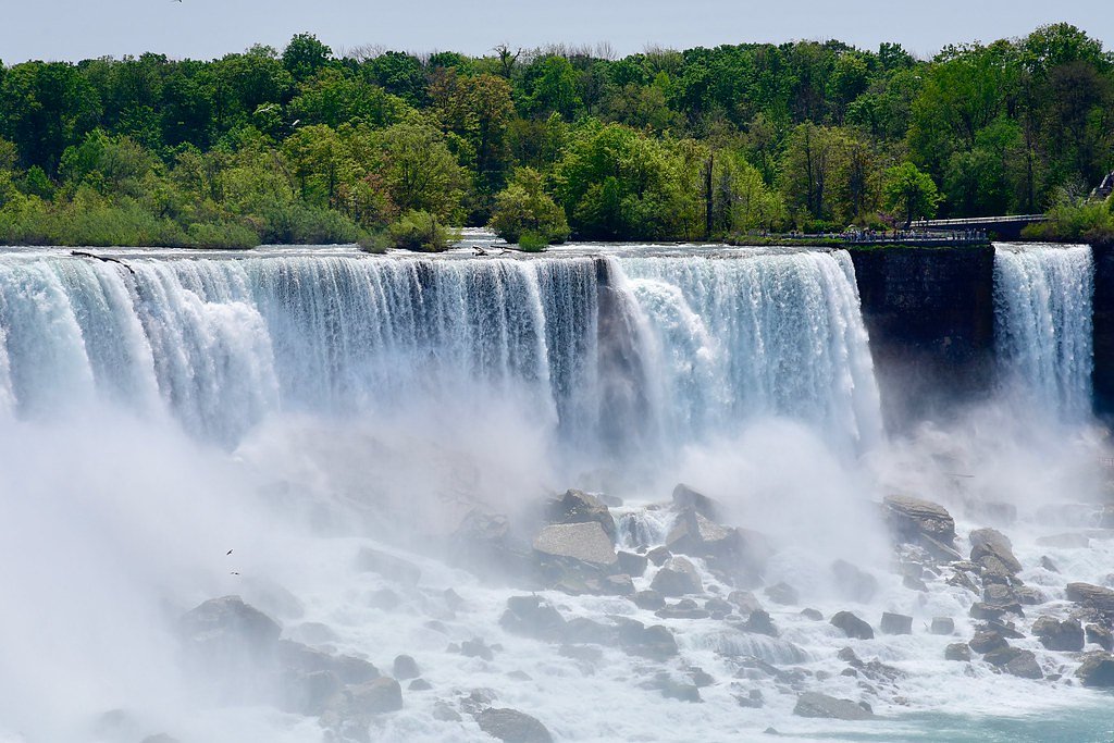
High Falls
Ontario • Algonquin Provincial Park
By Armen Suny · Last verified Jun 2026
Photo Credits (1)
Difficulty
Moderate
Trail Length
4.0 km
Trail Type
Out And Back
About High Falls
High Falls is a scenic waterfall in Renfrew County, Ontario, located at approximately 45.7089, -77.8277 and roughly 35 miles from Pembroke. The falls occur where a river or creek drops over exposed bedrock, producing a prominent single drop or short cascade. Specific published measurements and official park designation for this particular High Falls location are limited; visitor reports indicate variable flow depending on season and recent precipitation.
The Setting
High Falls sits at 242 metres within Algonquin Provincial Park, in the foothills of Ontario.
Why This Waterfall Exists
High Falls flows over hard crystalline rock, primarily gneiss, laid down over 1.0-1.6 billion years ago. These resistant rocks form a durable ledge that water cannot easily wear away, creating the falls where softer material downstream has already eroded.
Trail & Hike Details
Trail Description
Trail information for this specific High Falls location is not well-documented in official sources. Reports from similar rural Ontario waterfalls suggest a short, unmaintained path from the roadside to the falls, often under 1 mile round trip, with uneven, rocky, and sometimes muddy surfaces. Expect tree roots, wet stones, and possibly a short scramble to reach the best viewpoints. Trails may be poorly marked or informal.
What to Expect
A natural, undeveloped waterfall setting with few or no facilities. Water flow varies by season, high in spring and after heavy rain, lower in late summer. There may be limited viewpoints; no guardrails or formal platforms in many locations. Expect insects in warm months, slippery rocks near the water, and potentially unstable edges. Cell service can be limited in rural parts of Renfrew County.
Accessibility
The trail is not wheelchair accessible. Uneven terrain and elevation changes require steady footing.
Frequently Asked Questions
🐶 Are Dogs Allowed at High Falls?
❌ Dogs are not allowed
Are There Any Fees or Permits Required?
🆖 No fees required
🏊 Is There Swimming at High Falls?
❌ Swimming is not allowed
When to Visit
Early spring (snowmelt and higher flows) and late spring offer the most dramatic water volumes. Late spring to early fall provides easier trail conditions and warmer weather. Fall also offers attractive foliage. Winter can produce ice formations but access and safety are more challenging; only attempt in winter with proper equipment and experience.
Seasonal Access
The best time to visit is Spring, Summer, and Fall. Winter access may be limited. Check with Algonquin Provincial Park for current conditions.
Safety Information
Hazards can include slippery and unstable rocks, strong currents, cold water, sudden changes in water level after rain, steep or unprotected edges, poor or intermittent cell service, and limited emergency access. Wear appropriate footwear, stay a safe distance from edges, do not climb on wet rocks, and avoid swimming unless conditions and local signage explicitly indicate it is safe. If in doubt, err on the side of caution.
Current Water Conditions
Based on a Water Survey of Canada gauge 44.5 km away
35.7 m³/s
Current discharge — how much water is flowing
About average for this time of year
Based on 110 years of record
2.55 m
Water depth at gauge
7-Day Discharge Trend
What does this mean for your visit?
Flow is about average for this time of year.
About This Gauge
This gauge is on a regional waterway. Conditions at the falls may differ, especially after local rain.
7-Day Flow Outlook
Based on the WSC gauge PETAWAWA RIVER NEAR PETAWAWA (45 km away).
Today
Moderate
36 m³/s
8/10Tomorrow
Moderate
35 m³/s
8/10Tue
Moderate
38 m³/s
6/10Wed
Moderate
41 m³/s
6/10Thu
Moderate
37 m³/s
8/10Fri
Moderate
37 m³/s
6/10Sat
Moderate
34 m³/s
8/10Best window: Today — moderate flow, partly cloudy (trip score 8/10).
Best time of year: this gauge typically runs highest from early April to early July, peaking in April.
How we calculate this
This is a transparent outlook, not a precise forecast. We take the waterfall's current flow strength (how it ranks against its historical normal for today, from the nearest WSC stream gauge), carry that ranking forward along the gauge's seasonal curve, and nudge it for forecast rain. Confidence is highest for the next day or two and falls further out. Always check official conditions and your own judgment before visiting — high flows can be dangerous.
Know when to go.
Get a free email alert when waterfalls near Pembroke hit peak flow. We only send when conditions are worth the trip — no weekly newsletters, no spam.
Weather Forecast
Location & Access
Getting There
Access is typically by car on county or logging roads; use the provided coordinates (45.7089, -77.8277) and local maps/GPS to navigate. Roads in the area may be unpaved and narrow. Expect to turn off onto secondary roads; cell service may be intermittent. Confirm route and road conditions locally before travel.
Get Directions on Google MapsParking
Parking may be limited to a small informal pullout or roadside area. There may not be a formal parking lot, signage, or facilities. Park well off the roadway and avoid blocking driveways or gates. If you find a small marked lot, follow any posted rules.
Elevation
242 metres above sea level
Coordinates
45.708875° N, -77.827724° W
Land Management
Managed by Ontario Parks
Visitor Tips & Gear
1) Use the GPS coordinates and confirm local road conditions before you go. 2) Wear sturdy, closed-toe footwear with good traction; bring a walking stick if you expect rocky or steep approaches. 3) Do not venture onto wet rocks near the edge; slippery surfaces and strong currents are common hazards. 4) Respect private property and posted signs, some access routes may cross private lands. 5) Leave no trace: pack out all trash and avoid disturbing vegetation. 6) Check local recent trip reports if available for current conditions.
Where to Stay
Browse vacation cabins and private rentals nearby
Unique outdoor stays — tents, yurts, and treehouses
Rent a campervan or RV for your waterfall road trip
Some links are affiliate links. We may earn a commission at no extra cost to you.
Nearby Campground
Basin Lake Access Point (#19)
3.7 km away
Additional Information
Nearby Attractions
Nearby communities (for services) include Pembroke (approximately 35 miles) and other Renfrew County towns. Provincial parks, lakes, and additional rivers are common in the region; confirm specific nearby attractions using local tourism resources.
Wildlife
Typical regional wildlife may include white-tailed deer, small mammals, waterfowl and songbirds, and occasionally black bears or moose. Ticks and mosquitoes can be prevalent in warmer months. Always store food securely and be bear-aware in areas where bears are present.
Cities near High Falls
Other waterfalls named High Falls
31 other waterfalls share this name across Canada.
-
01
Bridgeville
Current flow 127 ft³/s -
02
Copenhagen
Current flow 346 ft³/s -
03
Cranberry Lake
Current flow 185 ft³/s -
04
Grahamsville
-
05
Lake Placid
Current flow 1 ft³/s -
06
Lyon Mountain
Current flow 107 ft³/s -
07
Lyon Mountain
-
08
Philmont
Current flow 93 ft³/s -
09
Prospect
Current flow 5 ft³/s -
10
Rochester
Current flow 891 ft³/s -
11
St. Regis Falls
Current flow 172 ft³/s
Writing about High Falls? Embed this waterfall on your site for free.