
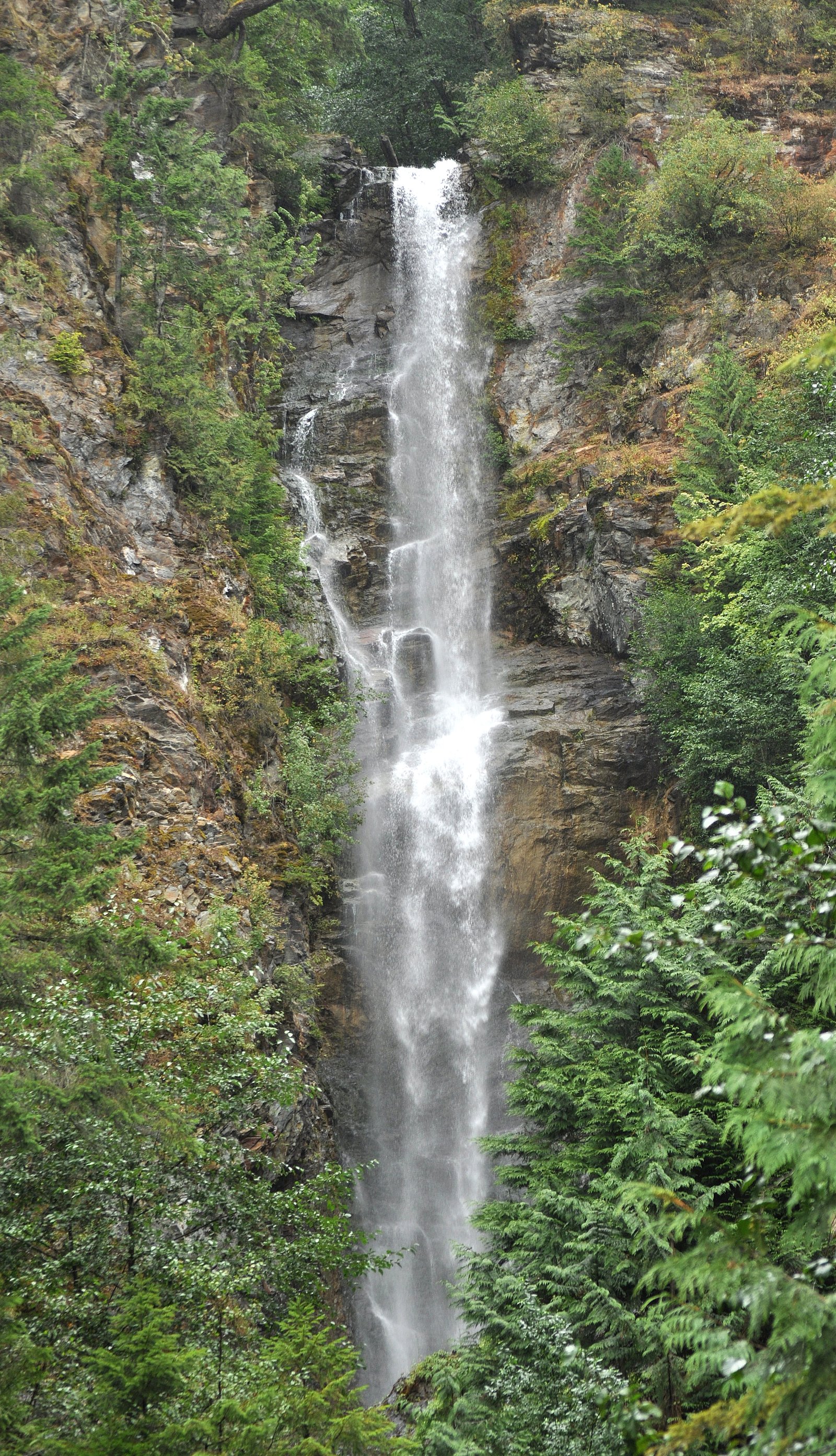
Slollicum Falls
By Armen Suny · Last verified Jun 2026
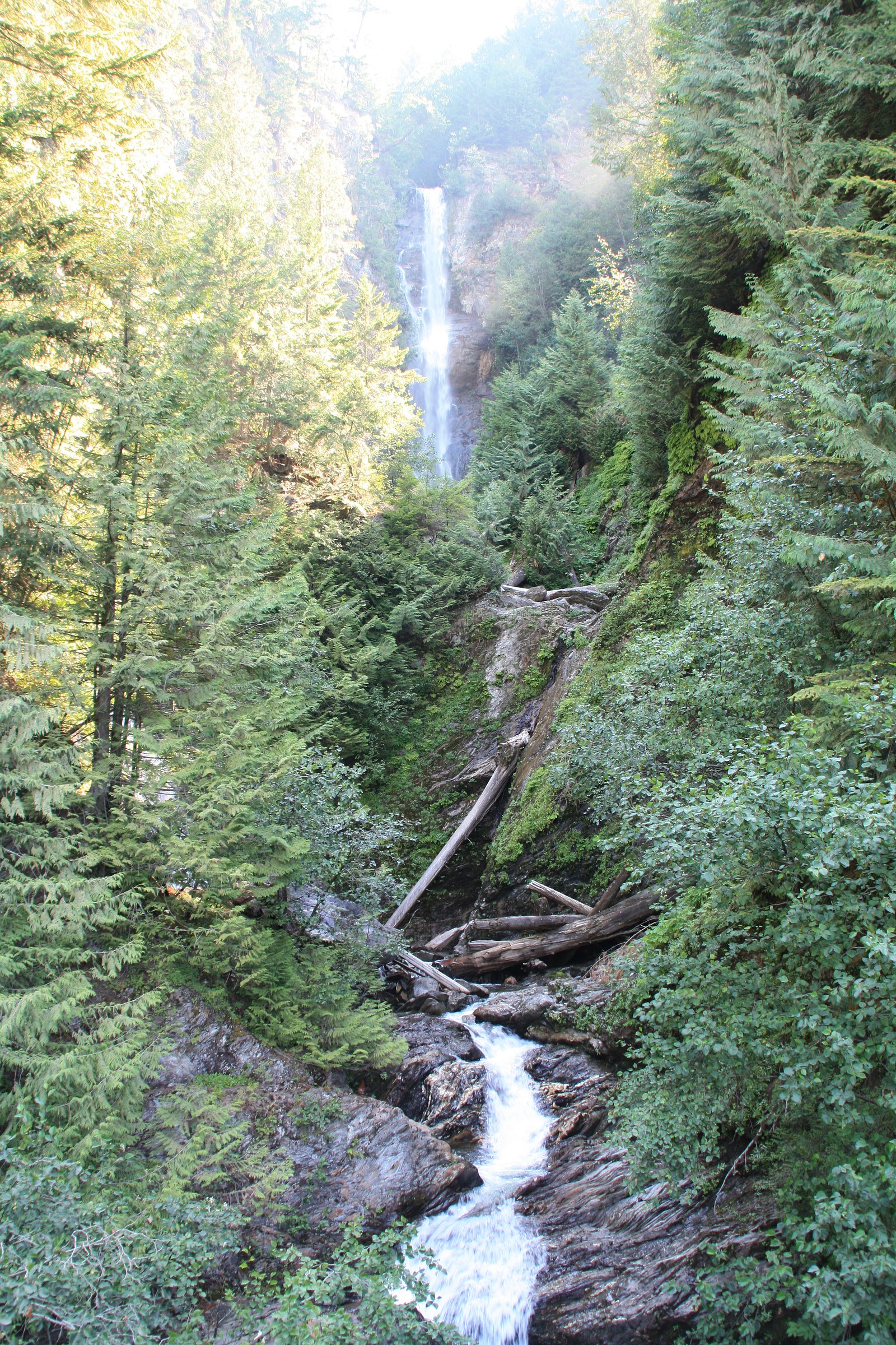
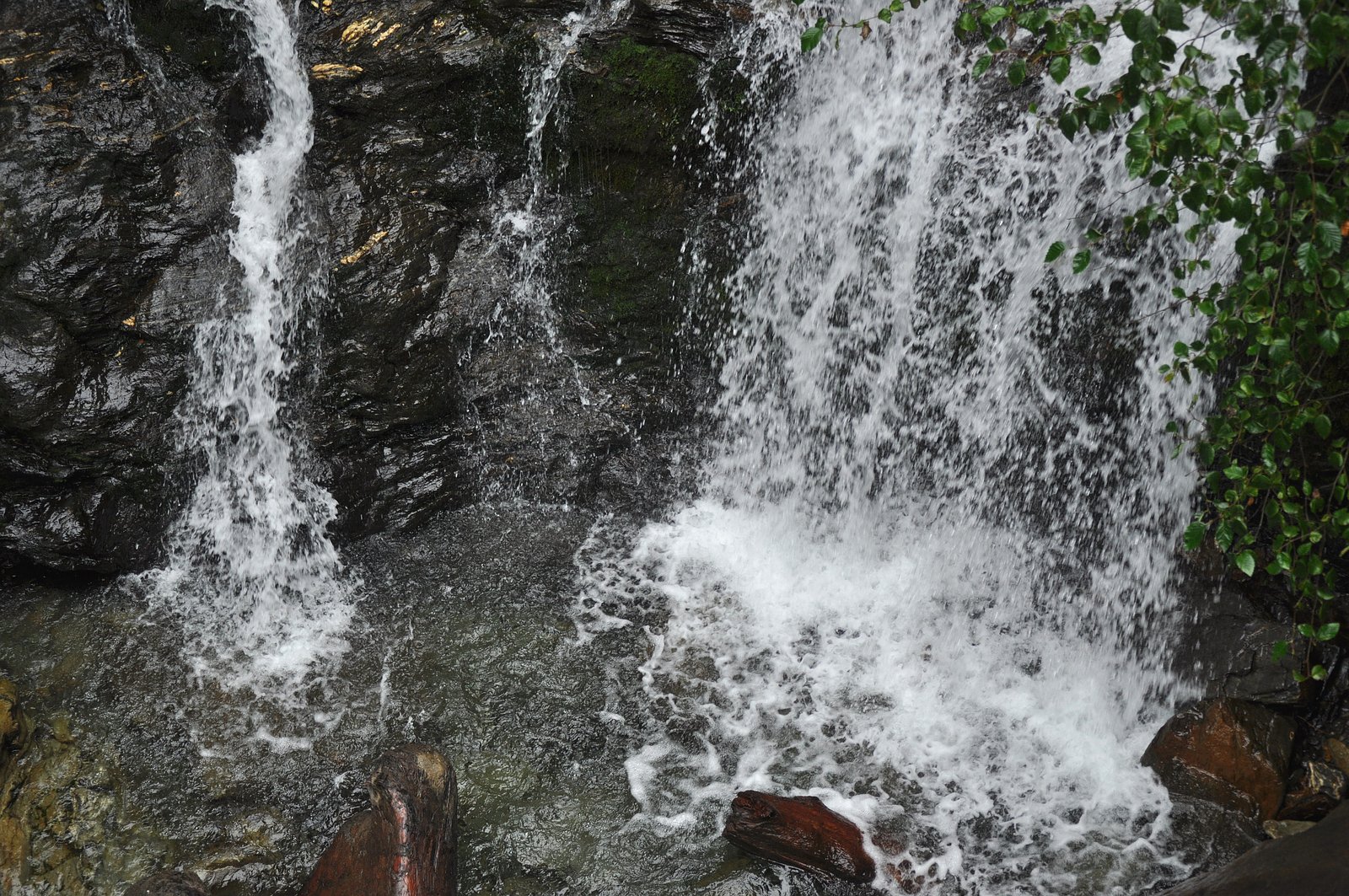
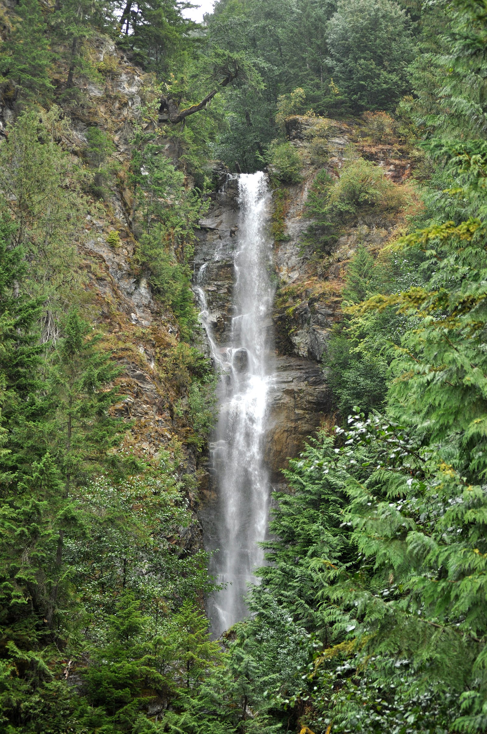
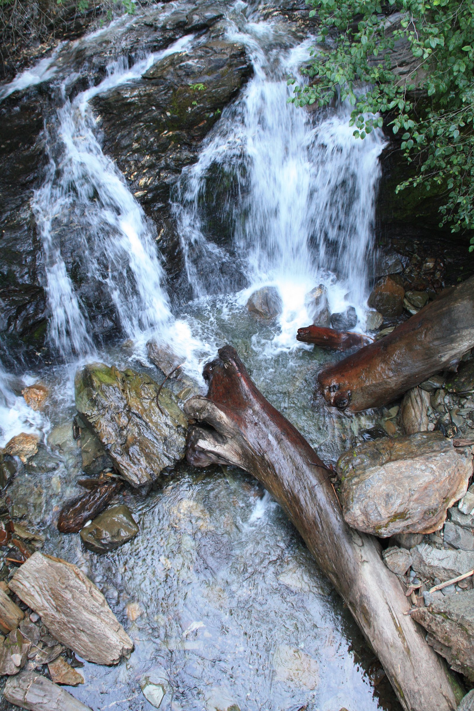
Photo Credits (5)
Difficulty
Drive Up
Trail Length
0.2 km
Trail Type
Out And Back
About Slollicum Falls
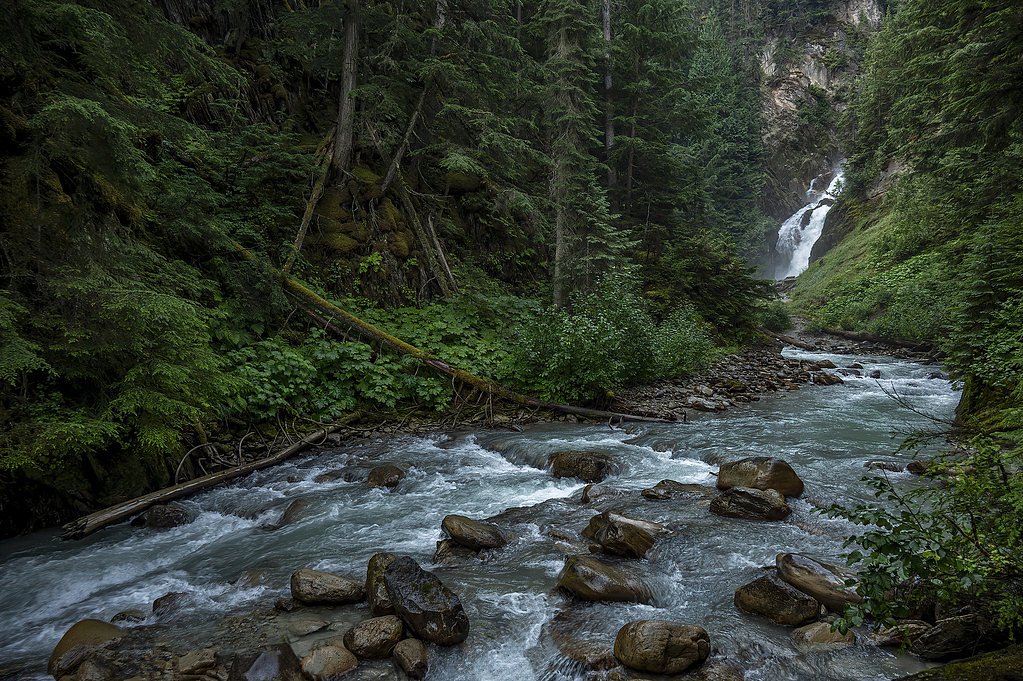
Slollicum Falls is a small forested cascade on Slollicum Creek in the Fraser Valley region of British Columbia, located northwest of Chilliwack (coordinates 49.3987, -121.7451). The falls sit in a mixed second-growth forest and are best described as a scenic, seasonal cascade rather than a large plunge. Access appears to be informal and the site is not developed or staffed, expect a natural, low‑infrastructure experience and some bushwhacking from the nearest road.
Why This Waterfall Exists
Slollicum Falls flows over layered sedimentary rock laid down about 66-252 million years ago. Over time, the stream has worn through these layers at different rates, creating the step that forms the waterfall.
Nearby Falls Worth Visiting
Rainbow Falls (140 m) lies 0.8 kilometres to the west. Also nearby: Bear Creek Falls (20 m, 7.6 km) and Eagle Falls (15 m, 9.5 km).
Trail & Hike Details
The Approach
No hiking required. Slollicum Falls is accessible by vehicle with a roadside viewing area.
Trail Description
There is no widely maintained or officially marked trail to Slollicum Falls. Most visitor reports describe a short, rough approach from a nearby forest road involving a creek crossing and some bushwhacking through forest and alder. The final approach to the falls may require scrambling down an eroded bank; expect slippery, uneven ground near the water. Because route details are variable and local, plan for unmarked paths and limited signage.
What to Expect
A modest cascade in a forested setting with mossy rocks and a narrow stream channel. Flow is seasonal, highest in spring/early summer with snowmelt and after heavy rains. There are limited vantage points and no built viewing platforms or railings. Expect muddy, uneven trails, slippery rocks at the water's edge, and potential blowdown or recent logging debris on approach routes. Cell service may be intermittent.
Accessibility
This waterfall is viewable from a vehicle-accessible area. No hiking is required.
Frequently Asked Questions
🐶 Are Dogs Allowed at Slollicum Falls?
❌ Dogs are not allowed
Are There Any Fees or Permits Required?
🆖 No fees required
🏊 Is There Swimming at Slollicum Falls?
❌ Swimming is not allowed
When to Visit
Late spring (snowmelt) through early summer typically yields the best water flow and pleasant weather for the short bushwhack. After prolonged dry spells in late summer/fall the falls may have reduced flow. Avoid visiting during or immediately after heavy rainfall when creek levels and currents can rise quickly.
Seasonal Access
The best time to visit is Spring, Summer, and Fall. Winter access may be limited. Check with the managing park or local authority for current conditions.
Safety Information
• The area is undeveloped: expect no railings, no maintained paths, and natural hazards (slippery rocks, steep banks, loose footing). • Water flow can increase quickly after rain, avoid getting close to the creek during high flow. • Limited or no cell service in spots; tell someone your plans. • Road access may cross active logging areas, be alert for trucks and closed gates. • Respect private property, do not trespass. • Seasonal hazards include mosquitoes in summer and muddy/icy conditions in shoulder seasons.
Current Water Conditions
5.5 m³/s
Current discharge — how much water is flowing
Much lower than usual for this time of year
Based on 47 years of record
8.89 m
Water depth at gauge
7-Day Discharge Trend
What does this mean for your visit?
Flow is well below normal for this time of year, so the waterfall may be a trickle.
About This Gauge
This gauge is on a nearby waterway and may not reflect exact conditions at the falls.
7-Day Flow Outlook
Based on the WSC gauge CHEHALIS RIVER NEAR HARRISON MILLS (18 km away).
Today
Barely Flowing
5.5 m³/s
4/10Tomorrow
Barely Flowing
5.4 m³/s
4/10Tue
Barely Flowing
5.2 m³/s
4/10Wed
Barely Flowing
5.1 m³/s
4/10Thu
Barely Flowing
4.9 m³/s
4/10Fri
Barely Flowing
4.7 m³/s
4/10Sat
Barely Flowing
4.9 m³/s
3/10Best window: Today — barely flowing flow, cloudy (trip score 4/10).
Best time of year: this gauge typically runs highest from mid April to early June, peaking in November.
How we calculate this
This is a transparent outlook, not a precise forecast. We take the waterfall's current flow strength (how it ranks against its historical normal for today, from the nearest WSC stream gauge), carry that ranking forward along the gauge's seasonal curve, and nudge it for forecast rain. Confidence is highest for the next day or two and falls further out. Always check official conditions and your own judgment before visiting — high flows can be dangerous.
Know when to go.
Get a free email alert when waterfalls near Chilliwack hit peak flow. We only send when conditions are worth the trip — no weekly newsletters, no spam.
Weather Forecast
Location & Access
Getting There
Slollicum Falls is in the general Chilliwack/Maple Falls area (user-provided coordinates 49.3987, -121.7451). Access is typically from local forest/ logging roads or unmarked pullouts off minor roads in the area; there is not a clearly signed, maintained trailhead. Use a detailed map or GPS with the provided coordinates. Vehicle access on some spur roads may require high-clearance or 4x4, and roads may be gated seasonally. Confirm current road conditions and private property boundaries before driving down forestry spurs.
Get Directions on Google MapsParking
Parking is limited and informal, expect roadside/gravel pullouts. Do not block gates or driveways. If you cannot find an established parking area, consider turning around rather than parking on narrow shoulders. Some nearby roads may be private or subject to logging activity.
Elevation
501 metres above sea level
Coordinates
49.398655° N, -121.745115° W
Visitor Tips & Gear
• Use a GPS or mapping app with the exact coordinates; trails are poorly signed. • Wear sturdy, waterproof footwear with good traction; the approach can be muddy and steep. • Stay off slippery rocks and do not approach the edge of the falls during high flow. • Be aware of private property and logging operations; do not block gates or roads. • Let someone know your plans and expected return time, cell coverage may be unreliable. • Pack out all trash and avoid disturbing vegetation; the site is undeveloped.
Where to Stay
Browse vacation cabins and private rentals nearby
Unique outdoor stays — tents, yurts, and treehouses
Rent a campervan or RV for your waterfall road trip
Some links are affiliate links. We may earn a commission at no extra cost to you.
Nearby Campground
Cascade Peninsula Campground
5.1 km away
Nearby Hot Springs
Hot springs near Chilliwack, British Columbia
Dorr Fumarole Field
Dorr Fumarole Field reaches 194 degrees at 8,168 feet elevation on Mount Baker's active volcanic slopes, producing superheated ...

Sherman Crater Fumaroles
Sherman Crater Fumaroles register 266 degrees Fahrenheit at 9,463 feet elevation within the active volcanic crater atop Mount B...
Baker Hot Spring
Baker Hot Spring emerges at 108 degrees Fahrenheit on US Forest Service land in Mt. Baker National Forest, flowing 59.5 degrees...
Looking for a soak after your hike? Explore more hot springs near Chilliwack, British Columbia on SoakingSprings.
Explore British Columbia springsAdditional Information
Nearby Attractions
Chilliwack and the Vedder Valley offer multiple outdoor options (hiking, fishing, parks). Other nearby points of interest in the general region include local viewpoints on Sumas Mountain, Chilliwack River Provincial Park, and larger, more developed falls and parks closer to Chilliwack and Harrison Hot Springs, check maps for exact distances and access.
Wildlife
Typical Fraser Valley wildlife may be present: deer, small mammals, a variety of songbirds, and possibly black bears. Be bear-aware (store food securely, make noise when hiking). Cougar sightings are rare but possible; exercise standard wilderness safety precautions.
Cities near Slollicum Falls
Nearby Waterfalls
Writing about Slollicum Falls? Embed this waterfall on your site for free.