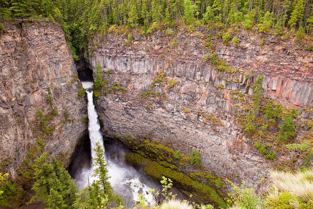
Bear Creek Falls
British Columbia • 20 m
By Armen Suny · Last verified Jun 2026
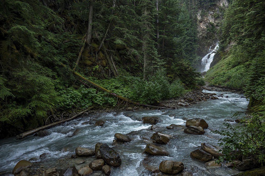
Photo Credits (2)
Difficulty
Drive Up
Trail Length
0.2 km
Trail Type
Out And Back
About Bear Creek Falls
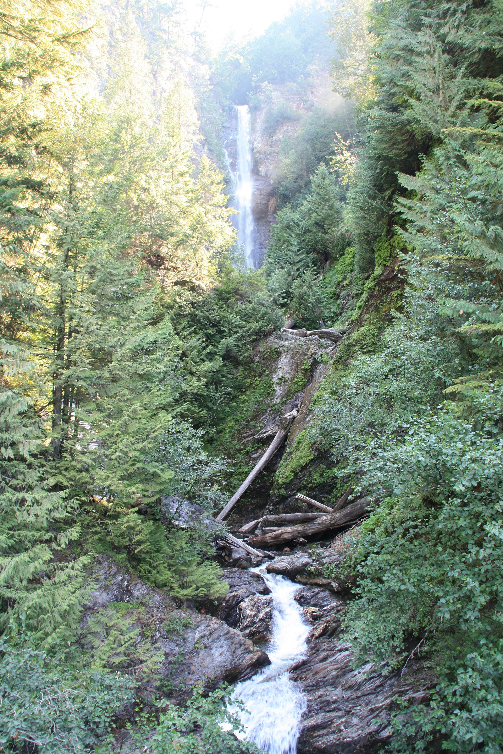
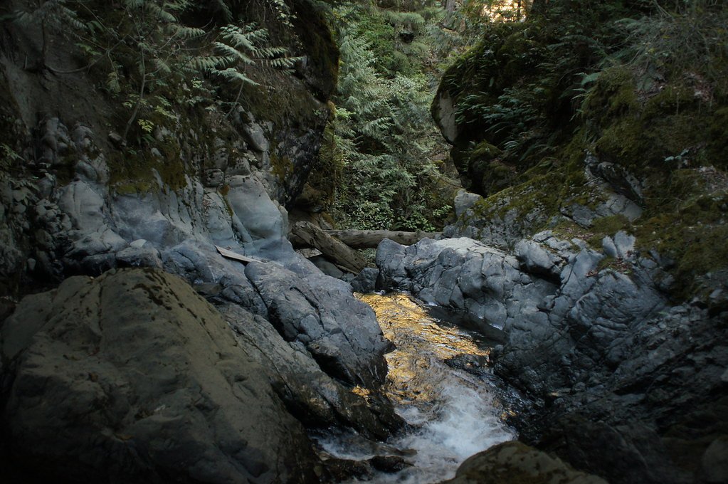
Bear Creek Falls (approx. coordinates 49.4654, -121.7619) is a forested cascade on Bear Creek in the eastern Fraser Valley / lower Cascade foothills region of British Columbia. The waterfall is relatively remote and not heavily developed for tourism; approach typically involves forest roads and short, sometimes unmaintained trails. Flow varies seasonally (higher in spring snowmelt and after heavy rain). Exact published height and official signage are not well documented in major guide sources.
The Setting
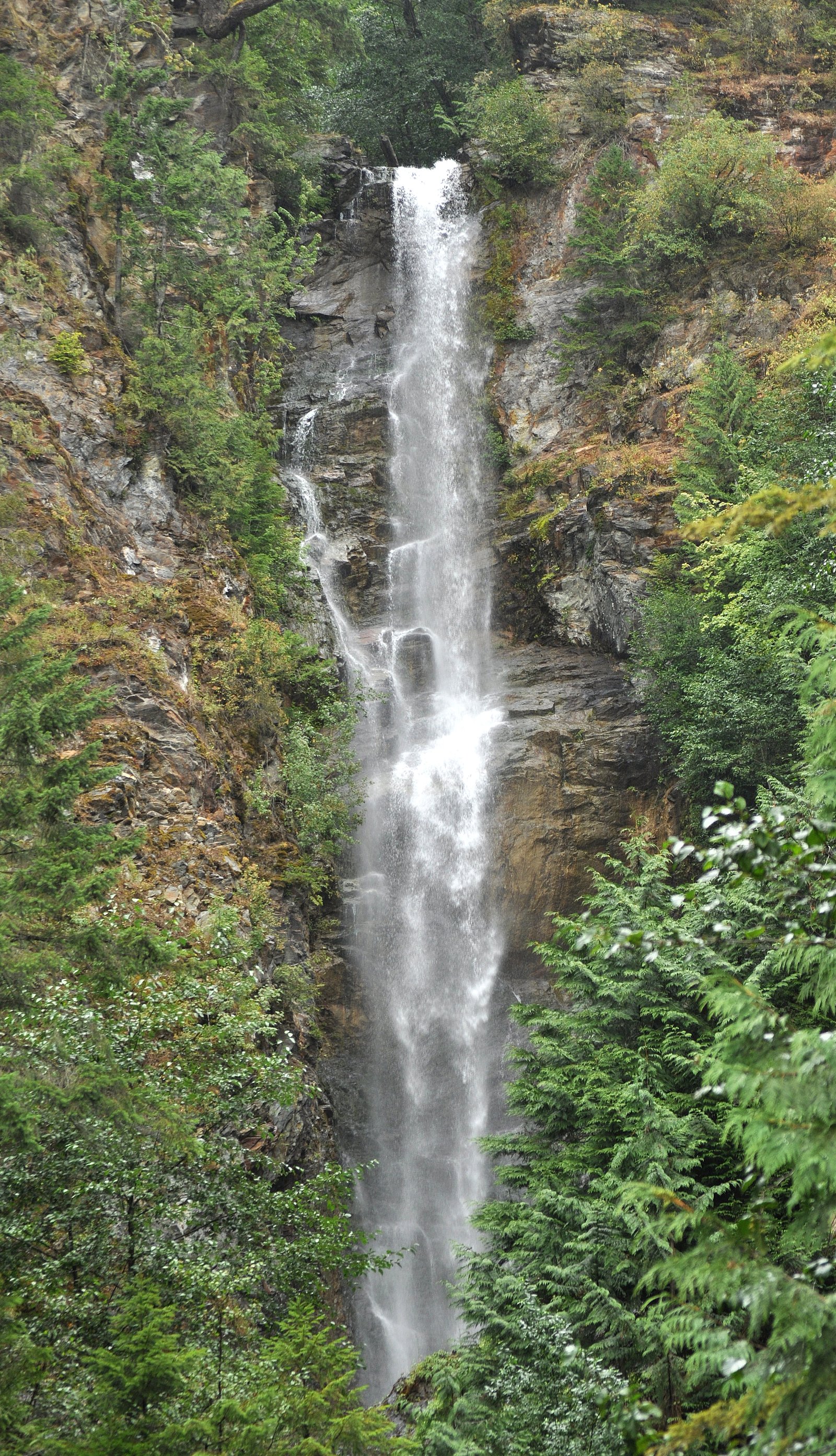
Bear Creek Falls sits at 86 metres in the coastal lowlands of British Columbia. The falls drop 20 metres.
Why This Waterfall Exists
Bear Creek Falls flows over layered sedimentary rock laid down about 66-252 million years ago. Over time, the stream has worn through these layers at different rates, creating a 65-foot drop that forms the waterfall.
Nearby Falls Worth Visiting
Rainbow Falls (140 m) lies 7.6 kilometres to the south. Also nearby: Eagle Falls (15 m, 6.3 km) and Walian Creek Falls (7 m, 7.1 km).
Trail & Hike Details
The Approach
No hiking required. Bear Creek Falls is accessible by vehicle with a roadside viewing area.
Trail Description
Reports and typical access patterns for similar falls in the region suggest a mix of gravel/forest-road driving followed by a short hike on a natural trail. The final approach may be on an unmaintained path with roots, rocks, and steep or slippery sections. There may be no marked viewpoint, and reaching a good view could require short off-trail scrambling. Trail details and signage are not well-documented in official sources, so plan for minimal infrastructure.
What to Expect
The falls drop 20 metres over layered sedimentary rock.
Accessibility
This waterfall is viewable from a vehicle-accessible area. No hiking is required.
Frequently Asked Questions
🐶 Are Dogs Allowed at Bear Creek Falls?
❌ Dogs are not allowed
Are There Any Fees or Permits Required?
🆖 No fees required
🏊 Is There Swimming at Bear Creek Falls?
❌ Swimming is not allowed
When to Visit
Late spring (peak snowmelt) for the strongest flow and full waterfall appearance. Early summer for good hiking weather with still-robust flows. Fall can offer lower water but fewer bugs and autumn colors. Winter may be scenic but trails, roads, and creek crossings can be icy, snowy, or flooded, check local conditions and be prepared for winter travel.
Seasonal Access
The best time to visit is Spring, Summer, Fall, and Winter. Check with the managing park or local authority for current conditions.
Safety Information
Hazards include slippery rocks and riverbanks, rapidly changing water flow after rain or snowmelt, limited cell coverage, remote access, and potential logging traffic on approach roads. Do not approach cliff edges, avoid crossing fast-flowing water, and be prepared for sudden weather changes. If using forest service roads, be aware they can be rough and sometimes gated, check closures. Carry proper navigation tools and emergency supplies.
Current Water Conditions
5.5 m³/s
Current discharge — how much water is flowing
Much lower than usual for this time of year
Based on 47 years of record
8.89 m
Water depth at gauge
7-Day Discharge Trend
What does this mean for your visit?
Flow is well below normal for this time of year, so the waterfall may be a trickle.
About This Gauge
This gauge is on a nearby waterway and may not reflect exact conditions at the falls.
7-Day Flow Outlook
Based on the WSC gauge CHEHALIS RIVER NEAR HARRISON MILLS (22 km away).
Today
Barely Flowing
5.5 m³/s
5/10Tomorrow
Barely Flowing
5.4 m³/s
4/10Tue
Barely Flowing
5.2 m³/s
4/10Wed
Barely Flowing
5.1 m³/s
4/10Thu
Barely Flowing
4.9 m³/s
4/10Fri
Barely Flowing
4.7 m³/s
4/10Sat
Barely Flowing
4.9 m³/s
3/10Best window: Today — barely flowing flow, mainly sunny (trip score 5/10).
Best time of year: this gauge typically runs highest from mid April to early June, peaking in November.
How we calculate this
This is a transparent outlook, not a precise forecast. We take the waterfall's current flow strength (how it ranks against its historical normal for today, from the nearest WSC stream gauge), carry that ranking forward along the gauge's seasonal curve, and nudge it for forecast rain. Confidence is highest for the next day or two and falls further out. Always check official conditions and your own judgment before visiting — high flows can be dangerous.
Know when to go.
Get a free email alert when waterfalls near Chilliwack hit peak flow. We only send when conditions are worth the trip — no weekly newsletters, no spam.
Weather Forecast
Location & Access
Getting There
The falls are in a rural/mountain area northeast of Chilliwack (roughly 22–25 miles by road). Access is typically via local or forest service roads off the regional highway network; roads may be gravel, rough, gated, or seasonally closed. Use up-to-date maps (government forestry maps, AllTrails, or local trail reports) and a reliable GPS to locate the trailhead. Expect limited cell service in places.
Get Directions on Google MapsParking
No formal parking lot is known; parking is likely limited to roadside pullouts or a small informal clearing near the trailhead. Park well off the road, avoid blocking gates or private driveways, and obey posted signs.
Elevation
86 metres above sea level
Coordinates
49.465366° N, -121.761894° W
Visitor Tips & Gear
1) Check recent trip reports (AllTrails, local hiking forums, provincial forest service notices) for current access, road conditions, and gate closures before heading out. 2) Wear sturdy, grippy footwear, rocks and banks near the falls can be very slippery. 3) Drive a suitable vehicle for rough gravel forest roads; obey posted gates and private property signs. 4) Bring a map/GPS and tell someone your plans; expect limited cell service. 5) Practice Leave No Trace, pack out what you pack in. 6) Be cautious near edges and fast water; do not underestimate currents or slippery surfaces.
Where to Stay
Browse vacation cabins and private rentals nearby
Unique outdoor stays — tents, yurts, and treehouses
Rent a campervan or RV for your waterfall road trip
Some links are affiliate links. We may earn a commission at no extra cost to you.
Nearby Campground
Bear Creek Campground
0.3 km away
Nearby Hot Springs
Hot springs near Chilliwack, British Columbia
Dorr Fumarole Field
Dorr Fumarole Field reaches 194 degrees at 8,168 feet elevation on Mount Baker's active volcanic slopes, producing superheated ...

Sherman Crater Fumaroles
Sherman Crater Fumaroles register 266 degrees Fahrenheit at 9,463 feet elevation within the active volcanic crater atop Mount B...
Baker Hot Spring
Baker Hot Spring emerges at 108 degrees Fahrenheit on US Forest Service land in Mt. Baker National Forest, flowing 59.5 degrees...
Looking for a soak after your hike? Explore more hot springs near Chilliwack, British Columbia on SoakingSprings.
Explore British Columbia springsAdditional Information
Nearby Attractions
Chilliwack valley recreation areas (rivers, parks), Slesse Memorial Trail and surrounding alpine hiking, Chilliwack Lake Provincial Park, Cultus Lake area. Many scenic drives and viewpoint trails are in the broader region.
Wildlife
Typical regional wildlife may include black bears, deer, cougars (rare but present), small mammals, and a variety of forest birds. Exercise normal wildlife safety precautions.
Cities near Bear Creek Falls
Nearby Waterfalls
Other waterfalls named Bear Creek Falls
5 other waterfalls share this name across Canada.
Writing about Bear Creek Falls? Embed this waterfall on your site for free.